Scott Mountain
February 19, 2020
494m
Mount Vernon, WA
Scott Mountain is a small summit attached to the slightly-bigger Devils Mountain in the vicinity of Mount Vernon. Both peaks fall into the category of dumpter-diving and Scott Mountain is particularly worse. Reaching the summit of Devils Mountain is nothing more than a 3-km walk on a gated logging road, but to traverse to Scott Mountain requires route-finding through thick and prickly bushes. On top of that, Scott Mountain only boasts 30 m prominence from Devils/Scott saddle and such doesn’t even make it qualify as a separate summit by Washington standard. However, the name is official so I must do it. I think there might be a better route to tag this summit from the west side via logging road system, but among the selected baggers who actually dare to ascend this shitty summit, most would combine it with Devils Mountain. To reach the summit from Devils/Scott saddle one can choose to directly attack the east ridge, bushwhacking the whole way, or connect to a system of logging roads on the south and then west side of the peak, taking a very roundabout route that avoids most, but not all of the bushwhacking.
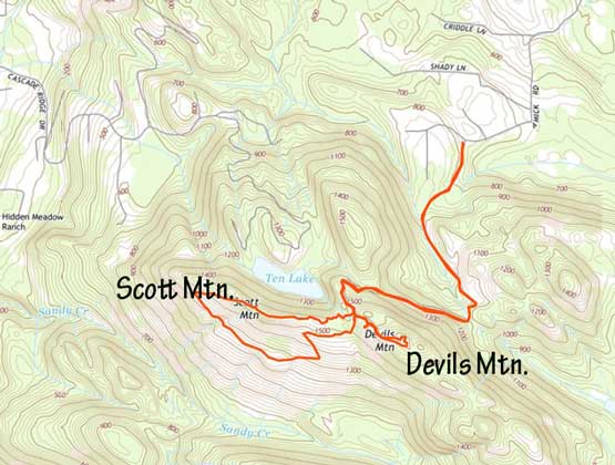
Devils Mountain and Scott Mountain via Devils Mtn. Road. GPX DL
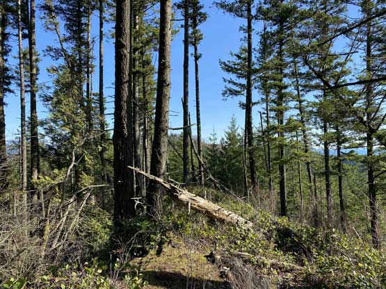
Earlier in the day I had hiked to the summit of Big Rock, and then tagged Devils Mountain. I chose to take the roundabout route by descending ~100 m to the south side logging roads. I soon found out that even just reaching the south side road required bushwhacking through prickly bushes. What appeared to be an “old road” on satellite images turned out to be completely overgrown and I had to bushwhack while hiking down the road. Thankfully once joining the main road traversing the south flanks, the bush gave way to a cruise sail. The logging road led me around to the west ridge of the peak. The best view was actually from the highest clear-cut on the west ridge of Scott Mountain. To reach the true summit one must bushwhack and there’s absolutely no view whatsoever from the highest point.
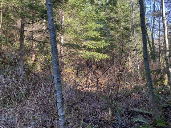
Bushwhacking on the overgrown logging road south of Devils/Scott saddle

Another photo to show the stretch of old, overgrown road

Thankfully the roads weren’t all that bad. These were open sections
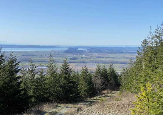
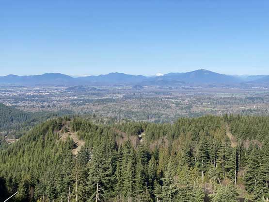
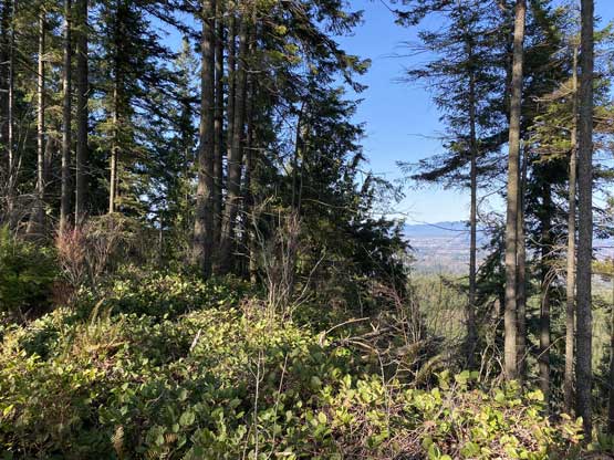
The view towards Puget Sound lowlands actually opened up too

Scott Mtn. gives pretty good view of the Olympics in the far distance
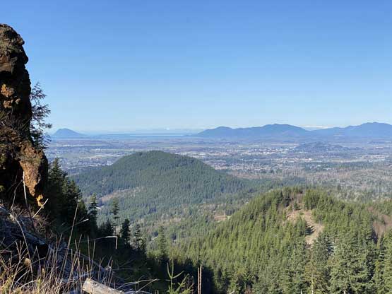
A northern view from the highest clear-cut.
Looking towards Anderson Mtn. et al. to the north
Little Mountain in the foreground – my next objective
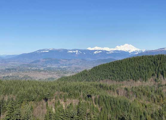
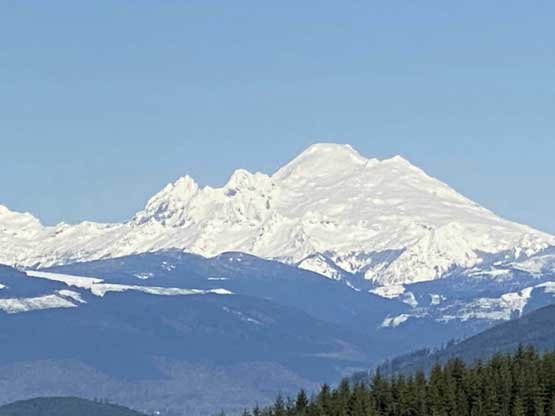
Mt. Baker dominates the skyline; Lyman Hill is the wooded ridge on left
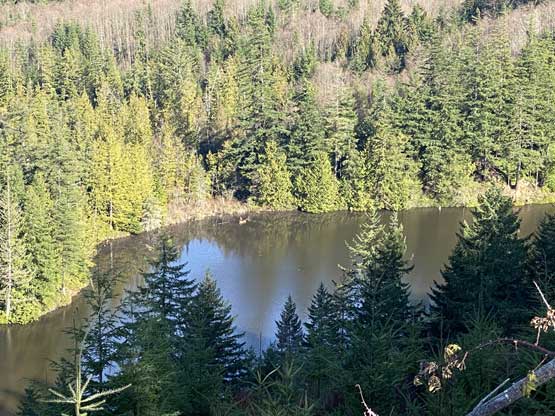
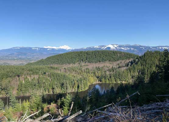
Looking down at Ten Lake immediately north of Scott Mtn. summit
A super zoomed view of Mt. Baker

Me on the highest clear-cut of Scott Mountain

Entering the woods now, looking back

Me on the true summit of Scott Mountain
Instead of retracing the roundabout route and dealing with the uphill bushwhacking on that short stretch of old road, I opted to explore the east ridge descent. For the first 1/3 I actually managed to stay on a game trail with flagging, but the trail soon lost itself in some thick underbrush. Thankfully the bush here wasn’t very prickly but still, the going was painful and miserable. The bushwhack on the lower part of the east ridge would be “BW3” on average and took quite a while. I also got quite scratched from the brambles as I wasn’t dressed properly for such type of terrain. Eventually I joined the main Devils Mountain Road and easily walked back to the truck. I was actually doing good on time so I decided to bag Little Mountain before going home for work.
Traversing the east ridge of Scott Mountain. Wasn’t too bad here
The brushes were getting thick in no time

The bushwhacking was pretty bad for a while…
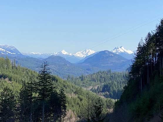
Whitehorse Mtn., Mt. Pugh and Glacier Peak from Devils Mountain Road
