Ayesha Peak
May 7-8, 2014
3063m
Wapta Icefield, BC
Ayesha Peak is a sexy looking peak, buried deeply at the far northwest corner of Wapta Icefield. Though not nearly as high as the bigger ones like Balfour, it’s certainly one of the most technical summits on this Icefield. To successfully bag it one has to cross the entire Wapta Icefield, ascend a long section of 30-35 degrees snow arete, traverse exposed south facing slopes, ascend very steep and exposed 45-50 degrees south facing gullies followed by climbing loose and exposed low 5th class rock steps. It’s one of the big prizes of winter mountaineering and certainly not for the faint of heart.
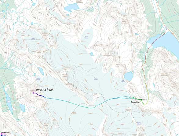
Ayesha Peak ski ascent route via Bow Hut. GPX DL
That being said it requires very strict condition. Apart from having stable snowpack and cool temperature, you want good visibility to cross the Icefield (and also for some nice views), but on the mean time you don’t want the south facing slopes to get sun baked. This past Thursday seemed like the right day. After a weekend of crappy weather dumping 40 cm on snow, sun finally arrived on Wednesday providing some essential melt-freeze, and another system was supposed to move in by midday on Thursday. Avalanche condition was moderate/low/low. The overnight freeze was not going to be as deep as the previous week, but still decent.
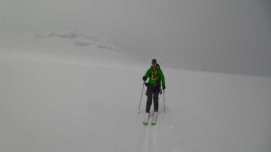
Like its higher neighbour, Mount Collie, this one can also be done in a day from Bow Lake parking lot, but to make it safer Vern and I decided to ski in to Bow Hut the previous evening, and to make it more secure, we’d wake up at 3:00 am and cross the Icefield in dark to beat the sun. The hut was a luxury place, costing almost 50$ per night per person, but apparently we’d have the entire Bow Hut to ourselves on Wednesday night, so I wasn’t gonna complain anything about it. We were a bit worrying about the ski-in since it’s gonna be late in the afternoon/evening. But the snow held up nicely even after a whole day’s sunshine, and by 7:20 pm we were already skinning across the frozen Bow Lake on a fast pace. Having already done all nearby peaks, this would be my last peak-bagging trip via Bow Hut. We made good progress on the approach thank to a solo skier’s track and 2 hours later we were at the hut. Above us was a crystal clear sky with millions of stars and impressive, but familiar mountains around. It was such a peaceful environment.
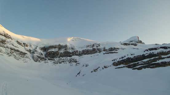
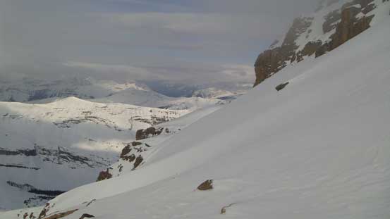
An obligatory shot of the terrain trap
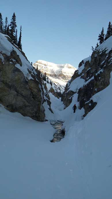
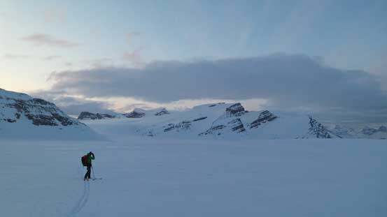
Ascending into the flats just after exiting the trees

A closer look at Vulture Glacier
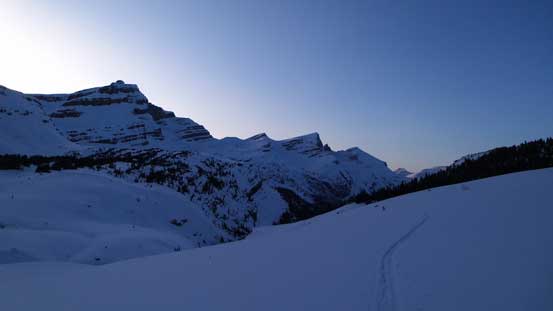
Looking back. Mt. Jimmy Simpson at center
After catching up a couple hours’ sleep we woke up at 3:00 am, still being able to see stars which was very good. Out we went, guess what we saw?! After a bit of confusion we soon realized it was the Northern light! Amazing. It fainted pretty quickly, but like I said earlier, there were a million of stars above and we were able to tell the outlines of the mountains easily. I also armed with accurate GPS tracks so navigation was simple. After following the solo skier’s track for a short while we deviated climber’s right towards The Onion, and after gaining the headwall we aimed more or less straight towards the distant Mount Rhondda.
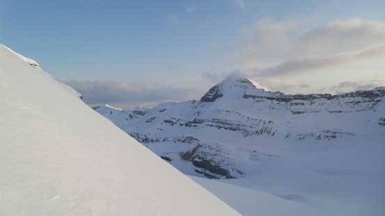
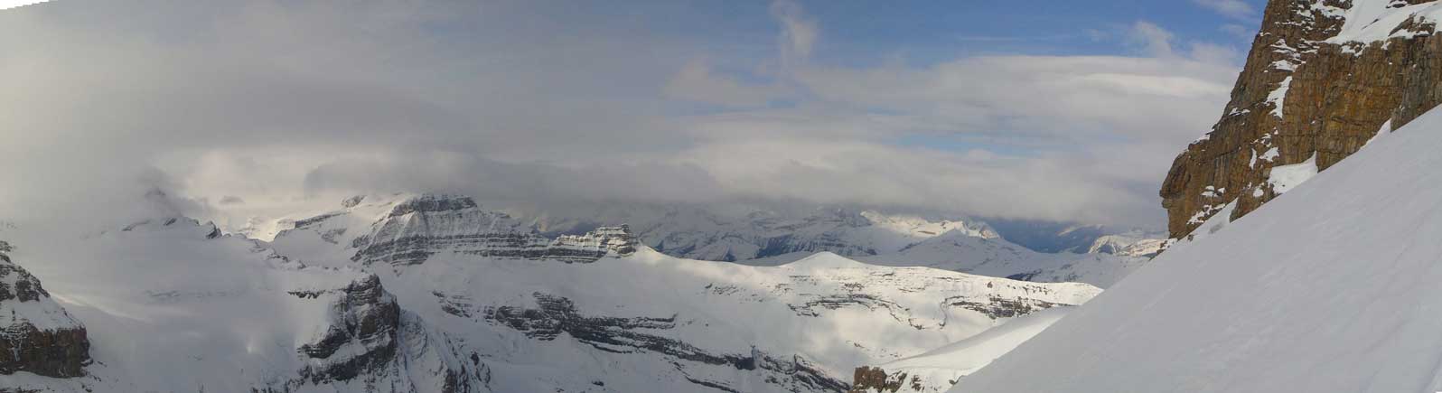
We resisted gaining elevation and by the time we were able to see the impressive Mount Collie, sky had already lighted up a bit behind us. From the broad Gordon/Rhondda col we had to lose more than 100 vertical meters down to the western half (BC side) of the Wapta Icefield. From our Collie’s trip we knew it’s a foreshortened view but given the fact it was dark we opted to keep the skins on. For Ayesha we didn’t need to lose all of the elevation, and in a short time we were able to see our objective. Curving around the base of Rhondda we aimed more or less straight towards the Ayesha’s sexy snow arete. This part was again, very foreshortened and seemed to drag on forever, but during which we got excellent view of our previous destination, Mt. Collie. Its summit ridge looked insane from this vantage point (well, it was indeed insane)… It took us 3 hours from Bow Hut to the base of Ayesha’s arete.

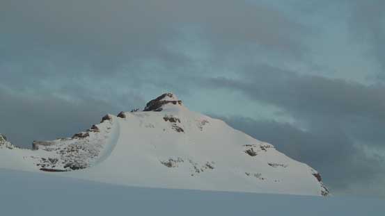
Skiing towards our objective. “Colliesha” on left
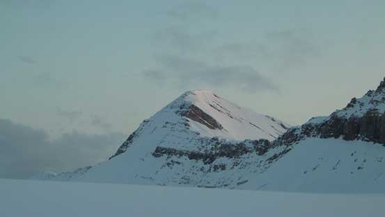
The mighty Collie at sunrise hour

Looking back towards St. Nicolas Peak and Mt. Olive
Mt. Baker is still on my to-do list
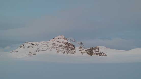
Our objective, the sexy Ayesha
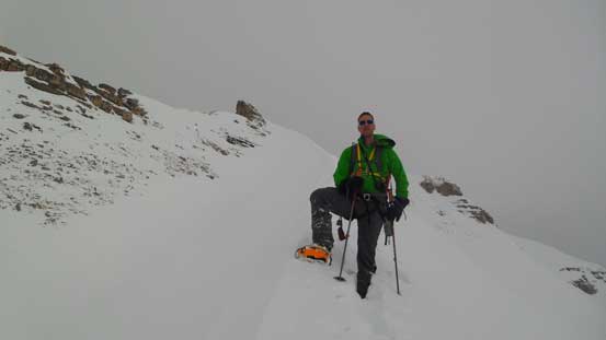
Vern taking in the views.
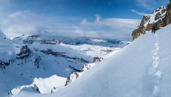
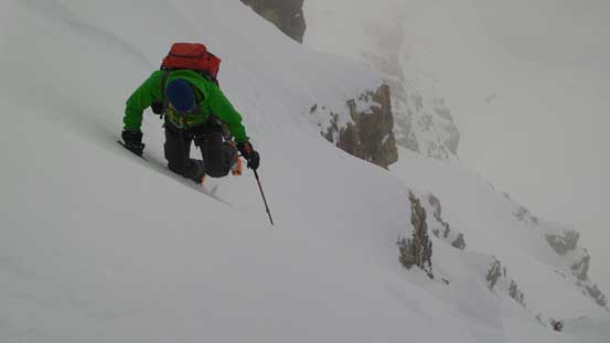
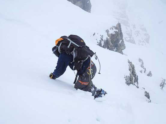
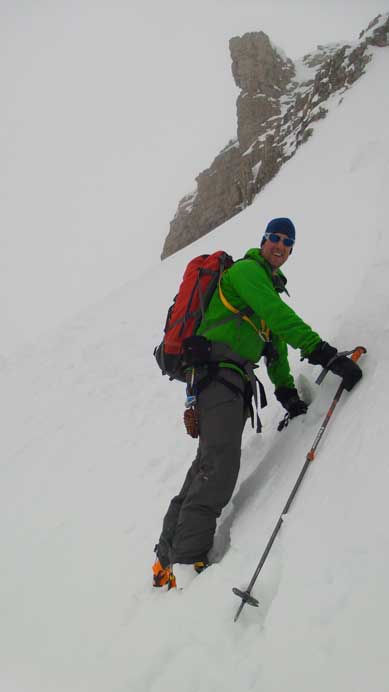
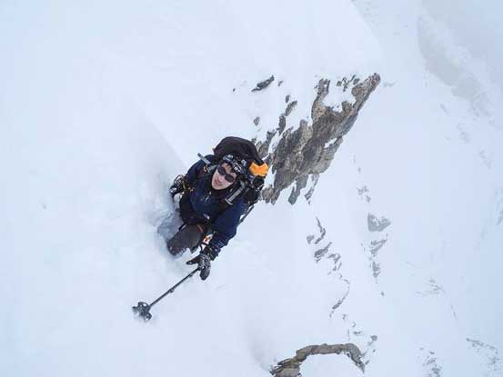
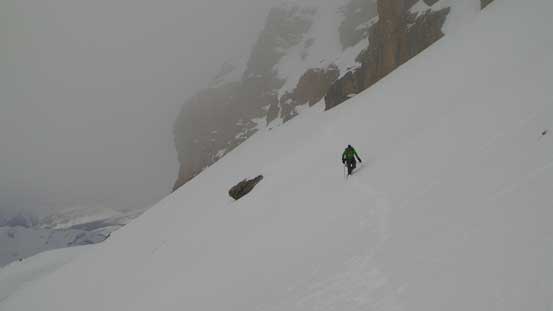
By now some clouds had already rolled in. It was a few hours earlier than our expectation but for this particular objective we were actually glad to have the clouds – to keep the south facing slopes stable. We skin’d as far as we felt comfortable on the snow arete. There seemed to be a lot of snow and we could have gone even further up, but looking back I wasn’t feeling comfortable skiing down this, so we soon switched to bootpacking. Well I should say, post-holing… On average it was knee deep post-holing, steeply uphill, and needless to say the travel was exhausting and mind-numbing. After a while the top of this arete just didn’t seem to get any closer and I decided to bail down leftwards into a broad gully. The snow turned out to be much better on this (left) side of the arete so we decided to keep following up the ridgeline until near the top where we eventually went to the middle of the gully. By now the clouds had lowered down soaking in the summit and we lost the blue sky.

Ascending the arete now. Terrible post-holing

Looking back. Impressive “Colliesha”

Looking down towards where we ditched skis
The slope is steep… Looking towards Mt. Baker

Me post-holing up the arete. Photo by Vern

Vern ascending the arete
Higher up
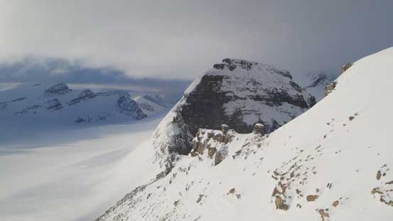
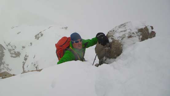
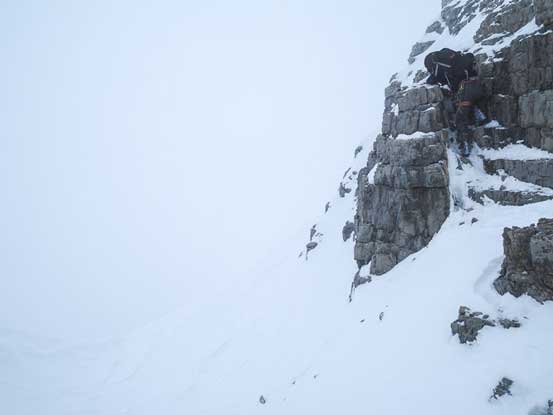
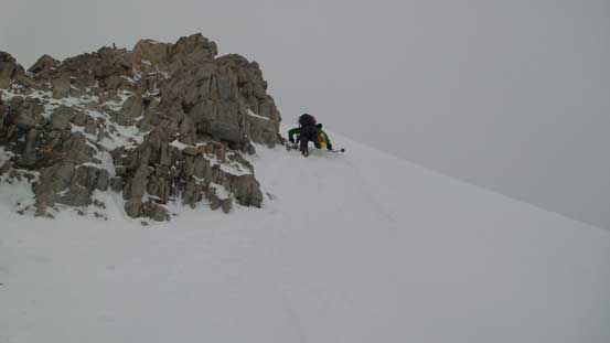
We had two options for the next section. Having Eric’s trip report in my mind I didn’t hesitate but immediately tackle the rock section straight ahead. It was slippery, difficult and exposed. It provided me a good warm-up for the summit block. Vern had his crampons on already so he went climber’s right up a steep snow slope which turned out to be the better route. Again, this was also a good warm-up for what’s gonna come next. We were soon facing against the steep and exposed south facing slope traverse ahead. This was also where Eric’s group turned around. I could totally understand why… You must be absolutely certain about the stability to tackle this traverse. Otherwise even if a small sluff happens you would not survive (because it will dump you over big cliffs below).
Exiting the snow arete, looking ahead. I took the rock route while Vern bypassed the rock on snow, climber’s right

Looking back, almost as high as “Colliesha” now
Weather is definitely moving in.
You want to be very certain about this slope before committing to it.
Probably the most blue sky we could see from now on. Click to view large size.
I picked a line diagonally up straight towards the base of the ascending gully. Some obvious rock ‘guards’ naturally separate the main gully into three smaller gullies paralleling each other. We chose to ascend the rightmost one because it appeared to be the least steep. Well, that’s still very steep… I was more or less looking straight upwards. The snow was a bit softer than the perfect condition but that was still okay. The bottom part was post-holing but soon switched to step-kicking about halfway up. Near the end it was at least 45 degrees and once above the rock ‘guards’ we had to traverse climber’s left. It was so steep that we had to traverse sideways and kicking hard and front pointing into the slope. This part reminded us Collie. We were not dealing with any cornice here but it was as exposed as on Collie.

Vern starting to traverse the south facing slopes
Me approaching the ascending gullies. Photo by Vern
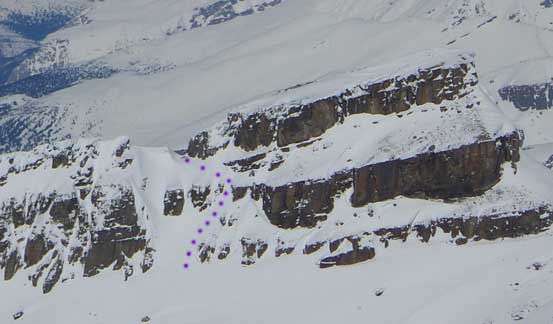
The purple dots show our route up the gullies. Photo taken from Mt. Collie in the previous week.
Vern climbing up steep snow. Typical terrain on and above the gullies. South facing, ridiculously steep and very exposed…
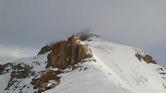
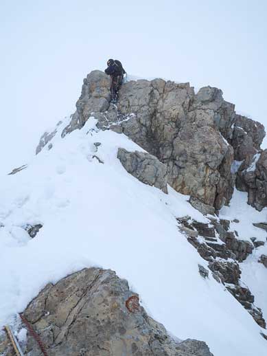
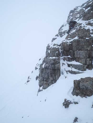
And we were not done yet… Probably because we were too stressed on the snow section, we kinda ignored the difficulties on the last part. There were still two sections of low 5th class rock waiting for us. The first one was easier but much more slippery, looser and longer. It didn’t appear to be very difficult so I kept my crampons on which was a mistake. (Of course it turned out to be more difficult than I thought). Cramponing on rocks was awkward. After this section I removed them. The next step was shorter but more vertical (almost overhanging), and quite exposed. I tried a few ways and eventually committed to it and made it up. And then it was merely a walk to the summit. It was a white out.

Me climbing up the difficult terrain, 1st rock step. Photo by Vern

Vern clearing the 1st step
Vern climbing up the 2nd step

Me approaching the summit in a white out. Photo by Vern

Me on the summit of Ayesha Peak
The summit stay was short since we couldn’t see anything other than ourselves… On the descent we took our time and down-climbed the two rock sections. We thought about rappelling them but decided not to. We’re both very confident on loose and exposed terrain and it was much faster to down-climb and both sections turned out to be easier than expected. For the upper one I felt it was easier to down-climb than up-climb. For the snow gully there’s also the option to rappel it but as usual we didn’t feel the need to do that. Having our steps to follow it was pretty straightforward and we were off the difficult terrain quickly.
Me down-climbing the 2nd step. Photo by Vern

Vern down-climbing the 2nd step
Me down-climbing the hardest part of the 1st step. Very slippery, loose and no hold, and very exposed and on ski boots… Photo by Vern
Me down-climbing the last bit of 1st step. Photo by Vern
Me starting the snow part. Firstly I had to face inwards and traverse to our gully. Photo by Vern
This photo shows the angle of the slope…
Me ready to down-climb. Straight down… Photo by Vern

Vern down-climbing the gully. I was bombasted by snow balls.
Vern traversing back the south facing slopes. Good thing the sun was out.
As expected as we lowered ourselves we escaped from the clouds again. At this point we were still hoping to ascend “Colliesha”, the unnamed peak between Collie and Ayesha. But the lower we descended the less motivated we were. The snow arete was already blended with the background due to flat light. And by the time we got to our skis weather was really moving in. “Colliesha” is rather the back-up plan (if we didn’t get Ayesha), or bonus (if we did get Ayesha and wanted some extra views), certainly not something we “must do”. We wouldn’t get any view from its top neither and the ski would be miserable so we figured it’s not worth. We were really glad we didn’t go for it as 20 minutes later we were in a complete white out.
Down climbing steep snow to bypass the rock step on the lower ridge
Vern descending the snow arete
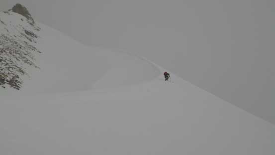
Ready to ski down the rest of the arete.
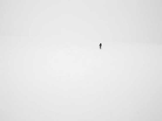
Our ski tracks were fainted but still visible so we didn’t need GPS at this point. We removed the skins on the western half of the icefield since it was mostly flat or very gentle downhill, and once around the base of Rhondda we put the skins back on. Temperature was hot and the snow was balling under our skis at this point. Travelling was quite miserable and we knew there’s still nearly 200 vertical meters to slog up. Thankfully Vern brought his skin wax which helped a big time. Up onto the eastern half of the icefield the white-out got even worse. We couldn’t see anything other than ourselves. I pulled out my GPS quite a few times but we still got a bit too close to The Onion. That was okay as we could easily correct ourselves. The ski down to Bow Hut was hard thank to the flat light condition.
Skiing across the Wapta. Nearly white out
Now it’s a white out… Photo by Vern
We still had the entire hut to ourselves and took a lengthy break. After doing some basic “hut stuffs” we were ready for the return. Like expected, snow was in bad shape and I was struggling on making turns on the dense and slushy stuffs. I couldn’t see the slope angle neither thank to the weather… Anyway, I somehow managed to ski down the big gully and then into the canyon, and then out through the canyon. I took a couple falls and was 10-15 minutes behind Vern so not too terrible. But in next season I really have to improve my downhill skills.
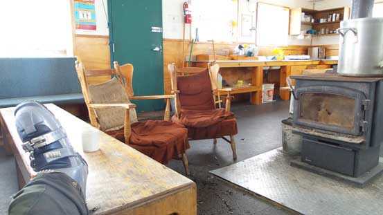
Having the Bow Hut to ourselves
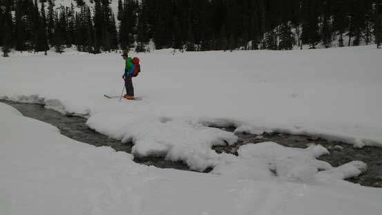
I’m sure this snow bridge won’t last any longer… Ski season is almost over.
It was a very satisfactory trip to have Ayesha Peak bagged. By now I’ve got most of the peaks on Wapta Icefield except for a few via Peyto Hut plus Mt. Des Poilus (summer via Little Yoho). Bow Hut is a lovely place and I’m sure I’ll be back here someday to purely enjoy the wilderness and the skiing without the ‘pressure’ of bagging a summit. Speaking Ayesha Peak itself, only the hardcore would consider doing it, and among those ones many had to turn around after slogging a long way up there and we were really glad to have the ideal condition. Together with its neighbour, Mt. Collie, they are surely the highlights of ski mountaineering on the Wapta. Awesome climbs.
