Mount Adams
June 14-15, 2022
3742m
Mount Adams Wilderness, WA
The famous volcano of Mt. Adams is the second highest peak in Washington that sees thousands of hikers and mountaineers each year. The standard route, the “South Climb” is entirely non-technical and non-glaciated. A lot of people pick Mt. Adams as their introductory climb to mountaineering at higher altitude and I would agree. The route can be done as a day-trip (over 2000 m elevation gain) but most folks opt for two days with a camp at “Lunch Counter” at 2850 m elevation. In the period of 2016-17 I climbed the four other Washington volcanoes. I somehow missed out Mt. Adams but never came back to finish the business mostly because of the unappealing long drive. One needs a vehicle with decent clearance to overcome the water bars on the last 2 miles to the trail-head so I couldn’t tackle this drive in my Corolla. I could have easily tackle it in the Tacoma but that’s far from being fuel-efficient. I was hoping that someone would eventually offer to drive me there but this peak had never come up on the agenda until 2022. I actually had a few offers as a handful friends wanted to do this peak with me, but in the end I decided on a mid-week weather window with Elise. I also wasn’t keen to do this peak as a day hike so I was very glad that Elise agreed on the overnighting plan. The rewards of sunset and sunrise would definitely offset the extra 15 lb of pack weight. Mt. Adams also requires a climbing permit so I booked our dates on the computer and that costs 10 dollars per person.
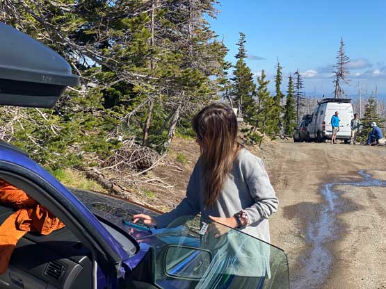
Elise picked me up from White Rock at around 9:20 am on Tuesday morning and in no time we were driving southwards down I-5 in Elise’s Subaru Forester. This Subaru (circa 2003) was missing a lot of the modern era things but somehow has the heating seats. There are quite a few ways to get down there and we picked the most obvious route by detouring to Portland and then Hood River. This route might be slightly longer than the Yakima variation but whatever. Elise had just slept over 12 hours so did the whole drive by herself, whereas I was tired by just sitting on the passenger seat. I took a few naps somewhere from Seattle southwards. From Hood River we drove northwards crossing Columbia River on a toll bridge and the next stop was Trout Lake at the foot of Mt. Adams. We then followed Google’s direction onto the FSR system. There were lots of downed trees that had been recently sawed. Towards the final few kilometers we started to encounter water bars that would definitely scrap the bottom of a passenger car and then we started to drive into that final stretch passing Morrison Creek campground. Contrary to the previous trip reports in the past few weeks we actually managed to drive all the way to the trail-head at Cold Springs campground, but there were at least 20 deep water bars on this final stretch. The final one just before the campground had surely put Elise’s Subaru in test.

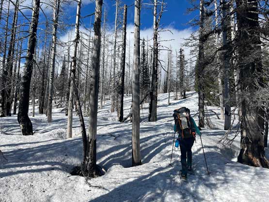
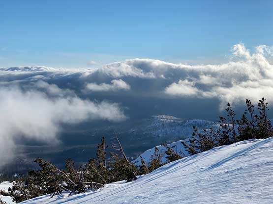
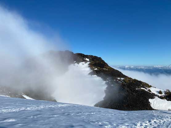
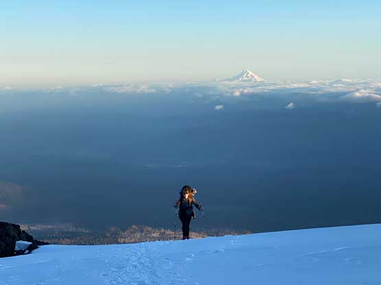
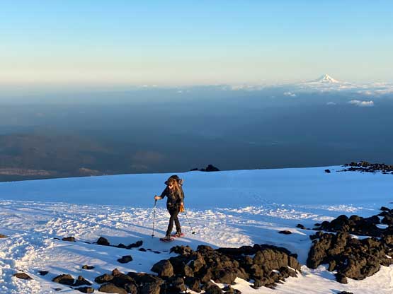
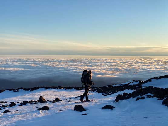
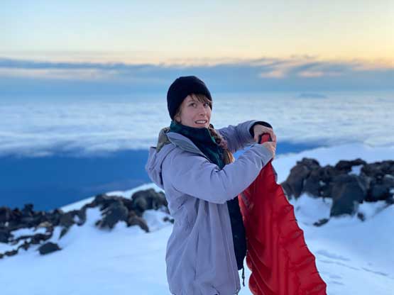
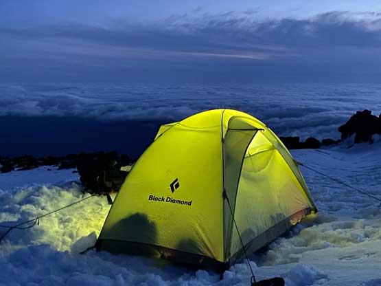
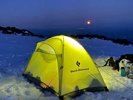
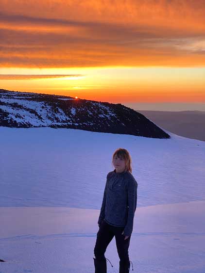
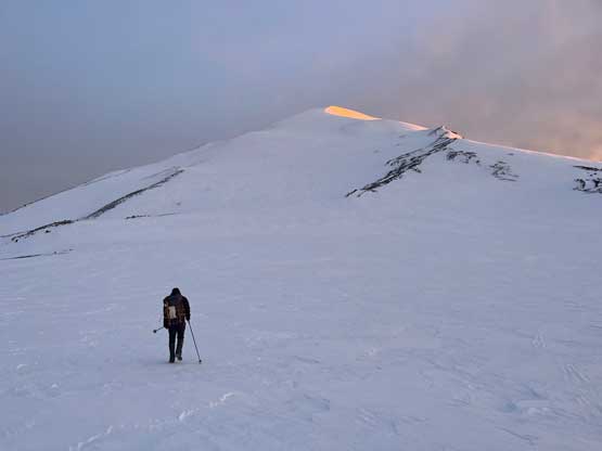
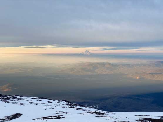
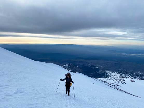
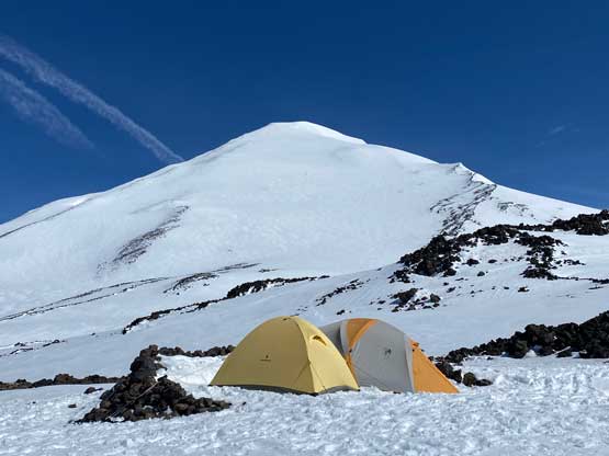
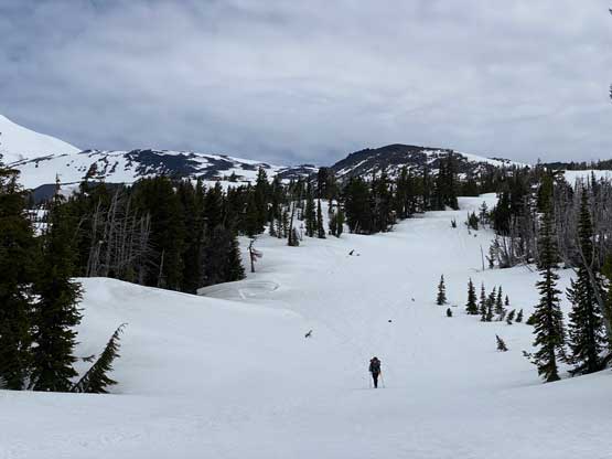
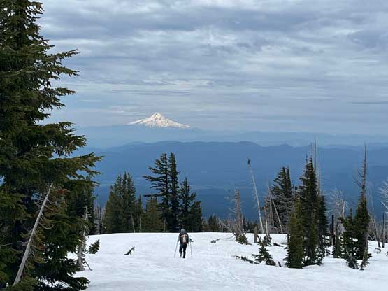
We took our time to pack and repack as we didn’t want to risk missing out some important items. We eventually started the plod at 6 pm. Right off the bat we encountered continuous snow so we donned snowshoes. At the start of this approach we chose to ignore the existing path and instead, we opted to follow the fresh skier’s tracks to take some short-cuts. The upper short-cut we took was free of snow, so we took the snowshoes off and carried them in our hands. Beyond that we merged onto the main climber’s track which didn’t seem to follow the exact line as per the Gaia’s GPS map. In any way we were above the burnt forest in no time and the next stage was simply putting one foot in front of another, gaining ~400 m to the base of South Butte. There were some intermittent white-outs thank to the low clouds but we completely broke through this cloud layer once above South Butte. The original plan was to camp here, but we were doing good on time so the new decision was to camp higher at Lunch Counter. We took one long break to regain some strength for the soul-crushing 500 m slog to the campsite. The view was extremely foreshortening so constantly consulting with the GPS was the key to survive this stage. The views were thankfully improving drastically in the evening hours and we eventually found a perfect spot to perch the tent right around sunset. There were at least 5-10 more tents but nobody was right next to each other. We then did our evening routine things and went to bed at 10 pm. I had brought my -32C sleeping bag so the sleep was extremely comfortable.
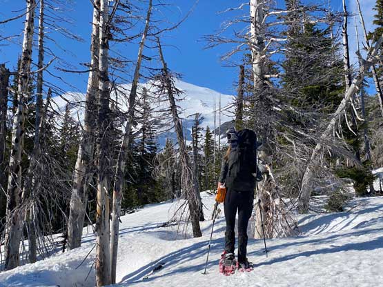
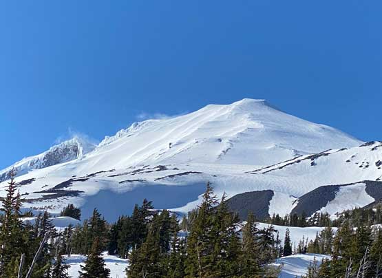
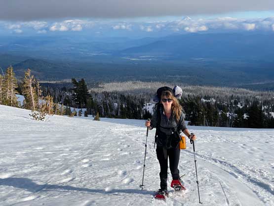
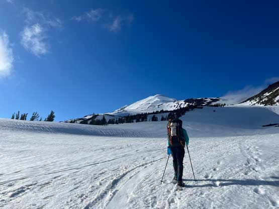

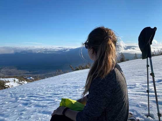


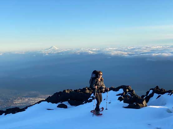
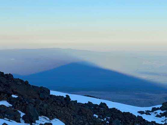
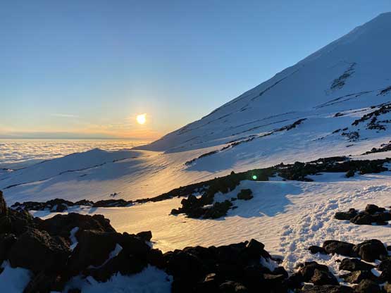
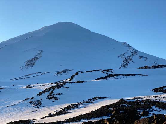
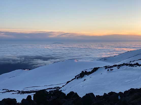
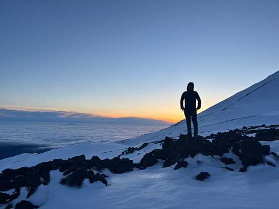
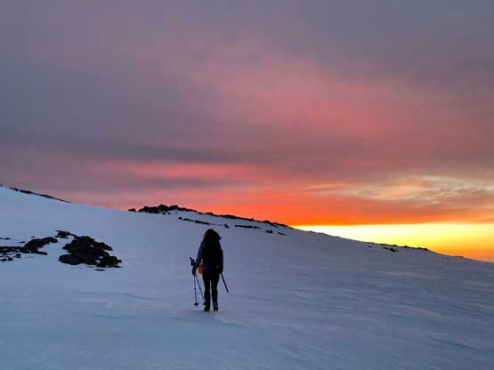
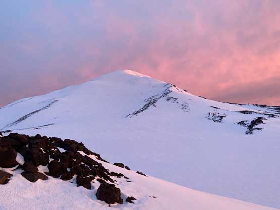
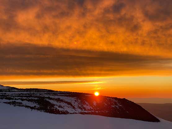
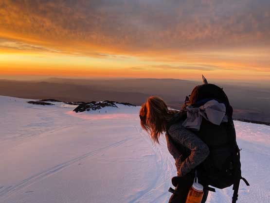
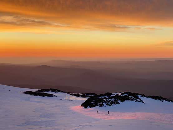
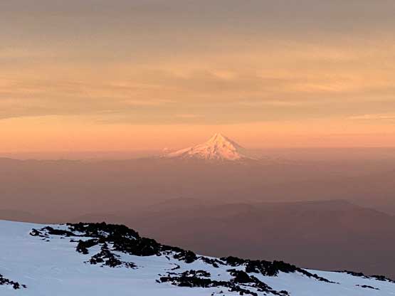
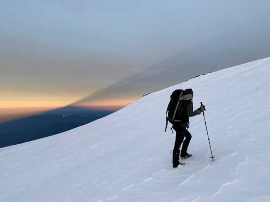
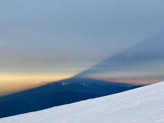
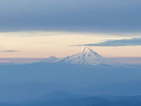
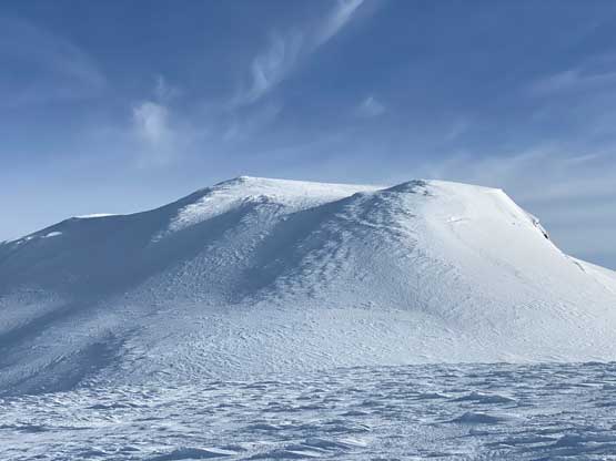
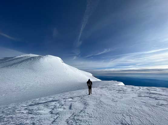
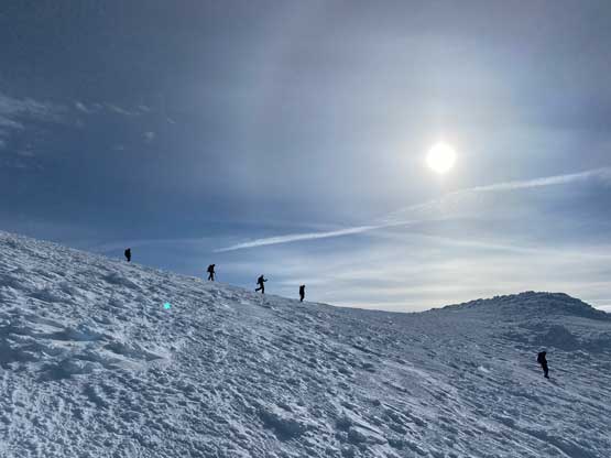
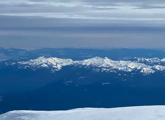
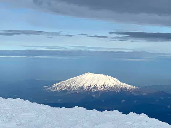
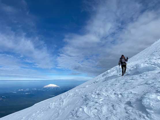
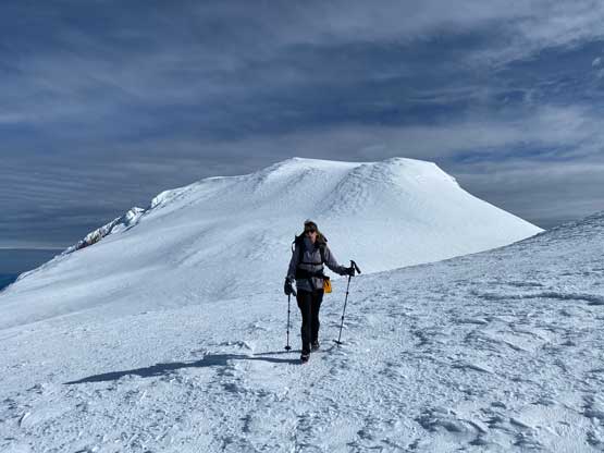
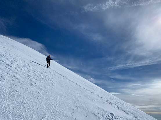
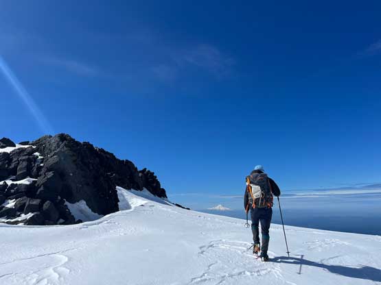
Ideally we would like to watch sunrise from the summit of Pikers Peak or even the summit of Mt. Adams itself but such would require getting up at 2 am which none of us was keen on. The secondary solution was then to get up at 4:30 am and watch sunrise from near our campsite. This worked out reasonably well. We started the day at about 15 minutes before sunrise. I spotted a nearby high point labelled “Suksdorf Ridge” on the Gaia map so we went there to get our views. The sunrise turned out to be quite an epic show. Had we ascended higher into the bowl under Pikers Peak we would have missed the actual sunrise. After taking a million photos we carried on. A group-of-five was about 20 minutes ahead and stayed ahead of us for the entire ascent so we more-or-less just followed their route. The climb onto Pikers Peak was again, a soul-crushing, 700 m slog mostly on 35-degrees slopes. The condition was very icy such that boot crampons were definitely required. We didn’t even bother to carry snowshoes and just ditched them at camp. We started the ascent with boot-packing but as soon as the slope angle increased we stopped to don crampons. We didn’t end up using the ice axes though, as this was overall just a 35-degree snow slog. The final bits onto Pikers Peak’s ridge had a few steeper rolls. The main track traversed under Pikers Peak to shoot straight for Mt. Adams but we opted to plod up and over Pikers Peak. This is overall an officially-named high point so we couldn’t just ignore it.


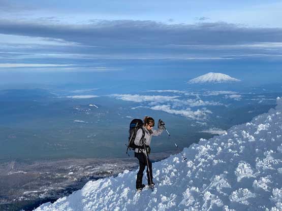


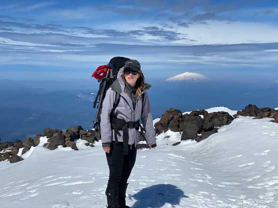
After plodding over Pikers Peak we traversed a long ways due climber’s left to join the foot prints. The final 200-m ascent to the summit of Mt. Adams was very similar to down there under Pikers Peak, but not as long nor as steep. The actual summit had a few contenders so we made sure to have tagged them all. At first we guessed the leftmost high point (SW) being the summit but then the name on the Gaia map is labelled on the NE high point so we traversed there as well. The solo hiker who had been following us most of the morning caught up to us on the summit.
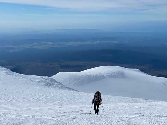
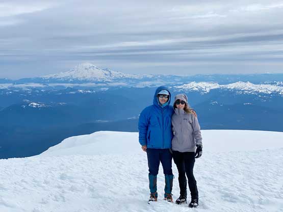

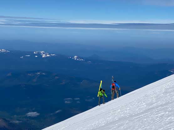
The summit itself was windy and cold and we briefly lost the sun due to some incoming high clouds, so we couldn’t linger longer than necessary. We soon plunged back to Adams/Pikers saddle and then took the traversing route to minimize elevation regain. And then there came the 700-m descent to camp. About 1/3 of the way down we observed at least two dozens of skiers and climbers ascending and to our surprise, some of them were still trying to skin up this increasingly icy and steep slope. And sure enough the next second we saw one skiers taking a tumble, sliding down at least 200 m if not more. We walked to the fallen skier’s partner and helped her to make a sketchy transition to the downhill mode so she could slowly ski down to help her partner. None of them had brought boot crampons so that’s the problem. The other parties on the mountain had already descended to help the injured skier so we resumed our own descent. By the time we finished breaking camp the skier was still there and didn’t move. We assumed that she might actually need to be helicoptered out but we didn’t see nor hear any helicopter activity in the next few hours, so hopefully she was okay and walked out on her own.
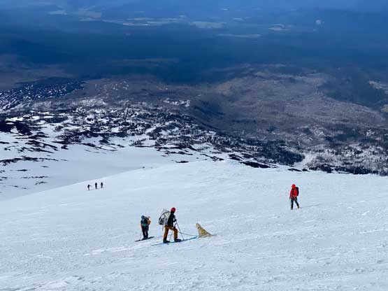


The snow had softened enough that crampons were no longer needed below our campsite. The snowshoes might be needed at some point, but we decided to start with boot-packing. I even managed to link up several glissades to descend to South Butte whereas Elise mostly walked as her pants weren’t as smooth as mine. The post-holing in mushy snow below South Butte almost made me want to don snowshoes but we toughed it out in the end and didn’t bother to do any more transition. We somehow went off-route near the end but corrected the mistake by some brief bushwhacking. The round trip time was exactly 10 hours combing the two days and that included the time we spent breaking camp. I think this would be a reasonable day-trip time as well for those not willing to spend the night up there.
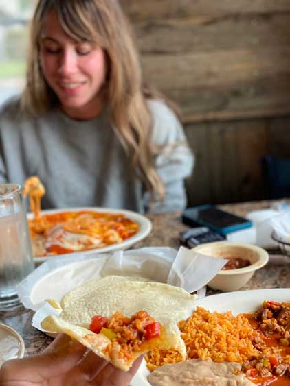
We finished the climb at noon so we didn’t have to rush driving back home. The Google once again directed us towards Yakima and this time we opted to listen to the technology. The drive through Yakima and Snoqualmie Pass was actually more scenic and less busy than the Portland-Olympia direction and this way we also closed in a driving loop in southern Washington. We stopped in Las Palomas in Toppenish for a well-deserved dinner. The Mexican food was as good as the ones I had in New Mexico and that was an unexpected bonus. Elise was somehow still high on energy and did the rest of the drive all by herself and we eventually got back to White Rock at 9:30 pm, and that concluded another successful mission. I think this trip turned out to be exactly how I wanted to tackle Mt. Adams and that was surely an awesome finish for my quest to climb the Washington volcanoes. Now moving onto the bigger Cascadian volcanoes list I still have 4 smaller-ish ones in Oregon left. Most of them aren’t particularly interesting though…