Tye Peak
December 23, 2017
1669m
Stevens Pass / US-2 Corridor, WA
The peaks around Stevens Pass of Central Cascades do have one thing in common – small with little mountaineering interest in general, and “Tye Peak” isn’t an exception. The name of this little peaklet is given according to the proximity to Tye Lake and Tye River but the status remains unofficial even though it’s pretty commonly used on the internet. The peak locates within a couple miles from the ski resort but is fairly unpopular in the hiking community for simple reason there’s no trail to the summit. The best time to ascend “Tye Peak” is during winter when deep snowpack covers the brushes and boulders. In the right conditions you will see skiers ripping the south-east face.
For peak-baggers it makes natural sense to ascend “Tye Peak” and “Sky Mountain” in a single trip as they share the same approach. This was exactly my plan too. The recent low-elevation snow combined with a supposed heavy-duty trail-breaking meant I had to downgrade my ambition even though the avalanche hazard had dropped back into “moderate”. An access from one of the few high divides seemed like a good idea. It’s about 270 km drive each way from where I live to Stevens Pass but unlike the Pemberton area the road trip down I-5 is much simpler than the mentally-draining Sea to Sky Highway. The decision was a very last minute call so I didn’t get to sort things out and drive down there the previous night. Instead I opted to wake up at 4 am. About 4 hours later after a whole lot of morning routine things I did manage to park at the ski resort. The rules were confusing but I did manage to find a free parking spot.

Winter ascent routes for Tye Peak and Sky Mountain. GPX DL
The first business was crossing US-2 onto the north side on a foot bridge. The employees do not allow a direct crossing of the highway for this-or-that reasons. I then picked up the old radio tower road switching back up the hill sides. The traffic was heavy and the trail had been packed down but I still opted to use the snowshoes mainly for the heel-lifts and the added traction. Past the radio tower I came to a couple unsigned junctions on the trail and then took a smaller branch heading towards Skyline Lake. The next task was to reach the “ridge” above Skyline Lake but apparently I had little idea where exactly to aim at. As a result I took a wrong trail again which soon became a dead end. After backtracking to Skyline Lake I then found the correct trail on the north side and had no further issue.
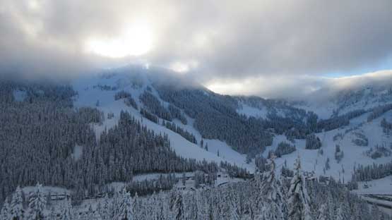
Partway up the switchbacks, looking back at the ski resort
Hiking into the sunshine.
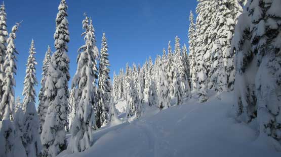
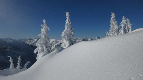
Thank to the massive amount of recent dump the scenery is really good

It looks like a hack of winter wonderland to explore ahead.

Reaching the frozen Skyline Lake now.
Beyond the “skyline ridge” one has to drop about 100-150 meters of elevation into the north side bowl. By now all forms of traffic were exclusively made by skiers with a significant reduce in the volume. I was the only snowshoeer heading that way on this day. The trail-breaking was thigh deep in the soft powder so I pretty much stayed entirely on the skin tracks. Even on the tracks I post-holed occasionally down to waist deep. After a while I realized the tracks descended a bit too low than I had originally planned and then there showed up two skiers going up. They were also heading for Tye Peak. After a bit of conversation I figured they knew what they’re doing so opted to follow behind. They surely did an excellent job navigating to the Tye/Sky saddle which was about 80 meters above.

I joined these two skiers and now we were going towards Tye/Sky saddle
From the saddle the simple business was then to follow the south ridge all the way to the summit. This south ridge was a bit more complicated than I thought with a couple steep rolls and a few steep open traverses higher up. I just had to follow the previous skiers’ tracks up and the post-holing conditions gradually improved a bit with the increasing wind effect the higher we went. At the summit the others did a quick pit test. The recent 1.2-meter snowfall bonded pretty well to the previous surfaces and the only sign of minor instability was within the storm snow.

Sections of the lower south ridge was quite steep…

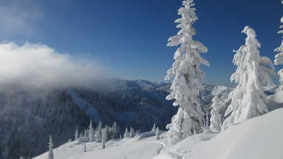
Skinning up. Note the mist coming in and out.

The upper slope is much mellower
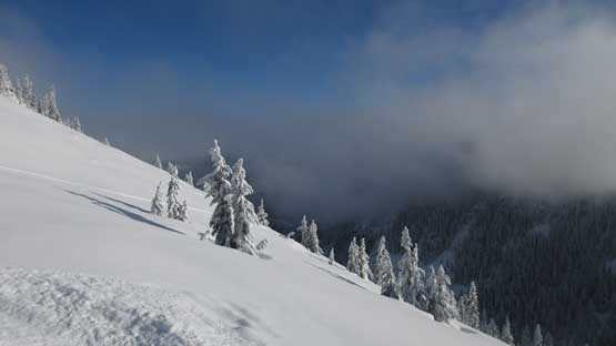
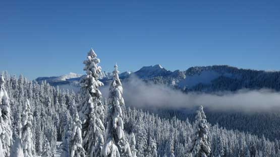
Again this shot shows the fog layer. I didn’t get much of a distant views from this peak.
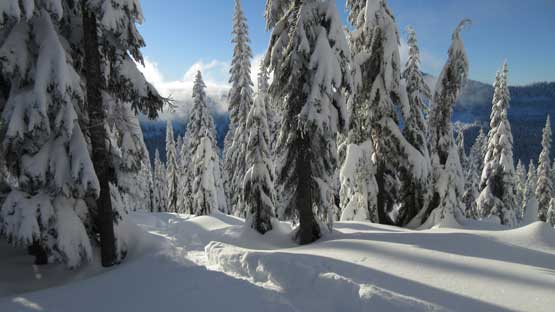
The best views from Tye Peak today was the frozen tree statues.

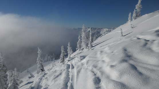
Steep skin tracks traversing on open slopes.
Just another shot to show the tree statues
Almost there. Note the new and old ski tracks

This is the steep SE Face that the other skiers eventually opted to descend
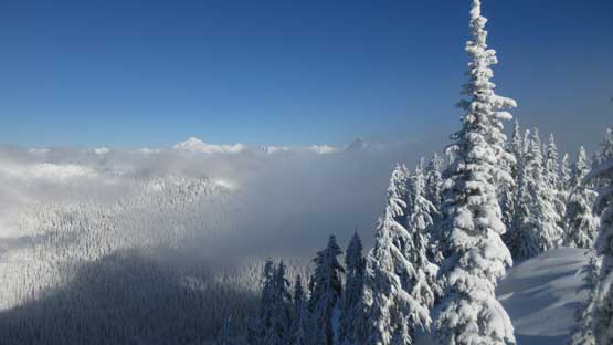
This is a summit view towards Glacier Peak on the horizon

Studying the history of this snowpack.
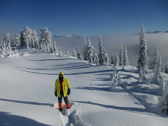
Me on the summit of Tye Peak
The skiers decided to ski some steep lines on the south-east slopes while I would simply retrace our ascent tracks. I thought about connecting Sky Mountain directly from Tye/Sky saddle but the clouds had obscured the visibility plus I had no beta saying whether or not it’d go. I had no interest in playing with the unknown on this particular day. The only beta I had for Sky Mountain was by traversing the east ridge so my job now was reversing my tracks all the way back to where that east ridge starts. Hordes of snowshoeers had already packed down a path to a “rock garden” but few seemed to venture beyond due to some steep terrain. This seemed like a good place to take a break.

Descending back into the “north side bowl”
One of the few openings while grunting back towards the “skyline ridge”
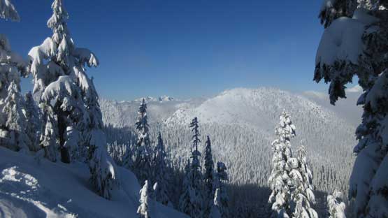
The weather’s gradually improving with more and more peaks showing up
Looking back I could see the top of Tye Peak in the foreground
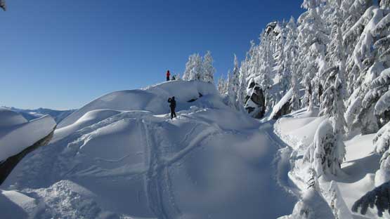
Hikers enjoying this rock outcrop and some views

The rocks around here are gigantic in size..
After a while I decided to continue on towards Sky Mountain to finish this pre-planned double-header day.
