Mount McCausland
December 28, 2019
1752m
Stevens Pass / US-2 Corridor, WA
Mt. McCausland is one of those small summits in the immediate vicinity of Stevens Pass that’s relatively popular in all seasons. In the summer time one can drive a couple miles up the Smith Brook forestry road but for peak-baggers like myself, the peaks in Stevens Pass area are only served as winter objectives. The access is easy and the slopes are gentle enough that avalanche is usually not a primary concern. Masayo was keen to get out on the last Saturday of 2019 but the decision to snowshoe up Mt. McCausland was a very last-minute one. I knew there had seen over a meter of fresh snow in the previous week so even with the “moderate” avalanche conditions we still had to be conservative in picking objectives. Mt. McCausland was not a “creative” objective as I had snowshoed 4 summits in Stevens Pass area and I knew these peaks pretty well. It’s more or a “show-up-and-do-it” type of outing, as I was tired from work that I didn’t want to spend too much time browsing maps and condition reports.
I drove south across the border at 5 am without event and picked up Masayo at around 5:30 am in Bellingham. We did one stop in the McDonald’s near Mt. Vernon before resuming the southwards drive towards US-2. The drive eastwards up to Stevens Pass was relatively fluent although the road was snowy and the weather was foggy. There was a layer of stubborn low clouds the whole day that kept the temperature well below freezing at the pass level. The proper trail-head pull-out was a ways east of the pass and a few hundred vertical meters down. In the winter time the Smithbrook Road was used primarily for snowmobiling and that added about 5 km of road walking each way.

Mt. McCausland winter ascent via Smith Brook. GPX DL
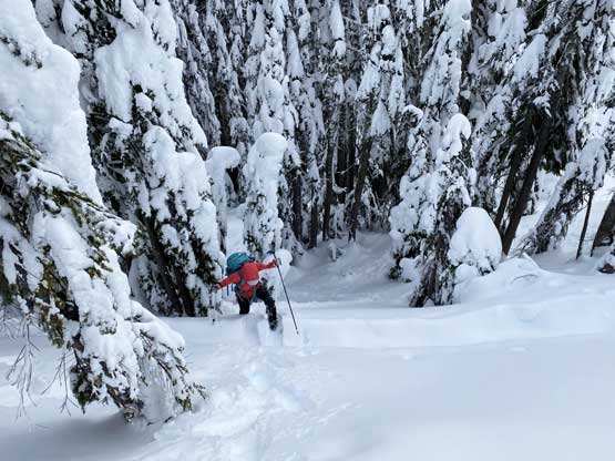
The crux was actually the first 300 m of walking because we had to walk on the shoulder of highway. After that we got onto the forestry road that’s already well packed by snowmobiles. Snowshoes weren’t needed for the road walking but we strapped them on anyway for increased traction. There’s more elevation gain on the road that I remembered from Union/Jove Peaks trip almost 4 years ago. About 100 m past the summer trail-head we dropped into the forest, following a maze of snowmobile tracks to the south side of Smith Brook. There’s no defined “winter route” while ascending the upper Smith Brook drainage but the general idea was to follow close to the creek but staying on the south side. The sled tracks were confusing, but did go more-or-less towards the direction we wanted. After a series of steeper rolls we deviated from the snowmobile tracks at the base of the impressive north face of Lichtenberg Mountain.

Starting the road plod. Photo by Masayo L.

Me at the end of road plod, looking up the valley. Photo by Masayo L.
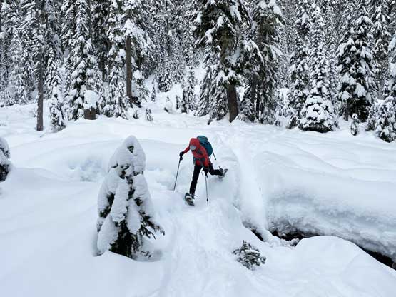
Masayo crossing Smith Brook to its south side
Masayo taking turn trail-breaking. It’s starting to become heavy…
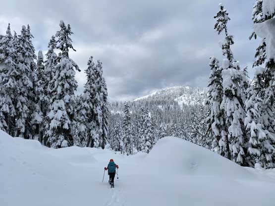
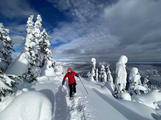
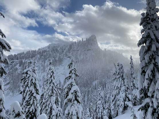
Our objective – Mt. McCausland ahead in the distance
Masayo fell into a creek weak spot.

We traversed under the north face of Lichtenberg Mtn.
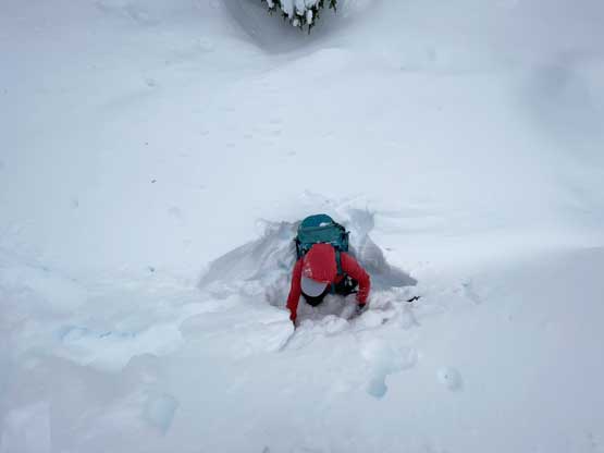
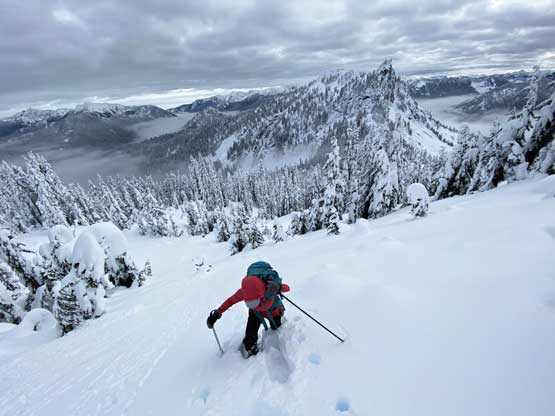
The trail-breaking was terrible from around 1400 m all the way to the summit. The supportive crust lower down had given way to deep and heavy powder that I sank past knee deep even with 30′ snowshoes. We also had to be extra careful about weak spots and that included buried creeks and tree wells. Masayo even discovered a chest deep weak spot but was able to get out on her own. The original aim was the broad saddle between McCausland and Lichtenberg but we somehow got disoriented in the winter wonderland. We crossed Smith Brook back to its north side without noticing and soon we found ourselves wallowing up the increasingly steep SE flanks directly towards the summit. By the time I checked the GPS to realize the navigation error it was already too late to correct. The new plan was to just find a way up this side of the peak. Apart from being steeper with sections over 35 degrees we also had to deal with tight, young trees and the associated tree wells. The trail-breaking was very slow going but at least we weren’t particularly far away from the summit. With perseverance we managed to wallow through the misery arriving at the partially forested summit. The views were better than expected given the not-so-great weather forecast.
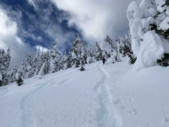
Fighting gravity up the steep forest. Already a bit off the planned route.

Masayo leading into a long stretch of young timbers.

This was around the worst of trail-breaking.
Masayo wallowing up with Lichtenberg Mtn. behind

Me wallowing. Photo doesn’t show the steepness as it’s about 35 degrees

Near the summit, this is looking down towards Stevens Pass covered in clouds

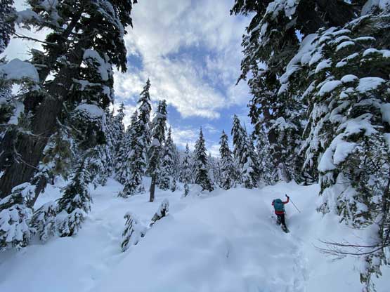
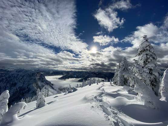
Masayo breaking trail up the final bits to the summit
Rock Mountain and Mt. Howard to the east

A zoomed-in shot of Sloan Peak – the Matterhorn of Cascades
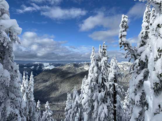
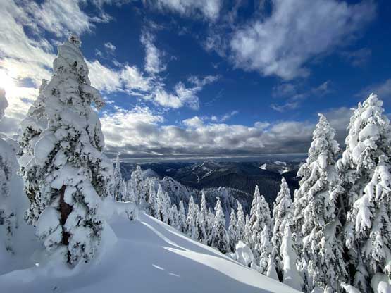
To our surprise we started to see more and more of blue skies

We went north a bit in hope to see Glacier Peak but to no avail

Masayo hiking back towards the true summit
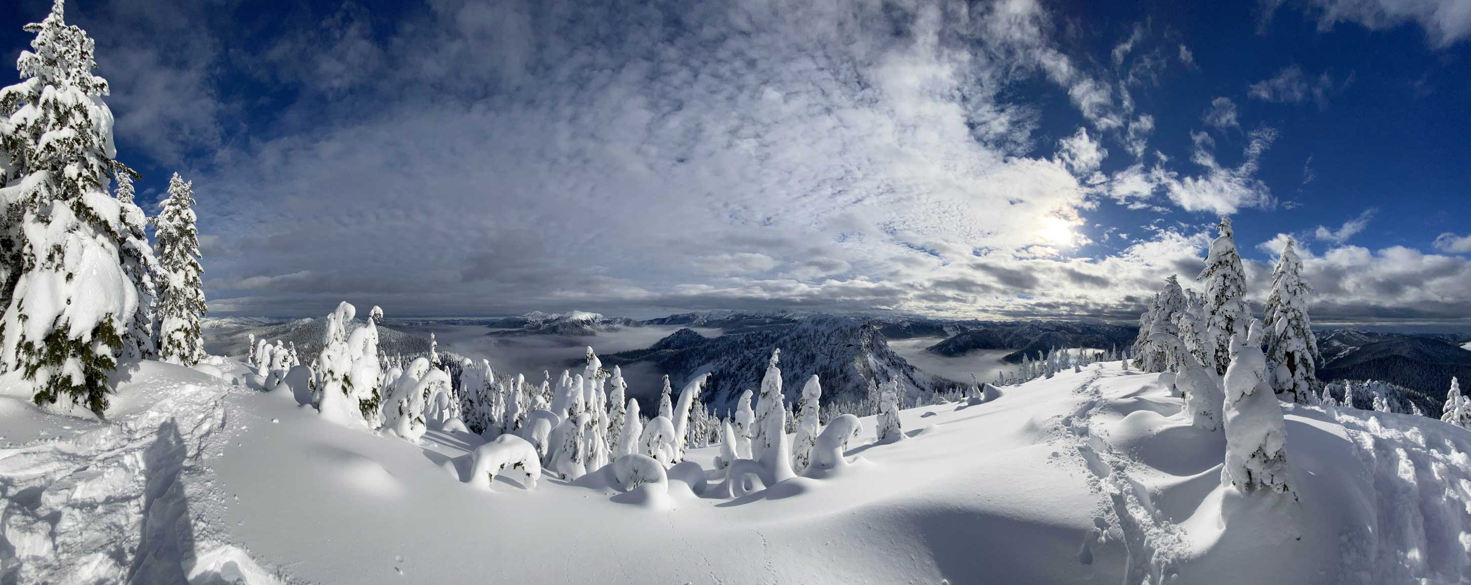
Partial Summit Panorama from Mt. McCausland. Click to view large size.

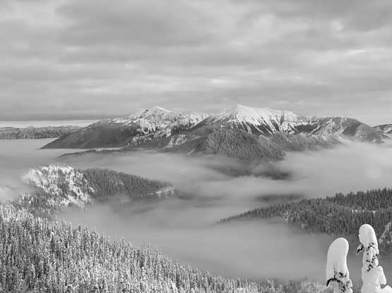
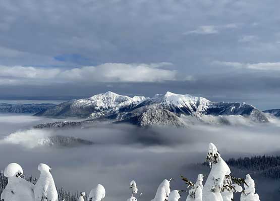
Nason Creek and Stevens Pass corridor covered in valley clouds

The north face of Lichtenberg Mountain
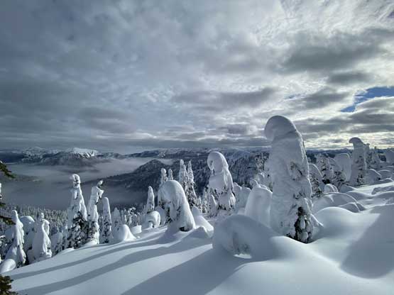
A wide-angled view looking south from the summit.

Another view of Lichtenberg Mtn. and the valley fog
Mt. Howard (L) and Rock Mountain (R)

Jove Peak catching a bit of sun rays
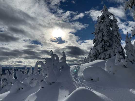
Lots and lots of snow mushrooms here
Exploring the summit of Mt. McCausland
Another photo of the late-afternoon sun

Yep another photo of the view looking south.
This is a western view looking towards Alpine Baldy

Me on the summit of Mt. McCausland
After staying for about half an hour including visiting another high point immediately to the north but still with no sight of Glacier Peak we reluctantly started the descent. Plunging down the deep and heavy powder was probably five times faster than wallowing up that in no time we were back down into the upper Smith Brook drainage. We followed our own tracks down through the forest and in short time we were back to the road. That final 5 km walk was boring and tedious. We both removed snowshoes once the grade became consistent downhill.

Masayo heading down from the summit
The fast and furious plunge down the steep sections

Back down into the upper Smith Brook drainage following our own tracks
The misty view of the north face of Lichtenberg Mountain
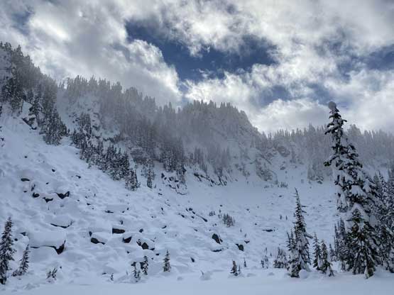
One last view of the north face of Lichtenberg Mountain
On the drive back we had to deal with heavy traffic because of the Stevens Pass ski resort. I also had to pull over once to take a short nap. After the power nap I had no problem driving Masayo back to Bellingham and then continued northwards. The border crossing was a bit on the heavy side but understandable given that it’s a Saturday evening. I arrived home at dinner time.
