Mount Outram
May 5-6, 2016
2461m
Hope / Manning Park Area, BC
Mt. Outram is a tall peak dominating the west gate of Manning Provincial Park and certainly one of the biggest out there along Highway 3 corridor in the BC Cascades. Having driven through that road many times in the past few months I was keen to check this one off my “list” sooner than later. The standard route is nothing but a (very) long plod but does have a sting in the tail. The reported “true summit” is 1-2 m higher than the tourist’s south summit and to get there a short, but exposed traverse is required.
The standard time to ascend this peak is in summer but the same route also makes a good winter outing. I chose spring time instead mainly because I didn’t find a good opportunity to tag it in this past winter. Due to some unexpected cancellation in my work schedule I got a last-minute window that’s roughly 24 hours long from Thursday noon to Friday afternoon. Checking the weather forecast I made a spontaneous decision to head out. Theoretically I could have pushed this peak as an “all-nighter” ascent but realistically I just had to have at least a “decent amount” of sleeping hours to not fall asleep during Friday’s work. To make that happen the only solution was to haul overnight gears and catch those hours of sleep in my tent high up on the slopes.
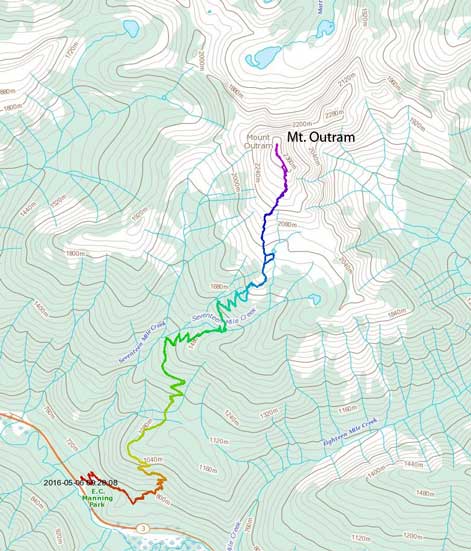
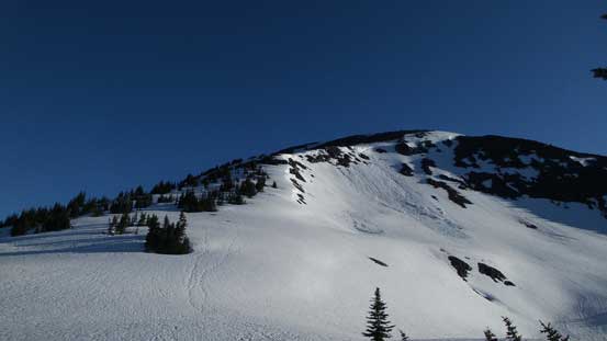
The standard ascent route on Mt. Outram. GPX DL
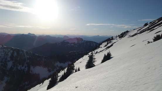
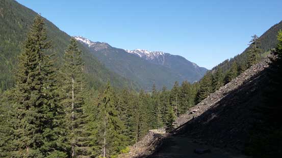
The drive was uneventful and I started the plod under a somewhat overcast sky. The trail was very easy to locate and well signed. After a few turns it started to gain elevation steeply and from there on all I needed was some extreme patience.. There was a somewhat flat bench around 1050 m but elsewhere was entirely an unrelenting plod up endless switchbacks. Hauling snowshoes, overnight gears and wearing rigid winter mountaineering boots did not make the trek any easier. After a long while I reached the supposed creek crossing (crossed on an awkward log) and soon enough that I started to encounter some patchy snow. The snow was awkward in the way that it’s soft/deep enough for some sort of post-holing, but never continuous enough for me to don snowshoes.
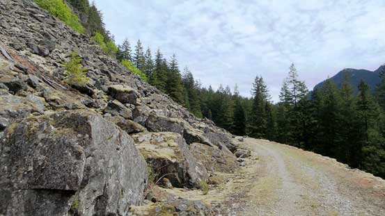
One section of the trail was following this deactivated quad road
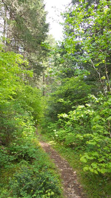
The typical trail..
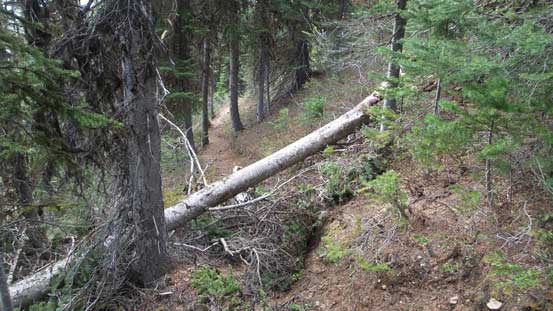
Annoying dead-falls
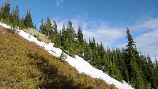
Patchy snow here and there…
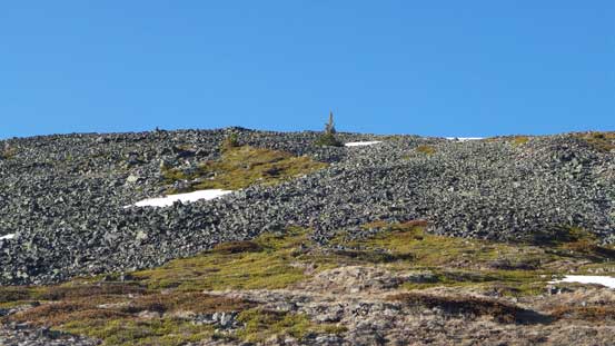
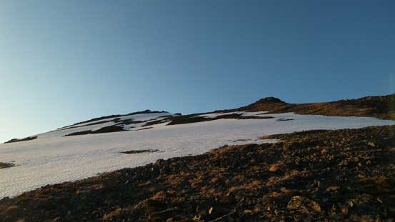
That kind of condition lasted all the way to the sub-alpine meadows at rough elevation of 1700 m where I finally hit the continuous snow. I strapped snowshoes on for the aid of some extra tractions and the heal-lifts but in fact, I could have get by easily without the snowshoes. Oh well… Since I hauled them up I just had to make use of them to justify the work I put into. Once onto the broad south rib I had to take the ‘shoes off as the upper slope was almost melted out to nothing but tedious rubble. Thankfully there was still some patchy of snow to utilize. Eventually I found a somewhat flat spot and called it quit for the day as otherwise the next “flat spot” would be on the false summit. Half an hour was spent setting up camp, having a well-deserved dinner and then it’s evening alpenglow time.
Marmot Mountain et al. – a roadside group but rarely ascended
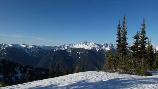
This is the alpine meadows.

Ascending the south rib, looking back down at the meadows
More of looking back..
Looking across the broad south slopes. The Sun’s getting low now.
Tedious slog up the talus field…
Looking at Snazzy Peak, Snass Mountain group
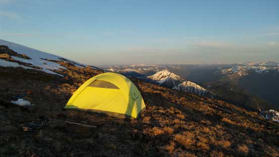
My tent high on Mt. Outram
Only a mere 100-m to the summit..
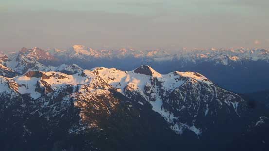
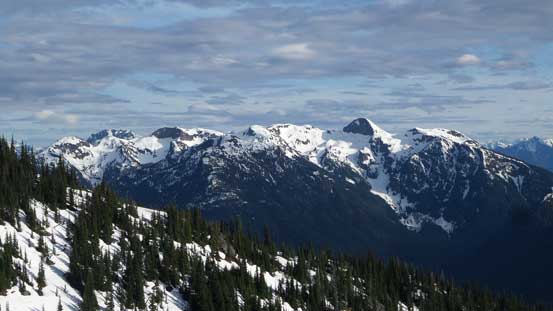
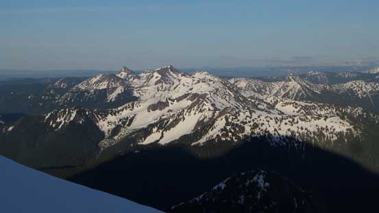
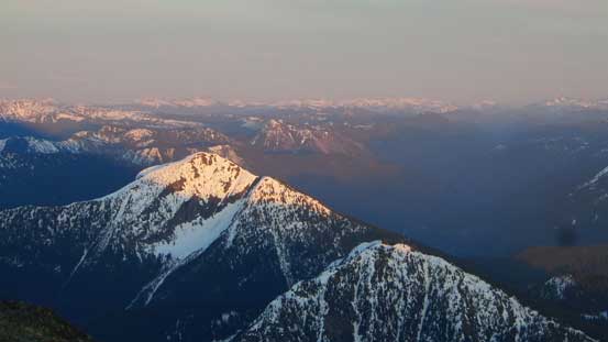
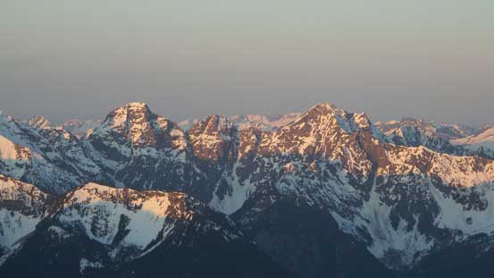
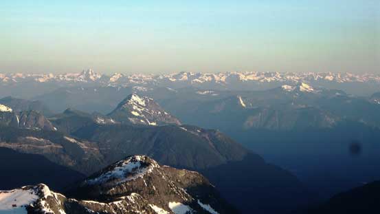
Looking over the summit of Marmot Mountain towards distant giants in the North Cascades
Jack Mountain is a big bulk
The infamous double-summit Hozomeen Mountain
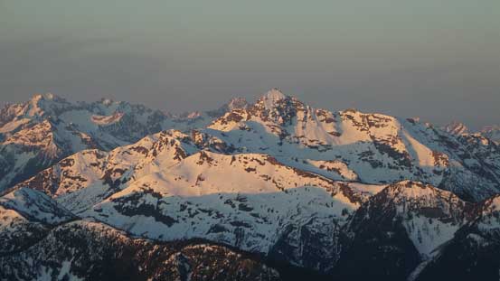
Those “giant hills” in Manning Park dominating the skyline looking NE
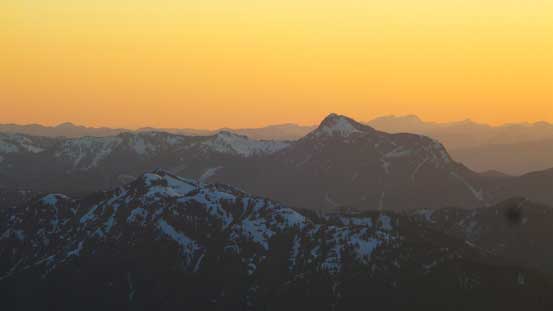
Isolillock Peak is an “interesting” peak near Hope
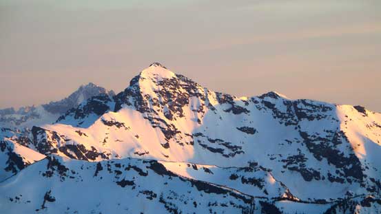
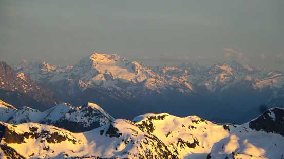
Silvertip Mountain is a giant..
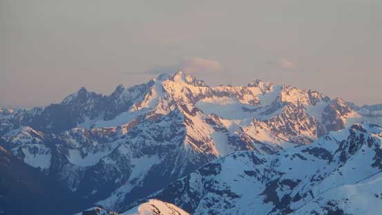
Mt. Spickard massif just south of the border

Sunset of the horizon!
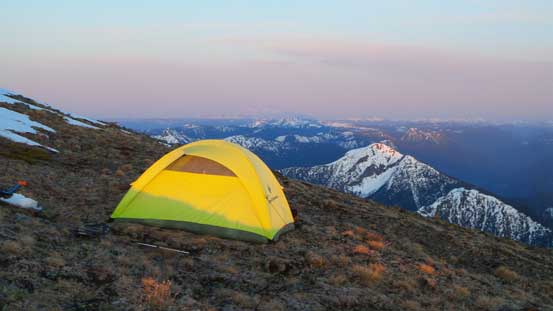
Another look at my tent
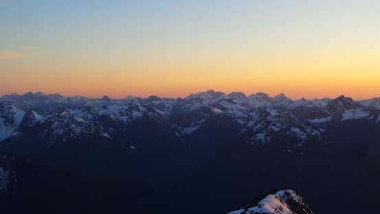
The pink horizon at dusk
Mt. Judge Howay on the horizon
Unfortunately the wind picked up through the night and my tent was really tested for its “weather proof” design. The structure stayed strong but fearing to be blown off the mountain together with the tent I had to crawl out at least 3 times to move around some big boulders nearby. I never got the good sleep that I was expecting, but did manage to catch up hours here and there, and by 6 am it’s time to get going again. There’s no way my stove could work in that wind so I just skipped breakfast and went straight for the summit bid. Only an extra 100 m elevation gain was required to hit the south summit and from there I got my first view of the true one.
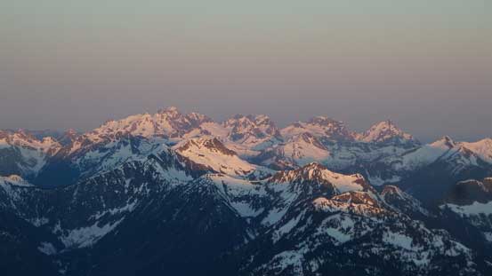
The Cheam Range on alpenglow
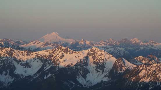
Mt. Baker at alpenglow
Mt. Rideout et al.
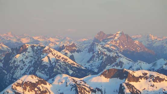
Silvertip Mountain
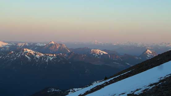
Those peaks nearby Hope. Isolillock Peak is the big one on left
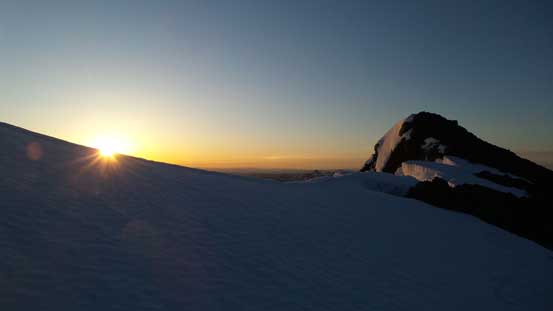
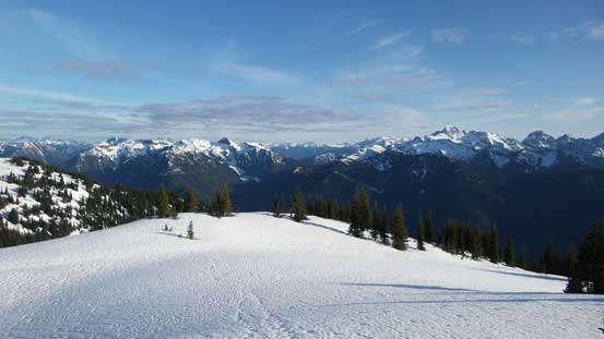
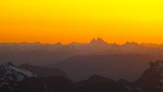
Sunrise time!
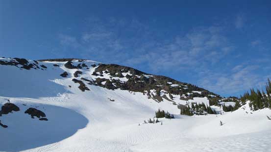
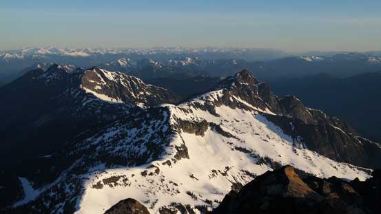
Plodding up the final summit ridge

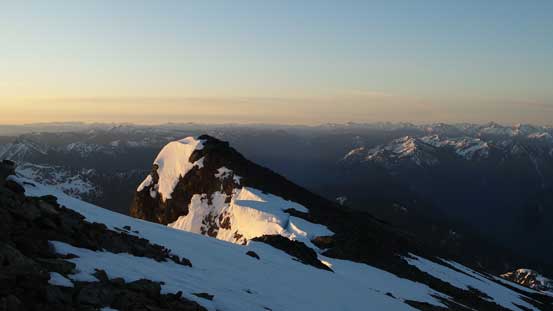
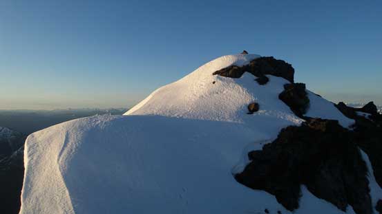
The false summit ahead
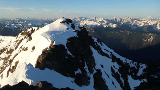
Here’s the first view of the true summit
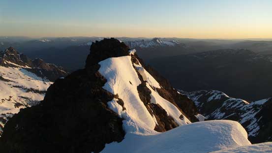
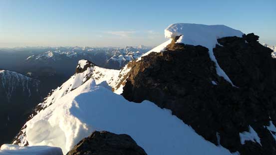
Looking back from the false summit
The traverse looked a bit more involved than expected, but I did come prepared with ice axe and crampons. The first part involved a bit of down-climbing on exposed snow on the edge of a huge cornice, and the middle part was balancing over a snow arete followed by a short, but exposed down-scramble with crampons on rock. The scramble up the true summit was straightforward by comparison but the wind was so strong that I didn’t bother to linger any longer than necessary up there. I soon made my way back across the ridge and then down the slopes to my tent.
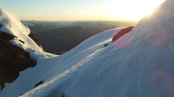
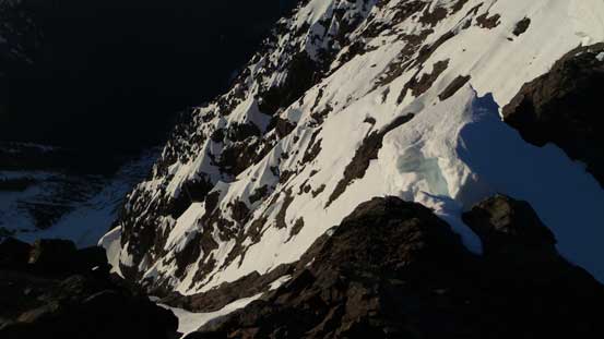
A bit of snow traverse
Looking back after the first section on snow
This part was the crux – exposed scrambling with crampons on rock
Looking over Hope Mountain (fg) towards peaks in East Harrison
The ridge continues northwards towards McLeod Peak et al.
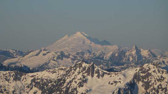
A closer look at Mt. Baker
The steep E. Face!
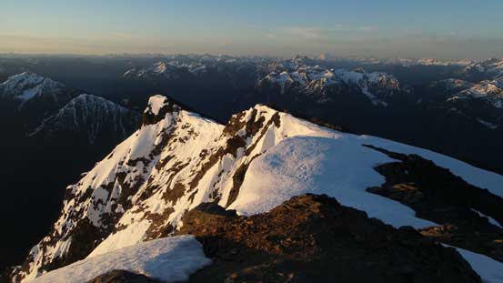
Looking back at the false summit, from the true summit
Another half an hour was spent packing up (really had to think about the sequence of breaking camp in that wind otherwise I would lose more than one piece of gears). I bailed down the south rib for as fast as I could (but had to be cautious on those tedious rubble slopes), don crampons once hitting some icy snow and then into the forest. Crampons off at elevation of roughly 1600 m and then I re-crossed that creek at the same place (never able to find a bridge or some sort like that, but who cares)… Down the trail I again, went as fast as possible and I got down to the parking lot before 10 am.
Down the mountain I went..
Almost back into the forest..
Almost done…
The drive back home was a bit tiring but thank to my fast descent I managed to earn two extra hours before the start of my afternoon work. The nap surely felt nice but still, too short to fully get rested, but still, good enough so that I didn’t fall asleep during work. All in all I did all I could to squeeze a big summit in between two work-days. I’ve to say this was quite a productive peak-baggin’ method which I’m sure I’ll use more often in the future…
