North Twin (Twin Sisters, WA)
October 14, 2015
2013m
Bellingham / Mt. Baker Area, WA
North Twin is the second highest peak in the jagged Twin Sisters Range about 15 km south-west of the glaciated massive Mt. Baker. On a clear day this summit offers unobstructed view of the nearby volcano, but what makes it unique is the superb scrambling quality. The rock in this range is a rare type called dunite, an ultramafic rock that’s almost exclusively composed of olivine. From climbing perspective, this coarse-grained rock is so grippy that it almost feels like sandpapers. The North Twin offers about 500 vertical meters of sustained 3rd class scrambling on this solid and grippy rock and is rumoured to be the best one in Matt Gunn’s scramble guidebook. The only downside is the moderately long approach thank to the closure of the access logging road. As for now the most efficient way is taking a bike but the 600+ vertical meters of uphill biking is surely a grunt.
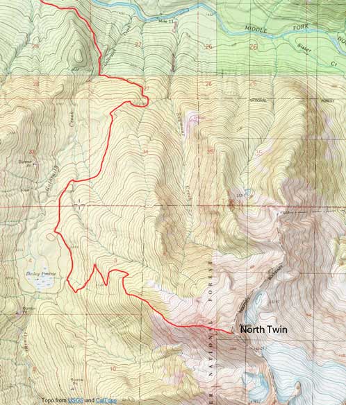
North Twin Sister scramble route. GPX DL
The recent storms had dumped fair amount of snow to the north, but the south stayed reasonably dry. Simon and I figured we should take advantage of this mid-week high pressure system and our objective was settled to be the North Twin Sister. I was excited about the scramble but I had quite a few concerns about the biking section. Before this trip I’ve only done mountain-biking once (Mt. Bryce) and it was such a brutal exercise for my leg muscles… And that trip was pretty much my only biking experience in the past 6-7 years so I really had no clue how I gonna do this time, especially comparing to Simon who’s been biking to work everyday.. It turned out to be not as bad as I was expecting. Well, there’s still quite a bit of painful work but at least I managed to bike roughly 1/3 of the distance (and pushed up the rest). In 1 hour 45 minutes we arrived at the North Twin/South Twin junction where we ditched the bikes. I probably slowed down Simon by half an hour since he managed to bike entire way up..
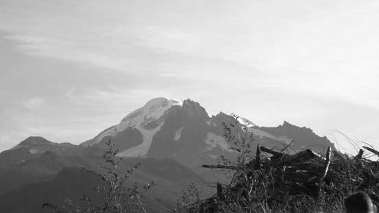
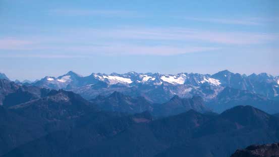
Morning view of Mt. Baker. The dark peak in front is Lincoln Peak

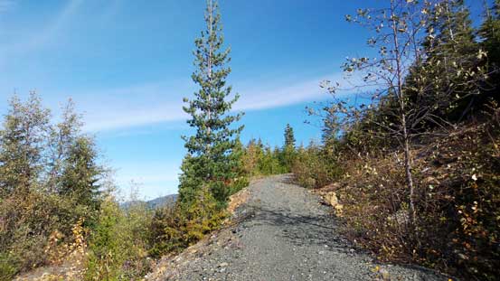
Simon biking up the road

More about the road
From the junction we took the left branch which looked bushy initially but soon got better. The next 2-3 km up this spur was a pleasant walking and in short time we arrived at the end of this complicated logging road system approach. The trail started right there and was marked by a cairn. We followed it through a section of young grown fairly effortlessly (would be horrendous bushwhacking without the trail), up a mature forest and then the forest thinned out and we could see our objective ahead. The ridge leading to the base of the W. Ridge was a little bit bushy but relatively short-lived. At the base we ditched some unnecessary gears, and then the scrambling started!

Hiking up the last logging road spur
Even this stretch was in a good shape
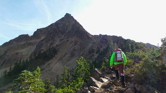
Breaking out of the trees now, looking ahead
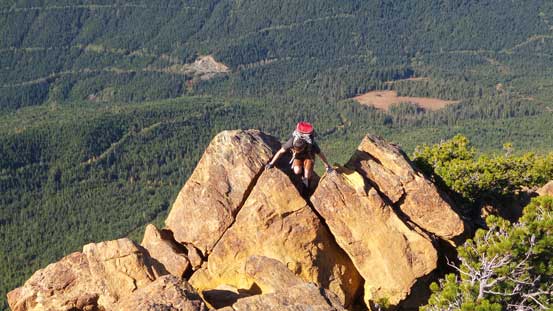
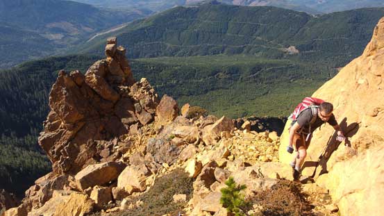
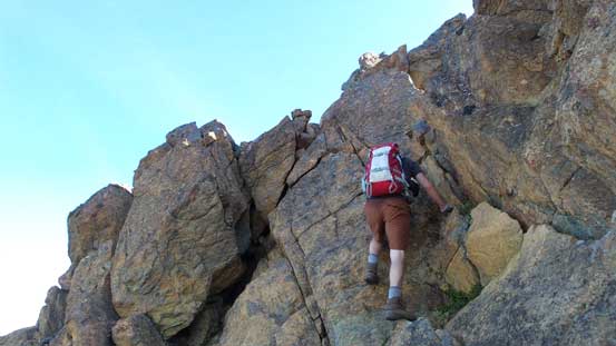
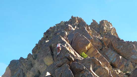
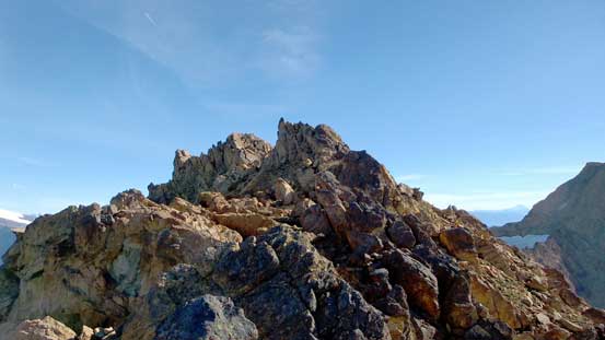
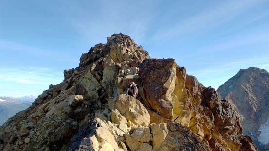
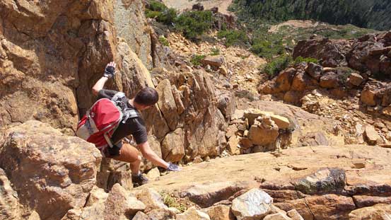
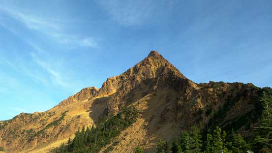
There’s actually not too much to describe about this scramble. As mentioned earlier the rock is super solid and grippy and on top of that, there’re plenty of holds and most of them are positive holds. The route basically follows the ridge crest and detours to the right (sometimes) or left (occasionally). With good route-finding it shouldn’t get any harder than Class 3 but there’s plenty of opportunity to make the route harder and we did so a few times since the rock was so good. About 2/3 of the way up we bypassed an imposing pinnacle on the right side. The upper 1/3 seemed to drag on forever and the easiest route through the next major wall was on the left traversing on a down-sloping ledge.
A bit of warming-up here and there
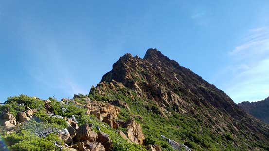
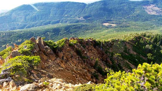
The ridge peters out a bit here
A bit of bush to thrash through

Fun stuffs!!

It’s getting steeper
Ascending a trickier step
Typical, typical
Looking back at a sub-summit that we bypassed
This section was on the north side
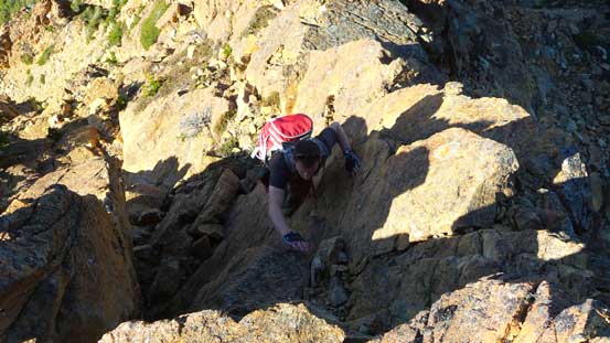
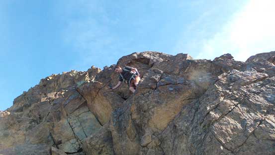
Simon attacking the next wall head-on which I again, bypassed on the left side

Simon finishing his route

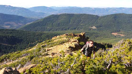
Ascending on the sunny south side now, still a bit of ways to go
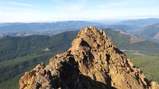
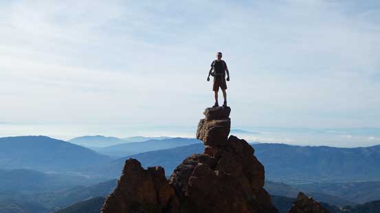
And then it’s the final summit ridge. It was also very foreshortened and seemed to drag on forever again. The view from the true summit on the far end was as expected, pretty good but not superb. More than half of the panorama was the coastal low land so there weren’t that many peaks to see from the top. The bonus for me was a glimpse of Mt. Rainier, but beast of the beasts down south by Seattle. And it was warm and windless so we took a fairly long break before committing to the descent.
The summit ridge is longer than you think!

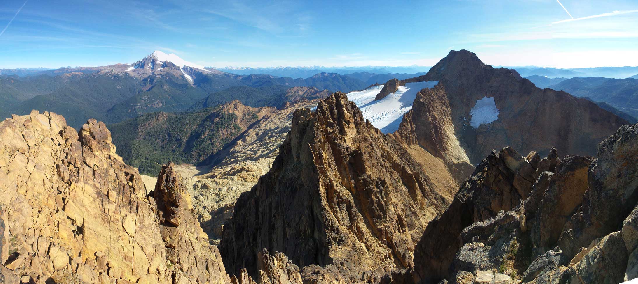
Summit Panorama from North Twin. Click to view large size.

The massive Mt. Baker
Cheam Range in the show
Peaks north of Fraser Valley including Robie Reid and Judge Holway (R)

Mt. Blum with Mt. Terror (L) and Jack Mountain (R) behind its shoulder
This interesting peak is Mt. Triumph
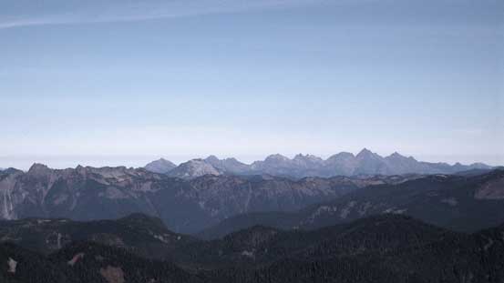
Some high peaks in the North Cascades including Primus Peak (L) & Eldorado Peak (R)

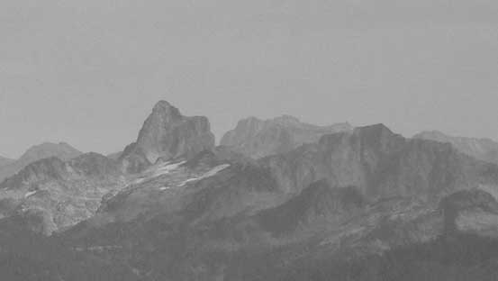
Old Guard Peak (L) and Bonanza Peak (R)
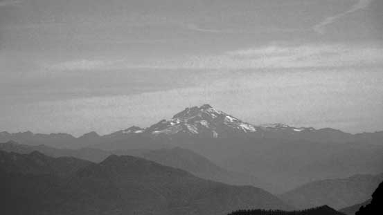
Glacier Peak is another volcano

And here is the gigantic mass of Mt. Rainier

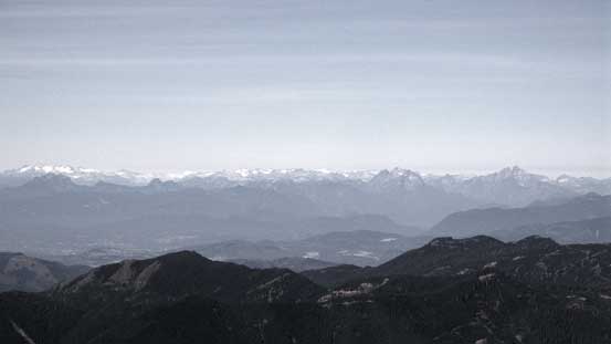
Looking towards the Lower Mainland
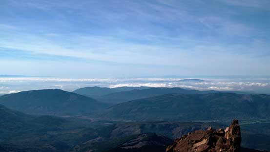
Some low clouds and the Coastal low land areas

The heavily crevassed glacier below South Twin

South Twin is the higher neighbour
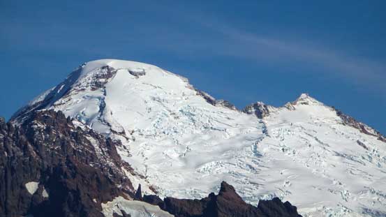
A zoomed-in view of the summit crater of Mt. Baker

Easton Glacier

Me on the summit of North Twin

Our group shot. Photo by Simon
Another panorama from the summit. Click to view large size.
The descent route described in Matt Gunn’s book was a steep snow slope on the north face, but for us that’s no longer the option (as expected after a long dry summer). There’s basically no snow at all except for a few small dirty patches and the rock looked horribly loose and cemented by some frozen hard dirt. Down the W. Ridge we went, it was just as fun as on the ascent with a lot of stemming, “crab-walking” and a bit of down-climbing here and there. We managed to stay on the easiest line for most of the descent.
Starting the descent

Here’s the down-sloping ledge traverse to bypass the upper wall
More down-climbing
Simon posing on the characteristic pinnacle
Stemming
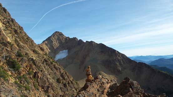
A look at the South Twin.
Looking back up North Twin
The summit block of South Twin. Route goes up the RHS ridge
Looking down the remaining sections of the W. Ridge
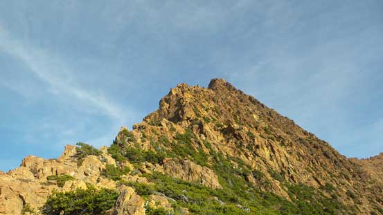
One last look at our objective
The hands-on stuffs were over pretty quickly. Walking down the trail and then the logging road wasn’t too tedious and then it’s the biking time! Having already done the hard work in the morning it’s time to enjoy the fun ride down. The grade was pretty steep but the surface of the road was very well maintained. Simon managed to cruise down in less than 20 minutes. It took me a little bit longer but still, it’s infinitely faster than walking.. Our round trip time was just over 8 hours. Weather still held for the following day and it’s time to think about the next trip…
