Harrison Hill
December 2, 2020
612m
Chilliwack / Fraser Valley, BC
The lowly forested bump of Harrison Hill locates immediately to the north of the city of Chilliwack on the north side of Fraser River. This “peak” is a stand-alone hill that boasts a rather significant prominence as it’s surrounded by Fraser River, Harrison River and Nicomen Slough and almost makes an island. I had been curious about Harrison Hill for over a year because there’s no trail on any side of the slopes and the route information was difficult to find. The selected few (brief) trip reports on ClubTread and peakbagger.com all indicated a mandatory crossing of the train bridge over Harrison River and that sounds a tad sketchy. They way they started was by parking at Kilby Provincial Park and bushwhacking up the north slopes and NE Ridge. I wondered if the SW Ridge would make a better option but a few brief comments pointed out some private property issues on the south-west side that parking could be an issue.
I had made some zooms on various maps over the past year and I thought there for sure would have some places to park on Malcolm Road near the base of Harrison Hill’s SW Ridge, and if not, I could always park at the Chevron on Lougheed Highway and added 1 or 2 km of road walking. The decision to finally pull the trigger was a random and spontaneous one. I literally didn’t make up my mind until the morning. I set my alarm at 7 am anticipating to do something as the weather was too nice to stay home. I had a few ideas in mind and opted to explore Harrison Hill in the end. An hour and half later I made to Malcolm Road and my first choice was to drive up the short switchbacks on the west slopes of the hill. This soon turned into a private property dead-end so I turned around and drove back to Malcolm Road. I turned east and found the T-junction between Malcolm and Dyke Roads having no sign of “private property” so I parked there. The short switchbacks on the south slopes immediately above where I parked were gated so I really had to earn the elevation.

Harrison Hill via SW Ridge. GPX DL
I opted to bring only one pole and wear my Trango Towers mountaineering boots anticipating a lot of bushwhacking. In retrospect I should have gone with two poles as the bushwhacking was never that bad and the footings were generally slippery that two poles would help. I easily plodded up on the gated roads that soon brought me to what seemed like a deactivated quarry site. From the site I went straight up onto the steep cut-block and then into the forest. A while later I came to an old spur road but only followed it for a short distance.

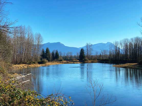
Nicomen Slough from where I parked

Walking up the gated quarry road
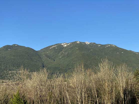
Looking back at Deroche Mountain that I ascended in 2015

The start of the SW Ridge of Harrison Hill
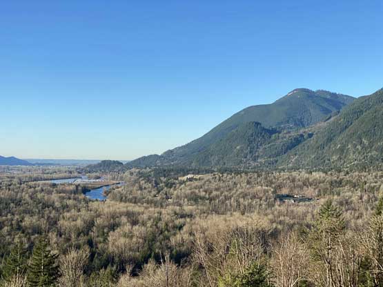
Looking back towards Nicomen Mountain
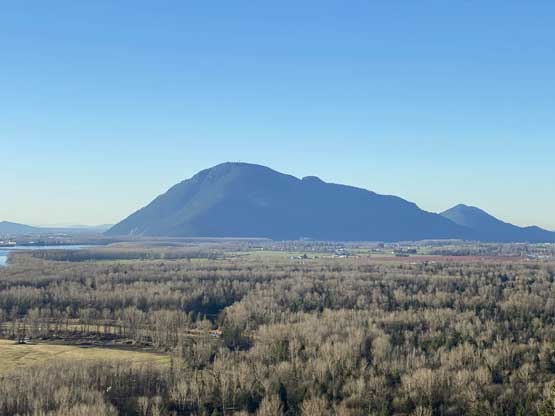
Sumas Mountain looks rather like a dry island…
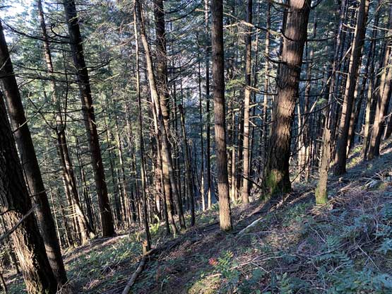
The bushwhacking was mostly “BW2” with some brambles type of plants that required caution. The grade of the forest was pretty damn steep though. The grade eventually eased at around 400 m elevation and there’s even one section of undulating terrain. I had to constantly check my GPS to make sure I was following the route/ridge that I wanted to use. The underbrush was a bit annoying on these flat sections but the bushwhacking never exceeded “BW2” in my opinion. A short while later I came to a nice viewpoint but based on Simon and Grant’s trip reports I knew the best views would be from the bluffs directly south of the true summit, so carried on. I firstly went to check off the true summit, and then bushwhacked down to the aforementioned bluffs. The view from this bluff was quite impressive. The bluff itself had some vertical-to-overhanging walls that could totally be used for rock climbing or paragliding.
The steep parts of the bushwhack

The flat stretches of the bushwhack
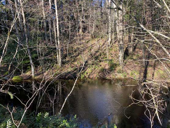
There’s even a couple tarns on the upper ridge
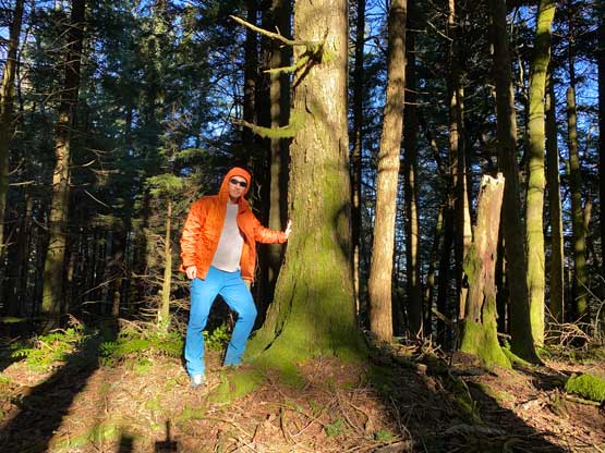
Me on the summit of Harrison Hill

I was determined to find the bluffs for views and I’m glad I did
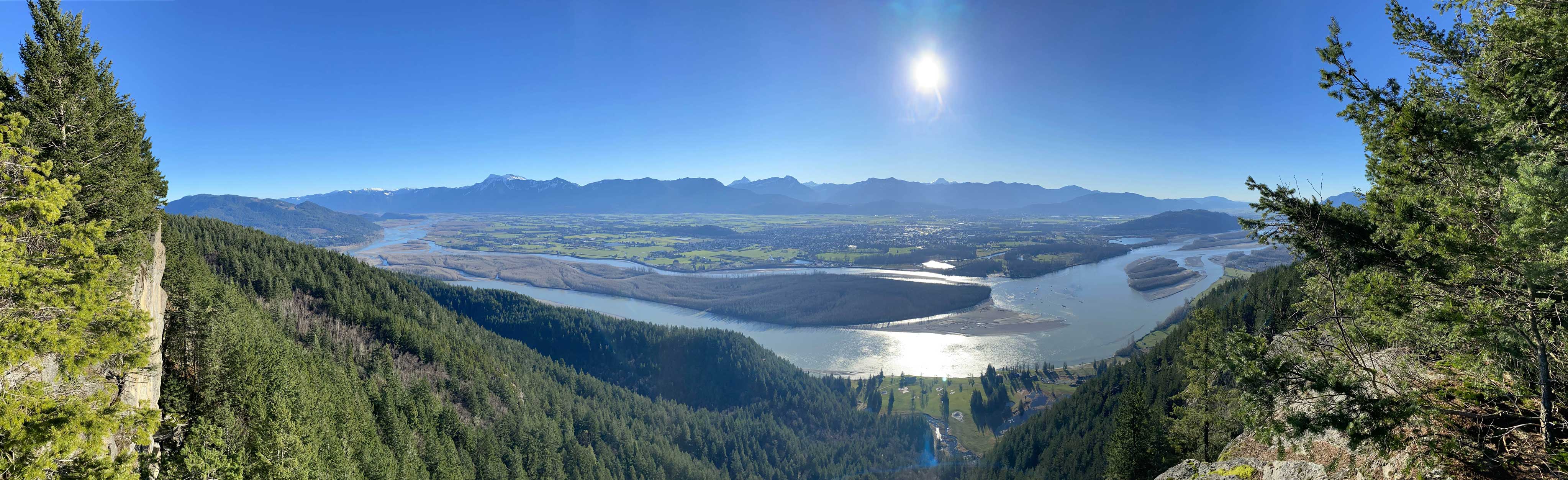
Panorama of Fraser Valley from this bluff. Click to view large size.
Fraser Valley and Cheam Range
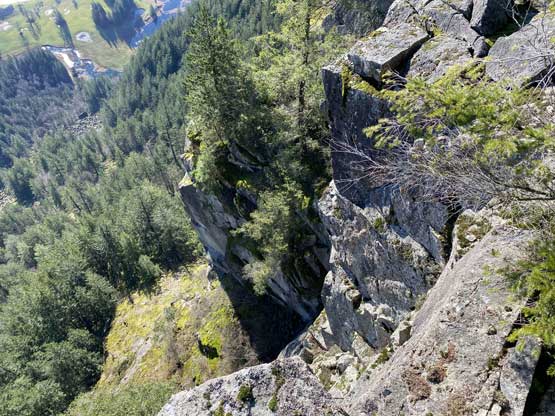
Vertical cliffs on this bluff. Rock climbers?
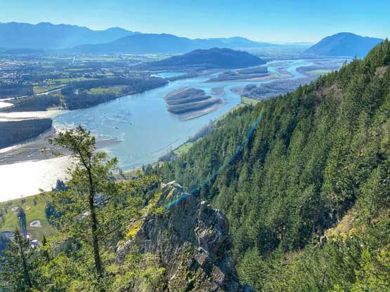
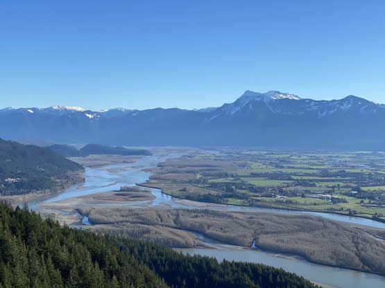
The mighty Fraser River from Harrison Hill’s bluffs

Me posing on Harrison Hill for the ‘gram
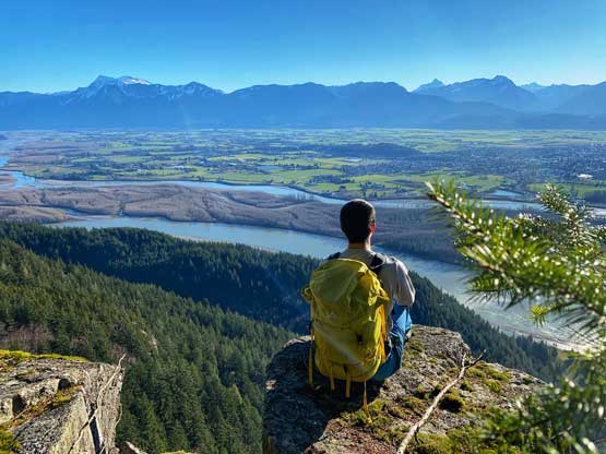
Another photo of me on the south bluffs of Harrison Hill

Me and my brand new backpack in front of the Fraser Valley
After grabbing a few photos I went back into the forest and made a short-cut traverse to rejoin my ascent route. I didn’t go back up onto the true summit again. Once cutting back onto the ridge I just retraced my own route back down the ridge with very minimal variation. I checked the GPS dozens of times to make sure I didn’t deviate too much from the “known”. Descending back into the quarry site required a bit of shitty scrambling on loose rocks as well as bushwhacking in brambles. The rest of the descent and the drive back home was uneventful. I made a stop in Mission’s ABC Donair Zone for a late lunch, and got back home with 1 hour of spare before the afternoon work.
Back to that tarn

Fast forward. Down to the quarry now

Walking down the road with Deroche Mountain ahead

My Taco parked at the junction between Malcolm Road and Dyke Road
One last look at Nicomen Slough before drying home
