Mount Brazeau
July 23-25, 2013
3470m
Brazeau Icefield, AB
Mount Brazeau is the highest peak in Alberta’s front range. It’s also one of the (technically) easiest 11,000ers that one can get in a dry year. If not because of the icefield crossing it will be just an easy scramble. I was very grateful to be invited to this trip by fellow climbers from ClubTread, Shaun Vincent (nmcan84) and Clayton Dunham (Candy Sack). I’d done Mount Sparrowhawk with Clayton last year, and this would be my first trip with Shaun. As the date coming closer the weather forecast was not looking inviting, with rain for all areas throughout the week, possible thunderstorms, and warm temperature that would rise the freezing level to above 4000 meters. I was not confident with the condition at all, but I figured that even just getting the alpine bivy experience is better than staying home.. It’s gonna be my first real alpine bivy trip and getting the experience is essential for more aggressive plans later in this year. So at 9am, Tuesday, three of us met at the trail-head. We quickly loaded our huge packs up. The weather was surprisingly clear at this point and we were hoping for the best.
Our plan was to break it down to a 3 day trip, with the second day being our summit day, and we would attempt the nearby Valad Peak and Mount Henry MacLeod on our second day as well. I could have the trip done in just 1.5 days but I’m very glad to have extra time enjoying the awesome bivy spot near Swan Pass. The weather turned out to be the exact opposite as forecasted and we got three days with perfect weather. The freeze was also good in the morning and we enjoyed the entire up-walk with zero post-holing. Now I wish we had an extra day up there for Mount Warren, but oh well.. The summit view from Mount Brazeau is definitely one of my top 5.
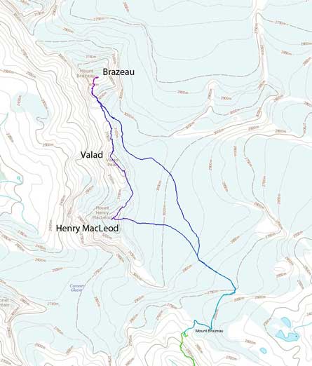
Brazeau to Valad to Henry MacLeod traverse route
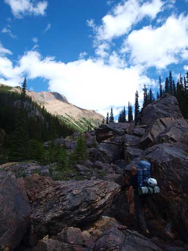
The first part of the lengthy approach is via the well-maintained Poboktan Creek Trail, for a bit more than 6km. The ground is very gentle uphill with many flat and down-hill sections and we covered it pretty quickly. After a short break we turned right and continued on the trail towards Jonas Shoulder for 2km or so. Just after the Poboktan Campground we crossed two streams consecutively. A faint trail branches off to our left just after crossing the second stream. We would leave the trail here. By now we’d covered pretty much half of the approaching distance.
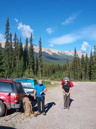
At parking lot with our big packs

Some brief views from the first 6km approach trail.
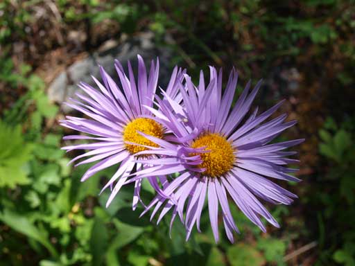
Asters
There’re a lot of similarities between Brazeau’s approach valley and Coronet’s. They both go to the same direction, with similar grade and no official trails. But this one has game trails/paths most of the way. The trail pretty much stays on the right side of the creek. It does get faint at a couple bouldary and boggy sections but generally easy to follow. There were some minor bushwhacking hopping over deadfalls but that’s it. Higher up we came to a flat meadow field, with a small tarn stealing the show. Here the trail pretty much disappeared but travelling was still easy since the direction was very clear. On the other side of this meadow we entered the forest and found the trail again, but somehow managed to lose it and ended up too high on climber’s right side. We had to do some extra bushwhacking to cut climber’s left and eventually hit a creek bed. We would be following this creek up and we were officially out of the trees now.
There’s a small boulder field

A small tarn stole the show

At a flat meadow field. Going straight ahead
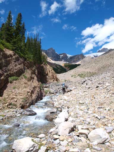
Out of the trees now, at the creekbed leading up the upper valley
The next 2 hour or so was probably the most unpleasant part of our trip. There was some paths to follow but the majority was side-sloping on tedious scree. At an obvious rock band we ascended climber’s right side and cut left, side-sloping on scree. This part was pretty miserable on mountaineering boots and with big packs, but would be fine with day-trip gears. Thankfully it was short lived, and it didn’t take us long to start ascending straight up again. Higher up we merged to a snow field and the pleasant step-kicking offered some refreshment. We soon topped out on Swan Pass and found quite a few lovely tent pads. We picked the one with the least amount of wind. It was still early in the afternoon, and weather was partly cloudy but a bit windy. We hadn’t got any rain yet.

Aiming climber’s right up a pile of scree

Side-sloping wasn’t very pleasant

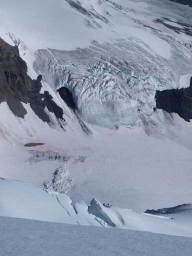
Part of Coronet Glacier

Shaun just about to top out on Swan Pass

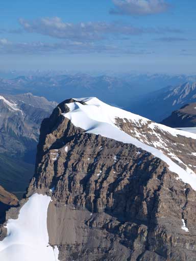
Mount Henry MacLeod
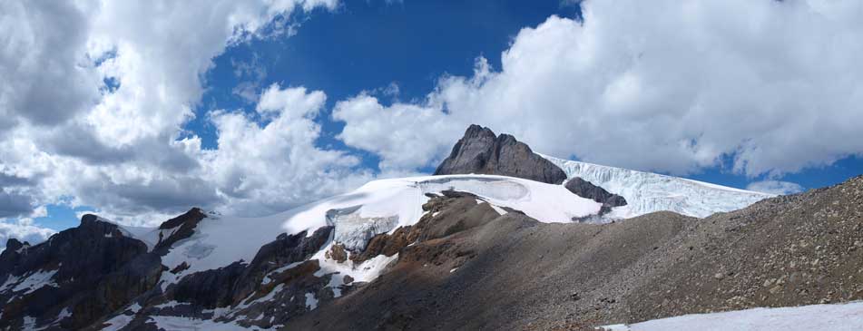
Henry MacLeod and Coronet Glacier

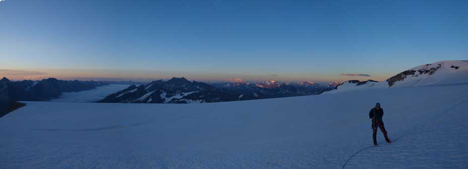
Panorama from near our bivy spot.
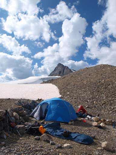
Our bivy spot
Shaun
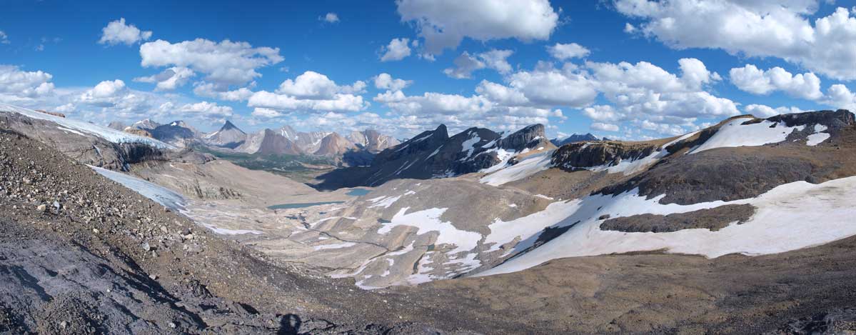
Another panorama looking east

It’s worth to go here even for just backpacking.
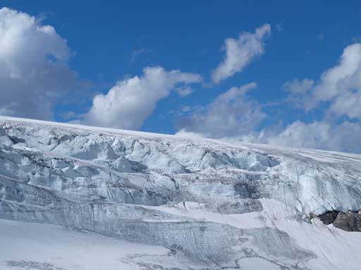
Seracs..
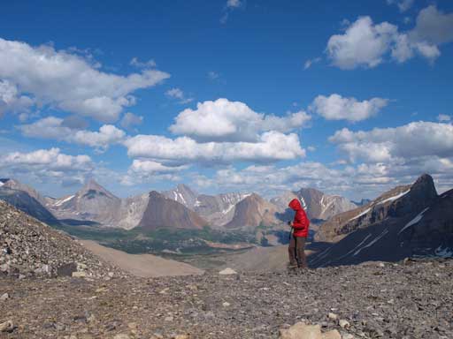
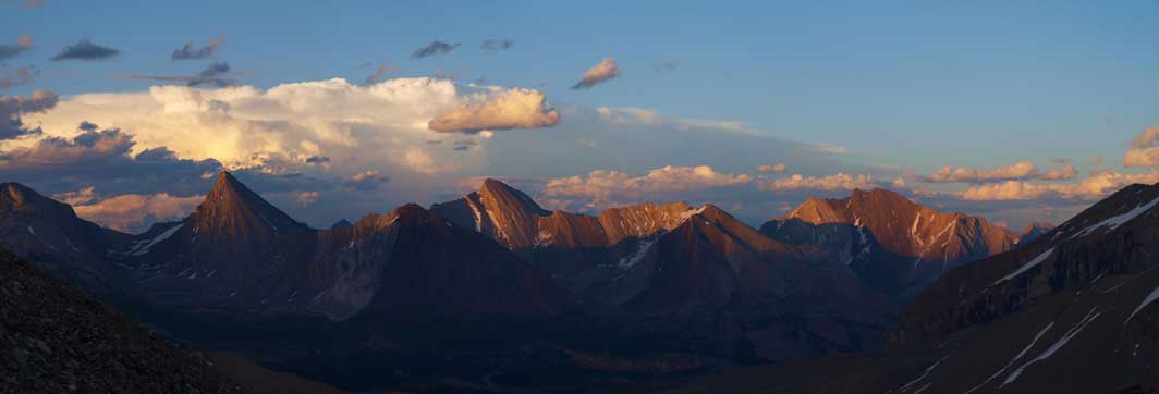
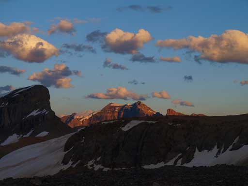
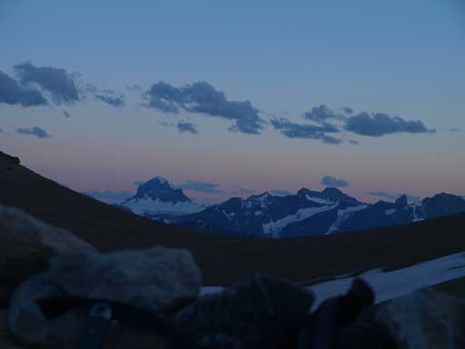
Through the evening the weather only got better. The clouds pattern also showed no sign of a moving-in weather system. I think it was now that I really started to feel we could make the summit the next day. Clayton and I went up a nearby highpoint for some better views. I went up it again the next day at sunset time and got much better photos. But even in the afternoon the views were breathtaking. I think I’m officially falling in love of alpine bivy trip. We went to bed early but I didn’t fall asleep until after midnight.
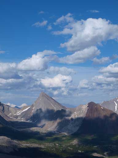
Unofficially named Moriah Peak

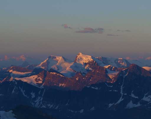
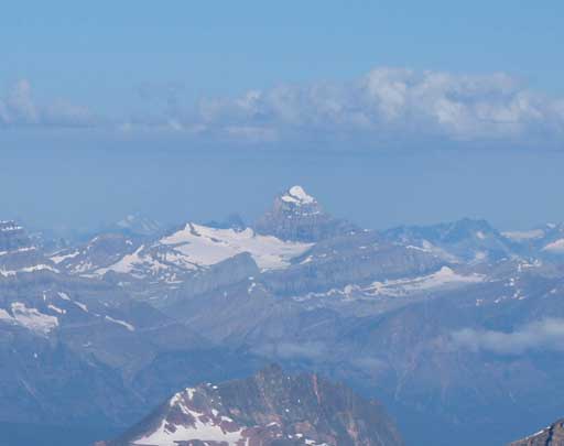
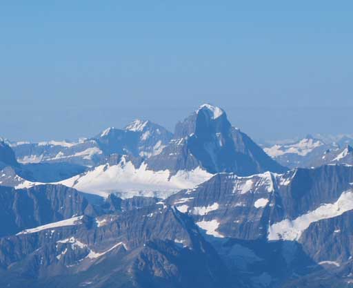
Mount Alberta
Sunwapta Peak is a big glaciated one on left. Kitchener is the rounded peak in background.
Me on the highpoint

From my bivy sack, looking back towards Alberta
A zoomed-in panorama towards the group of front range peaks, looking east
A tip of Poboktan Mountain from my bivy sack
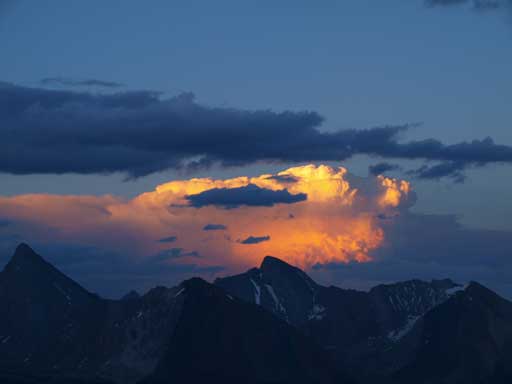
The last sunlight shone on an intense thunderstorm afar. It’s been lightning all night long.
Mount Alberta again.
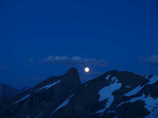
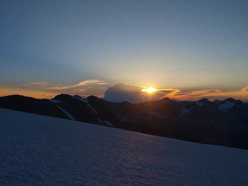
Now, a full moon rises up!
At 3:30am our alarm went off and we were up with a full moon lighting up the sky. The initial part was losing some elevation to get down to a glacial tongue. A snow slope offered some easy travelling than the moraine but the snow was just barely soft enough to walk down. This was actually good since we did want good freeze even though the temperature wasn’t very low. By the time we hit the glacial tongue we put crampons on. This part of the glacier was dry so we kept ropes in our packs. There was one section with water hidden beneath a ice crust and we just plunged through it. Thankfully it wasn’t deep enough to get our boots wet. Once on the other side we started traversing climber’s right on an obvious rocky ledge. This ledge was much better than it looked from afar and we would soon rope before merging to the main glacier.
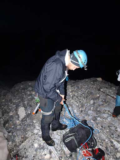
Clayton gearing up for the glacier
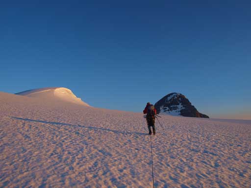
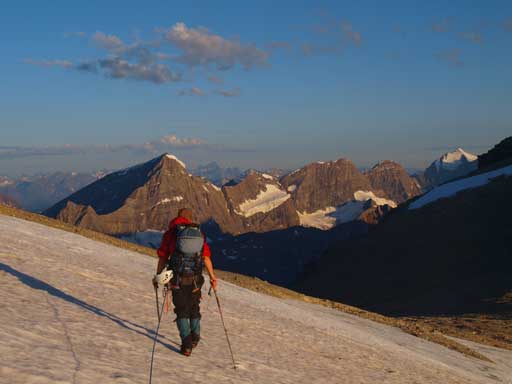
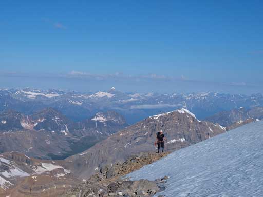
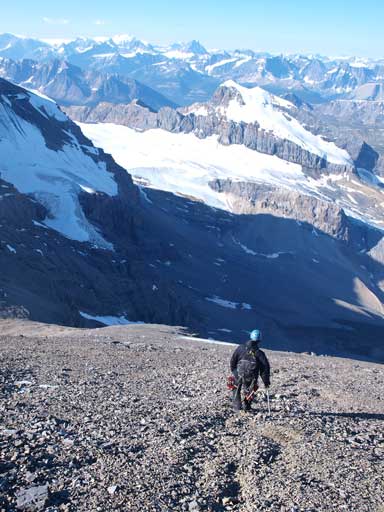
Shaun led the way through the initial dry part. We did see some crevasses here. Once crossing the firn line we would travel climber’s left towards Henry MacLeod first before cutting right up the icefield. Like many other icefield trips, the view was very foreshortened. The peaks just kept going backwards and it took us ages to get closer to Henry MacLeod. But the morning view was needless to say, awesome. It took us a long time to finally see our objective, a huge pile of black scree… It looked to be fairly steep though. We quickly made our way passing Valad Peak on our left side to Brazeau’s base where we ditched gears.

Shaun leading the way
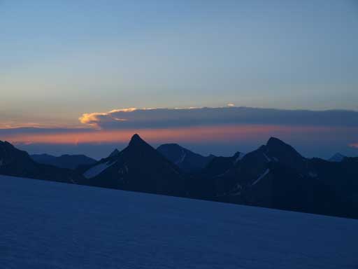
Morning colours showed up above Moriah Peak
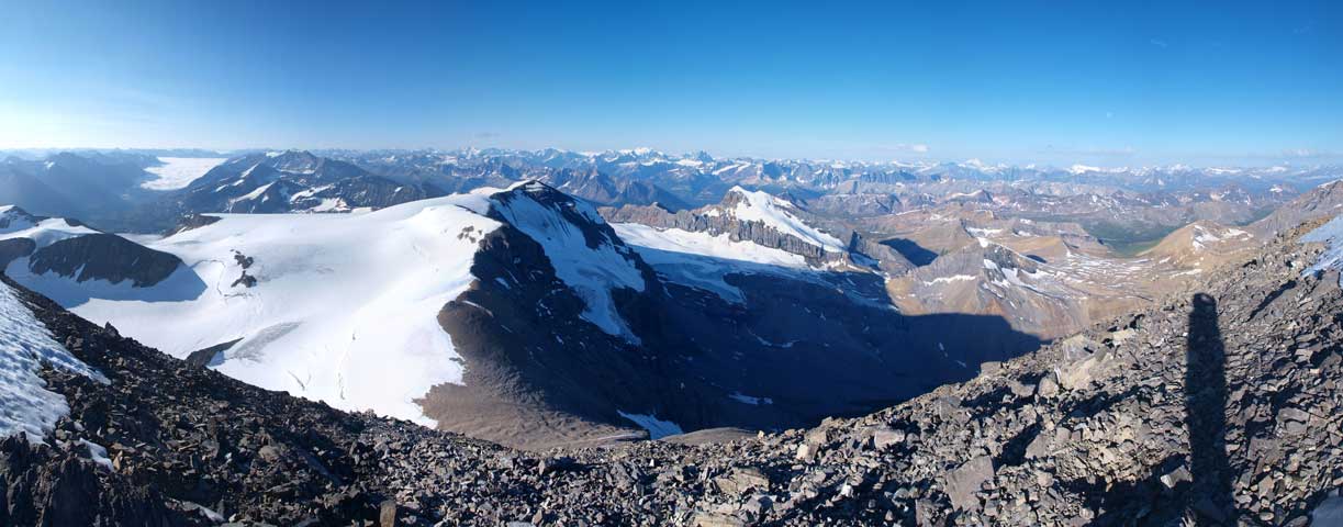
A panorama from the icefield

Zooming-in towards Sir Winston Churchill Range
Glow on Athabasca and Sunwapta!
Now, sunrise time!

Clayton
Shaun leading towards the distant Brazeau/Valad col
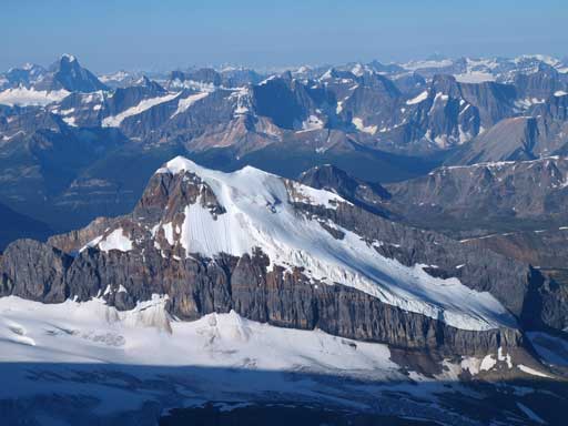
Valad Peak

Shaun will have a date with Brazeau soon!
Valad Peak will be our second objective of this day.

As you can see, there’re some saggings around.
Shaun almost at Brazeau/Valad col
There was only a short steep snow slope to ascend (front-pointing on hard snow), and the rest was pure scree slog. I think the elevation gain of this slope is more than 300 meters but I’m not sure. I trended slightly to climber’s left aiming for the least steep area, but the scree was loose everywhere. There’s not much to describe except for slogging up loose scree on mountaineering boots. This was a bit of a ugly finish for a beautiful 11,000er, but oh well, I’m not gonna complain anything about it. The snow on the summit was proved to be not a cornice so we went up it for a full panorama. Oh WOW!! That’s what I could say..

At the col, looking towards Coronet Mountain
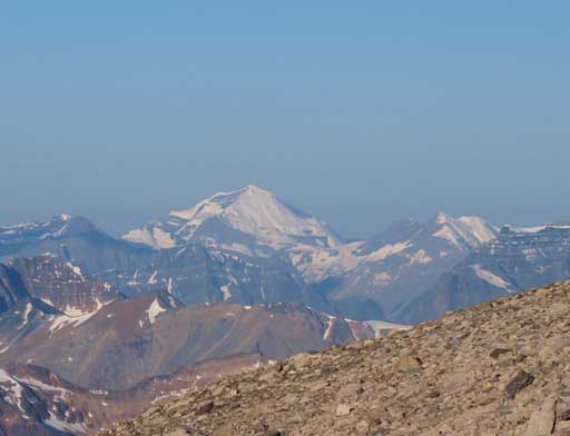
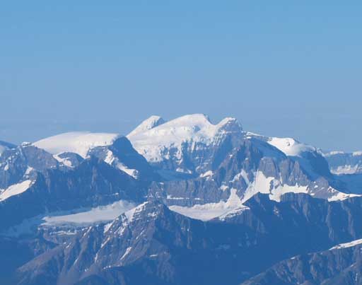
Mount Clemenceau

The moon was still bright
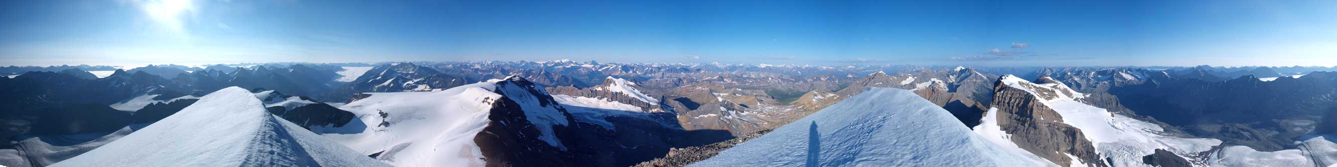
Summit Panorama. Click to view large size.

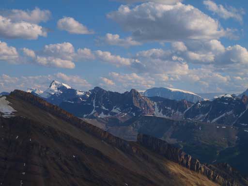
Sir Winston Churchill Range

A sea of peaks
Fryatt

Looking north

Charlton and Unwin

Another sea of peaks!
Warren
Coronet
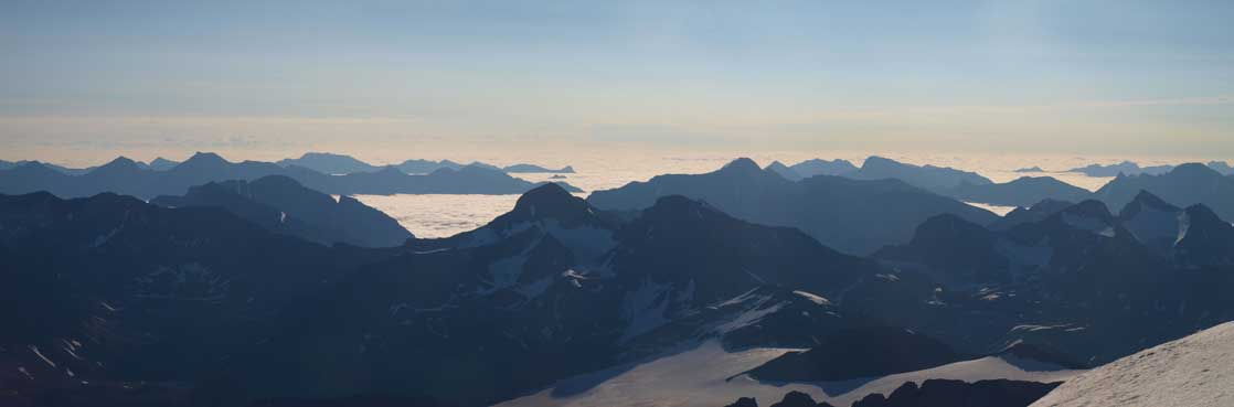
A sea of clouds above Alberta’s prairie.
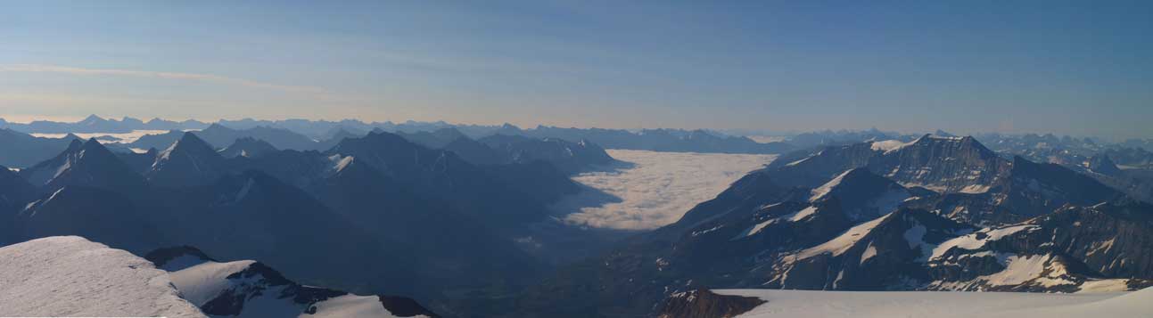
More low clouds scenery
Another panorama. Valad and Henry MacLeod look tiny from here.
Columbia, North Twin, Twins Tower. They’ll be my primary objective next spring!
Alberta. Too hard to reach for me now…
Shaun approaching the summit. What a perfect birthday gift for him!
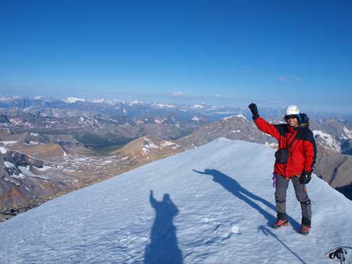
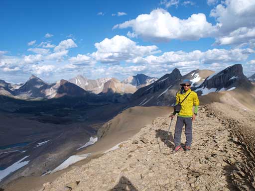
Me on the summit of my 4th 11,000er
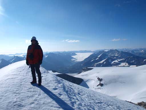
Me on the summit again

Another photo showing the sea of clouds

Looking down the steep north face!
Icefalls on Mount Warren
Clayton starting the descent (scree run)
After a not-very-long summit stay we quickly ran down the scree before continuing to our second objective, Valad Peak.

I love your website. It is very inspirational. Two peaks that you have to do are Mt Joffre and Mt Columbia.
Thanks, yet I agree. Mt. Columbia is on the short-term radar. If condition/weather for next weekend is as good as yesterday then it’ll be down the list.