Pogo Mountain
March 9, 2022
1486m
Vancouver Island, BC
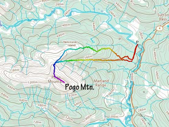
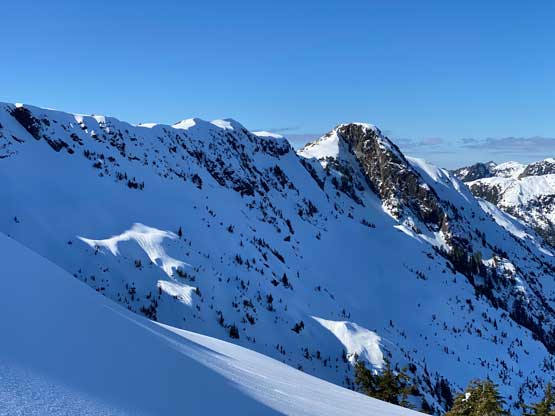
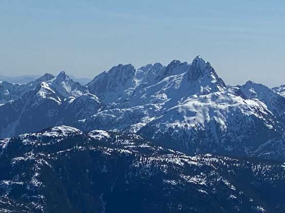
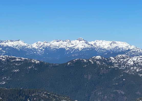
Pogo Mountain is an iconic and recognizable peak that looms above Highway 4 that connects Port Alberni towards Tofino. This peak also boasts over 800 m prominence. The access is right off the bat from the highway but there is no trail heading to the alpine. I wouldn’t be surprised if a trail will be built at some point in the future, but currently there’s only a “flagged route” on the E/NE Ridge. Despite the flagging one needs to deal with substantial amount of bushwhacking in summer months. The standard (summer) route is also doable in winter. The degree of bushwhacking is significantly reduced (but not eliminated) in winter, but one has to deal with a harder crux just below the summit ridge, that can range from a simple 45-degree snow climb to ice/mixed, depends on how fat the snow coverage is.
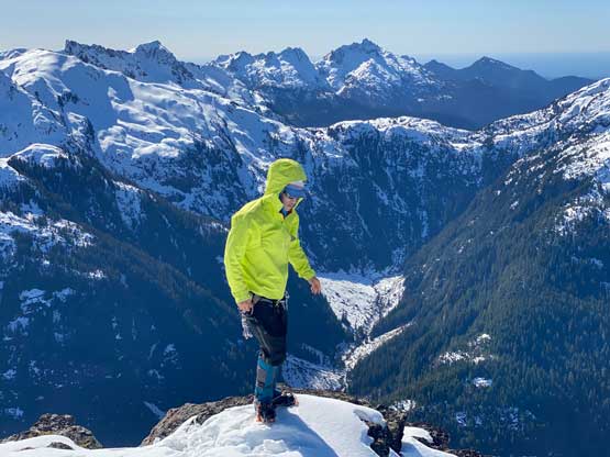
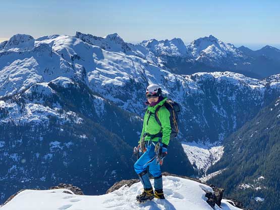
The more aesthetic way to climb Pogo Mountain in winter or early spring is via the gigantic east face gully that shoots straight up from the road westwards to 1150 m on the north ridge. This route can be easier or harder than the “standard route” depends on the snow coverage and the snow conditions, but either way this route completely eliminates bushwhacking. The route-finding is also much simpler as there’s only one way to go once entering the gully. I had been eyeing on Pogo Mountain for about two months and I had missed out several prime windows. A rare mid-week window formed again in early March and this time I finally managed to convince Lily to come along. The avalanche conditions had dropped to Low/Low/Low for a few days in a roll and the temperature stayed cool. There had been two separate recent trip reports on Facebook but the write-ups were vague. One group had climbed the Main Gully while the other (solo) climber ascended the ridge option. Lily had the patience and asked them a whole bunch of questions and that helped us to make some crucial decisions. The first decision was the route choice and the second decision was to leave snowshoes behind. Knowing the condition would be firm and icy we each decided to carry two ice tools (Petzl Quarks), steel crampons (Petal Lynx), mountaineering boots (Trango Towers), and as a team we would bring one 60-m rope, three pickets and several ice screws. We did not end up using all of them but we did make use of some.
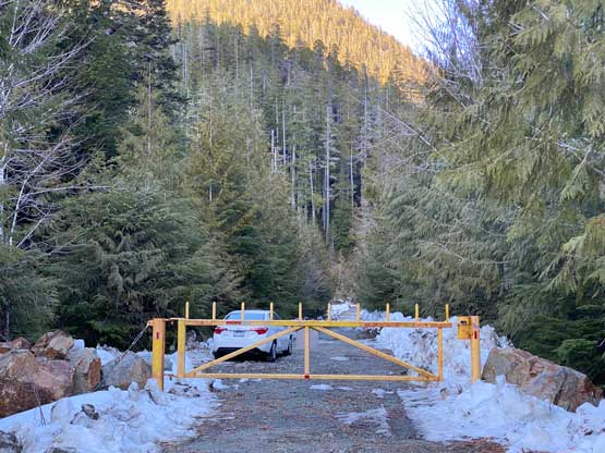
The best window was on Wednesday which wasn’t my day-off, but once such a bomber window formed I could bail off any day of work even at the last minute. Since I wouldn’t be working late into Tuesday night we managed to catch the 8 pm ferry from Horseshoe Bay to Nanaimo and eventually made to the trail-head before midnight. The drive would be mostly on paved roads so I swapped vehicle with my parents. Driving the Corolla was a bit easier on gas. The last kilometer was on a logging road but the road was flat and easy such that I had no problem driving the Corolla to the closed gate on Haa-ak-suuk Creek Main. There wasn’t much room to park in front of the gate so thankfully no one else was there. The night was cold so once the alarm went off at 5:30 am nobody wanted to get up. We slept in and eventually started the day at 6:30 am, about half an hour before sunrise.
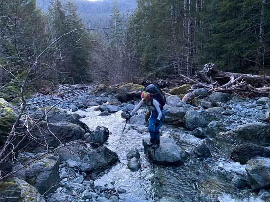
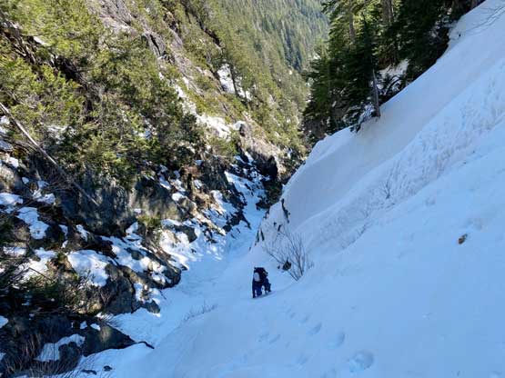
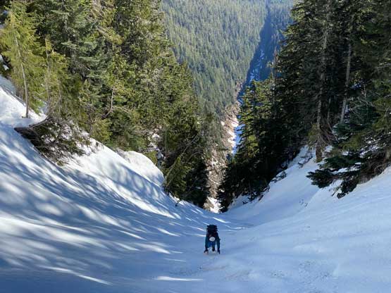
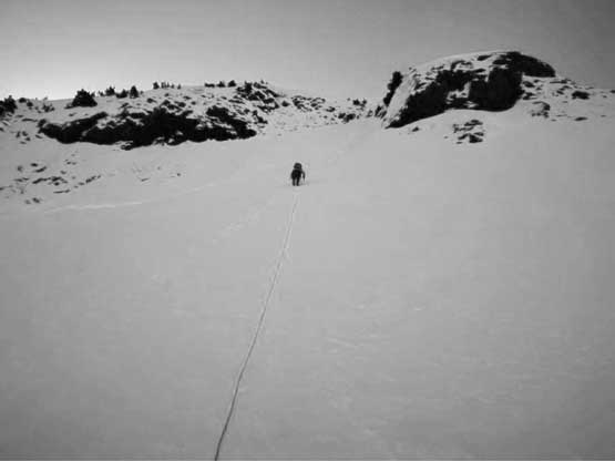
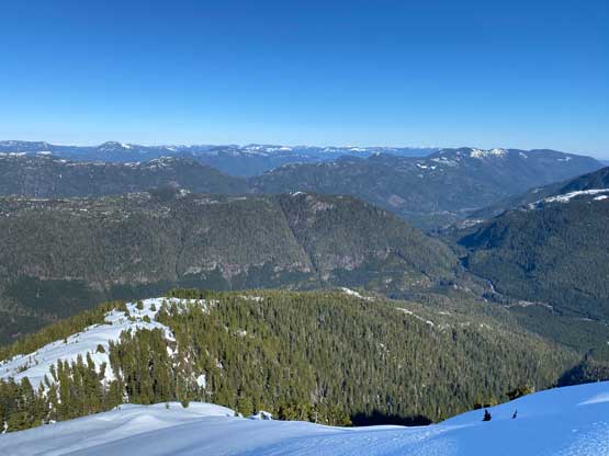
In the dark I shouldered the 28-lb backpack and off we went. The first 15 minutes was to plod across the flat Haa-ak-suuk Main past the gate to the start of the gully, which was rather just a dry creek bed. Plodding up the creek bed was easy until the creek appeared out of nowhere. The creek must had gone underground lower down. The general bearing was straightforward but the micro-terrain was tricky. We tried to stay on one side of the creek but it wasn’t possible. By the time we finally hit continuous snow under the gully proper we must have hopped 20 times back and forth across the creek. The rock-hopping was never difficult, but mentally taxing as a slip into the creek would mean a fail of the trip. A lot of concentration was required to balance on those slippery boulders. Eventually at around 500 m elevation we ascended onto a chock point of avalanche debris (must be 10 m thick) and took the first break of the day, donning crampons, harness, helmet, etc. From this point onwards we would be entirely on snow. The grade did not appear steep enough until much higher so I still opted for two poles instead of the ice tools.

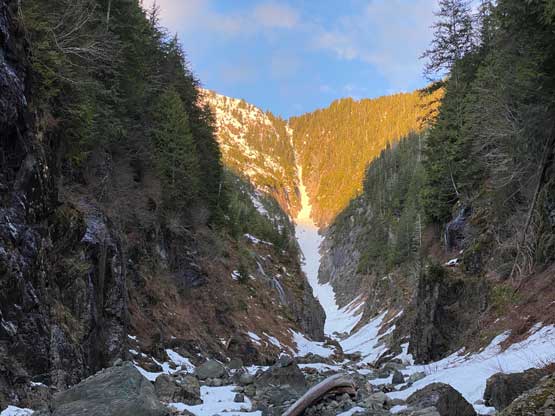
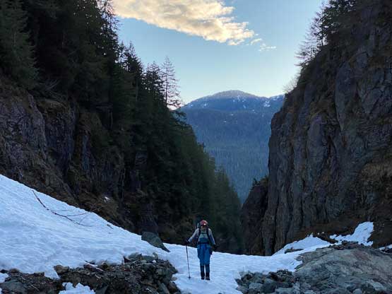

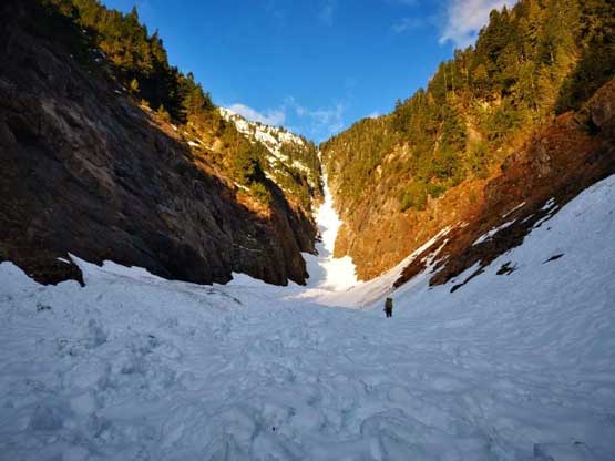
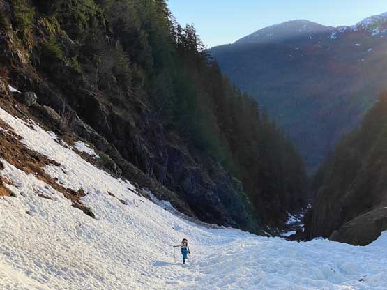
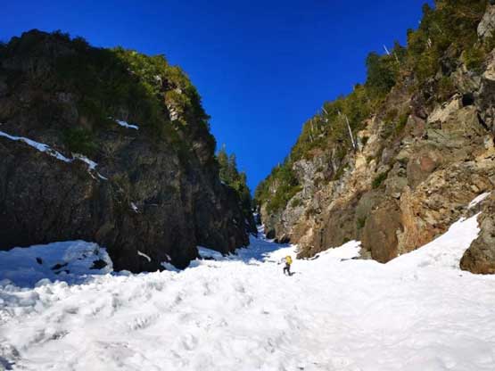
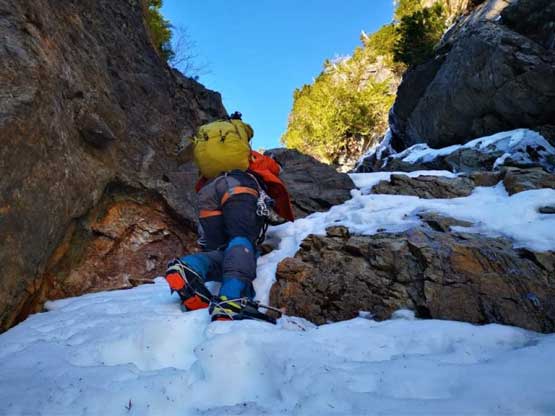
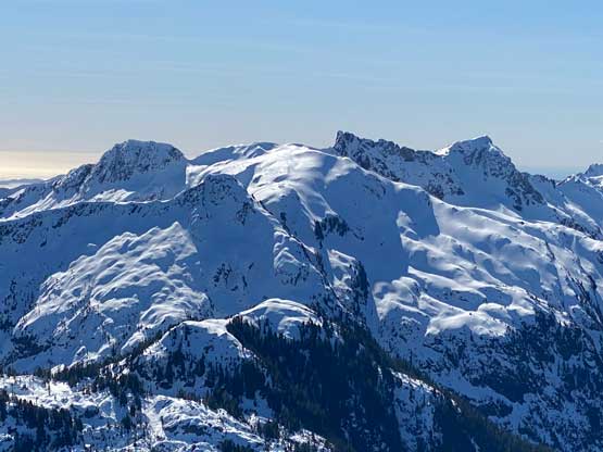
The terrain stayed mellow to around 750 m where the grade steepened towards 40 degrees and the snow was still very icy. I finally made a transition to don the two ice tools. I thought about to leave the poles here, but we weren’t sure whether we would even come down this route, so I quickly abandoned that idea. The 300-m couloir ascent was harder than expected but mostly because of the conditions. After reading some trip reports I think the snowpack this season was low, revealing several harder steps that could normally be just a walk-up in other years. The icy condition also meant we had to front-point the whole way and that was both physically and mentally draining. The first difficult section was a 2-m mixed step. I had to spend at least 5 minutes trying the moves before making a commitment. The ice tools would not gain any purchase and the crampons were on a down-sloping ledge. Immediately above this step we encountered a partially-opened moat that required a short, but interesting mantle move on ice tools. Higher up a rocky section forced us to ascend a 55-degree pitch towards climber’s left side using the staircases made by the previous parties. This pitch was then followed by a 45-degree traverse to get back into the gully proper. The rest of the couloir was easy and mellow, but the conditions stayed icy the whole way to the col.

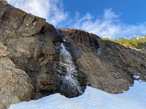


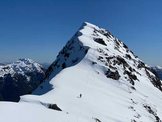
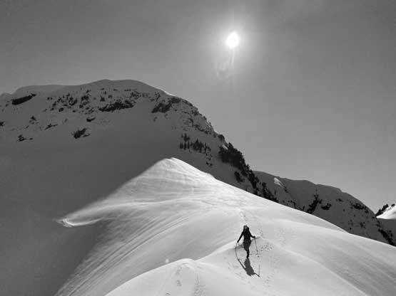
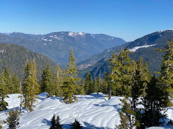
We took a long break to regain some mental strength for the upper route. We already made a decision to descend the “standard route” despite the warning of “a nightmare of post-holing”. We did not bring snowshoes, but given the cold temperatures we anticipated easier conditions than the other group had a few days earlier. The ascent to the base of the upper crux step at 1350 m was easy but scenic. The conditions stayed firm and icy but the slope angle was gentle. And then there came the crux, which was rather not as bad as I thought. The chock point had mostly been filled in. We could see a bit of ice so still opted to rope up. I dragged the rope to a small cluster of trees. The previous parties had dug out the trees and it’s easy to girth-hitch a root to build a station. Lily came up and used an ice screw to back up this station. I then led out to the right of the ice step on some steep and loose snow, and belayed Lily up from the summit ridge on a T-anchor. Lily had the pleasure to actually climb that few steps of ice. I also wanted to climb the ice, but my position at that tree-root station meant I could only climb out to the right.

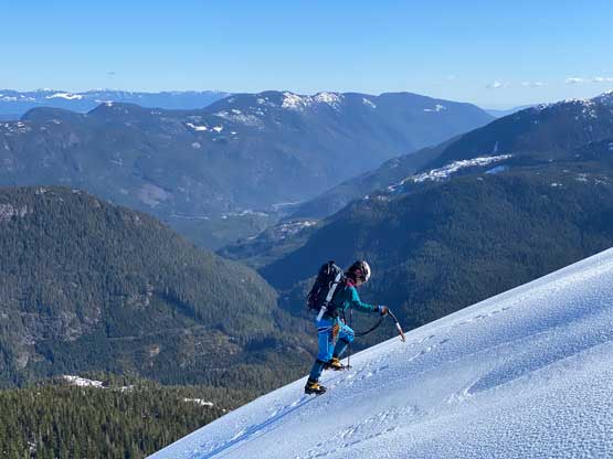


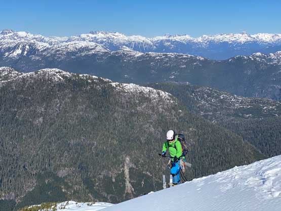
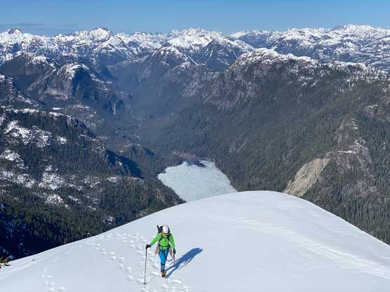
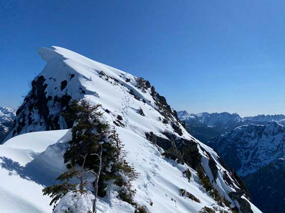
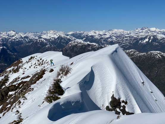
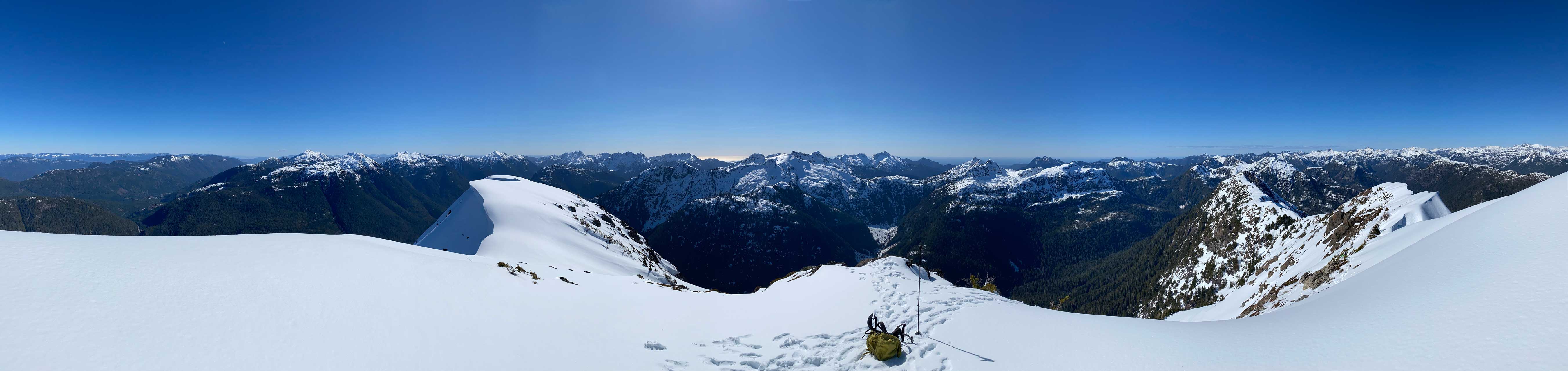
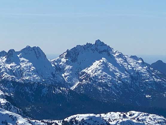
We ditched a bunch of gears at the T-anchor since we anticipated a walk-up to the summit. In retrospect we should have kept using the two ice tools as there was one more steep and exposed step on the summit ridge. The ascent of that step was not difficult by following the previous parties’ tracks, but having two tools instead of one would definitely make us more comfortable. The conditions were still icy as fuck despite the sun exposure and the temperature stayed cold the whole day. I had to traverse the summit ridge wearing all layers I had brought up. The true summit was quite a ways back and the traverse eventually started to feel like a drag. Lily only wanted to stay 2 minutes on the summit. I said that I needed at least 15 minutes of stay but I don’t know if I actually managed to stay that long…
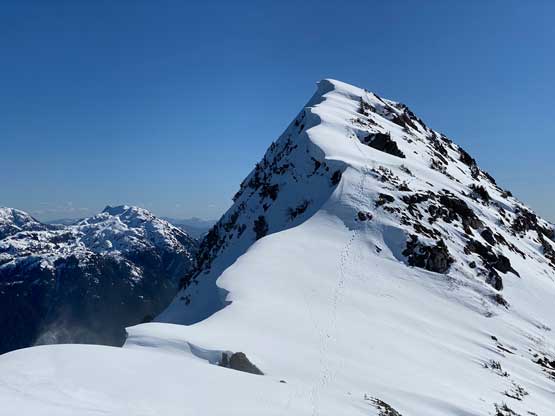


To descend the summit ridge I basically dashed back at a furious pace since I didn’t want Lily to wait. I caught up to her just above that steep down-climb and then we re-grouped at the T-anchor. Lily gave me a belay to check out a different tree that we planned to use to rappel down. I determined the tree was bomber enough. We then both rappelled off the “upper crux” using that small tree. The walk to the treeline zone on the “standard route” was rather scenic. Just when we thought we might be lucky to completely skip the post-holing nightmare we started to discover knee+ deep holes. The previous party had some sustained post-holing in soft snow. The snow was not soft on this day, but the crust started to break under our weight. I think overall we still had some easier time, but things did become annoying from 900 m down to around 700 m. We then slowly ran out of snow.


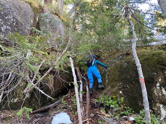
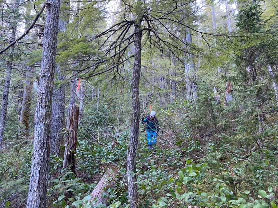
The final 500 m descent was far from pleasant. I had read reports that someone had flagged the whole route so I came here with an expectation of an actual “trail”. Nope. It was still a full-on bushwhacking game. Maybe the islanders are used to their bushwhacking but I felt this to be quite awful despite having abundant flags to follow. Firstly the terrain had loads of bluffs such that we couldn’t just shoot down the slope. We must constantly pay attention to the micro-terrain that soon became mentally annoying especially for me leading in front. The bushes were not very thick, but the branches were stiff and pokey (likely due to the coldness but could also be the vegetation type). In short words I do not find this area’s bush to be similar to what I’m used to in the South Coast. Eventually with determination we descended to a dense band of secondary growth timbers and then came across an old FSR. We followed this FSR (on snow, surprisingly) southwards for a short distance and then went into the forest again. The forest suddenly became much more open so we just dashed down. A while later we came across another branch of old FSR and followed this road back to the main line. About 10 minutes later we got back to the car and our round trip time was exactly 10 hours.


I estimated that we would have no chance to catch the 5:45 pm ride from Departure Bay but we should have plenty of spare time to catch the 8:15 pm ride from Duke Point. We took our time on the drive back to Nanaimo including taking a much-needed nap. We also made one Tim Hortons’ stop and got to the terminal with about 40 minutes of spare. I eventually got back home at around 11:30 pm, exhausted but satisfied.
