H’kusam Mountain
September 7, 2020
1671m
Sayward / Vancouver Island, BC
H’kusam Mountain is the highest summit in Prince of Wales Range of the north-eastern Vancouver Island, overlooking the small town of Sayward and Kelsey Bay. This range is fairly “low elevation” and forested but the peak boasts over 1500 m topographical prominence making it one of the four “ultra-prominent peaks” on the island. The range is separated from the other ranges on the island by Salmon River, pretty much down to sea level. H’kusam Mountain is by no doubt the easiest of the four Island “Ultras” that the standard route is mostly just a hike with a short scramble up a loose gully. There are two trails that can be used. The shorter trail requires a 4×4, high clearance vehicle to access, and assuming one does make the trail-head, the ascent can be done in a mere few hours.
Towards the end of our Island trip Winnie and I were low on motivation. The original plan was Warden Peak but we were a bit sick of loose rocks at this point so I threw out the idea to finish off my Island “Ultras”. Winnie wasn’t particularly keen on this walk-up summit but reluctantly agreed. After a luxurious and memorable dinner on one of the beaches near Campbell River we drove north to Sayward Junction and followed the direction on our various GPS devices linking up the logging roads. The roads were much narrower than expected but not very rough, although there were indeed at least 100 water bars. None of the water bars was troublesome for my Tacoma. The last kilometer or so was a bit steeper and rougher but again, I had no problem driving all the way to the trail-head in my Tacoma with all-terrain tires.
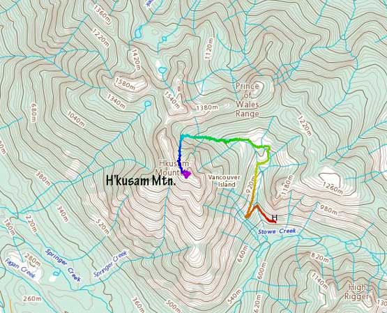
H’kusam Mountain standard route. GPX DL
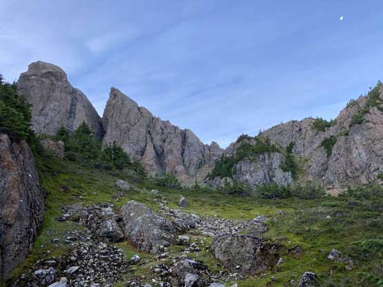
The parking lot was unfortunately on some slanted ground that sleeping in my tent was very uncomfortable. The result was that none of us got much sleep at all. By 4 am I was done with the frustration of not being able to fall asleep and opted to start right away to watch sunrise from the summit. Winnie decided to skip this peakbagger’s summit in hoping for a few hours of sleep. There wasn’t much worth documenting for the approach sections as the trail was well-marked on my Gaia app. I had also downloaded Greg Slayden’s GPS track so all I needed was to check my phone upon hitting every intersection. The going had been cruising until I reached the spot where I needed to leave the trail into a hanging valley leading to the base of the loose scrambly gully. It was still in a pitch dark that even with the GPS track I managed to disorient myself into some confusing steep and bushy terrain. After a while I determined it was definitely wrong so turned around and backtracked all the way to the trail. Then I went higher up on the trail and happened to come across a faint set of climber’s trail heading for the direction I wanted. I followed it half-hearted and it turned out to be the exact path I wanted. It got me bypassing the steep and bushy waterfall that turned me around lower down.
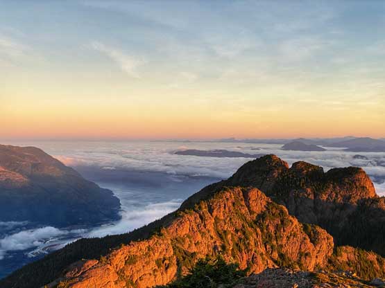
There was still trails and paths once I entered the hanging valley but also lots of signs of recent bear activities. The sky’s also become a little bit brighter but the head-lamp was still needed. Towards the head of this hanging valley I could clearly see the loose gully that I needed to aim at, but to access the base of it involved some boulder hoping. I wasn’t sure if I picked the most efficient line as the route I took involved a long stretch of rock garden that required caution. The scrambling in the gully was quite shitty with lots of loose rocks and steep scree, as well as one awkward chockstone that honestly felt like 4th class on the ascent (easier on the descent). There were still fair amount of loose shits beyond this chockstone but nothing difficult. The summit was easily reached once I topped out on the gully. I made the summit at around 10 minutes before sunrise and lingered for almost an hour watching the morning show. It was an incredibly scenic but cold and chilly morning.
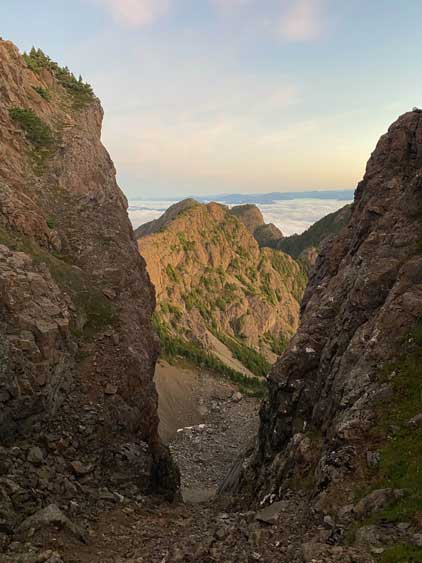
The chockstone gully that I scrambled up through

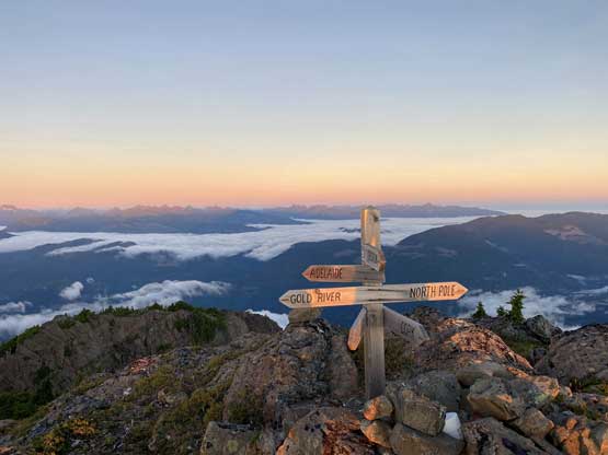
Pretty interesting geo labels on the summit

Johnstone Straight that separates this part of the island from the mainland

Partial Summit Panorama from H’kusam Mountain. Click to view large size.

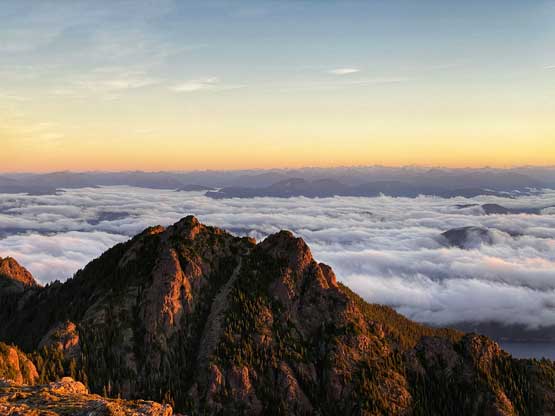
Partial Summit Panorama from H’kusam Mountain. Click to view large size.

Sunrise behind the Coast Mountains
The summit cross with geo tags shone by morning sun rays

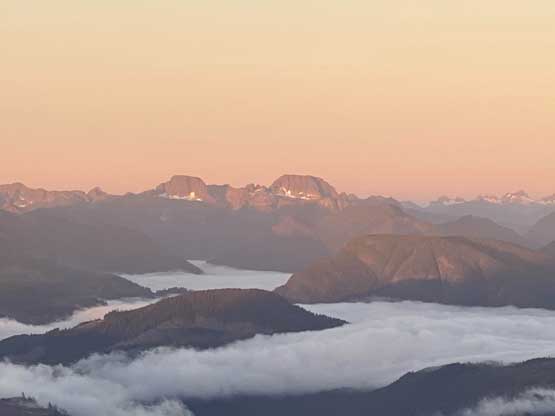
Mt. Cain and Mt. Abel and a bunch of other peaks out that way

Tsitika Peak and Bonanza Peak north of Highway 19
Mt. Schoen

Victoria Peak is the 3rd highest on Vancouver Island
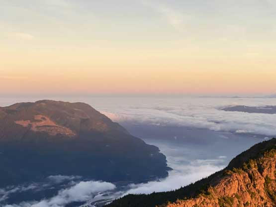
Looking down towards Sayward and Salmon Bay

This is a southern view.

Mt. Waddington dominates the NE skyline
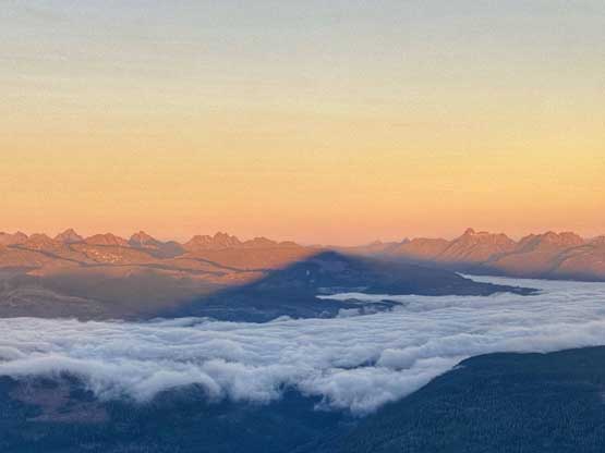
The shadow of H’kusam Mountain
Just another view looking northeast towards the Central Coast
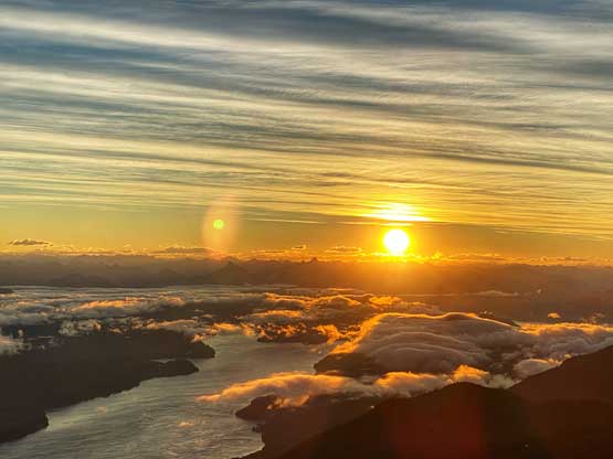
A closer view of the sunrise
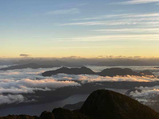
Salmon Bay and the northern summits of H’kusam Mountain massif
One more photo looking north.

Me on the summit of H’kusam Mountain
Once having enough of the sunrise photos I opted to descend as quickly as I could. I ran down to the loose gully because I was literally freezing in the cold winds, then plunged down the scree. The rock garden at the bottom of this gully still needed caution, and so did the descent off that hanging valley on the narrow and slipper paths. Once back to the main trail the rest of the descent was uneventful but boring.

One last view before starting the descent
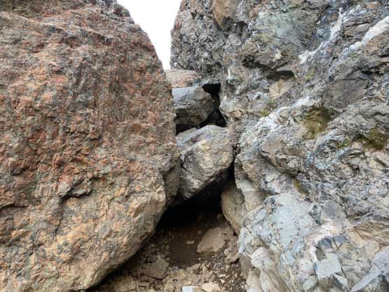
This is the chockstone crux
Back down to the cirque under the gully. Looking back
Looking down the hanging valley
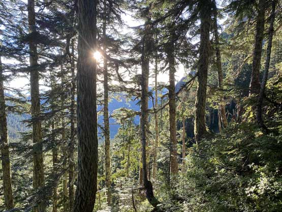
Sun rays through the trees

Passed a weird hut
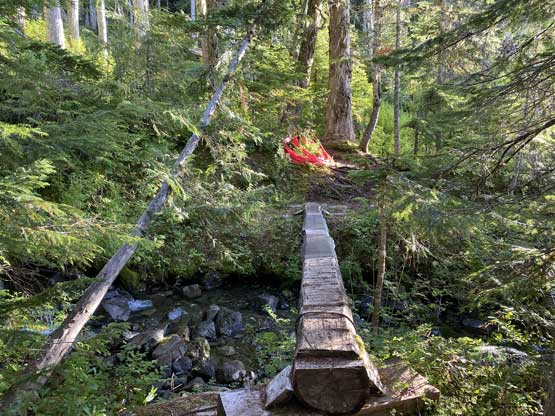
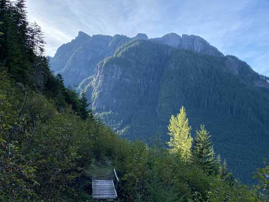
A hiker’s footbridge near this hut

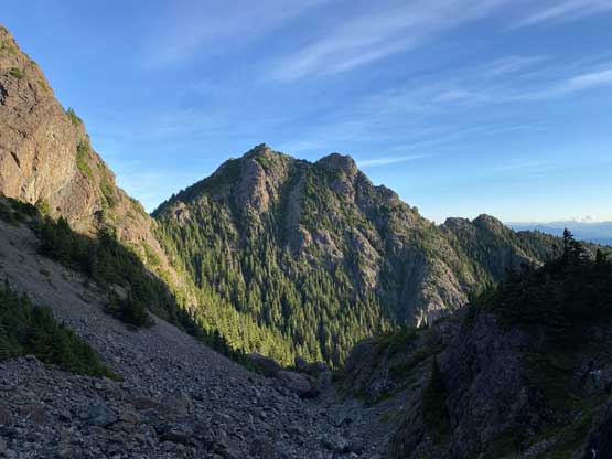
Looking back towards H’kusam Mountain
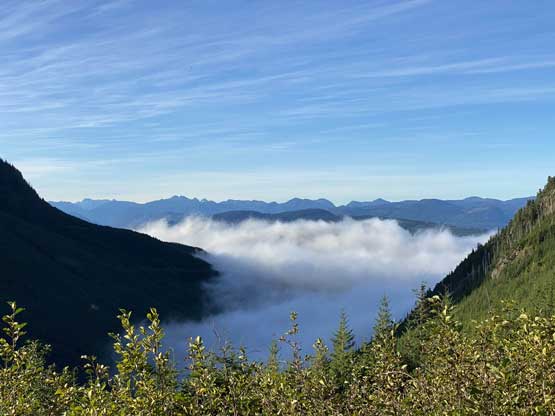
The valley fogs were still there when I was almost back to the truck
As much as the road walking went near the end
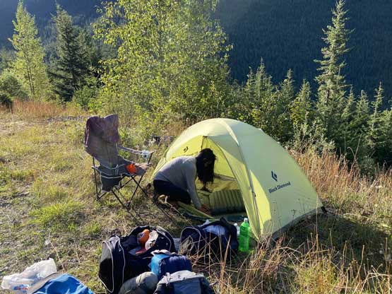
Winnie’s packing up our gears when I was back
Winnie indeed managed to catch up some sleep and had already helped me packing up some gears. We took our time packing the rest of the gears and I also needed a breakfast. We then carefully drove down the narrow logging roads and southwards down the island highway back towards Nanaimo. It was a long weekend Monday and we expected a long wait at the ferry terminal. I was wishing for something like 2 or 3 hours but the wait turned out to be over 5 hours and 3 rides. We eventually got onto the second-to-last ride and two hours later we were back in Horseshoe Bay. Despite the long waits we were treated by an incredible sunset show on the ferry deck.

Sunset from the ferry ride back towards Horseshoe Bay
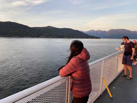
Winnie soaking in the evening views
