Moapa Peak
January 1, 2018
1972m
Las Vegas / I-15 Corridor, NV
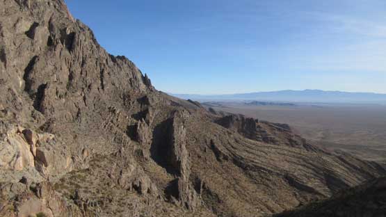
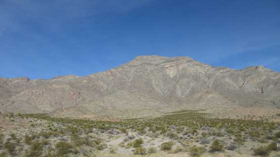
About an hour’s drive north-east of Las Vegas in southern Nevada stands the shear rock fang of Moapa Peak – a true “desert classic” for those living in the close proximity. This might not be the most famed objective near Las Vegas, but famous enough to catch attention from the “far north”. At least two iconic peak-baggers from our Canadian Rockies community had driven that far down south to taste its infamous knife-edge summit ridge and that tells something. The scrambling difficulty should not exceed a modern grade of “class 3” but the position is very aesthetic. The crux is actually the drive as about 8 miles of rough dirt road must be negotiated. A trusty 4×4, high clearance vehicle is required unless you want to walk a significant portion of the approach road.
This was the 7th day of this past holiday season desert trip between Jake and myself. We had been pushing hard for almost every day and this wouldn’t be an exception. The statistics for Moapa Peak isn’t impressive – about 1000 m elevation gain and 6 km of round-trip distance, so to make full use of the daylight hours we decided to combine Moapa Peak and Angels Landing in a single day. This wasn’t without some detailed calculations and the conclusion was to give that a try. The ascent of Moapa Peak would be done mostly in the dark while the descent from Angels Landing would probably be in the dark as well, but that’s standard for our style of peak-bagging. The previous evening we had carefully negotiated the 8 miles of rough road to the actual trail-head and believe or not the whole section took over an hour. This road had certainly put Jake’s 4Runner as well as our off-roading skills in test.
Moapa Peak standard scramble route.
The next morning we woke up at 4:30 am as planned. There’s no trail to follow on Moapa Peak so much of the navigation was done entirely by the GPS technology. Jake did an excellent job leading us through the cross country “desert walking” part into a dry wash which eventually narrows down into a canyon feature. We followed the flow of this canyon trending north-west and then west. The only obstacle was a 10-meter dry waterfall that seemed to require 5th class climbing. In the pitch dark we pulled out the description and sure enough we found the instruction. The correct bypass “trail” is on the left (south) side and we found it with a bit of back-tracking. After bypassing the waterfall we continued onward and the next stop was the saddle north of an unnamed 4542-feet highpoint.
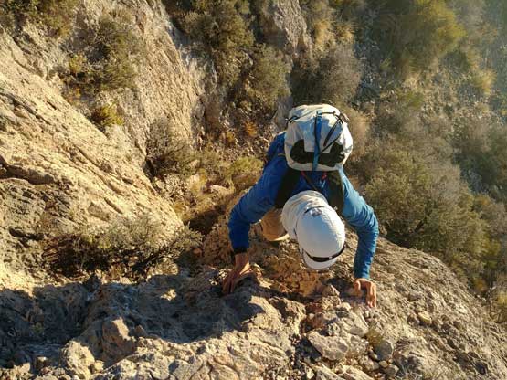
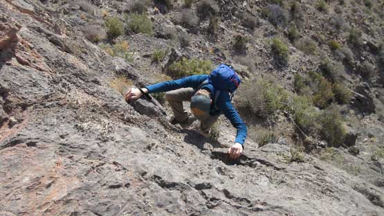
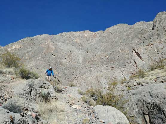
Apparently we did good on time but there’s little point in lingering so turning right, and up we went again. The next section is a mix of off-trail trekking and some class 2 scrambling on a series of ledges and benches. This section terminates at the base of a “headwall” feature. To break this headwall requires some careful route-finding but the route has already been well-marked by cairns. There’s one tricky move at the start which probably will qualify a “WA 4th class” but without much of an exposure. Beyond that the scrambling was straightforward and once above the headwall we veered right (east) onto a wide vegetated bench diagonally up towards the distant summit block.
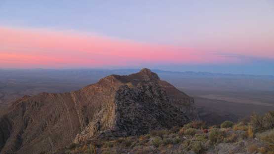
Pre-dawn horizon. It’s going to be a gorgeous day.

Above the headwall now traversing towards the summit block.
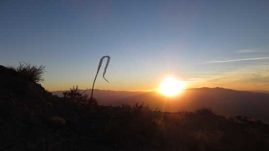
The bonus of doing such an (unnecessary) alpine start was to admire the dramatic alpenglow and sunrise while traversing these upper ramps. The ramp traverse was pretty straightforward on the ascent but it’s worth noting that one should take note for some key junctions for the return trip. We almost had to learn that the hard way.. The ramps eventually brought us to the infamous knife-edge summit ridge.

This is a lower western peak.
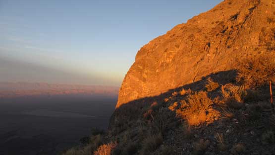
Morning light shone on the steep walls.
The gorgeous sunrise.

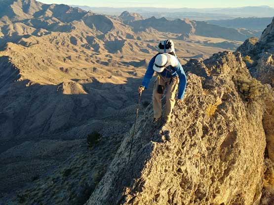
Jake hiking towards the base of an imposing wall.
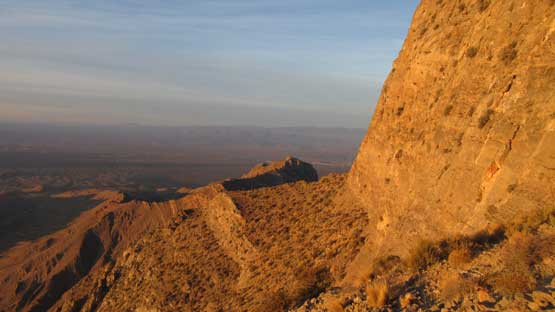
We traversed a long ways due east underneath these cliffs
Me scrambling up a steep step to gain the ridge. Photo by Jake R.
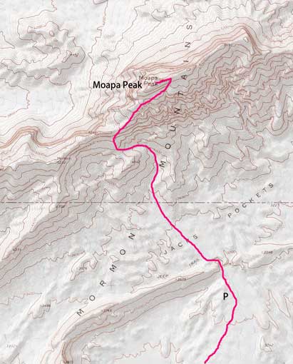
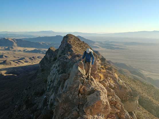
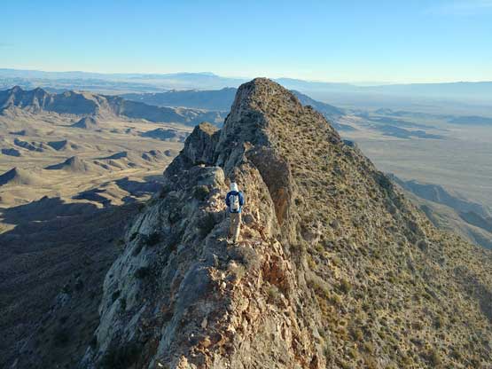
The summit ridge (east ridge) consists of numerous narrow sections mixed with a few 3rd class scrambling spots. The challenge is pretty standard for the seasoned scramblers but the position for this ridge is aesthetic. Our impression was that the moves are a wee bit too easy and the length is too short to qualify a “true classic” status but nonetheless it’s a very enjoyable route. From the summit we could see the vast desert scenery all around.

The start of this ridge is a somewhat tricky 3rd class move.

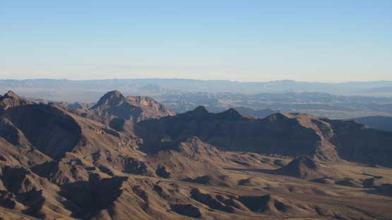
Great view looking at the taller Mormon Mountains

The ridge lies ahead. Full of excitement.
Me negotiating a narrow spot. Photo by Jake R.

Jake continuing up the ridge. Much of this part was hands-in-pocket style.

Getting closer and closer now.
Me enjoying the ridge traverse. Photo by Jake R.
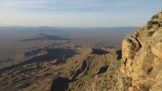
Near the summit I took this shot looking down at the desert plain
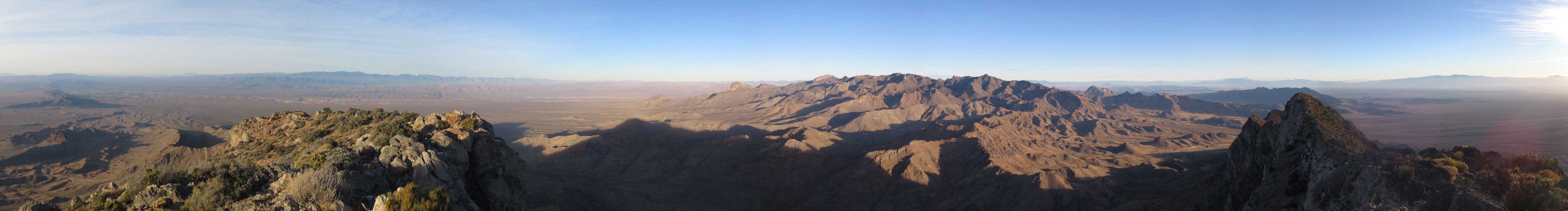
Summit Panorama from Moapa Peak. Click to view large size.
This is looking east towards St. George direction. Peaks in foreground are unnamed.

Mormon Peak is the tallest in this group

Looking south-west towards some taller “sky island” peaks

Pretty sure it’s Muddy Peak in the distance horizon

Familiar names from our Canadian side…
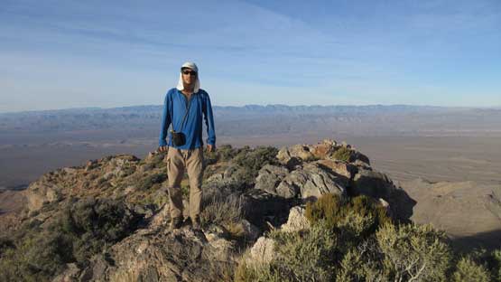
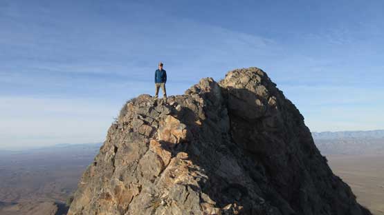
Me on the summit of Moapa Peak
After about 20 minutes soaking in the experience we had to start the descent. There’s still a long ways away to finish this day’s task. Reversing the summit ridge was easy and fun but then we somehow messed up on the “ramps”. There are two major benches/ramps and we somehow took the upper ramp which eventually led to a dead end. Inspecting up-close there’s at least a pitch of hard 4th class down-climb on cactus. No thank. The backtrack was very frustrating and in the end we ended up losing about 50 minutes in this detour. Once getting back on track we payed extra attention to the route and the rest of the descent was uneventful. The process was tedious but the scenery is fresh.
Time to go down. Photo by Jake R.
Jake posing on the narrow ridge.

Down-climbing that fun 3rd class step at the start of this ridge

Too bad we wasted a lot of time traversing a wrong bench…

This is looking back towards the summit block.

Somewhere above the “headwall” feature. This is the typical terrain
Jake down-climbing that tricky move at the bottom of “headwall”
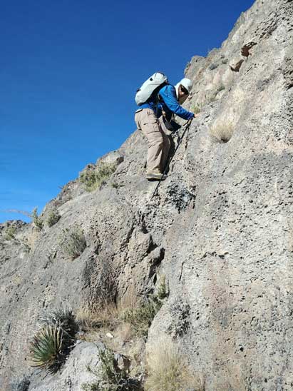
Me down-climbing the same step.
Below the saddle north of an unnamed point now.

As much as the lower route goes. Quite tedious actually.
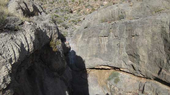
This is that dry waterfall that we must bypass

Down into the wash.
Me with the steep south face of Moapa Peak behind. Photo by Jake R.
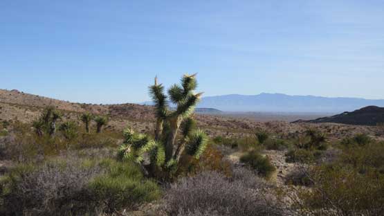
There’s about a mile of cross-country trek across desert floor
One last look at our objective – Moapa Peak, South Face
The ascent had taken longer than expected and meanwhile the drove (8-mile dirt road) had also taken longer than expected last night. That meant we didn’t have much time to waste so engine on, and off we went. Driving back down that crappy road also took more than an hour and then there’s a major traffic delay in the small town of Springdale just before entering Zion National Park. The whole drive from Moapa Peak’s trail-head to Angels Landing’s trail-head had taken more than 3 hours but we did manage to park there with about 1.5 hours spare before sunset. That left us plenty of time to ascend Angels Landing and the new plan was to watch sunset from the summit.
