Mount Weinhold
October 3, 2015
2387m
Phelix Creek / Birkenhead Lake Area, BC
With some sunshine and warm temperature in the forecast I was invited at the last minute to join a 2-day trip into Phelix Creek area about 1 hour drive from Pemberton with Alex (sandu), Dean (DeanP) and Ben (DoubleE Alpinist) from ClubTread. The choice was easy for me as I had never been to anywhere north of Pemberton… Exploring a new area is always appealing as I like the idea to get some different views from one trip to the next. This area is situated roughly in the middle of the triangle Pemberton-Lillooet-Gold Bridge on the Interior side of Coast Mountains and the landscape is dominated by non-technical summits joint by long ridges and alpine meadows.
There’s not much beta about this area (particularly the peaks we wanted to ascend), but looking at the satellite and topo maps Alex came up the plan to bag all the named peaks (3 official and 1 unofficial) with a basecamp at the alpine lakes beneath Mt. Taillefer. Getting there would require fair a bit of travel on logging roads, a few kilometers of hiking and some unknown bushwhacking… Two of the three things mentioned above always have the potential to make some quality adventures and I think we all had some sort of experience with that… And yes we were right…

Scramble routes for Mt. Weinhold, Mt. Taillefer and Prospector Peaks. GPX DL
After safely negotiating the Pemberton Portage Road to almost D’Arcy then up the Blackwater Creek FSR to almost Birkenhead Lake, we correctly located the much-narrower Phelix Creek FSR. A few clicks up this rough road we encountered two big boulders rolling off from the hillside… We almost gave up the plan but after a good 30 minutes work (with some creativity) we managed to move the smaller boulder by a few inches so that Alex’s Subaru could just squeeze through (barely)… There were a few more water bars and rough spots but we had no further major issue to reach the supposed parking area.
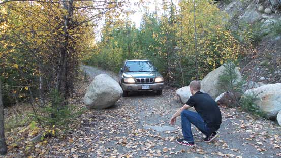
Mmm… Is this gonna go?!
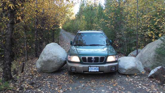
Barely, barely….
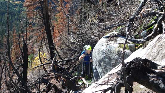
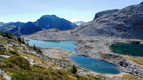
The final 1 km up a side branch was very overgrown so we started walking from there. In short time we were on the trail leading up the valley south of Mt. Taillefer, but unfortunately for us it didn’t last long… For the next few hours we were punished by some horrendous slide alders on very boggy ground, dense timbers and deadfalls in a burnt forest mixed with two creek crossings, but with good perseverance we made to the beautiful alpine lakes 3.5 hours after leaving the car. It’s easily the top-5 bushwhacking for me of all time but apparently it’s “not too bad” for the West Coast standard… We took a long break setting up camp but then it’s time to get going again.
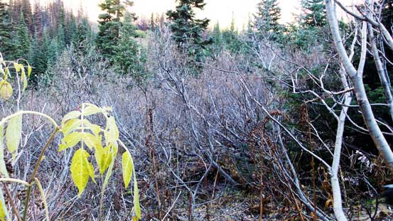
Bushwhacking starts…
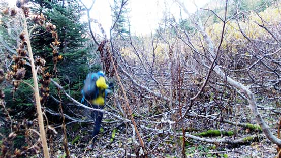
Dean powering through the slide alders…
Ben squeezing between the deadfalls and the boulder
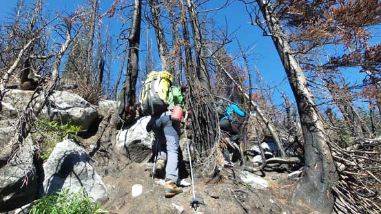
Continuing up through this burnt forest

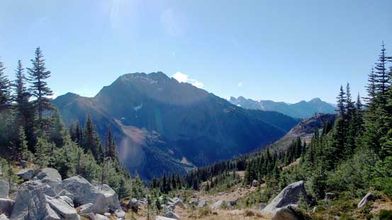
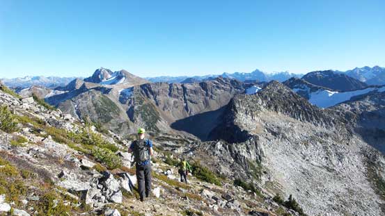
A view of part of Prospector Peaks
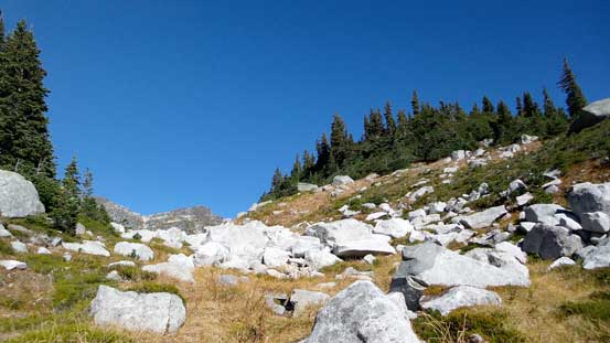
Out of the bush eventually
Looking back towards Phelix Peak
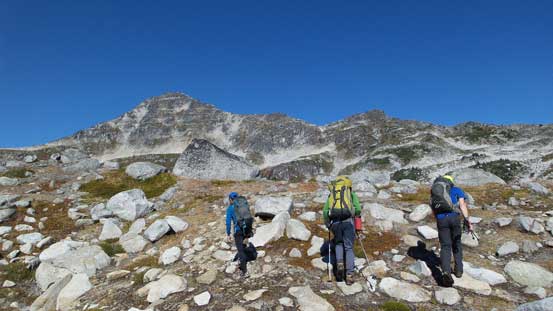
Guys marching up. Mt. Taillefer in the background
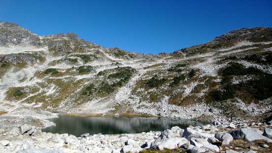
Now the lakes are coming in view
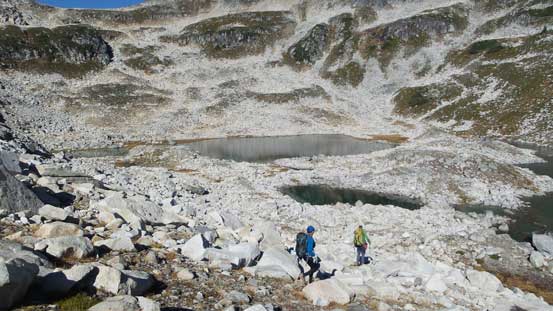
Descending towards our camp spot – the far side
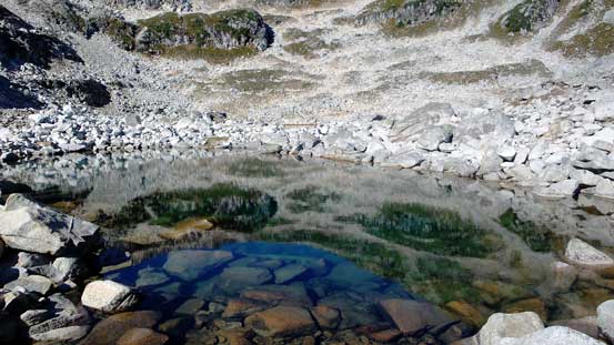
Very clear water

This is indeed a great spot to hang around
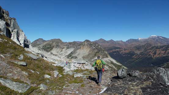
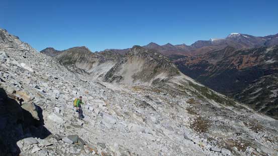
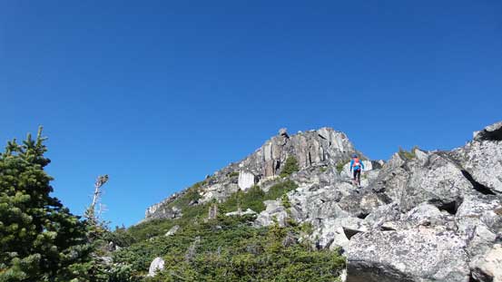
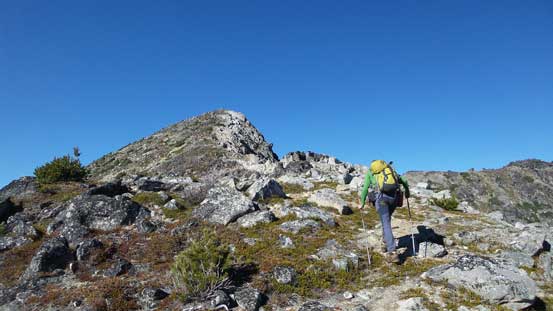
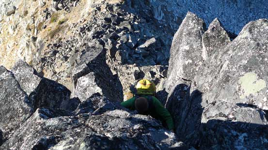
Mt. Weinhold is the farthest from our camp and we wanted to tag it first then traverse back over to the closer Mt. Taillefer. The first section was to gain the lower E. Ridge of Taillefer which proved to be nothing more than a steep hike. Then we skirted around an icy patch of snow/glacier and ahead was the long ridge walk towards our first objective. There were 2 major bumps to ascend up and over or traverse underneath on some unpleasant side-hilling terrain. We went up the first bump but got blocked by a steep cliff on the opposite side with some huge exposure. Ben tried to down-climb (and almost committed to it), but there’s that one tricky move we didn’t have 100% confidence so backtracked and found an easier line leading us diagonally down the southwest side, then traversed back over to the north to rejoin the ridge proper.
Looking back towards these lakes
Arriving at the lower E. Ridge of Mt. Taillefer
Our objective way far in the distance
Traversing above the snow/ice. A little bit tricky at spots
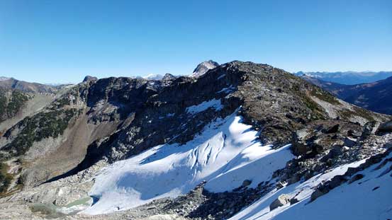
There’s a small pocket glacier on the north side of this ridge
Alex leading the way
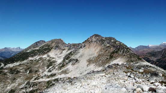
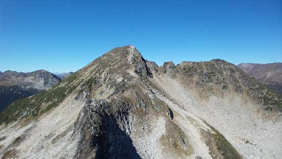
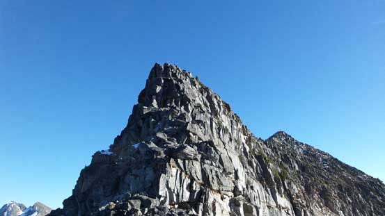
Bump 1, Bump 2 and the summit…
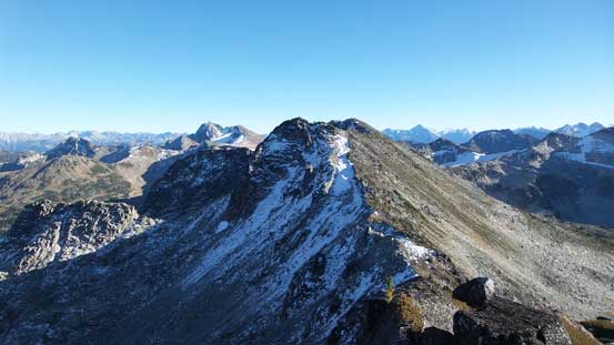
Ridge walk was the theme
Ascending towards Bump 1

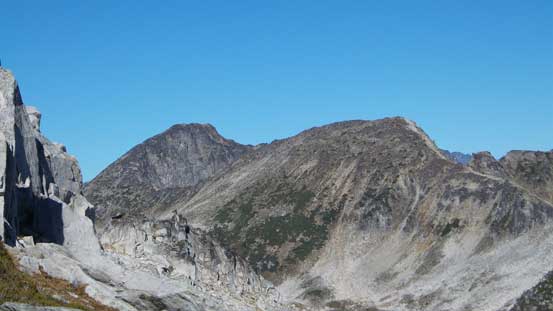
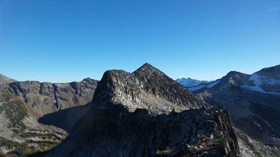
Looking back at the N. Face of Mt. Taillefer. Does it look like The Eiger?!

Quite a few lakes around here
Bump 2 ahead…

But now what?! Where to go..
Searching for a way down, but doesn’t quite go
Dean found an easier like down the side

Regaining the ridge, looking back
Ascending up and over the second bump was relatively uneventful. There’s one point I almost convinced myself the second bump was the actual summit but thankfully I had my GPS handy so didn’t get fooled by the foreshortened view. There’s still about half an hour’s work to the true summit but the terrain was “easy scrambling” only, albeit on the unpleasant granite boulders…
Alex slogging up Bump 2

The true summit ahead..
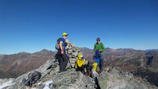
Finally made to the top

Partial summit panorama from Mt. Weinhold. Click to view large size.

Partial summit panorama from Mt. Weinhold. Click to view large size.

Looking down the NE Ridge

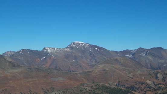
The tallest peak is Mt. Truax to the north
Some peaks on Bendor Range that I’m not very sure about the names
Whitecap Mountain is a big one in Bendor Range
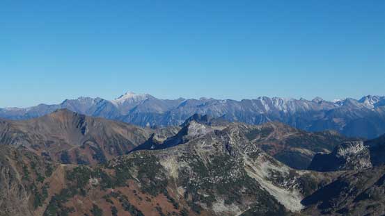
Mt. Seton way in the distance on left skyline

Mt. Aragorn
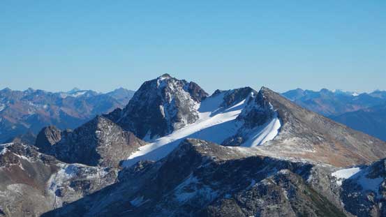
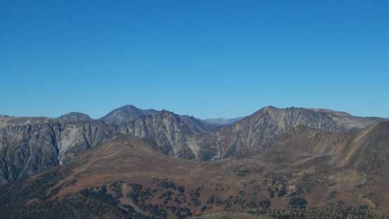
Prospector Peaks which will be our objective the next day
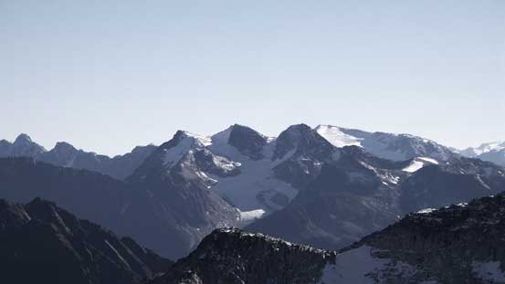
Birkenhead Peak looks awfully like the Lyells (I, II, III) from this angle…

Marriott and Cayoosh with part of the Joffre Group behind
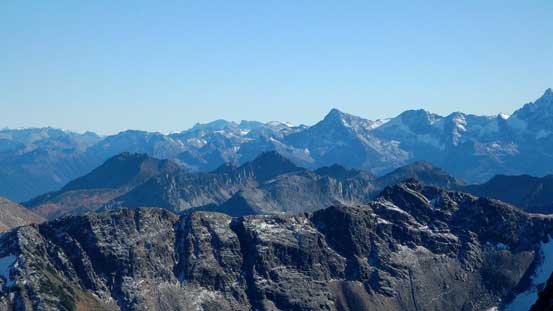
More peaks that I’m not familiar with
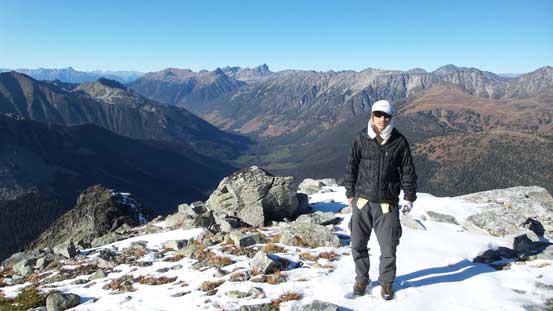
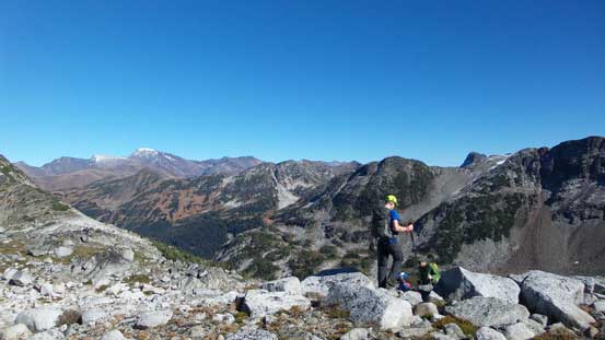
Me on the summit of Mt. Weinhold
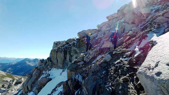
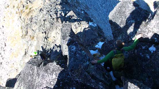
It didn’t take us long to realize we didn’t have too much daylight time left, so we immediately started traversing back. We opted to climb up that tricky tower section and once committed to a few crack moves it’s not too bad. This saved us some time from unnecessary elevation loss/regain or side-hilling.

There’s another tarn just to the east of this ridge

Looking back towards the true summit
Bump 2 ahead

The N. Face of Mt. Taillefer
Slogging back
It’s that tower section ahead
Taking the challenge or not?!
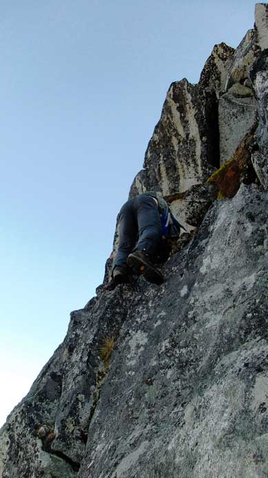
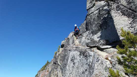
Ben showing the way

Alex on the crux move
Alex finishing the stemming move higher up

Dean finishing the tower challenge
We made good time to get back onto the lower E. Ridge of Mt. Taillefer. Checking my GPS there’s only less than 200 m elevation gain left, but with just over 1 hour’s daylight time left we had to hurry up to get Mt. Taillefer bagged…
