Cerro Cusín
December 27, 2022
4012m
Otavalo, Ecuador
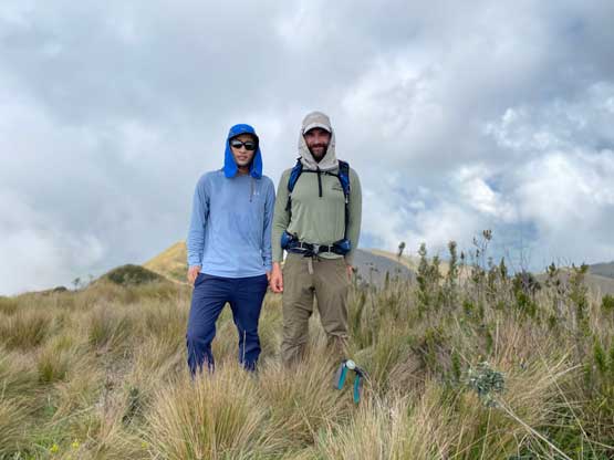
The original plan for the day immediately after climbing Chimborazo was to rest and travel to Otavalo with our private driver to be better positioned for Imbabura and Fuya Fuya, but Adam noticed this peak called Cusín on the maps and immediately wanted to squeeze that into the travel day. I wasn’t very keen but reluctantly agreed. This is a rather small peak by Ecuadorian standard but does boast over 800 m prominence. There’s not much “beta” as nobody had previously logged an ascent on peakbagger.com. Adam managed to find some tracks on Wikiloc that came from the north side. Upon further inspecting the satellite images Adam proposed that we should drive in from the east side as the roads seemed to extend higher. The roads weren’t even shown on my Gaia map so I anticipated some private property issues, but there’s only one way to figure that out.
Marquito had been our driver for Chimborazo’s ascent and would continue to be our driver for Cusín, Imbabura and Fuya Fuya. We hired him through the company “Lonely Summits” and the price for the driver, the truck and the gas combined was 270 dollars for the three days, though Adam and I had to pay Marquito’s food and accommodation as well. A lot of trekkers we met in these lesser known areas seemed to prefer the dirt-bagging way by using public transportation and/or bikes but we liked the flexibility and directness of having a private 4×4 driver. Paying 270 dollars of cash is overall much simpler than dealing with the complicated logistics especially given our limited Spanish.
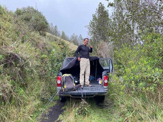
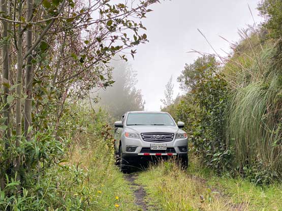
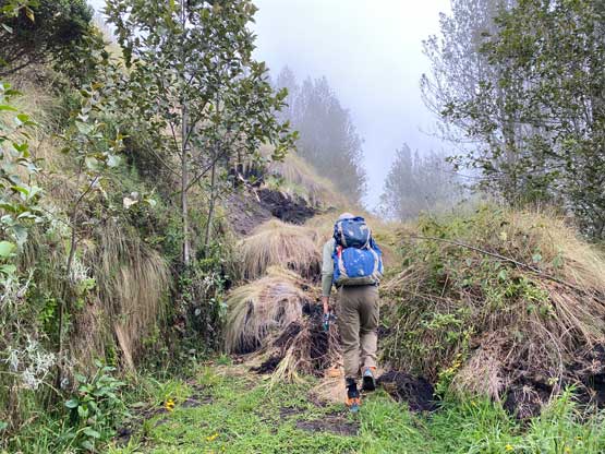
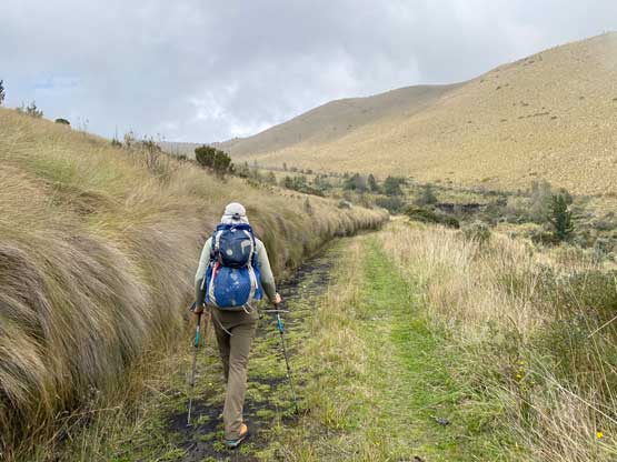
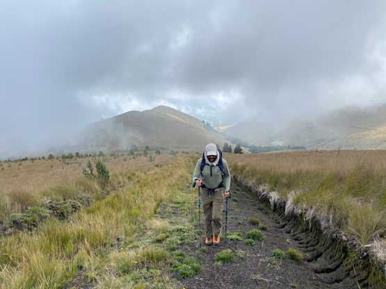
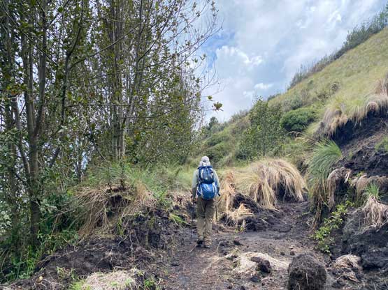
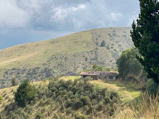
Marquito came to pick us up at 9 am and it took us a while to explain where exactly we wanted to go. In the end we agreed to firstly drive to the village of Cayambe for lunch and redirect from there. We told Marquito to find some almuerzo barato (cheap lunch) and he seemed to be good on that. The price for the three of us combined was just over 10 dollars. We then had to give him step-by-step directions as the spur roads on the east side of Cusín wasn’t marked on the Google maps. Marquito didn’t even have data nor offline maps downloaded so Adam and I basically had to take care of the navigation. After leaving the highway we had to switch to my Gaia topo map for navigation as the roads were at least marked to the small village of Chilco. The cobblestone pavement stopped immediately after passing this village and the road had become increasingly steep, muddy and rough. The recent dump of rain had made the road even more slippery. Nonetheless we had a Toyoto Hilux with “mountain tires” so we pushed literally to the driveable end. After driving past what seemed to be an abandoned house we got stopped by a mudslide. The road had become a singletrack by this point so Marquito had to back all the way back to that house to turn around. Adam and I unloaded our shits at the mudslide to start the hike while Marquito would take his time to deal with the driving challenges. Though we didn’t drive to the absolute road’s end we were well within the “walkable range”.
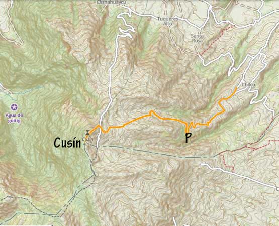
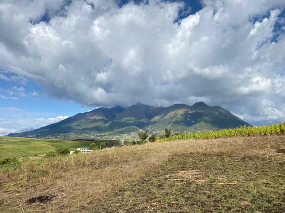
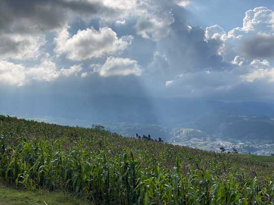
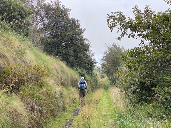
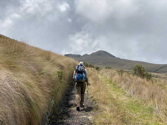
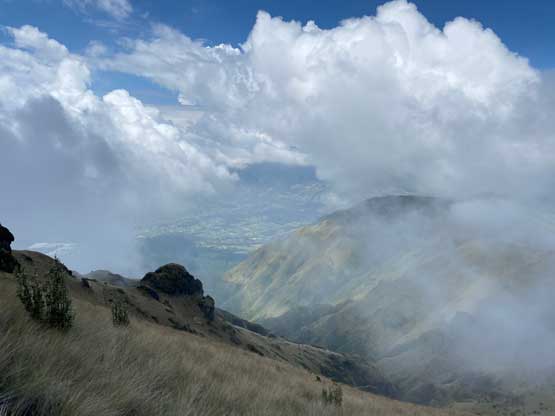
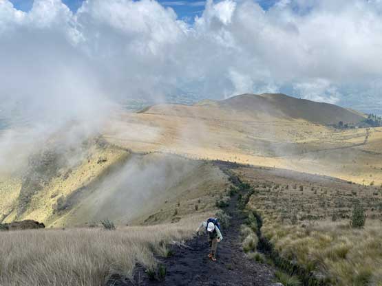
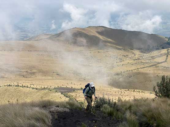
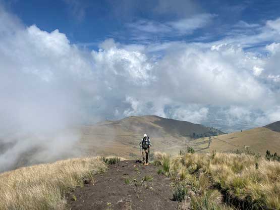
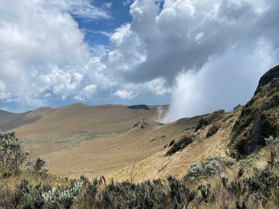
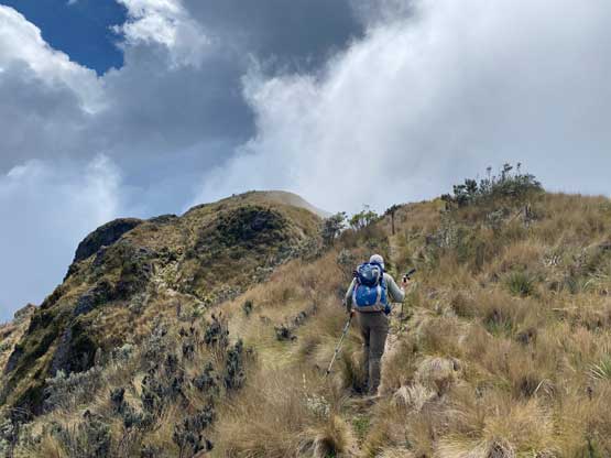
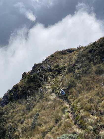
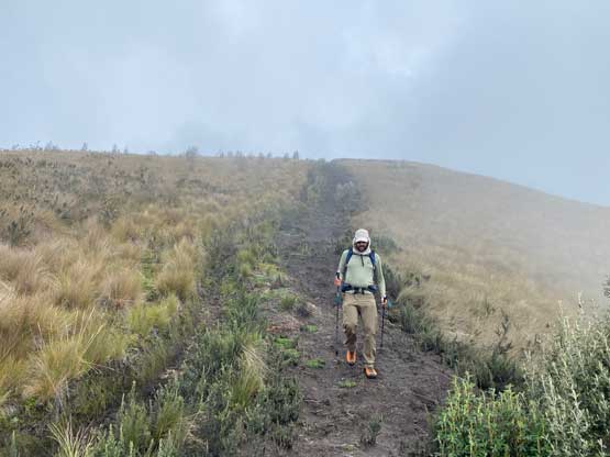
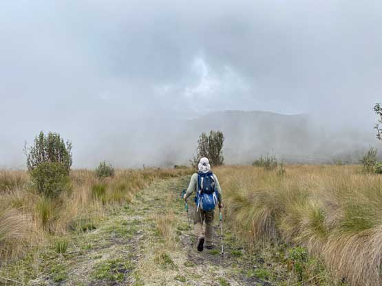
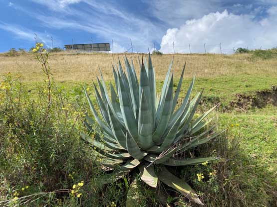
The ascent of Cusín from where we parked the truck was no-brainer. All we needed was to walk the remaining of this road to the end and ascend the north ridge. The roads turned out to extend even farther than expected, all the way onto the north ridge. It was a somewhat boring slog but we were able to hike fast as we were well acclimatized after just climbing Chimborazo. The weather was also better than expected without a single drop of rain. It was mostly a mix of sun and clouds. After the previous day’s dump of precipitation we apparently had entered a short period of stable pattern. The north ridge of the north summit was steep and muddy and it seemed like we were still plodding up a deactivated road. The true summit is apparently the south one across some undulating ridges but a trail goes all the way to the south summit so it’s pretty easy. We started to wonder why no ascent had been logged on peakbagger.com. Everyone who came all the way to Ecuador couldn’t bother with an easy add-on P600m objective?
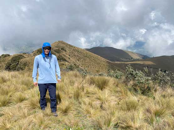
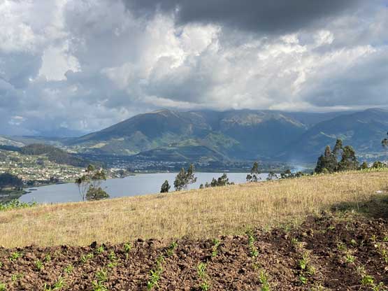
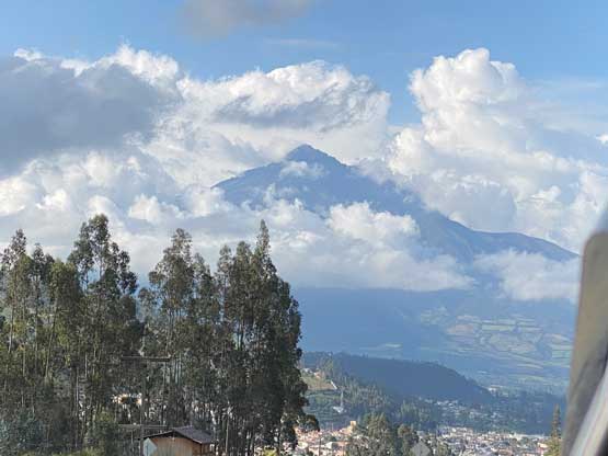
We stayed on the summit for quite a while since we were definitely ahead of schedule. Once committing to the descent we plodded all the way down to Marquito’s truck at that abandoned house in a single shot as this was overall a very short hike. We then drove down the rough roads back to the highway and Adam and I directed Marquito to drive us over the pass between Imbabura and Cusín. That seemed to be the most direct way to drive to Otavalo and we were correct. The roads were actually entirely paved so we got there more than an hour earlier than the earliest check-in time.
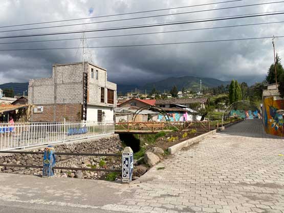
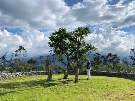
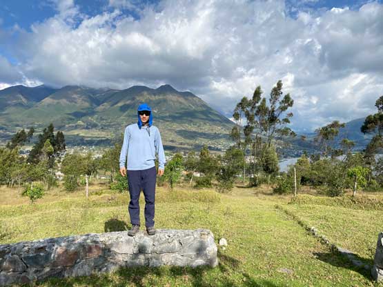
Adam had previously studied the maps and noticed a P100m dumpster-dive objective so we went there first. The plan was to drive to the summit but a construction on the road forced us to hike 10 minutes to the summit where a famous tree was planted. There’s some cultural significance of that tree (El Lechero) but I couldn’t remember much. We then drove to the neighbourhood of our Air B&B and found an excellent restaurant. The price in this city is at least 50% cheaper than in Quito but the quality was even better. The rooms we got turned out to be also better than the one in Quito so we really liked this town.