Blumlisalp Mountain
July 21, 2020
2159m
Clendinning Area, BC
Blumlisalp Mountain is rather a small bump but locates in the heart of South Coast. I did not expect much from this peak when Alex, Vlad and I did the 10-day Clendinning area traverse but while traversing across the ridge I noticed some immense rugged U-shape valleys to the west. Later at home I found out that this small peak sits on the quadruple divide point among Little Toba River that drains into Toba Inlet, Hunaechin Creek that drains into Jervis Inlet, Sims Creek that drains eastwards into Elaho River and eventually the Howe Sound, and Clendinning Glacier.

The section from Mt. Boardman to Blumlisalp Mountain.
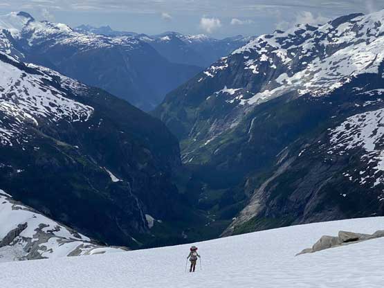
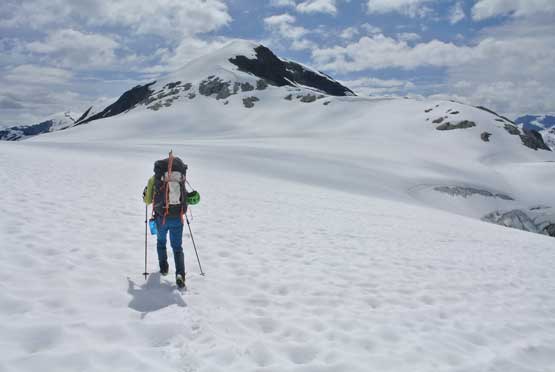
This was the 4th day of our traverse and we had pushed through the Clendinning Glacier area. We woke up with cloudy skies and took our time breaking camp. We had little idea where we wanted to be at the end of this day, but ideally as close to Mt. Tinniswood as possible to facilitate an ascent of that giant on the following day. The first stretch was to descend into Pivotal/Blumlisalp col followed by a tiring plod up the NE Ridge of Blumlisalp Mountain. The descent into the col was mostly on snow but we had to do some route-finding in micro-terrain. A few steep spots were bypassed on the north side of the ridge on snow. From the col the plod onto the false summit of Blumlisalp Mountain was easy, but tiring with the heavy packs.

Morning view of Mt. Alexander and Hunaechin Peak from our camp
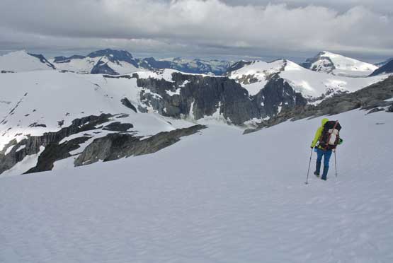
Me heading down into Pivotal/Blumlisalp col. Photo by Alex R.

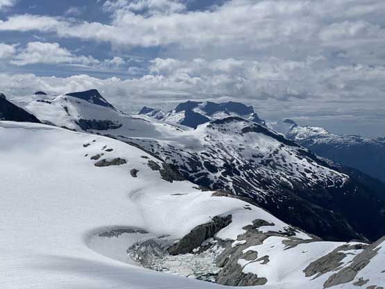
The NE flanks of Blumlisalp Mountain

Alex and Vlad plodding up with Swiss Arm of Clendinning Glacier behind
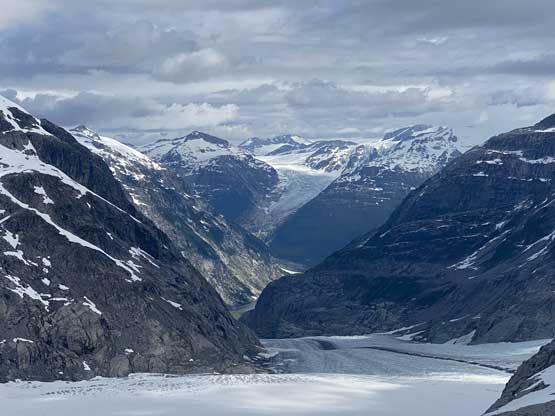
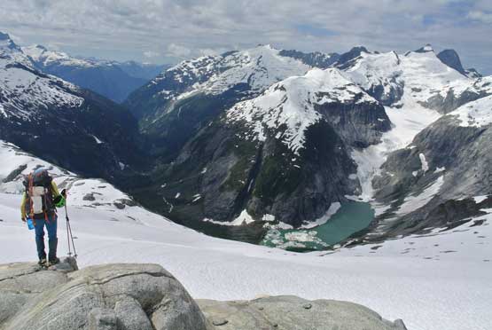
Looking down Clendinning Glacier into a bit of Clendinning Lake

The north face of Mt. Tinniswood looms behind Hammerstein Peak
We ditched the backpacks and went for the true summit, which was only marginally higher. The peak was labelled on the false summit on the government’s topo maps, but bivouac.com identifies the next bump as higher so we had to check that out. The traverse to the higher bump took about 20 minutes each way and was trivial. The true summit had a fun boulder problem that involved one or two moves.

Walking towards the true summit now without the packs
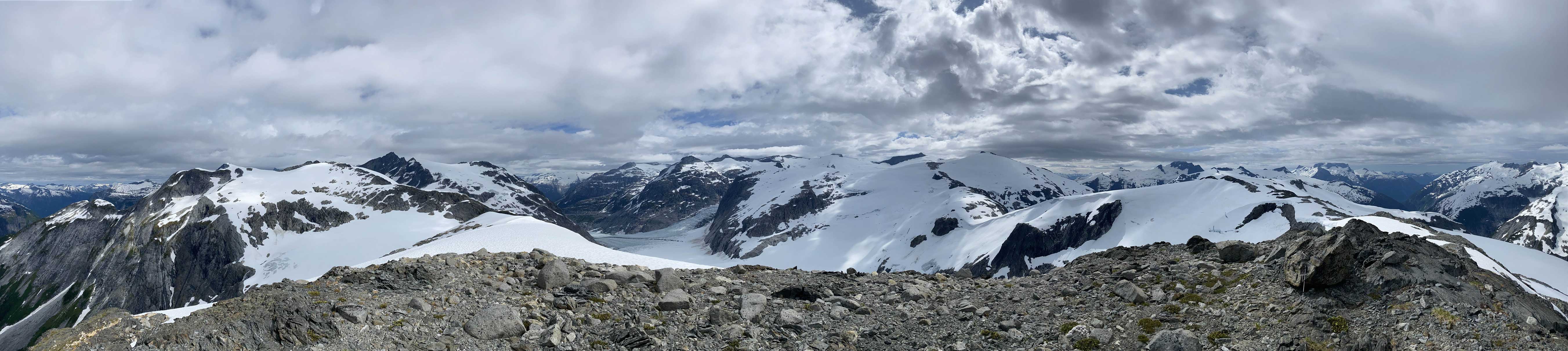
Partial Summit Panorama from Blumlisalp Mountain. Click to view large size.

Partial Summit Panorama from Blumlisalp Mountain. Click to view large size.
Monk Peak and Little Toba Peak across Little Toba River valley
Alex taking in the views into Clendinning Glacier

Me on the summit boulder of Blumlisalp Mountain
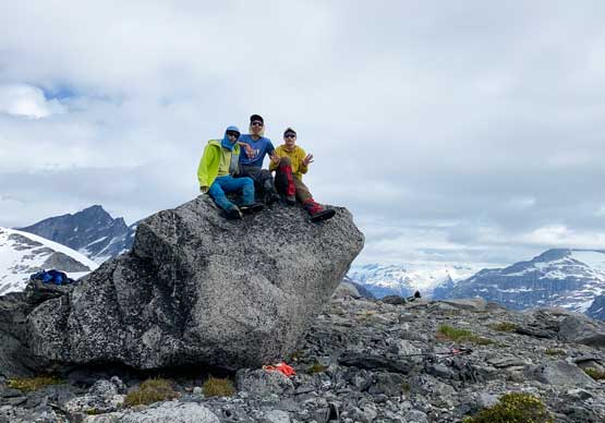
Our group shot on the summit of Blumlisalp Mountain

Another photo of the three of us on Blumlisalp Mountain
The highlight of this peak came after the summit as we descended the long and gradual south ridge into Blumlisalp/Hammerstein saddle. As mentioned above I did not expect much from this section as we were just losing elevation, but the views westwards into Hunaechin Creek valley completely opened up with some incredibly rugged terrain. The last 100 m descent into the low point involved some route-finding and a bit of class 3 scrambling but the general idea was to stay skier’s right to avoid difficulties. And then our next objective would be Hammerstein Peak.
Starting the descent off the south ridge with Mt. Albert looms behind
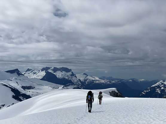
Vlad and Alex plodding down the south ridge of Blumlisalp Mountain
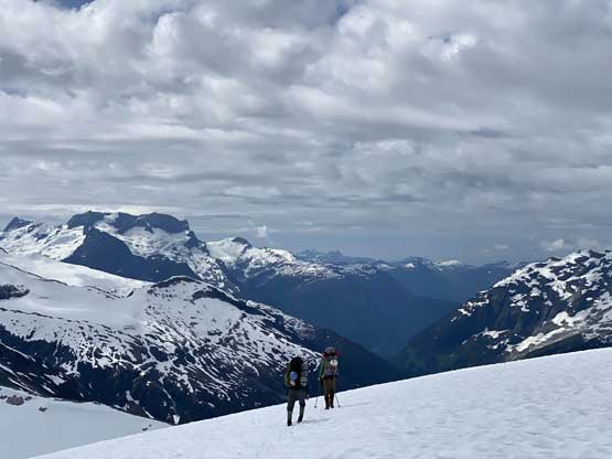
Alex plodding down with Hunaechin Creek valley fully opened up

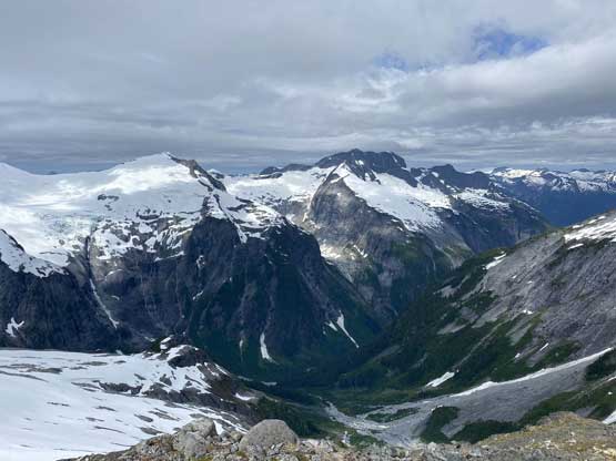
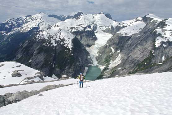
Hunaechin Lake, Hunaechin Peak, Mt. Alexander and Hunaechin Creek valley

A more zoomed-in view of Hunaechin Lake
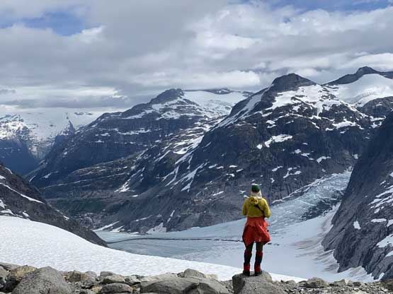
Me soaking in the views. Photo by Alex R.

A closer look into Hunaechin Creek
This is the unnamed glacier that’s truly the headwaters of Sims Creek
Me plodding down with Hunaechin Peak behind. Photo by Alex R.

A bit of route-finding and scrambling to get down into the col
The low point between Blumlisalp Mountain and Hammerstein Peak

Another photo of Hunaechin Peak and Lake
Me plodding across the flat glacier at Blumlisalp/Hammerstein col

Me taking in the views into Hunaechin Creek. This is a rarely seen view
