Manly Beacon
December 27, 2017
229m
Death Valley National Park, CA
Manly Beacon is by no mean a “glamorous objective” but is surely one of the most unique I’ve ever seen. It’s essentially a spire of mud and dirt sticking out of the Furnace Creek (core tourism) area of Death Valley. The unique profile attracts hikers and photographers and the fact there’s a somewhat exposed 3rd class route makes it famous in the local peak-bagging community. The shortest approach is from Zabriskie Point but for a full experience one should approach from Golden Canyon. Jake and I did it on the second day of this past holiday season desert road trip.
Manly Beacon scramble route via Golden Canyon. GPX DL
The Golden Canyon trail-head was crowded with tourists but actually not as bad as I was expecting. Lots and lots of cars were parked on the shoulders of highway but we somehow managed to find a spot in the actual parking lot. This is another peak that neither Jake nor I had done much research other than having downloaded a GPX track. That’s OK as we just have to explore it out ourselves. The first stage was travelling up Golden Canyon and as soon as we were 5 minutes in the crowds density had eased off. I have to say that the exploration up Golden Canyon itself is worth a visit. This is by far one of the most otherworldly places I’ve ever been to.
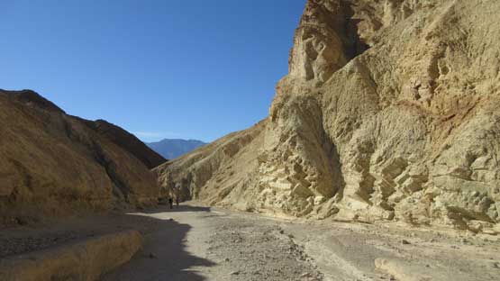
This is the start of Golden Canyon trail

Otherworldly formations

Dude exploring off-trail here

Continuing up the Golden Canyon trail

Upwards and onwards
At one point we briefly saw the imposing west face of Manly Beacon and then there came a junction. The correct route takes the narrower right branch which travels through some dry washes and then climbs up to a plateau at the base of this peak. Most tourists would wonder off-trail a bit to explore but very few would believe there’s actually a non-technical route to attain the summit. Jake and I didn’t want to join the hordes so resumed on, losing about 50 meters of elevation down to the south side. At this point we were still following the Golden Canyon trail.

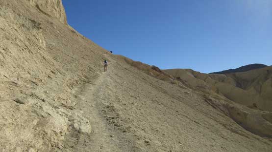
Finally starting to gain some elevation now.

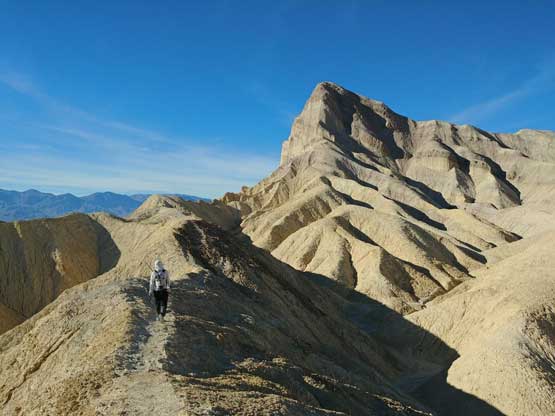
Jake hiking towards the base of Manly Beacon
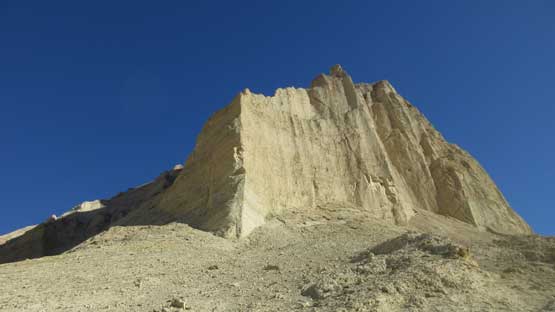
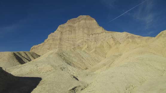
At the base of Manly Beacon. I wonder if this face will ever get climbed…
The trail traverses high across this face

Looking back down at the Golden Canyon landscape

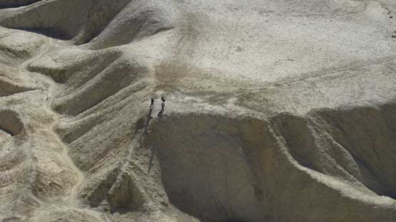
Another pair of hikers traversing the high stretch of this trail.
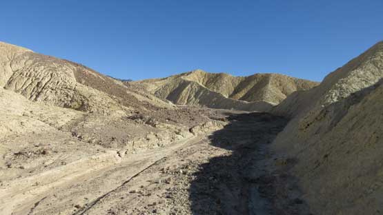
We were unsure as where exactly to leave the main trail so just blindly guided by the GPX track. It indicates we have to travel due north through a maze of ridges and washes but once getting closer and closer it started to make sense that we just had to simply follow one of the main dry washes. There’s some twists and turns but again the simplest way is to just follow the wash. It’s very obvious as where to leave this wash as we just had to follow the beaten path.
Now it’s about the time to leave the main trail.

Off-trail exploration up this dry wash. This would bring us to the base of the route.
The scramble up a “rib” to gain the summit ridge looked ridiculously steep but is actually not. There’s nothing tricky in following the beaten path other than the ground was loose as hell. And then there came the summit ridge and again the ridge looks insanely steep but is actually not. The “class 3” step is exposed towards both sides indeed, but speaking from a scrambling perspective I would hardly call that a “class 3”. It’s more like a “class 2” walk although the texture of this mud-and-dirt did create some eerie feel. None of us had previous experience with this type of terrain so caution was required. The summit has just enough room for a couple people and we stayed there for a long time. It’s always fun to gaze down at the tourists wondering what would they think about us “crazy dudes”.

The first part of this route goes up this broad rib. Note the tracks.
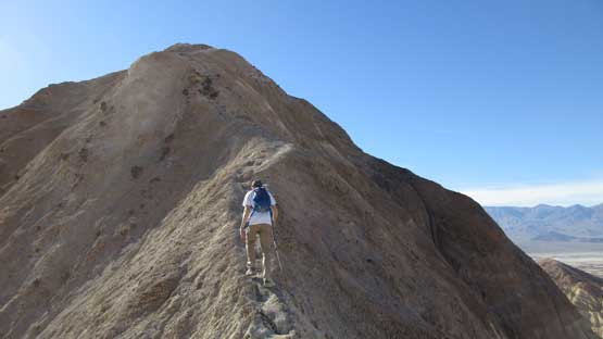
The next stage is to follow the summit ridge up.
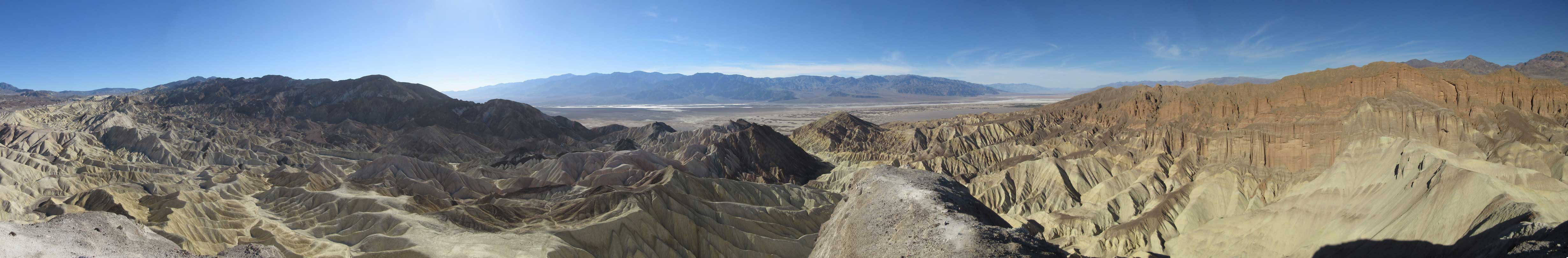
Summit Panorama from Manly Beacon. Click to view large size.

Jake surveying the immense vistas

The “Red Cathedral” looking north.
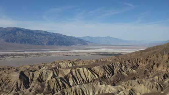
This is looking further north towards Furnace Creek area

Zabriskie Point is visible in this shot if you know where to look at.
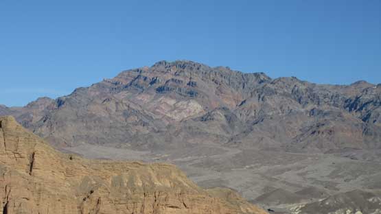
Schwaub Peak is apparently not easy to access nowadays.

This is one of the striking peaks nearby – Pyramid Peak

Looking down into the dry wash that we used to access this peak.
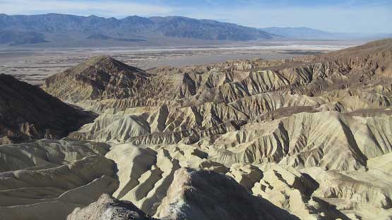
Golden Canyon area and Death Valley behind

Same as above. Death Valley landscape at its finest.

Red Cathedral looks fun to explore too.
Tourists wondering on and off trail.
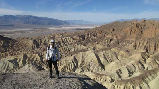
Me on the summit of Manly Beacon
Eventually it’s the time to descend. Down-scrambling that 3rd class step required more caution but otherwise it’s pretty straightforward. Lower down we decided to explore things around with a couple ideas of making “short-cuts”. And of course we screwed ourselves up by picking some wrong ridges so the “short-cuts” turned out to be more exploration and wondering. That’s not bad neither as we did have extra time to kill. The rest of the descent down Golden Canyon was uneventful and by this time of a day most tourists were already gone.

Me carefully descending the 3rd class step. Photo by Jake R.
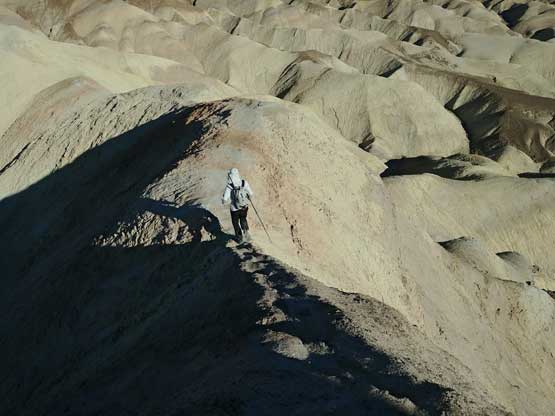
Me continuing down the summit ridge. Photo by Jake R.

Cannot stop shooting the unique terrain around us.

Down to the dry wash now but we soon decided to go explore..
Me travelling along one of the ridges with Manly Beacon behind. Photo by Jake R.

Another shot with me exploring the ridges. Photo by Jake R.
The south face of Manly Beacon aka. a vertical face of mud and dirt. Volunteers?

Back to Golden Canyon now.
Earlier in the day we had made a decision to ascend Mt. Whitney the following day after seeing how dry it actually was. The next mission was driving to Lone Pine, CA which is about 2 hours from Furnace Creek. The drive involves at least two major up-and-downs over some of the best desert landscape. Once in Lone Pine we did the evening routine thing and then spent about 1 hour in the McDonald’s parking lot sorting the gears out.
