Hinkhouse Peak
July 22, 2022
2304m
Washington Pass, WA
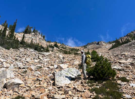
Hinkhouse Peak is a small but interesting summit on the immediate north side of Washington Pass. Despite the lack of approach distance this peak does not see much traffic. Part of the reason is the lack of statistical significance as this peak is not included in any peak-bagging list. The summit block has a bit of technical challenge and there’s also no trail to facilitate the ascent. One basically ascends 600 vertical meters straight up from the overlook with fair amount of bushwhacking, route-finding and scree bashing. In other words, this is a short, but not a no-brainer outing.
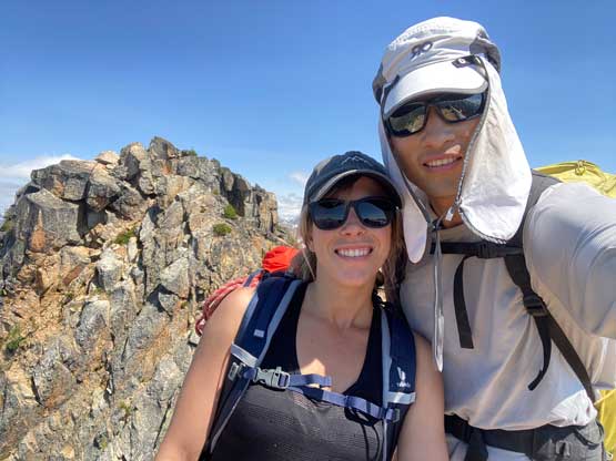
July 22nd is Elise’s birthday so naturally she wanted to ascend a peak but I was tired from the recent travelling and also needed to conserve energy for a major outing a couple days later. Elise also had a few days of intense work so realistically we shouldn’t plan anything major. I had Hinkhouse Peak on my mind for a while mostly due to the shortness out this outing. Elise found this peak cool mostly because it’s named after Jim Hinkhouse, the founder of OSAT, a community that helped a lot of alcoholics to recover through mountaineering. I did more thorough research and realized that we might or might not even end up needing the rope on the summit block challenge. We decided to bring the rope and if the ascent turned out to be too short we could pick a harder line just to make it more fun.

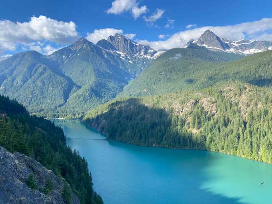
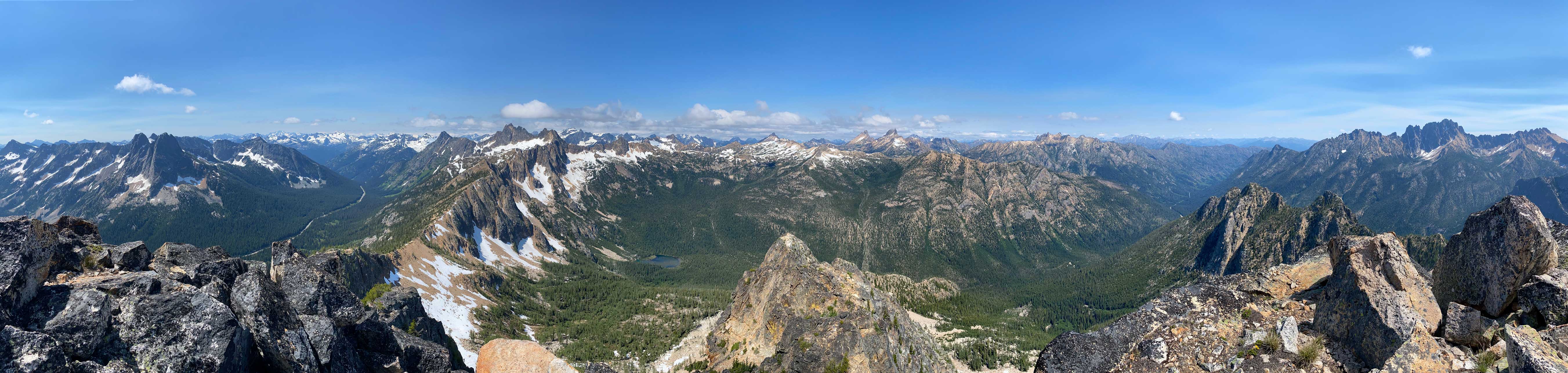
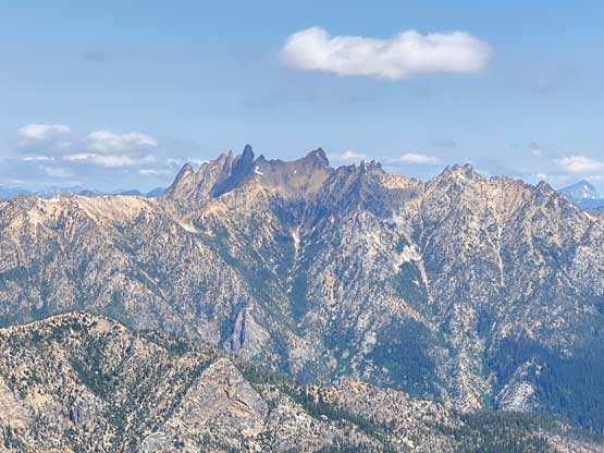
Elise showed up at my home at 5:30 am and in short time we were down in Washington with virtually zero border delay. I drove us in my Toyota Corolla to save gas as this entire drive was on pavement. The drive was a long one that took almost 4 hours but I was really taking my time and wasn’t rushing. We even stopped at Diablo Lake viewpoint for some photos. At Washington Pass we turned onto the smaller road and parked at the overlook, joined by at least a dozen tourists’ cars. There’s already great views of the Liberty Bell group that I climbed in 2019 on two separate trips.

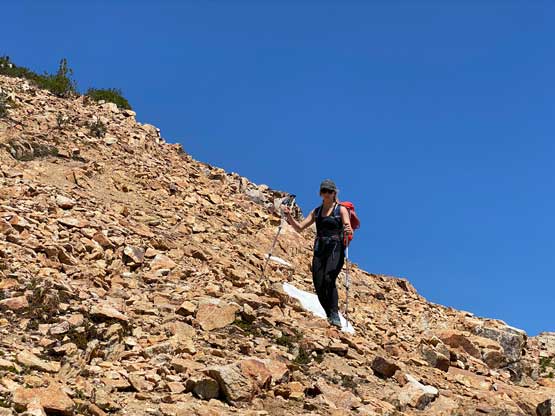
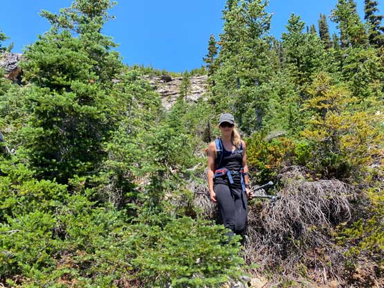
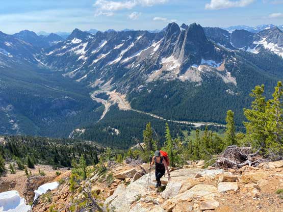
As mentioned earlier the ascent was not particularly aesthetic as right off the bat we had to enter the forest and bushwhack. The bushwhacking was never annoying but the route-finding wasn’t as obvious as I was hoping for. The general bearing was to go up and traverse climber’s left. We ended up ascending too far up and didn’t traverse left enough, so in short time our route was blocked by some gigantic slabs. We were then forced to traverse left overcoming a series of class 3, down-sloping slabs. I wasn’t even sure if we were “on route” but I didn’t even know what to expect on the so-called “standard route” anyway, as there’s no existing GPS tracks on the internet for us to download. A few hundred meters of elevation gain later we merged into a broad gully and from there onward the route-finding had become straightforward, that was to ascend straight the hell up. However, the scree was fairly tedious at times and the ascent was rather monotonous. Thankfully I had Elise with me so with good company and lots of conversation we really didn’t get bothered by much. The grunt was overall a short one anyway.


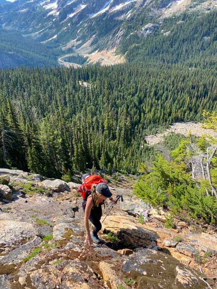

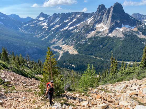


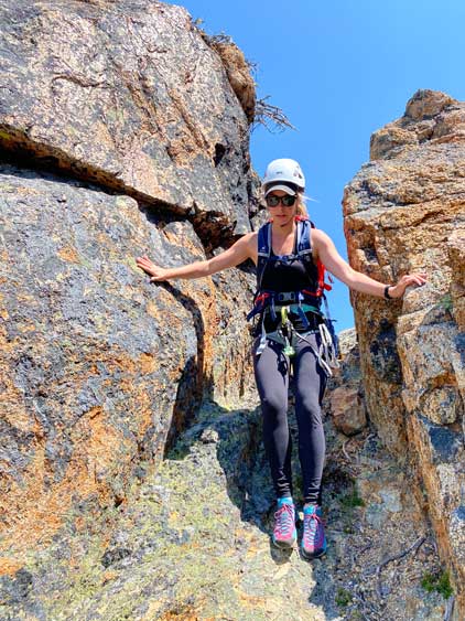
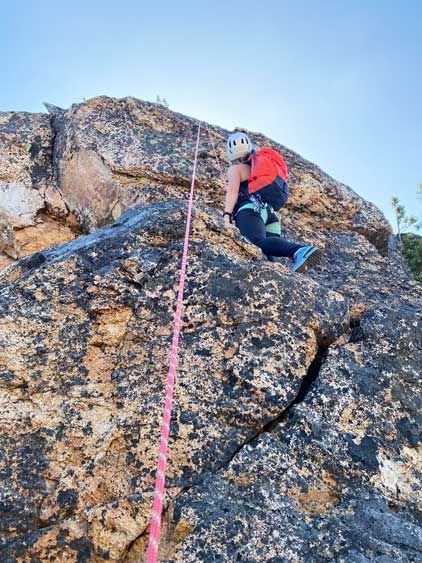
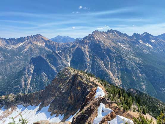
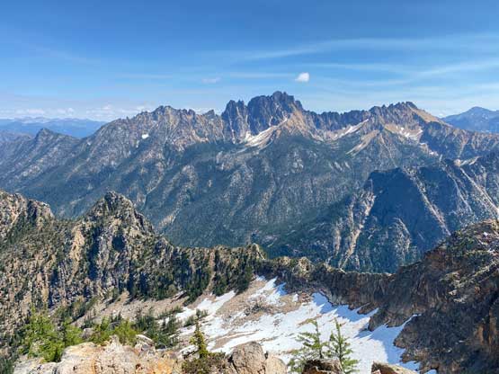
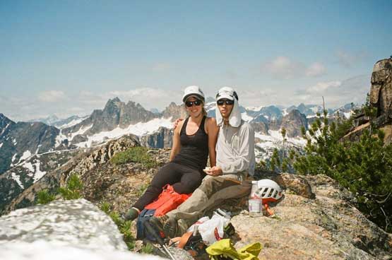
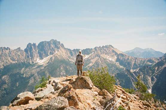
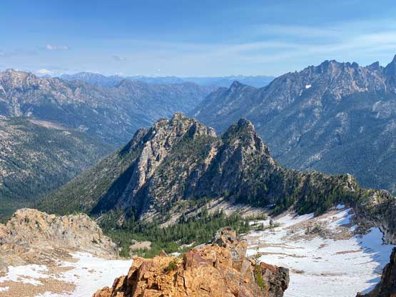
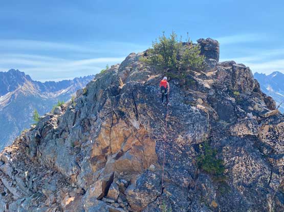
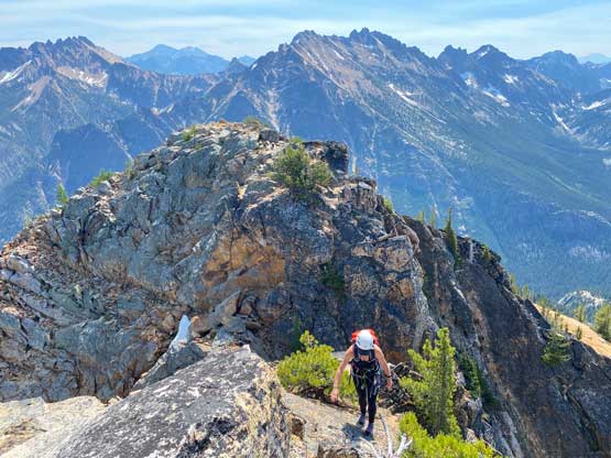
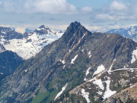
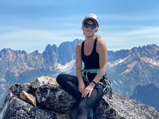
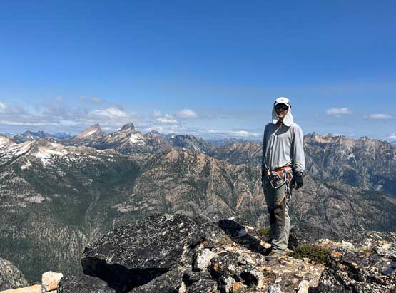
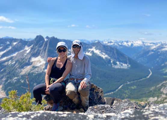
Once merging onto the summit ridge the view to the north suddenly opened up. We followed the ridge traversing leftwards and then ascended back onto the south slopes for the final grunt onto the false summit. The terrain wasn’t much different than lower down. From the false summit I could easily locate a traversing ledge down on the north face that could lead us bypassing the technical section, but we refused to use that mostly to justify why we brought the rope, harness and rock shoes up. I went to the edge of the pitch and easily set up the rappel using a tree anchor. After rappelling into the notch we left the rope for the return. The ascent out of the north to the true summit had some fun, mildly exposed class 3 moves and then we lingered fairly long on the summit mostly to kill more time. We had been really taking our time on this whole trip and we still made the summit in under 2.5 hours.


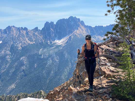


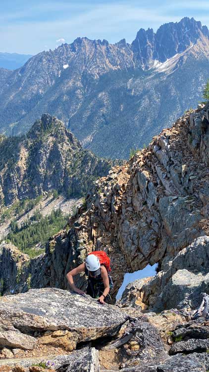


To make this peak even more memorable we opted to belay each other to climb directly out of the notch over the overhanging bulge. That proved to be fun but a bit challenging. I would say a few moves of at least 5.7 were required. I also swapped footwear to rock shoes since I brought them up. After this optional challenge we cleaned up the anchor and committed to the dreary 600 m descent. The scree and slabs was not particularly enjoyable to descend neither so again we took our time. Lower down we took a slight variation in the forest but it’s hard to tell whether our ascent line was better or our descent line. Our round trip time was 4 hours 15 minutes. We then drove back to Marblemount’s ranger station to obtain a permit for the next overnight outing, and eventually got back home at 5:30 pm. The drive was long and exhausting but again, with good company it wasn’t actually that tiring. I managed to drive all the way back without needing to take a nap.