Indian Ridge (AB)
January 26, 2013
2720m
Jasper, AB
Indian Ridge is probably the most popular Kane’s scramble in Jasper area due to the Gondola that takes you up 1000 vertical meters. Its front side offers a straightforward way up in dry condition but tricky if snowy. Ben and I decided to bag it from its much gentler backside in winter. After finishing Marmot Mountain and Muhigan Mountain, we were off to tag the last summit of this day. It’s also the highest among these three.

Marmot Mountain, Muhigan Mountain and Indian Ridge winter ascent route
From Indian Pass, the slope of Indian Ridge appeared to be a true slog (on scree, not on snow). Since we wouldn’t go back to this Pass, whether grabbing The Whistlers or not, we had to haul up snowshoes. The slope went on forever. Oh, I forgot this is a 2720m summit, more than 100m higher than Marmot… At least the view was getting better and better. And once we topped out on the ridge, we were treated with gorgeous view.
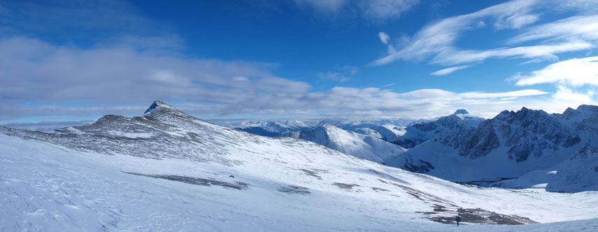
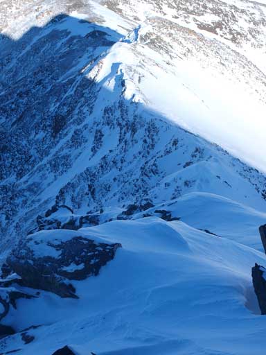
Almost made to the ridge crest.

Awesome view after topping out on the ridge crest.
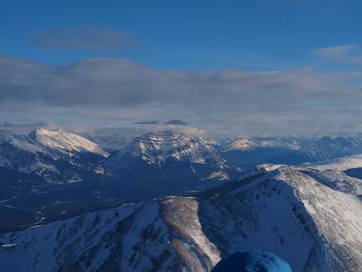
The summit bump looked to be nearby, but actually far away. We still needed to haul up the heavy stuffs for a good amount of distance and elevation. On the other side, glad we did this part of high ridge traverse, instead of going straight up to the summit. The view was inspiring especially looking at the Jasper’s giant – Mt. Edith Cavell.
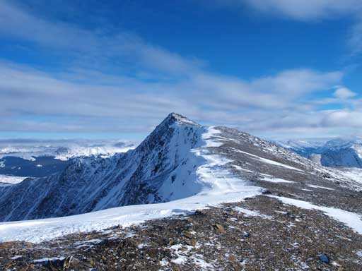
Summit of Indian Ridge isn’t that far
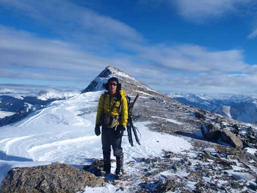
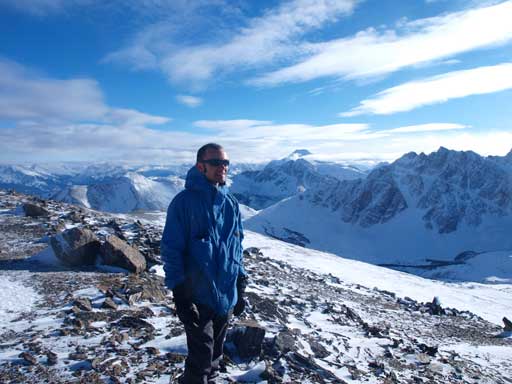
Me on the ridge
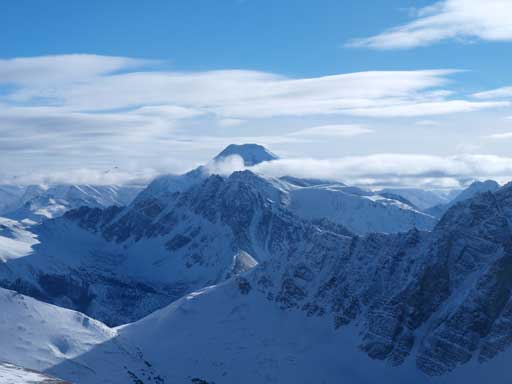
Great view of Mount Edith Cavell
Ben on the ridge
The summit castle looks to be moderate from far, but actually a walk-up. We both enjoyed our 3rd summit of the day. We took a 10min break here, the first break that was more than just having a quick bite, except for the summit stay on Marmot hoping for some sunrise shots. I went down the other side for a few meters to check out the connecting ridge to The Whistlers. It looks to be very steep, snowy, and corniced. A fall would be really bad towards skier’s left, and possibly triggering an avalanche towards skier’s right. And there were a good amount of this stuffs to deal with. We were both physically tired and mentally fatigued, and none of us was in the mood of challenging this traverse. For peaks like The Whistlers, I don’t like to take any risk. We can do it at anytime we want.. It’s as easy as one can expect from Whistler Creek in winter, and from the gondola side in summer.
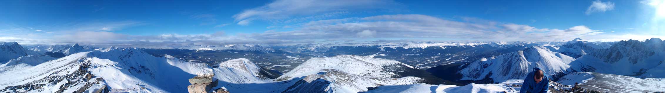
Summit Panorama.
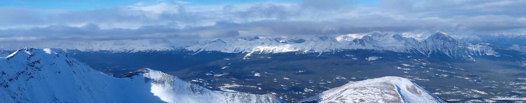
Panorama of Victoria Cross Range

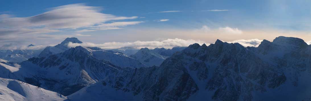
Panorama of Maligne Range
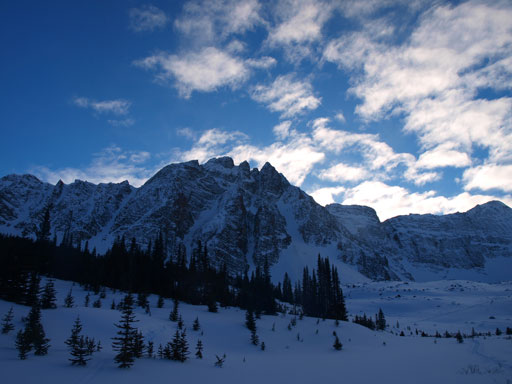
Mount Edith Cavell and Terminal Mountain
The connecting ridge to The Whistlers..
Mount Kerkeslin
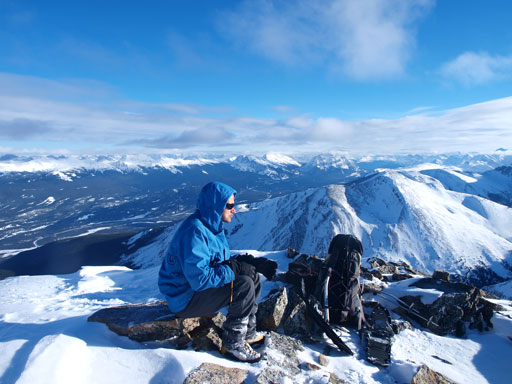
Taking a break on the summit
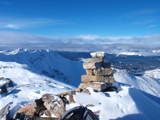
The summit cairn
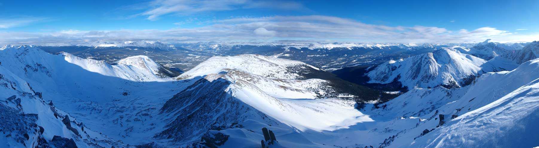
A panorama view of the east side bowl, with The Whistlers at the center
Descending Indian Ridge was much longer than appeared. The slope went on forever. We tried to go down more towards skier’s left, but we also didn’t want to side slope. Any line would work for us, and after eternity, we made back to our snowshoe tracks. Now we were pretty much home free. Plunging-step down towards Whistler Creek using our own tracks was soft and fast. Once getting back to Whistler Creek, make sure you keep looking back, or you will miss some good views.
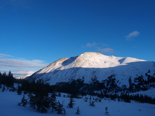
Marmot Mountain, the first objective of this day

Unnamed peak in Trident Range

The long long return starts here
Looking back at Terminal Mountain
The next few kilometers were as tedious as a snowshoeer can expect. The track was well set, which is good for going uphill, but poor for coming down. This section is the only part I wish to have my skis on. It goes on forever, just like the descent from Healy Pass, and eventually we made back to the ski area boundary, and another kilometer or two, the trail turns sharply right and towards the parking lot. This section was flat (and long), and we were both pleased to see the (empty) parking lot after more than 12 hours of trudging on full force. The next thing to do was walking down the final 5 km or so. It was pretty similar to the Skoki’s road walk. The road was quite steep which we didn’t realize on the way up. Checking the topo map afterwards, I realized there’s 300 m elevation difference between Portal Creek trail-head and the upper parking lot in Marmot Basin. Another half an hour or so, a truck came from behind and offered us a ride which saved the last 2km of our adventure. Our round trip time was just under 13 hours.
