Cerro Khapía
July 15, 2022
4809m
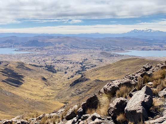
Yunguyo, Perú
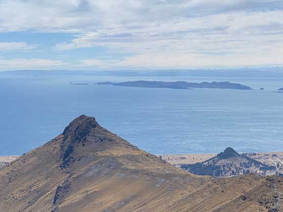
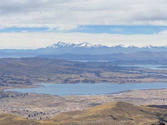
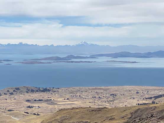
Co. Khapía is a broad massif that stands out of the surroundings with over 900 m prominence on the Peruvian side of Peru/Bolivia border. The nearest town is Yunguyo and it also locates with close proximity to Lake Titicaca. Despite the popularity of Lake Titicaca this peak is nowhere “popular”. In fact, finding “beta” on the internet had been difficult either in English or in Spanish. I cam across this peak solely by browsing the maps. I only had one day to bag a substantial-ish peak in the vicinity of Lake Titicaca and I really wanted to get this one, but I had to spend a lot of time to convince myself that it was doable in a day from Puno. The transportation logistics would have uncertainties that I must figure out at the last minute, but I decided to face it. The other alternative was really not that exciding at all.
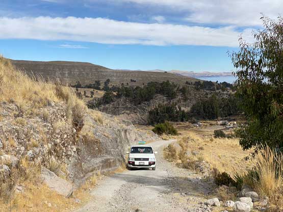
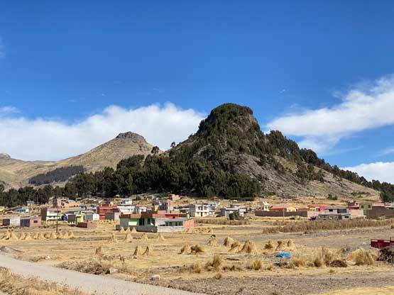
In the morning I left the hotel and took a taxi to the bus station and had no trouble hopping into a colective (carpool van) towards Yunguyo. This ride would be more than 2 hours away but they only charged me 11 soles, which was much cheaper than I thought. The drive positioned me in a very awkward spot so the sitting was very uncomfortable. I guess it was cheap for a reason. After getting dropped off in Yunguyo I couldn’t find any taxi available. I started to ask around in broken Spanish and eventually realized that I had to walk towards the downtown area, which was opposite as my wanted direction. I followed their instruction and came across a group of taxi. It then took me a while to explain where the heck I wanted to get dropped off (all in Spanish) and they eventually understood. However, they told me it was forbidden to climb this mountain, but I said “tengo experiencia” meaning I had experience. After a bit of hesitation one of them decided to drive me there and charged me 15 soles. The road I planned to take came from the north side of this peak near the small village of Acari. We drove there, past the village but the actual road quickly degraded into a steep and rough 4×4 road. The taxi was nowhere 4×4, but I said I would pay 5 extra soles to get dropped off as far up as he wanted. It turned out that I used that 5 soles to shave off only 1 km and 100 m elevation gain… I couldn’t blame the driver as no way would I want to push a small 2wd car up any farther anyway.
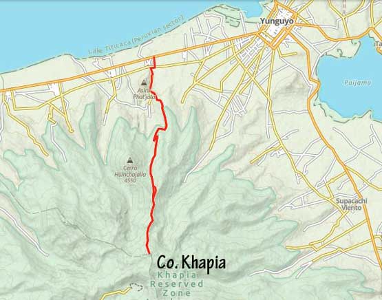
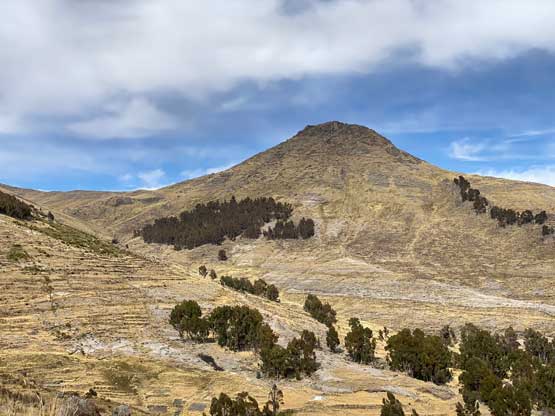
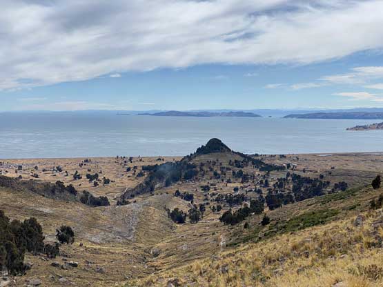
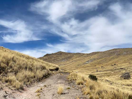
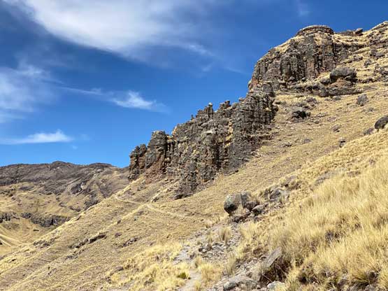
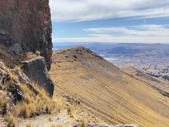
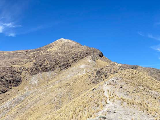
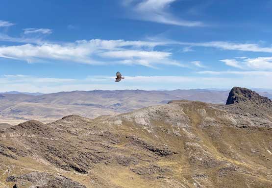
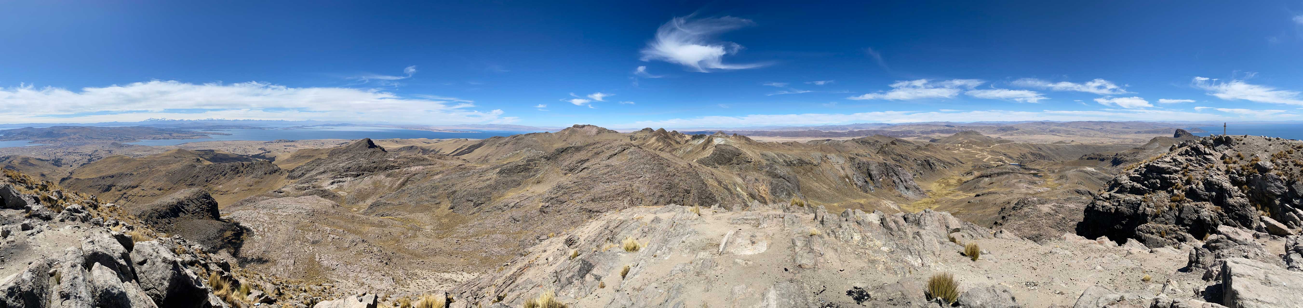
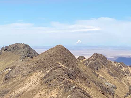
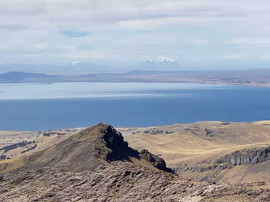
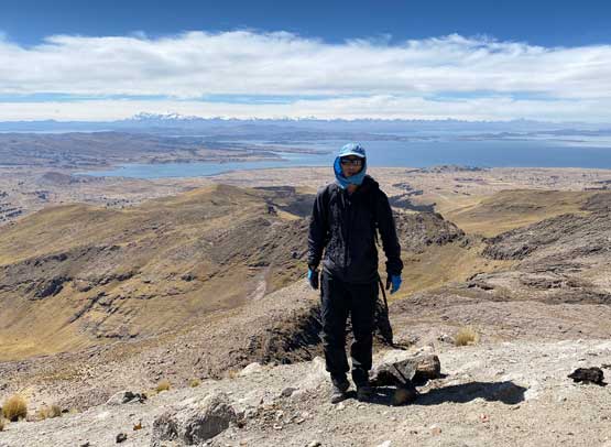
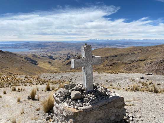
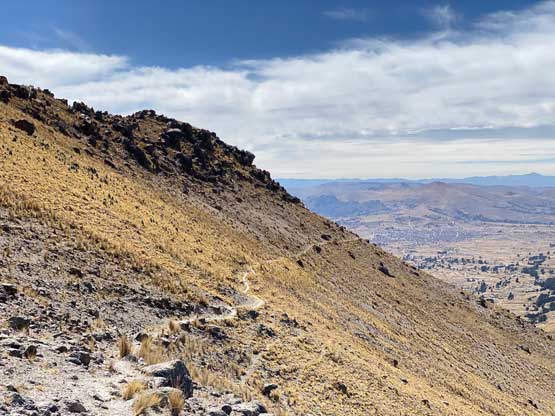
From the point I was dropped off I had to plod a long ways due south with substantial amount of elevation gain just to get to the road’s end and this started to shape up to be a longer hike than anticipated. I made quick work to the road’s end at around 4350 m elevation and ascended onto the ridge ahead. At this point I was not aware there’s actually a trail from here all the way to the summit, as the trail was not shown on my Gaia map. After descending briefly into the other side I picked up the trail. The original plan was to scramble over a series of towers on the ridge but with this trail I would just traverse underneath them. That saved a lot of time and before realizing I was already at the base of the north ridge. I had to take a break somewhere along this final 300 m grunt but overall it was an easy plod to the very summit. There was another peak much farther to the south that looked to be just as tall. The contour lines on the maps could not even tell which is actually higher, but it was too far away to investigate.


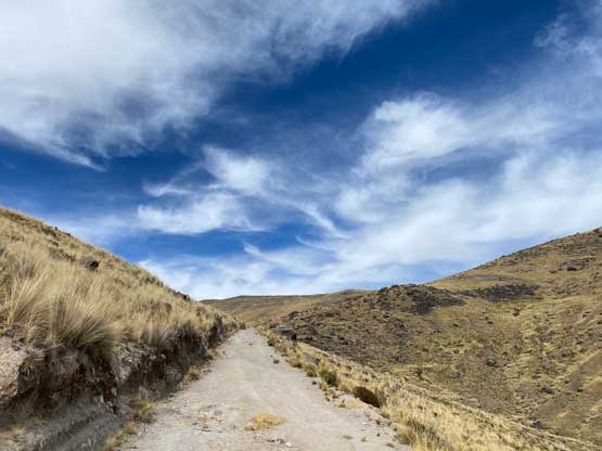


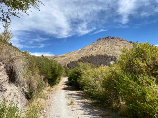
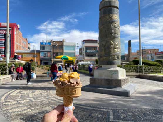
After forcing in some food and water I made quick work retracing my own route down the north side of this peak. Lower down I picked a better route staying more on the path avoiding unnecessary elevation regain and in no time I was back onto the road. The plod down this road into Acari felt like eternity but eventually I got there. I walked past several large, unleashed dogs. I was really concerning about this stretch but they turned out to be much more friendly than the ones in Huaraz. Only one of them barked at me from very far away. I was hoping that someone would offer me a ride down to the highway but to no avail, so I walked all the way down to the road. I then started walking towards Yunguyo a few kilometers away, and luckily someone saw me and offered me a ride. This dude even offered to drop me right into Yunguyo’s downtown as I said I was hungry and needed food. He did not ask for any money but I paid him several soles nonetheless. Again all of the communication had to be done in Spanish as nobody speaks English in this rural area. I then found some very cheap ice cream (1 sol) and a cheap but good lunch (8 soles). Two school teachers saw me struggling with direction and offered to walk me back to the bus station. One of them even spoke some English but I wasn’t sure whether my broken Spanish was better or her broken English. I then took the 11 soles colective back to Puno and arrived in Puno in the late afternoon. This was overall a very fun day figuring out the logistics by myself and greatly improved my confidence to travel in foreign countries.

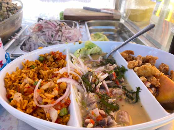
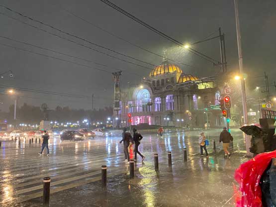
The next day Lily and I slept in, explored more of Puno and had a massive lunch of street ceviche before taking a bus to Juliaca. There was some kind of strikes going on and the bus arrived much later than expected, but we did manage to catch the flight to Lima without a problem. We then took a taxi ride to find a hotel and had a dinner in Lima. The following day we flew to Mexico City but with 18 hours of layover we must get out and explore the city as well. This was a fun part of the trip. And then the following day we went back into the airport and flew back to Vancouver. All bags arrived with no delay whatsoever.