Mount King Edward
May 27-30, 2017
3453m
Bush River / Columbia Icefield Area, AB/BC
Located immediately to the west of Mt. Columbia on the continental divide the 11,000er Mt. King Edward is somewhat overlooked except for those going after this nowadays-famed 58-peak list. This is a bit unfortunate as the approach and the surroundings are entirely different than the adjacent Columbia Icefield peaks making the experience of an ascent up Mt. King Edward one of the most unique in this family. This is assuming the trip is done in summer conditions but the standard route (SW Face/S. Ridge) also makes a great ski mountaineering objective, and has probably been done more often than I know especially by parties doing the Central Great Divide traverse. Two years ago a mere two days after Ben and I’s ascent of Mt. Bryce, the local legend Trevor Sexsmith and his buddy Ian Button put up a route on the East Face and ever since then I wanted to climb Mt. King Edward in similar conditions on snow.
To put it down this way might not sound outrageous on paper, but is far from being an easy task. In the “right conditions” the ascent is nothing more technical than 50-degree snow for short stretches but the timing can be actually trickier than the trip itself that in some years the window might not even open at all. The access requires an about 100 km driving on Bush River FSR each way so first of all this road has to be dry and free of dead-falls. The bridge-out at the start means a fearsome river crossing is required. There are massive crevasses on the west side of Columbia Icefield plus the three major rock bands must be filled in making a thick snow coverage a must, and as other steep snow climbs a decent overnight freeze along with a guaranteed weather window is critical. These 5 factors do conflict each other and it’s nearly impossible to have them all lined up perfectly for us mountaineers.
This past weekend saw a major high pressure system settling up in the western North America and I literally could choose objective(s) from anywhere within a day of driving from Vancouver. I had lots of plans in different regions but Vern and Ben was quite keen to give Mt. King Edward a shot to redeem their previous year’s failed attempt. The snow/wind storm on Wednesday along with the warming trend did make the conditions questionable but I figured my first coming-back trip to the Canadian Rockies had been long overdued. The commitment was made, the weather held nicely and Saturday morning saw me driving out of Metro Vancouver in my new Toyota Tacoma.
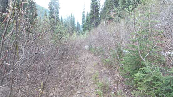
It felt like ages since my last time driving past the city of Kamloops along Trans-Canada Highway and part of me was excited even for just this road trip crossing the ranges of Monashees, Selkirks and then skirting around the Purcells into the town of Golden. The views were great but I had to hurry up as I was a bit behind schedule thank to a couple delays on the road. After picking up a chainsaw from Ian Button’s place I quickly drove to Josee Menard’s place and picked up Ben, Vern along with their gears. There were a ton loads of stuffs dumped on the bed but soon enough we were on the roll. The start of the Bush Road felt actually smoother than my previous trips that way (Mt. Alexandra, Mt. Bryce and the Lyells) but just as suspected the mother nature wouldn’t make us that happy… A huge avalanche came down and blocked the road at around kilometer 80 leaving about 16 km of road-walk to the King Edward’s parking. We did have a “plan B” and did briefly consider that, but given the fact we were already here we might as well just push for it. These extra kilometers would just mean a couple extra hours each way, so not a huge deal.

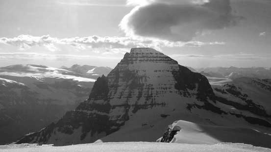
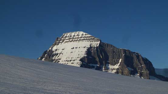
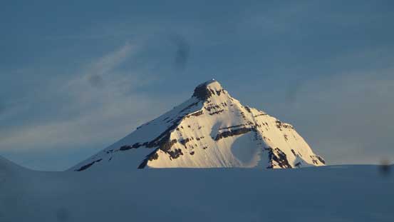
Mt. King Edward standard ascent route via SW Face/S. Ridge
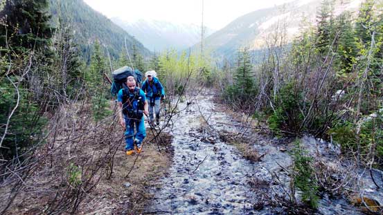
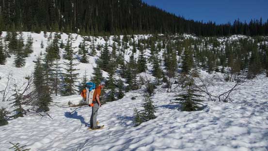
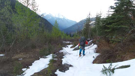
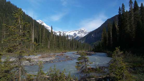
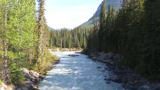
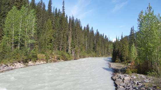
Apart from the avalanche debris there were three big downed trees which would certainly consume one hour, if not more had we driven over. We then met a black bear but didn’t even get a chance to take a picture as he/she flee really fast. Ben’s feet were having some problems as he wore ski boots for this road plod, while I wasn’t quite happy about the weight of my backpack as it’s been quite a while since I did this kind of adventurous type of trips. Other than these it’s just mind-numbing. It’s also worth noting that we started right underneath Cockscomb Mountain and after a long while we started to see Mt. Bryce in the far distance, and 11 km later we were at the base of it crossing the now-fixed bridge over Bush River. The right fork would go up Rice Brook while we took the left turn, and another 5-6 km later we made to the end at midnight. After briefly checking out the river the sleep fell pretty easily.
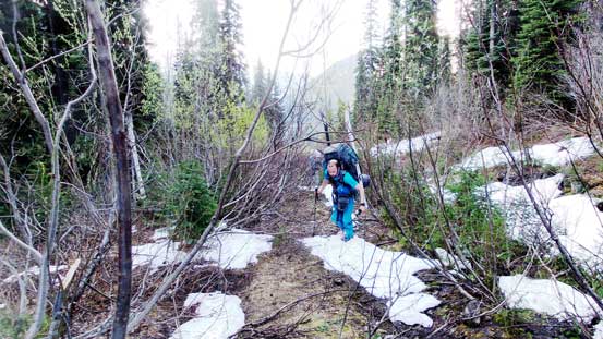
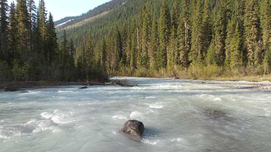
The following morning we woke up at about 5 am and got to see what that river really looked like. It was certainly a raging river but didn’t look too terribly bad to me, and without giving a second thought I just dropped in and went for it. The strongest current was right at the start while it’s just past knee deep, while the deepest channel was on the far side which might due to the bad route selection. Vern followed over in his wader without a problem but it did take Ben quite a while to commit to this. We all made through nonetheless and then it’s time to ditch the river shoes and ascend the quad road. The bulk part of elevation gain was right off the bat on a couple switchbacks but so far, so good. Later the alders started to grow in but it’s nothing by what I’m now used to in the west coast. There’s a stream of water running on the road bed at some sections but with a bit of careful work it wasn’t difficult to stay dry, and then snow became continuous at the first cut-block and it’s time to don snowshoes/skis.
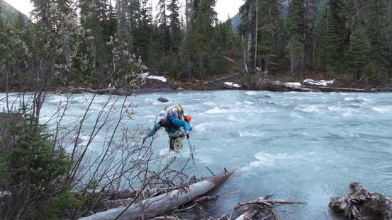
Vern crossing the upper Bush River in the morning.
There was a stream running down the surface of this quad road
Ben having lots of fun with the alders.
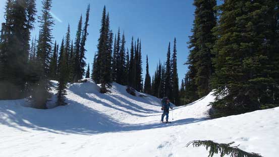
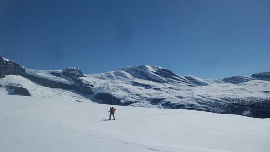
The freeze was fairly decent at this elevation and we did not sink in by much. The next stop would be the end of second cut-block where we spent some time applying sun protection and then left the road and went into the forest. The approach of Mt. King Edward is characterised by some paralleling ribs and gulches and the general trend is to resist gaining too much elevation while traversing further to the climber’s right. The terrain was forcing us to go left but we had Vern and Ben’s previous GPS tracks to follow so not that hard for us to stay on the most efficient path. The gentle rising traverse eventually dumped us into a large gulch and following it up we arrived at the alpine.
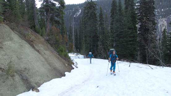
Finally able to put skis and snowshoes on.
Vern at the second cut-block showing me where they went last time.
Ascending this broad gulch into the treeline
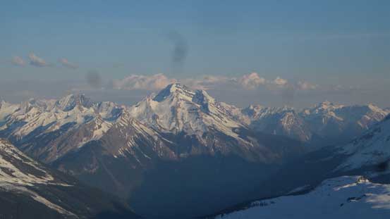
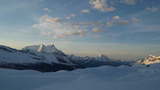
Mt. Columbia looming in front and the views were opening up.
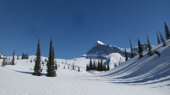
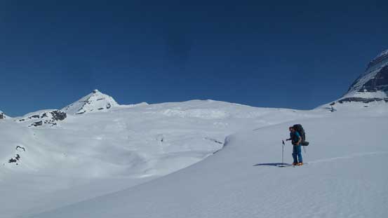
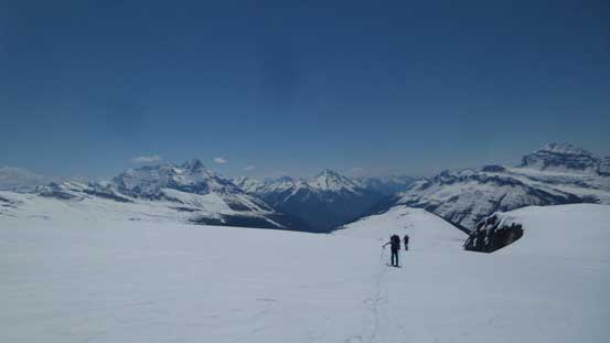
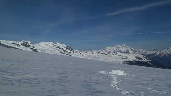
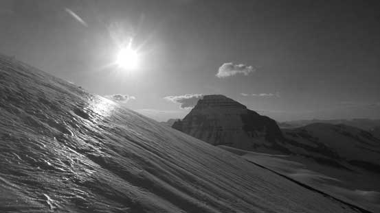
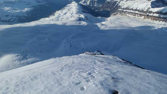
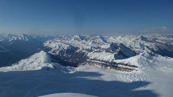
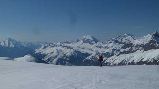
From where we were at treeline to the edge of the glacier was the most confusing in my opinion. It wasn’t difficult to keep a general bearing as the visibility was more than enough, but the micro-terrain was very rolling making some interesting traverses and trying around. It’s impossible to tell whether or not I had led a good line but the route we took did involve at least 3 or 4 major dips with probably about 100-200 m cumulative gain and loss. This was not a problem as we had the entire day ahead anyway. From the base of an obvious rock outcrop (which Vern and Ben had ascended as a bonus last year) we went for the climber’s right side to access the glacier. The slope leading up onto the icefield was very foreshortened, as usual, but once there everything really opened up. I would for sure push all the way to the base of Mt. King Edward to call it a day, but Vern and Ben wasn’t keen on that so we camped early, about 1.5 km away from our objective. I had no idea there’s a massive crevasse field in between and we didn’t bother to even scout it out. This certainly would eat up some time the next morning in the dark…

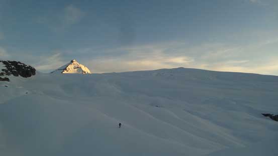
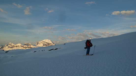
Onto the alpine now, looking back

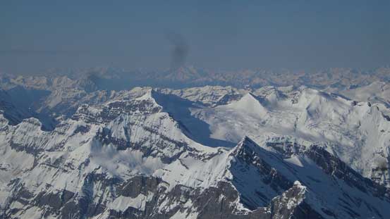
Impressive glaciers and seracs on the west side of Mt. Columbia.

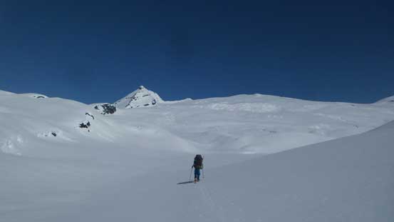
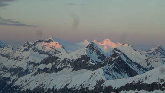
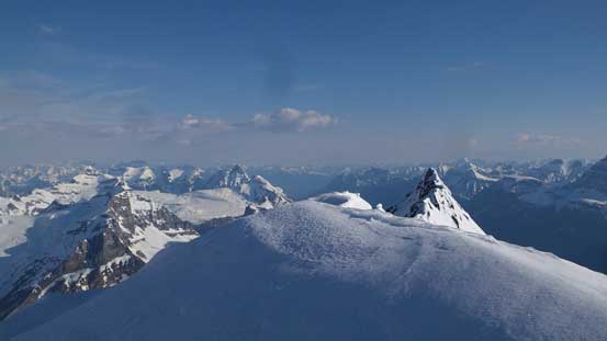
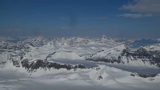
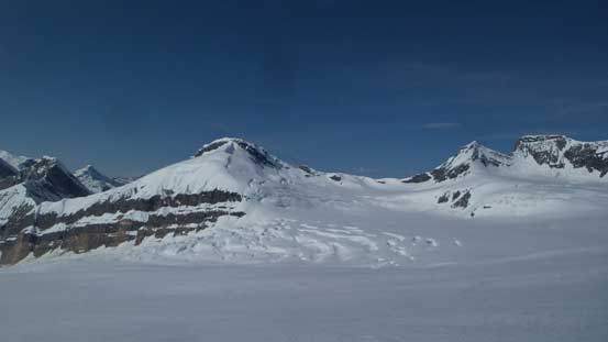
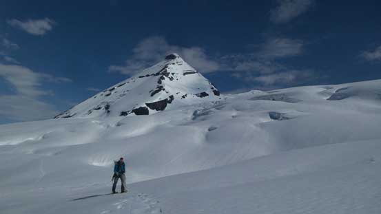
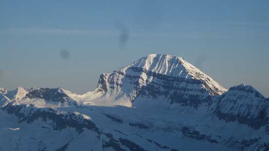
The western Columbia Icefield and our objective – Mt. King Edward ahead
Vern snowshoeing with Mt. Bryce behind
Ben enjoying the scenery
Vern following up
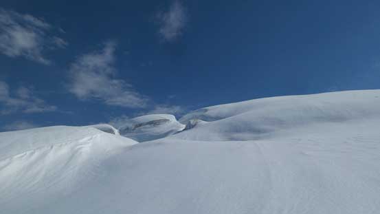
Upwards and onwards across this rolling section
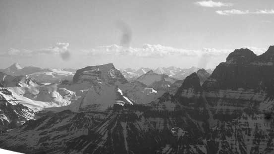
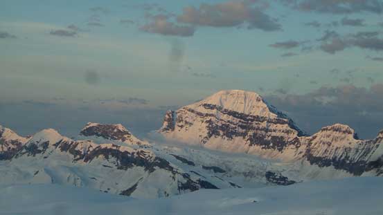
The west face of Mt. Columbia surely looks entirely different
Ascending onto the glacier now. Time to decide where to camp
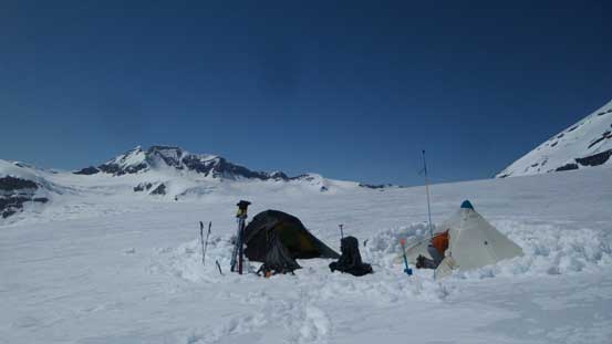
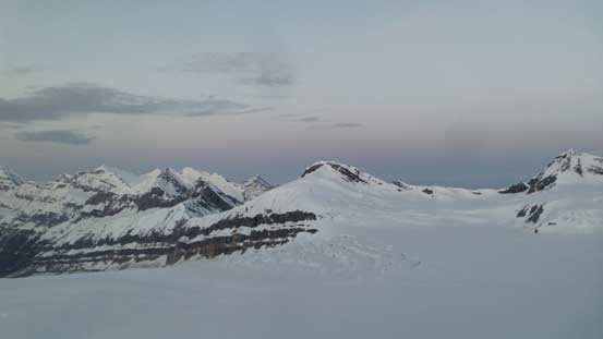
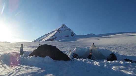
Our camp for the next two days
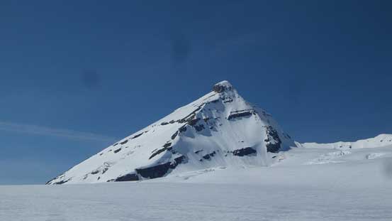
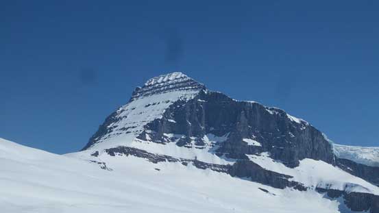
Our objective – Mt. King Edward. Route goes up the left face
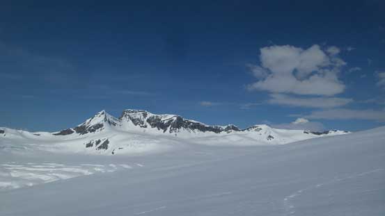
Cockscomb Mountain is an elusive objective in the Bush River Valley
Just another view from camp. Mt. Bryce behind
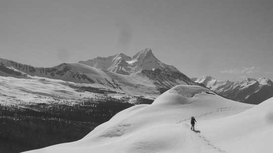
There’s about 8 or 9 hours to kill at camp and literally there’s not much to do. We did sort out the rope for a bit of morning efficiency but for the most of the time I just lied on my sleeping bag in Vern’s tent, regardless whether I was sleeping or not. I did not bring my music device (nowadays, my iPhone) for the sake of this “lightweight” thing so sleeping was my usual method to kill time at a camp.. The next morning we woke up at around 3 am as planned but the morning routine took a whole lot longer that what I normally do (like, more than an hour), from the moment the alarm went off to when we finally started the plod. As usual I took the sharp end of the rope and led the glacial traverse and not knowing where exactly the terrain ahead I led the group into the crevasse field, in dark of course. Quite a lot of guess work involved. I thought we were screwed but by breaking the challenges into pieces it actually didn’t take too long, although Ben had some interesting time with his skis. Vern and I were wearing snowshoes which worked much better on this undulating and crusty kind of traverses.
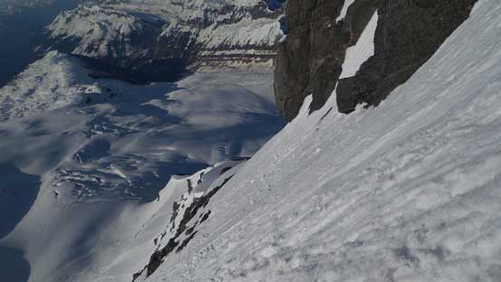
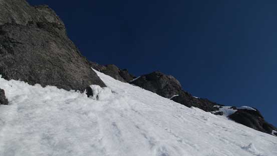
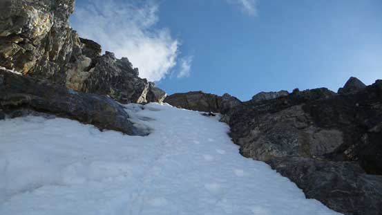
The crevasse field was finally behind now but there’s still a fair amount of plodding required to the base of the SW Face of Mt. King Edward. We made there at about 5:10 am which was actually not terribly bad. As usual the rope was then dropped and it’s time for the gear transition from snowshoes to crampons. I had been practising to make this kind of transitions as fast as possible in the past few years and I certainly did, and when Ben and Vern finally finished their gear swapping I was already a long ways ahead. The bottom of the SW Face was certainly questionable but as usual I would push a little bit higher up and see. A lot of post-holing on semi-breakable crust was required and then the moat crossing was interesting to say the least. It did not surprise me that Ben and Vern turned around but as much more of a sololist these years I would make my own decision, as many other trips of mine. Thankfully the condition improved dramatically higher up and once past the lower 1/3 of the SW Face the condition transitioned to the perfect step-kicking, and thank to all the solo ascents and the fact I was pushing hard on the “speed” thing in this past winter the trail-breaking did not really slow me down, although did tire me out eventually.
Morning horizon to the west

Vern and Ben just started up while I was already above the moat
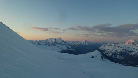
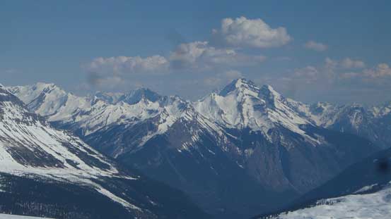
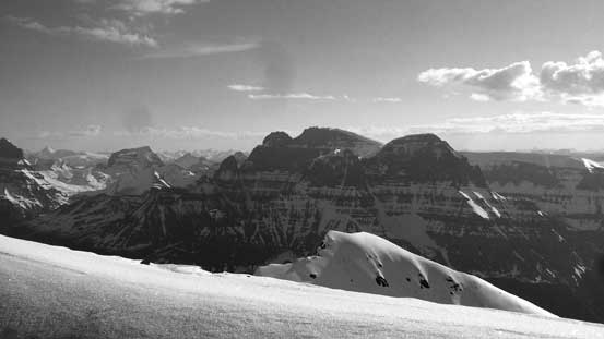
Morning horizon over south-east. Mt. Bryce stealing the show
Pawn Peak in the Chess Group
King Peak (L) and Queen Peak (R) in the remote Chess Group
I took a short break underneath the middle (second) rock band taking my ice tool out. It would be a long slip had I lost the grip and the ice tool certainly helped a big time on my confidence. I hauled it up anyway so might as well justify the purpose of doing that… Breaking the second rock band had two choices and the short option was a thin strip of snow directly above me. There’s another fatter gully at about 50 m to my left but I didn’t feel like doing unnecessary traverses, and with the ice tool climbing up that thin strip of snow was pretty easy. This dumped me onto a section of miserable scree (Rockies’ type, with crampons on) and as soon as possible I merged onto the snow line. The freeze had gone deep here and I barely left any dent on the snow with my crampons and some quick work was made, but eventually I did run out of gas so took a 10-minute break just below the summit block.
Above the second rock band now. The sun was beating down so I had to be quick

Ascending towards the summit block
A view from where I took the only food break on this ascent.
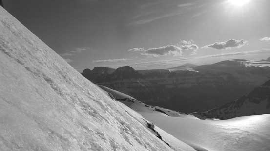
I thought about dumping rope, harness and a whole lot of gears that I usually do not even bother with, but some weird path in my thinking led me to the North Victoria trip in which I also took off from Ben and went soloing. I had dumped the rope below the bergschrund on that route, regretted higher up and had to cut a long and super sketchy traverse underneath a cornice on the descent to avoid down-climbing verglass covered rock. This time I would carry all the gears with me, figuring the transition I spent sorting these things (both ways) would probably just balance out the increase in my speed due to the fact I wasn’t that far from the summit now. The infamous traverse underneath the summit block wasn’t as nasty as it looked from our camp, but still the exposure was unbelievable and a slip (or a slide) would mean falling all the way down to the glacier. The snow condition was fine and with about 2 kicks on average I could make some bucket steps. The nature of this traverse had a rising angle but I made smaller steps just so that I could use them on the return too. And then there came the 45-degree couloir.
The infamous traverse underneath King Edward’s summit block.

Kicking in firmly…
From the same position, looking ahead to the couloir
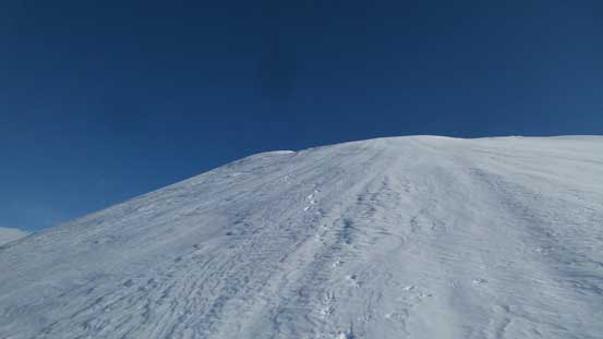
The steepest section of this couloir was right off the bat that I think the slope angle maxed out at about 50 degrees, but certainly not much more than that. Combing with the snow conditions this was dead easy comparing to what I’ve been soloing (say, Harvey North Ramp for example), although the length was longer than it looked, but soon enough I exited the upper funnel and onto the uppermost of the S. Ridge. The summit ridge traverse was a drag with two frustrating false summits along the way. I was not happy about that but at this point I just had to suck it up and make to the highest point. The usual panorama, a few zoomed-in shots and an inReach message and that’s all I did on the summit before rushing the way back down before condition further deteriorated.
A sideways view shows that the angle wasn’t that steep really.
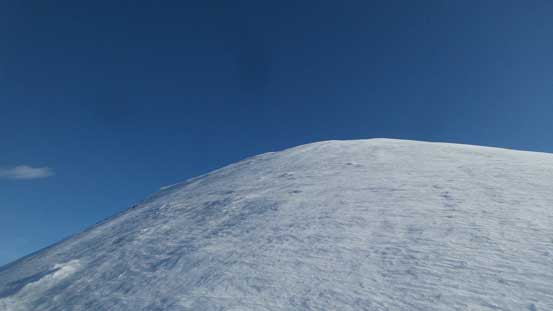
The final plod along the summit ridge was draining though…
Snapped a picture when I took a short rest step.
Looking down from one section of this summit ridge slog.
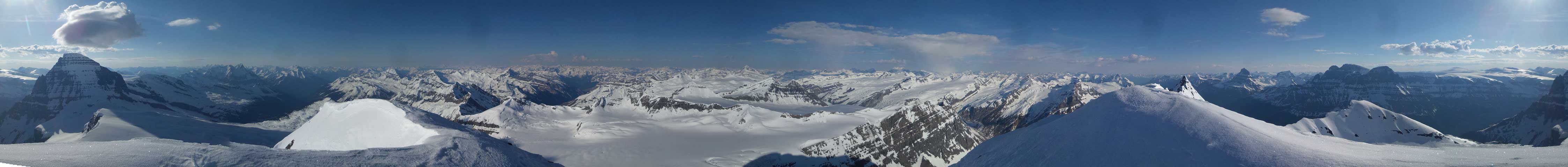
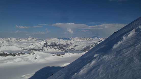
Summit Panorama from Mt. King Edward, my 40th 11,000er out of 58. Click to view large size.
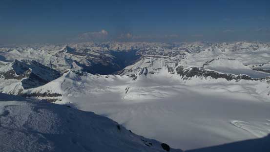
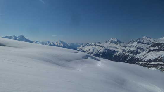
Looking down at the western reach of Columbia Icefield
The Bush River Valley. Mt. Bryce doesn’t look that big now.
The west face of Mt. Columbia still looks very big…
The Twins on the northern branch of Columbia Icefield – all 4 bagged in one day.
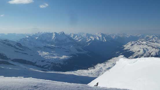
Summit view looking north showing the pointy sub-summit on the horizon
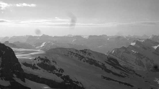
Sundial, Dais Mountain and others on the upper Chaba/Athabasca Valley

Looking across the Chaba Icefield towards the remote Tusk Peak and Mt. Clemenceau
Tsar Mountain is the most remote 11,000er, looming on the horizon

Looking down the now-inaccessible Sullivan River Valley

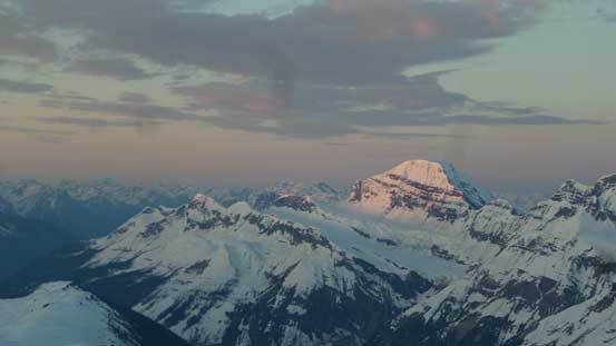
Mt. Alberta is by no doubt the most difficult 11,000er
Mt. Woolley brings back some good memories from the fall of 2014.
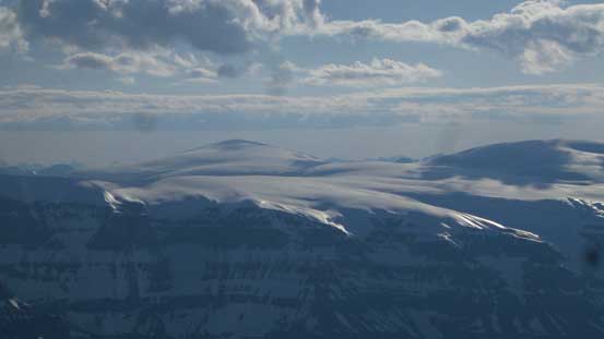
Mt. Kitchener is the only peak I haven’t done on the Columbia Icefield.
Mt. Amery on the skyline. This is looking into the Alberta side of the divide

Pawn Peak is now much smaller
King Peak and Queen Peak also far below. Mt. Rogers on the center skyline, far behind.
There’s no point in wasting time searching for a rumored rappelling station as down-climbing a 45-degree couloir using my own tracks shouldn’t be much of an issue to me, and sure it wasn’t. The cruxy section was surprisingly fast on the descent and in no time I was back on the SW Face. The scree was still miserable but it’s all down-hill now, so easy peasy. There’s a rappelling station above the second rock band too but to save time I just down-climbed the thin strip of couloir which was not bad using my own steps, and once the angle mellowed out I turned my face outwards and walked sideways using French Technique. This worked greatly until the lower 1/3 where I started to punch through past my knees. The solution was to then down-climb facing inwards using the exact tracks of mine and this way there’s no further punching through. The moat crossing wasn’t much of a problem and I actually thought the snow condition was better than a couple hours earlier for some reasons.. At the bottom of the face I again, did a very fast gear transition (pack dropped, crampons off, ice axe/ice tool stored, crampons stored, snowshoes on and then backpack on), and a couple minutes later I rejoined the group while Ben and Vern was patiently waiting.
The view looking south is better from the southernmost false summit.
Leaving the summit behind
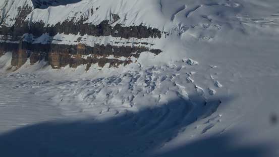
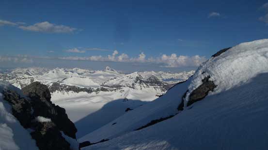
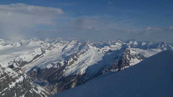
Neat crevasse field on the glacier below

Looking down from just above the upper funnel above the couloir
This is the thin strip of couloir to break the second rock band, far down now

From the same perspective of the last picture, looking down the lower face
The performance of mine on the ascent was only “marginally OK” for my own standard as I knew I could have gone a little bit faster had I eaten more in the morning, or it’s just because it’s been a while since I carried that heavy pack the day before. Ben and Vern did comment that I was fast on the ascent and judging by the time I sure was. But it’s all over now and we had to go back to camp, and as usual we did not bother with ropes anymore and just followed the tracks. Traversing back through the field of crevasses was pretty cool while actually seeing the scale of the terrain around. We were hoping for a better freeze the following morning so Vern and Ben could go get the peak, so the rest of the day was then spent in the tent again with hours and hours to kill. There was certainly not much talking on this day and I again, mostly just lying on my sleeping bag to conserve energy.
Ben skiing on the glacier with massive terrain behind

Vern and Mt. King Edward
The glaciers and the crevasses
Triad Peak to the west. Technically this is also part of the “Columbia Icefield” tho..

Vern crossing into the very filled-in crevasse sections
This picture shows the scale of the terrain
Crevasses everywhere.
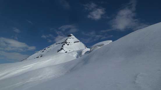
Mt. King Edward again
More crevasses coming

One of the sub-peaks of Mt. King Edward that looks cool
The west face of Mt. Columbia again
Cockscomb Mountain
Mt. Bryce which Ben and I ascended in May of 2015. This is not our ascent side tho.
Can’t stop shooting Pawn Peak
Our camp and Mt. King Edward
At 12:30 midnight we all woke up. Ben wasn’t feeling it so we slept in till about 4:30 am before making the breakfast thing. We all knew the river would be a problem but nobody really brought it up to further stress things out and we would see in a couple hours. Descending from camp down the glacier on the breakable crust made Vern and I really glad to not hauling skis on this trip (nor could we given the potential 32 km road walk). Eventually Ben caught up with us at the rolling terrain and then with some GPS work the descent through the forest was pretty quick too. Back onto the logging road there’s another gear transition where everybody took the skis/snowshoes off. Vern and I rushed the descent down to the river to check things out and it was certainly not looking good…

Mt. Columbia in the morning. I like the strips of clouds
One last photo of Pawn Peak
Alpenglow on King Peak
Vern is the tiny dot and King Eddy behind
The sun’s beating down on the east face now
Ben taking a break waiting for the snowshoeers.
Mt. Bryce and the morning horizon

Into the forest now.
Running out of snow
Alder bashing…
Vern and I went further downstream to where the two upper branches of Bush River meet. It looked better here although I wasn’t very sure about it, but we were there already so had to give it a shot. I dropped in first and even the first half wasn’t easy and it wasn’t even the strongest/deepest. In no time the water level was waist deep and the channel ahead appeared to be even deeper. There’s no way so I went back a little bit upstream aiming for two big rocks underneath. This would be the shallowest spot, but not with the slowest current. The water level was still waist deep and the splash was pushing towards my chest. Everything got wet but I was only a couple meters away from the other side, so just went for it using all my body strength against the water. And then I got knocked off balance but an instinct shift over to my right saved me and at the same time that actually got me through the hardest channel. This was probably the closest call I’ve ever had but it’s over now so I just have to cool down a lit. Vern tried but turned around, and a couple minutes later Ben arrived. They both tried various spots but with no good but they did manage to ford the other branch of Bush River to the west side. Looking around to see how dense the vegetation I knew we might be in for an epic as 6 km bushwhacking along Bush River nobody knew how long that would take.
How about that?! Excited?!
Great views though, but let’s get back in the game…

I went for it and almost got swapped away. Vern tried but turned around.

Ben and Vern on their second shot, but turned around again for being smart.
Even the short bushwhack from where I crossed to the end of Bush Road wasn’t easy with numerous dead-falls and some devil’s clubs.. There’s one surprise at the road as I could no longer see where my ditched sneakers were.. I spent about 15 minutes searching around but with no good luck and then I found that Vern’s stove was also gone.. The stuff bags were still there so the only explanation was someone went here and took them but I wasn’t really thinking that way especially given the 16 km road walk involved.. The 6 km walk back to the main bridge crossing Bush River was fast but numbing and then I took a 2-hour break waiting for Ben and Vern. At last I got an inReach message from Ben and their progress was about 500 m per hour. There’s no further point in waiting at the bridge so after leaving my extra food for them I texted back, saying let’s meet at the truck then. As soon as I started the final 11 km plod I saw some fresh tire tracks which indicated the debris might had been cleared. Eventually at about 5 km from the truck I got a lift by two Fairmont locals and then I drove back to the bridge.

Let the road walk began…

Mind-numbing? Yes.. Foot-numbing? Oh damn yes…
Bryce Creek was showing off its volume..
Oh the mighty Bush River. The bushwhack looks horrible here…
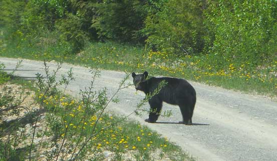
Bears on road just for more “fun”..

Soon after this I got picked up by a truck. Thanks!
Another couple hours were spent in the truck but now with musics and air conditioning (if needed) it’s much more civilized. They showed up quicker than I thought thank to an old logging road which saved their last mile or so, so at least everyone got out safe and sound.. Some sections of the Bush Road was also graded in these last couple days so our drive out was fast and fluent. At Golden we went for a dinner at McDonalds first, then Ian’s place and finally Josee’s place. It was already past 7 pm and all three of us were left for a long drive back home especially for me going back to Vancouver. I was not looking forward to that but I had to face it. I stopped for fuel in Revelstoke and then decided to push all the way back in one shot, but I was too optimistic on that. I was really, really beat after passing Kamloops and not wanting to die on the road I pulled out at Comstock Rd exit after passing Merritt. It was pouring rain and unpacking everything and digging out the wet sleeping bag was specially miserable, but I had no other choice. A couple hours later I woke up, resumed the drive over Coquihalla Pass and down into Hope for some breakfast, and then back home through the morning traffics which wasn’t too bad actually.
Overall this was certainly more of an adventure than any of us was planning for. Apart from bagging my 11,000er #40/58 there’s lots of things to be reflected. Was this summit worth all the risks I took for it? Probably not.. But this is what’s about mountaineering that we all have to take the oppurtunity and make our own decisions at some point. Ben, Vern and I had done a ton lot of trips together but our paths really started to diverge since 2015. Ben got more into the expedition type of trips and he just enjoys being out there camping in the remote places, while at the same time I became much more of a sololist and went further for timing, speed and efficiency, weekend-warrior type. But it’s very nice to finally catch up with friends and see what each other’s up for these days.
