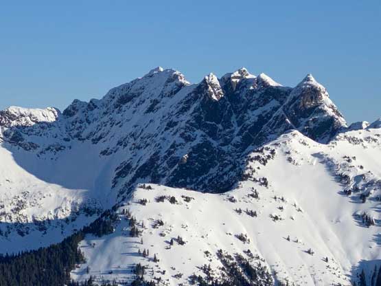
Mount McNair
February 12, 2022
1784m
Harrison Lake East, BC
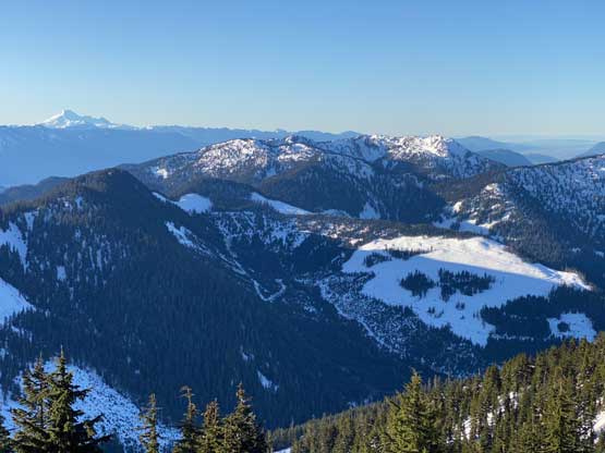
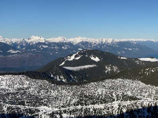
Mt. McNair is a peak with over 700 m prominence in the “East Harrison” area face to face with the much more fabled Old Settler. The only time that makes sense to do Mt. McNair is winter or spring when a thick snowpack covers the bushes. Almost the entire peak is covered in secondary growth forest and overgrown logging roads and the travel can be a real shit show without snow. The approach via Bear Creek FSR is the shortest but the road had always been gated at km-2 making an uninspiring slog. In the recent years a few folks started to toss around, or even tried other approaches including but not limited to Ruby Creek over Mt. Parker’s shoulder from the south, and Talc/Garnet Creek divide to the NE. Those are definitely the more interesting options but Bear Creek is still the shortest route even if the gate’s locked. Matt and I had been discussing this objective for months and eventually I convinced him to just take the easiest route to “get the job done”. Duffy and Ben were also keen on the mission.
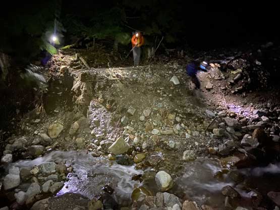
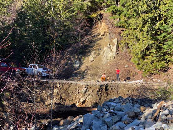
The main reason why I picked Mt. McNair was the sketchy snowpack and the associated “special public avalanche warning” in this weekend. I wanted to stay off from any slope that could slide, and Mt. McNair via SW slopes would be the right choice. A few hours before bed time I received several shocking trip reports – Mt. Crickmer on SWBC Peak Baggers and “Pretty Peak” on Crossna Wechat group. The conditions on Friday seemed rather bomber with a firm melt-freeze crust extending all the way to the summit. Those folks did not even need snowshoes. I messaged my group to remind everyone to definitely bring crampons since we originally were expecting no-freeze and sloppy snow due to the 3000 m freezing level. The early wake-up time seemed unnecessary at this point but it’s always a good idea to get back home early, so none of us brought that up to the discussion. I woke up at 3:30 am and grouped with Matt an hour later. Ben and Duffy were about 10 minutes behind in a separate truck. The road condition of Bear Creek FSR was the only uncertainty and it turned out overall better than expected. The gate was open so we drove two additional kilometers. A major washout at about km-4 stopped us or any motorized attempt, but moments after that we hit continuous snow so either way we would have to park the trucks.
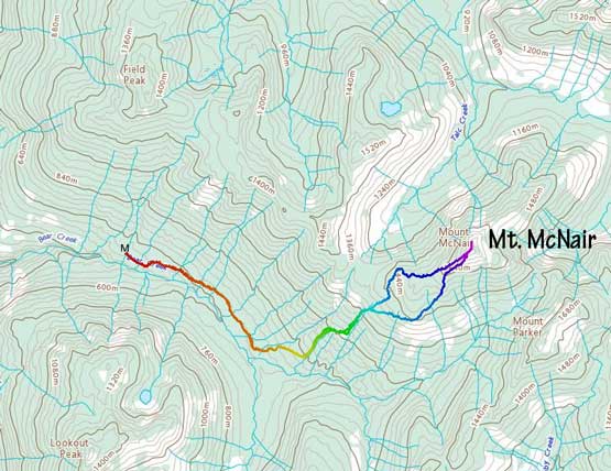
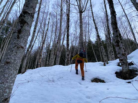
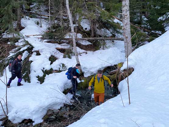
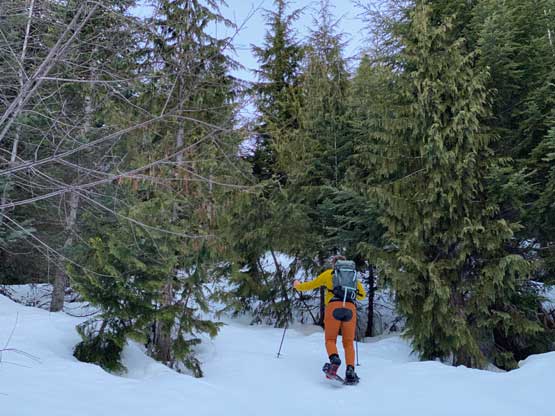
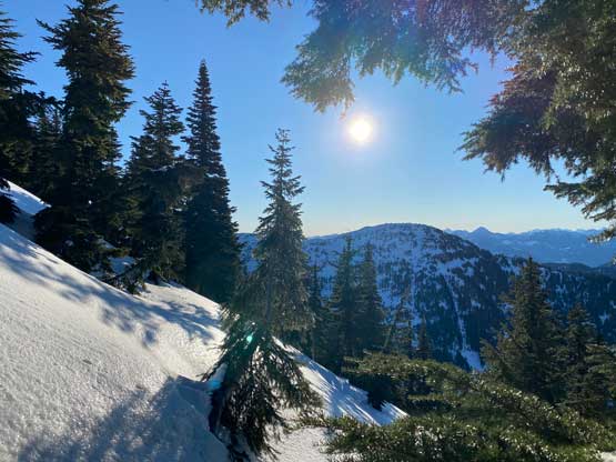
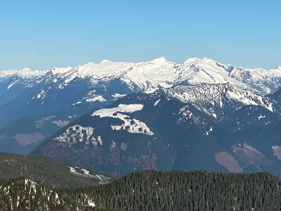
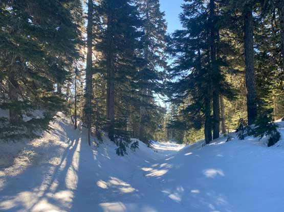
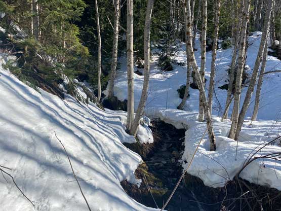
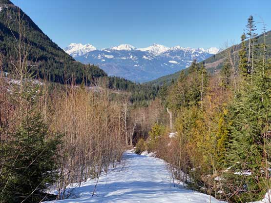
In the pitch dark we shouldered the heavy-ish pack and scrambled across that wash-out which wasn’t easy even on foot. I don’t think I would want to haul a bike across neither. We then easily plodded a few more kilometers up the FSR on some bullet proof crusts. There are a shit ton of spur roads in this zone and the only way to locate the correct spur was by consulting with the GPS regularly. The going on the spur road was still easy and then we ascended a few hundred vertical meters straight up a cut-block. The snow in this cut-block was still bullet-proof even on thin spots closer to vegetation and we finally no longer needed head-lamps. At the end of the cut-block we bushwhacked into the forest. The snow had disappeared completely but came back about 100 m higher. The bushwhacking was mostly light but felt annoying at spots. Matt led a route trending slightly towards climber’s right and in short time we came across some sets of old and overgrown FSRs. Consulting with the GPS again we made the decision to walk on this overgrown road across several creeks to the right before committing to another period of straight-up ascent.


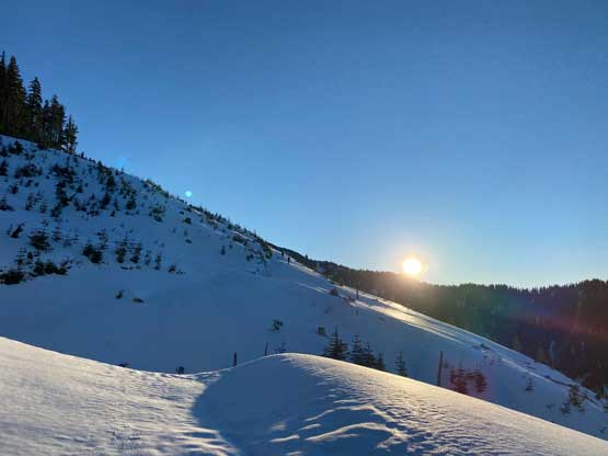
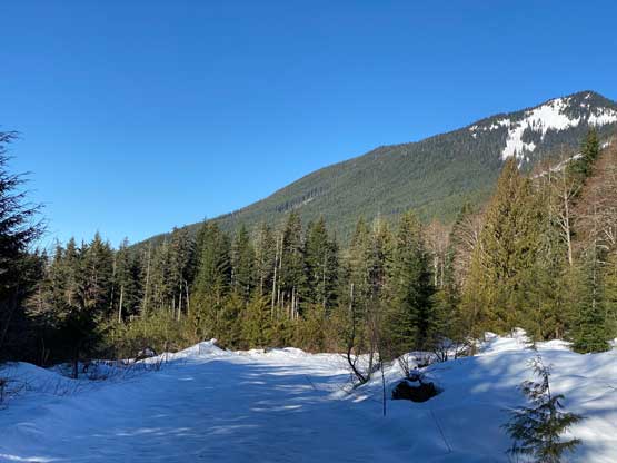
Moments into this second period of straight-up ascent we encountered softer snow and donned snowshoes. My new TSL Symbioz snowshoes were very disappointing. They weren’t too terrible on the straight-up portions but their traction wasn’t aggressive enough to tackle hard-packed slopes at 35-40 degrees, which was easy peasy in the MSR Lightning Ascents. There were some prolonged stretch of traversing and side-hilling on the upper route and that’s when the real shit show began. After coming out to a massive clear-cut we ascended diagonally towards climber’s right to short-cut onto the highest spur road. The surface of this spur road wasn’t flat neither so we were constantly traversing/ascending 30-35 degree slopes for at least 1.5 km distance. At one point I had to take the snowshoes off to boot-pack and I barely managed to traverse across that stretch without having to don crampons.


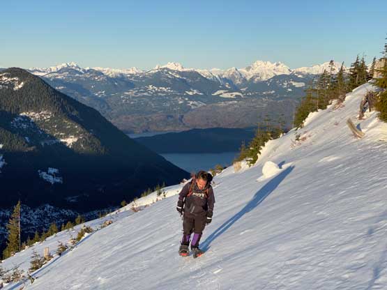

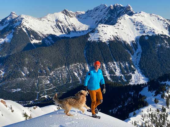
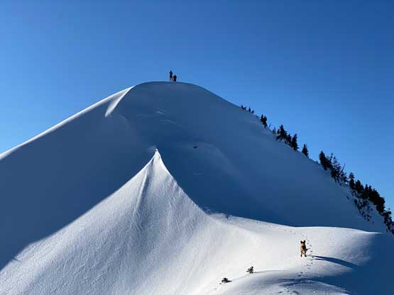
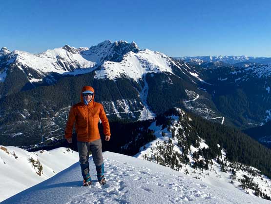
This highest spur road led us to the highest clear-cut and once there we pointed our bearing upwards again. Matt and Ben somehow led a route that involved more rightwards traversing. The TSL snowshoes were simply not designed to tackle side-hilling, so I spent a few minutes swapping footwear for crampons. The problem was that the crust wasn’t that supportive overall so I did quite a lot of post-holing. Thankfully wherever the slopes were wide and open the crusts were supportive. I boot-packed all the way to the summit which was a lot longer than the simple snowshoe travel. Once everyone showed up I made a spontaneous decision to traverse to the next high point to the NE which had a steep slope to down-climb. I was the only one wearing crampons on the summit so the others did not follow.


To descend I decided to wear crampons until I absolutely needed to use snowshoes. Matt and I had some discussion about the route and the general consensus was to take a different line on the descent sticking more on the west ridge. Matt did a great job route-finding and I definitely would recommend our descent track over the ascent track. I was hoping for a snowshoe-free descent but that was not the case. The one stretch in the upper forest was soft enough that snowshoes were absolutely required. At this point the four of us were all separated with Matt going first, followed by Ben, then me and finally Duffy. We all ended up descending solo on our respective pace. I wore snowshoes all the way to that few old FSRs around 1000 m and boot-packed the rest. The crust on the lower Bear Creek FSR stayed supportive by the time we got back to the truck from 11 am to noon.


The drive out of the FSRs was rather uneventful. As soon as getting back onto the pavement I fell asleep and stayed asleep until Abbotsford. We unfortunately then had some major truck problems on the highway. We had to crawl at 20-30 km/h on the highway’s shoulder for almost an hour as the truck had lost its power. This wasn’t the first time happening so after dropping me off in Abbotsford Matt went to some dealerships to buy a new truck.
