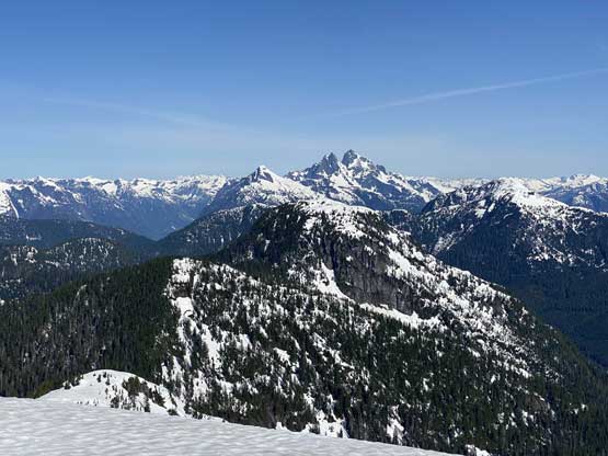
Statlu Peak
May 16, 2021
1430m
Mission / Chehalis Area, BC
There’s some common confusions about “Statlu Peak” with Statlu Lake as the two are nowhere related. The confusion is to be blamed by the fact that Statlu Lake and Statlu Creek are nowhere close to each other even though both are in the “Chehalis area”. The peak is unofficially named due to proximity to Statlu Creek and is the only peak south of Mt. Clarke in the “Chehalis area” that boasts over 600 m prominence.
“Statlu Peak” had been traditionally accessed from west via Lost Creek FSR but the spur roads are overgrown and the status of the west side access had been mysterious for a number of years. The east side access from Statlu and Blacklock Creeks had seen some very fresh logging activities but unfortunately the access was gated right at KM0 of Statlu Creek FSR at the junction with Chehalis River FSR. A couple weeks ago I went in to check out the east side access and reported back the gate issues. I was not ready to face the uncertainties on the west side spur roads as they appeared extremely bushy on satellite images but then all the sudden Carol and Dawn went in and did it from the west. With their fresh beta I immediately put “Statlu Peak” high on the priority list. The earlier I could make this happen the less bushwhacking I would deal with. The right window happened two weeks after Carol and Down’s trip. A sunny weekend finally showed up but the temperature was too hot to think about bigger objectives, and at the last minute Alex and I decided on “Statlu Peak”. I sent Carol a few questions mainly to confirm the status of the creek crossing and the alders on the road because with two weeks of melting I expected conditions to have changed.
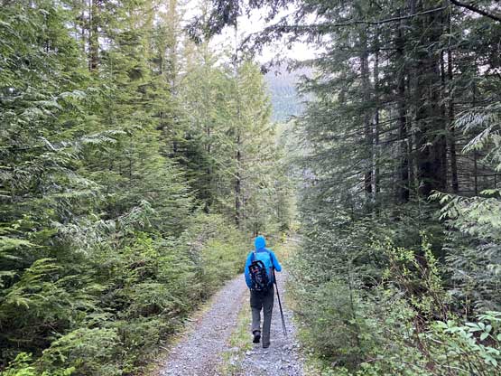
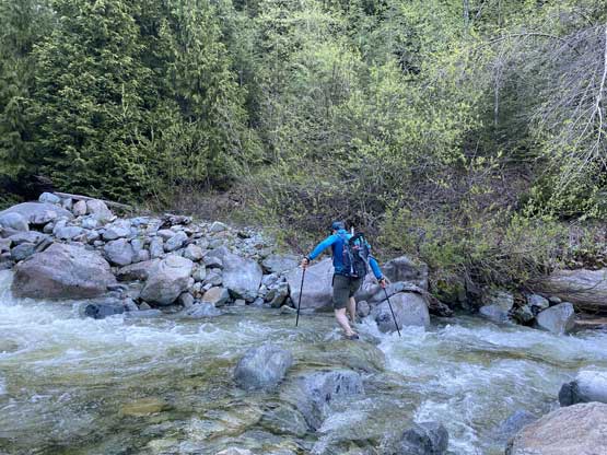
I wasn’t quite sure what exactly to expect so made the call to bring ice axe, crampons, snowshoes, mountaineering boots and river crossing footwear to make sure we could be 100% successful in the mission. A few pieces were proved to be critical but snowshoes were carried only for weight training. Alex and I met in Abbotsford at 5 am and drove up to Mission in my Tacoma. The going on Lost Creek FSR was smooth sailing until the last two kilometers before the spur turn-off, where the road degraded into a mess of pot-holes. Based on Carol’s words I expected to be able to drive a short ways up the spur roads and sure I went for the attempt. I didn’t get far but did dispatch over 1 km distance. I turned around and parked after crawling up a long stretch of boulders in 4Low. I did make a good decision to park as one downed tree and one major washout would have stopped my Tacoma from getting any further. A bigger vehicle might can push another kilometer further (bring a saw to cut that tree) but for us, there was no point in pushing further.

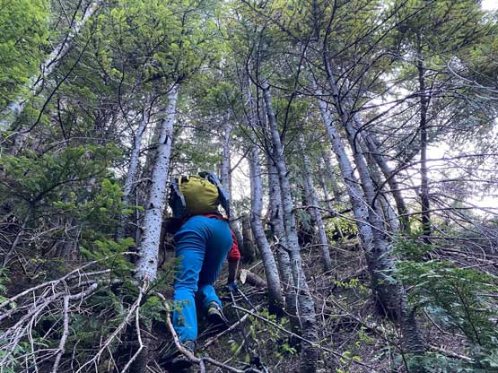
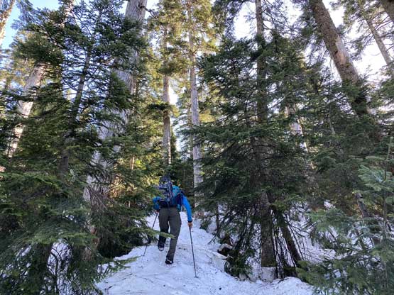
I walked in trail-runners for the first few kilometers while carrying Trango Towers mountaineering boots, until the creek crossing. Carol and Dawn was able to rock-hop across but for us, wading was the only option. Good thing we brought crocs for that purpose. The fording was very straightforward. After the crossing I ditched the crocs and the trail-runners. The alders soon took over on the road but as Carol said, the bushwhacking was never that bad on this road (BW3- at the worst) and although we did have to constant push the alders the thickest sections weren’t very sustained. There were however, a few stiff brambles that surprised me and as a result, my arms and legs were full of scars now.

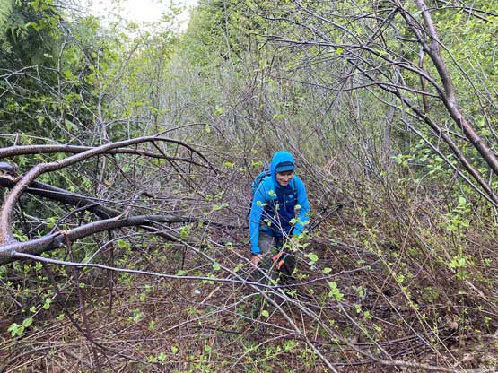
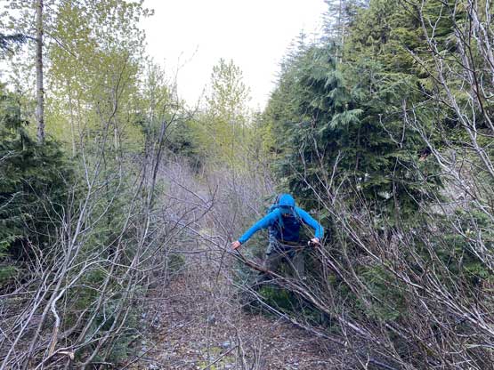
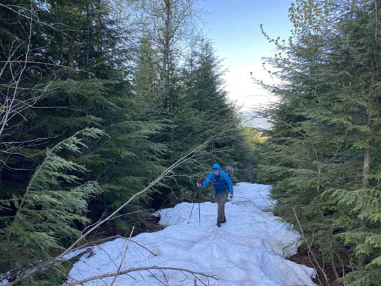
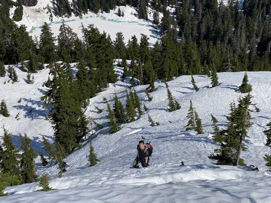
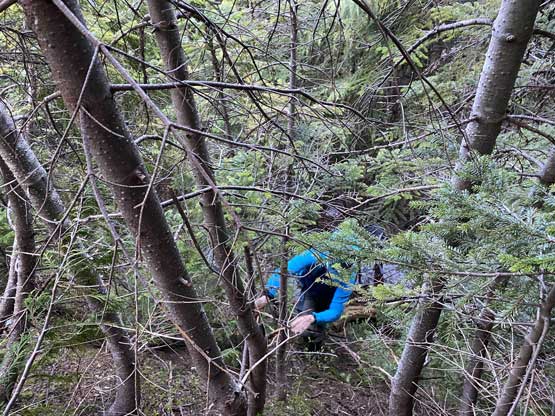
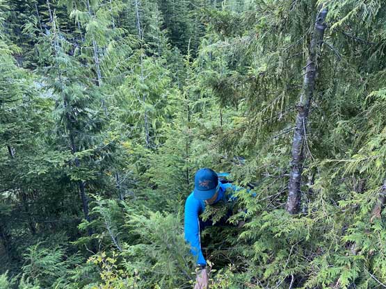
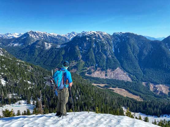
At 820 m we crossed another (minor) creek and between this one and the immediate next creek we were supposed to head into the forest to officially start the worst of bushwhacking. I didn’t quite understand why the previous group picked this line as if I were to choose, I would go further on the road and ascend the cut-block towards climber’s right. But since Carol’s line had been “proven” to provide a passage to the upper mountain we decided to stick with it and not fuss around with “other ideas”. The bushwhacking up the strip of forest between the two creeks was at the grade of sustained 3+ or 4- for at least 100 vertical meters. Even with some continuous snow patches higher up, the going was tight and slow. However, with perseverance we powered it through with some laughs and by 1000 m the going had become easier. From there to Kettley/Statlu col was mostly a steep ascent on snow. Traversing the ridge towards the NW Ridge of Statlu Peak we did have to briefly bushwhack but there’s nothing worth noting at this point.
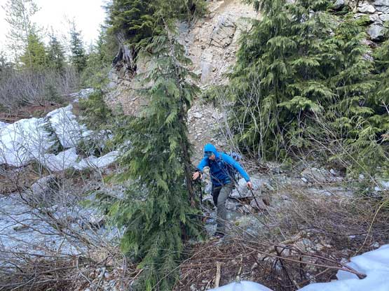

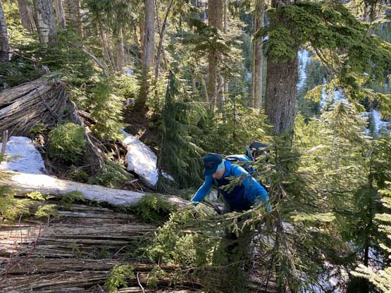


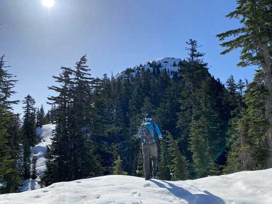
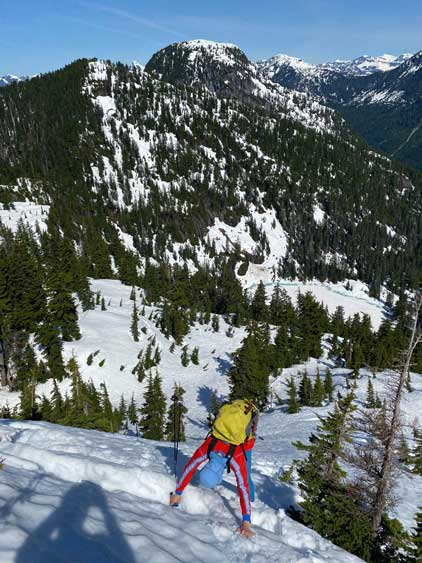
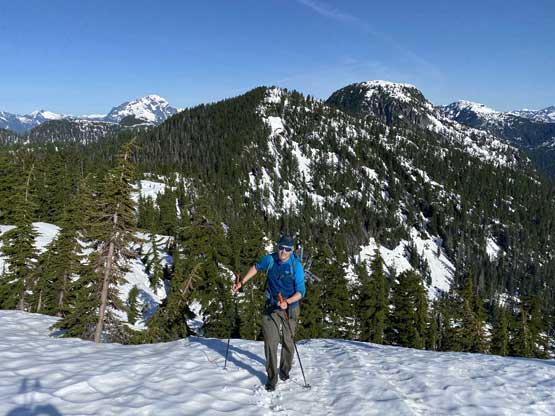
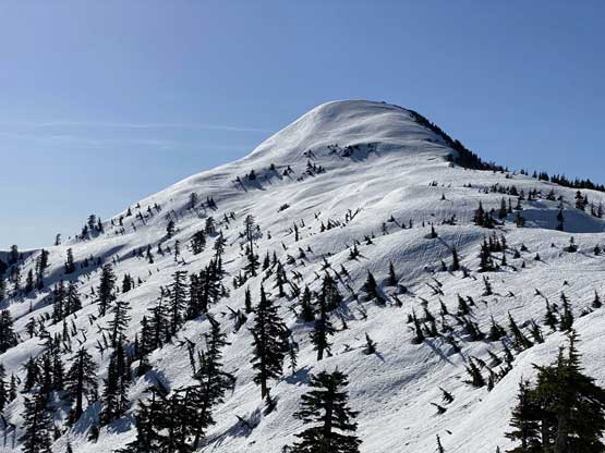
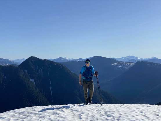
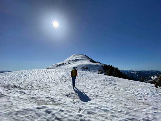
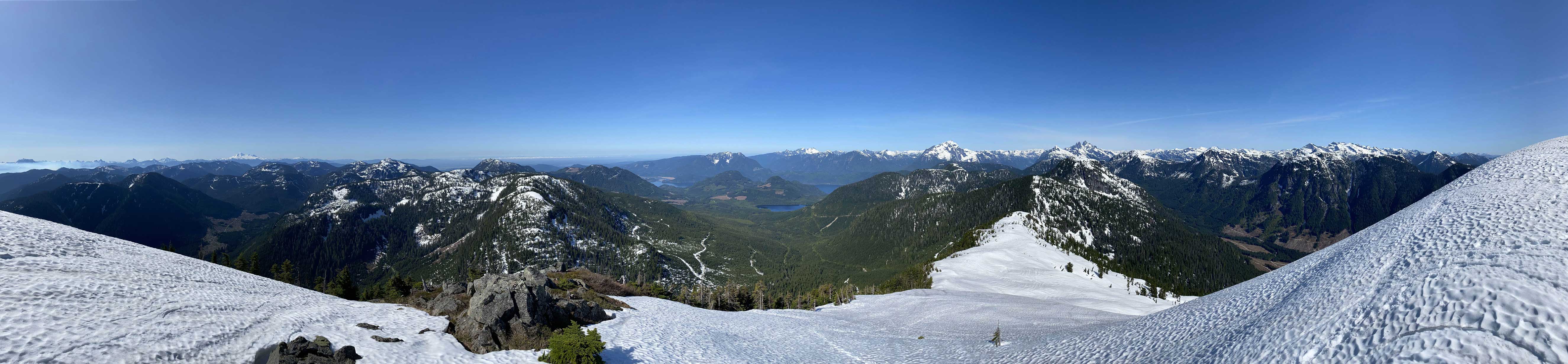
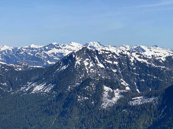
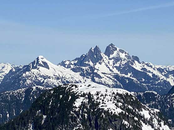
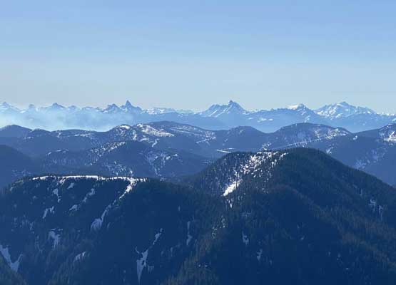
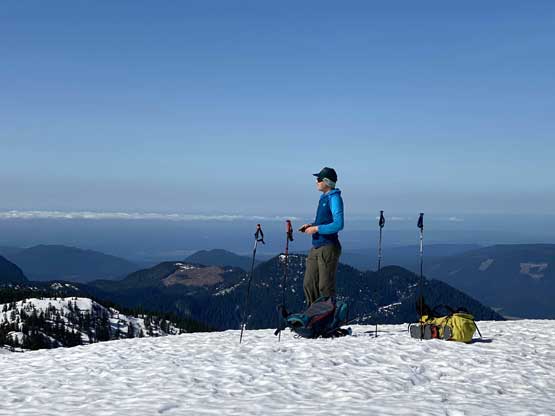
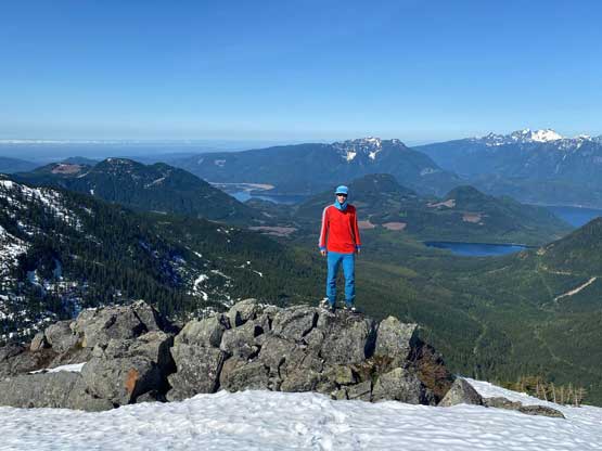
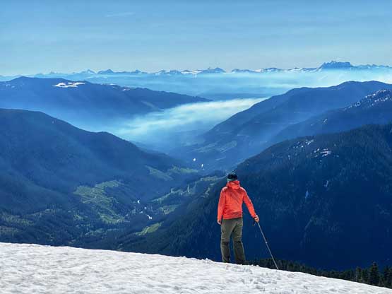
There was one steep roll (40 degrees) that required some careful step-kicking around several “tree moats” to pop onto the NW Ridge of “Statlu Peak”. After this roll the ascent to the summit was a cruise sail albeit with some foreshortened views. The ridge dragged on for quite a while. Other than carrying snowshoes for dead weight training I do think that we attacked this peak relatively efficiently. We earned ourselves a long break on the summit soaking in the views.


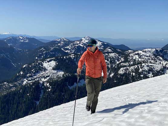


The descent of the upper NW Ridge was fast and fun and while descending that steep roll we noticed a solo climber going up. We soon recognized him as the fabled Simon C. in the local SW BC peak-bagging community. It’s been ages since any of us did a trip with Simon so we chatted for a while before resuming our own path. Simon had also noticed Carol’s trip report on peakbagger.com and decided to use the fresh beta to tag this otherwise, obscured and rarely-ascended summit. For Alex and I, the trip continued with an ascent of Mt. Kettley.