Mount St. Helens
November 10, 2016
2550m
Mt. St. Helens National Volcanic Monument, WA
Among the volcanoes in Washington state’s Cascade volcanic belt, Mt. St. Helens is the smallest but also the most unique. The eruption in 1980 had erased the summit dome and reduced the height of this mountain by about 400 m leaving an impressive crater rim up high. As of now the Lava Dome is gradually building up and by any mean Mt. St. Helens is still the most active volcano out there and nobody can predict the exact date of the next explosion. From mountaineering perspective although the summit is forever gone, reaching the highest point along the crater rim is still a worthwhile objective. The access is from a small town called Cougar on the south side and the ascent is not much more than a mere plod, in summer via Monitor Ridge and in winter via Worm Flow.
The complication mostly comes from obtaining the required permit(s) but as of early November all’s reduced to just a self-registration at the trail-head. This is the primary reason why I chose to ascend Mt. St. Helens in this time of a year, as opposed to in spring time on skis. I had a rare Thursday off in this past week and after evaluating back and forth between the weather models I made a spontaneous decision to drive a long ways down south. With only a few hours to plan anything I went to grab some food in the T&T Supermarket and then loaded my car with the car-camping stuffs. Not knowing how much snow would be on the hills I chose to bring snowshoes too just in case. By 10:30 pm Wednesday night I finally finished that day’s work and not even bothering to go back home I drove directly down south across the border, and 6 hours later I arrived at the gravel parking lot by Climber’s Bivouac.

Mt. St. Helens ascent route via Monitor Ridge. GPX DL
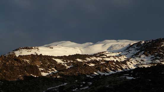
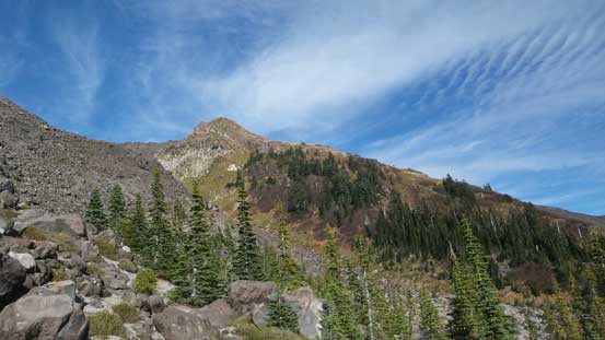
I thought about starting right away but decided against it as even just a little bit of sleep would be better than nothing. About an hour later my alarm went off and I quickly forced in two pieces of bread, and off I went in the dark. The climber’s self registration was very informative and was easily done. The trail was very easy to follow but the initial forested hike was a bit undulating, and also longer than anticipated. It followed a narrow strip of woods and seemed to go on for quite a while. Eventually after a few longer switchbacks the forest thinned out and then I arrived at the treeline. Beyond that the trail ascended steeply up a boulder field and then it’s the start of the long and foreshortened Monitor Ridge. I made to this point just in time for the sunrise and that was quite a spectacular moment.

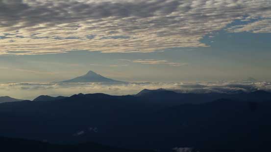
Mt. Hood looms on the southern horizon
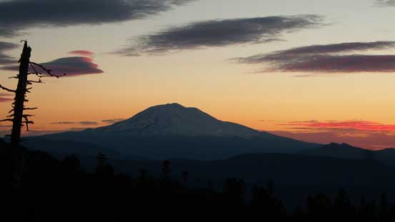
This is the mighty Mt. Adams before sunrise
Another picture of the dawn colours

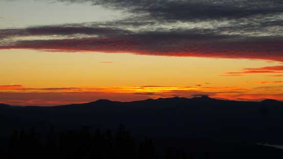
It’s sunrise time!!
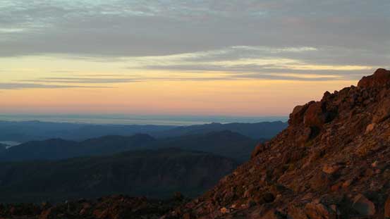
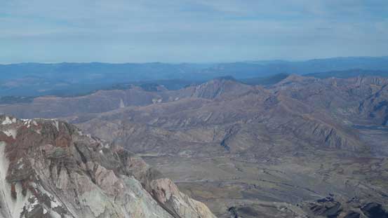
It’s a very beautiful morning. This is the southern horizon

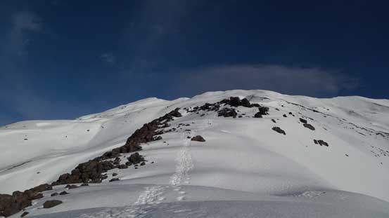
Ascending onto Monitor Ridge now.
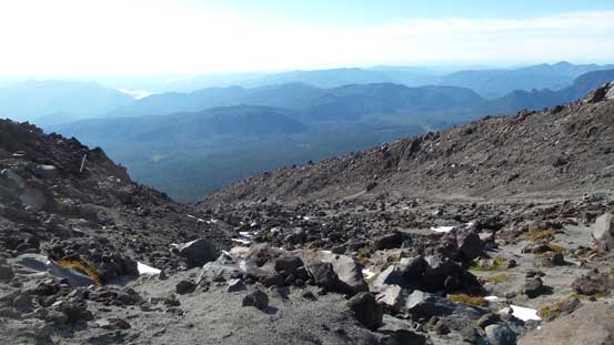
The trail was very well marked by some large wooden posts but at places it was difficult to stay exactly on the track. The punishment was some unpleasant boulder hoping, but generally fairly short-lived. At one spot the trail traversed on the climber’s left side of a buttress and into a mini valley feature and then it’s a long plod up that depression zone. Higher up the trail merged back onto the ridge and then I started encountering snow here and there. For some reasons I felt very sleepy so took a long break. The next section was a steeper ascent through boulder fields, but once levelling out the snow had become continuous and it’s time to strap the snowshoes on.

Ahead the route goes up that depression zone
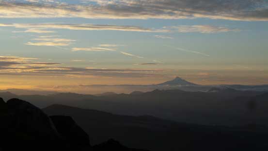
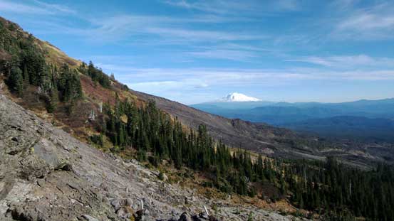
Mt. Hood
A zoomed-in of the snow capped summit.

Ahead is that steeper roll of boulder field
Another picture of Mt. Hood

Looking down at the lower Monitor Ridge
Looking ahead up the upper Monitor Ridge. I strapped snowshoes on here.

Looking sideways across the Warm Flow route
The weather was holding nicely as I gradually ascended that never-ending snow slopes, but towards the final rise that cold wind picked up. The upside was that I was getting closer and closer to the crater rim, and before noticing I was already there, gazing down the other side into the huge crater.

Plodding up…

It’s getting closer, at least…

Almost there!

Cresting the crater rim, now looking at the first false summit.
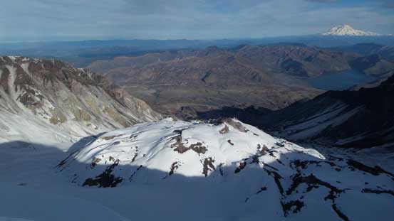
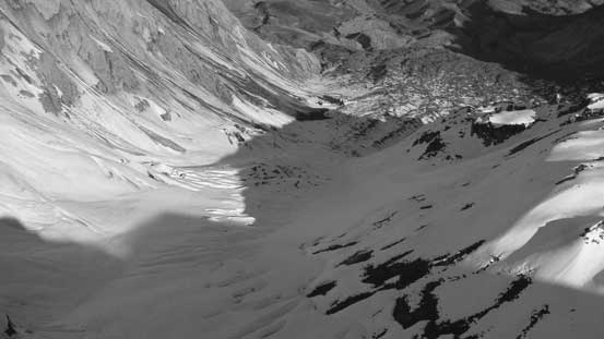
Looking into the crater. Lava Dome in the foreground

This is a sub-peak on the NE corner of the crater rim
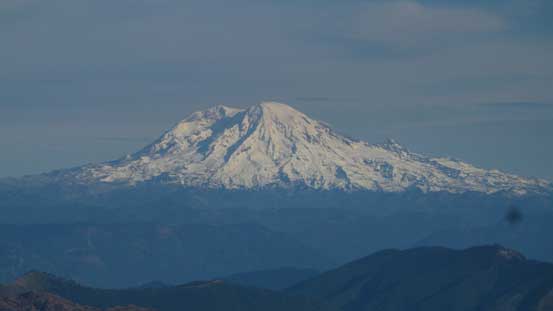
The mighty Mt. Rainier brings back some good memories

Mt. Rainier and Spirit Lake
Not wasting any time I soon turned my attention to the true summit on the climber’s left side. Traversing up and over the first highpoint I managed to keep the snowshoes on, but while descending the opposite side of the false summit I had to deal with a tricky icy roll. I did not feel like switching gear at that moment so turned my face inwards and carefully kicked some steps using the crampon systems of my snowshoes. The section ahead looked even trickier. The wind wasn’t as crazy at the false/true summit saddle so I spent a few minutes taking out the ice axe and strapping the real crampons on. Traversing over the next highpoint indeed involved a short stretch of narrow spot but then the final plod up the true summit was easy peasy, although I had to be careful about the huge cornices.

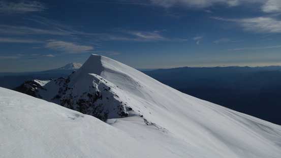
The true summit from the false summit

Looking back at the false summit (and that steeper icy roll)

The final push up the true summit

Looking through a gap on the rim
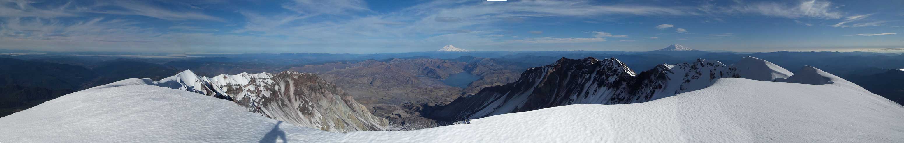
Summit Panorama from Mt. St. Helens. Click to view large size.
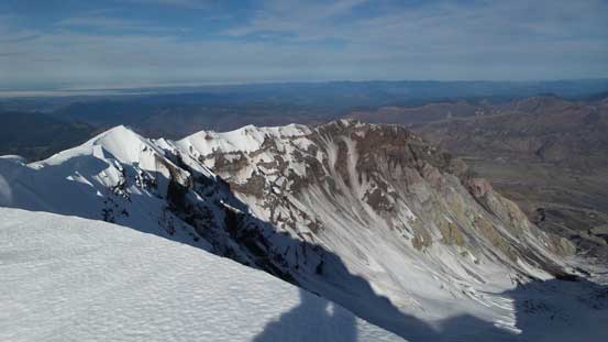
The rest of the crater rim on the NW side
Looks like there’s a sizable glacier in the crater

Mt. Adams looming behind
Johnston Ridge and its surrounding area which I just visited earlier in this year
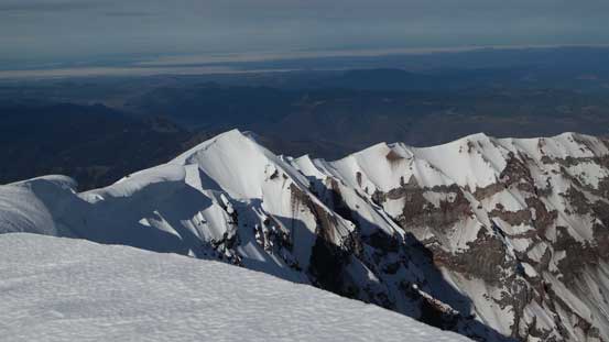
Another picture of the NW crater rim which is now below me.

There’s some very unique volcanic scenery for sure.

Mt. Rainier

Lava Dome in the crater

Me on the summit of Mt. St. Helens
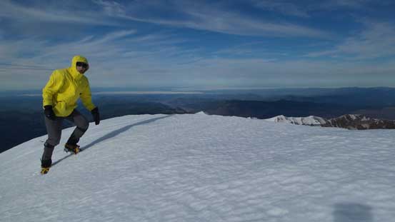
Another picture of me on the summit

Another panorama from the summit. Click to view large size.
I didn’t linger any longer than necessary so after some obligatory pictures I soon started the descent. Reversing my steps wasn’t difficult and I kept my crampons up and over the false summit as opposed to dealing with that icy roll on snowshoes. Eventually I strapped the snowshoes on as it’s faster and more pleasant just plunging and gliding. The upper snow slope was quickly descended and then I entered the lower boulder fields in no time.

One last look at the classic view from this summit

Leaving the true summit behind
Ahead would be the false summit which I’d have to go up and over

Fast forward, down to the boulder field now.
The rocks weren’t very pleasant but I could always find lingering snow patches as well as sections of volcanic ash to speed up my progress (also felt softer on my knees). The sleepiness soon took over. The lower Monitor Ridge felt like it’s been dragging on for quite a while, but I kept plodding down to the treeline to take that well-deserved break. About half an hour later I started resuming the return. And again, the forested trail felt much longer than what I remembered from a few hours ago. It was only 1:40 pm when I got back to the parking lot.
Descending…

Typical terrain.

Mt. Adams looks better in afternoon lighting
Looking sideways across the slopes. Mt. Adams behind

More rocks to descend…
Finally down to the treeline now

The forested descent
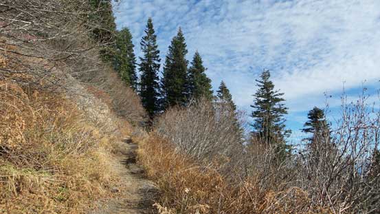
More about the forested descent. The trail’s in an excellent shape.
Driving down that winding and narrow climber’s access road was quite scenic and enjoyable, but the fun part was over in no time. Not wanting to drive with tiredness I opted for a nap break on the short of Yale Reservoir along SR 503. I woke up about 2 hours later right before sunset so I quickly grabbed some photos.
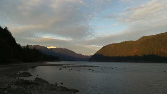
Relaxing on the shore of Yale Reservoir
The darkness fell in short notice and then I had my dinner in the town of Woodland. About 30 dollars in total for a well-deserved Mexican meal felt definitely worth the spent. Merging onto I-5 the rest of the drive back home was a mind-numbing game, although driving through Seattle downtown gong show was always “fun” and exciting.. I took a few breaks along various spots and made back home before midnight.
