Mount Rundle (West Peak / Banff Scramble)
August 28, 2011
2949m
Banff, AB
Note that this classic Banff scramble doesn’t go to the true summit of Mount Rundle. The true summit, marginally higher than this west peak, lies further south/east, is a technical climb that’s usually done as part of Mount Rundle Canmore to Banff traverse. However, most people “lie” by climbing this west peak to claim Mount Rundle. In my opinion, the true summit should be treated as a separate mountain anyway.
(Update: On July 20, 2013, Mike and I made a successful ascent of the true summit, so now I can finally safely say I’d summitted Mount Rundle).
A failed attempt on July 25, 2011:
I was very out-of-shape but after a tiring day on Cirque Peak, we still kept the original plan, to scramble up Mount Rundle. It would be my second scramble so I was not used to exposure nor loose terrain. I freaked out on the loose and slabby terrain above treeline all the way to Dragon’s Back. I pushed through that crux but turned around shortly after due to lack of daylight time, approaching weather, and complete exhaustion.

Mount Rundle from the classic Vermilion Lake viewpoint
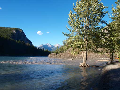
Bow River

Dad taking a break on the boring trail
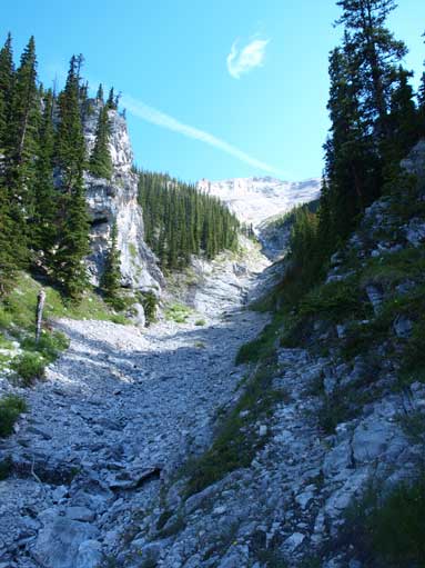
Crossing this gully. You should NOT go up this way.
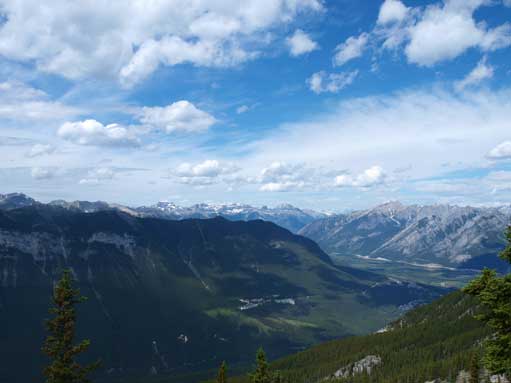
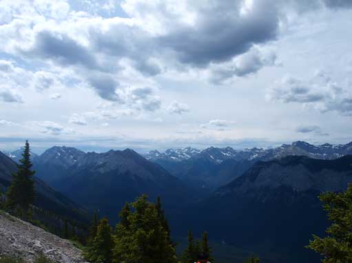
Beautiful view from above treeline

Mount Cory and Sawback Range
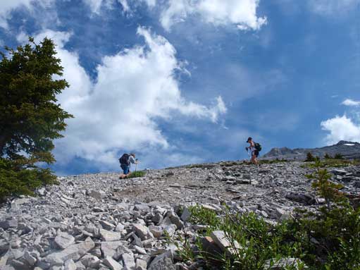
Two scramblers passed us on loose terrain
Clouds were rolling in quick
Dad scrambling up slabby terrain

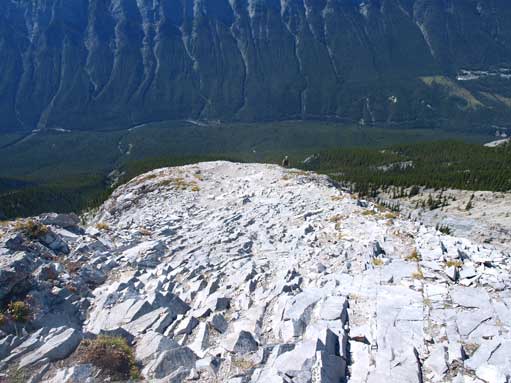
We turned around just above Dragon’s Back.
Trip report from August 28, 2011:
After the 11 hours lengthy trip on Cascade Mountain with my parents the day before, non of us wanted an early start. We discussed other possible objectives, but too bad I didn’t have any route information other than Mount Rundle. I didn’t have Alan Kane book by that time. Oh well, we started the ascent at 10AM in the morning.
The parking lot isn’t obvious. You follow Bow Falls road, cross the river, then you’ll see a golf course on your right. The parking lot is a pull-off on the right side. We walked down the road for another 100-200m, and look for trail head sign. This trail is considerably steeper than the nearby Cascade Amphitheatre Trail. I felt extremely short on energy at the start and I had to stop and rest for every few minutes or so. Good thing was, this problem didn’t last long. After the trail turns right and paralleling the base of the mountain, you gonna have to cover 3km on this section. It went on forever before the first switchback. Then it’s endless switchbacks.. After this section, you traverse horizontally towards climber’s right again, crossing 2 miner gullies, and then you’re at the main gully.
We carefully crossed the gully to the other side, looking for flags. Beyond this point, the trail is not maintained and steep. The forested ridge section is surprisingly long. Once above treeline, we had to focus on the endless scree above. The view was good, but not breathe-taking. Oh yeah, there’s nothing special about Sulphur Mountain (which occupies most of our view at this point). Mom awkwardly followed us up a few hundred meters and decided to stop and call for a day. She was very uncomfortable on the loose ground. She was afraid that, if she slipped she would slide down the entire face…
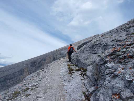
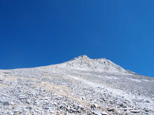
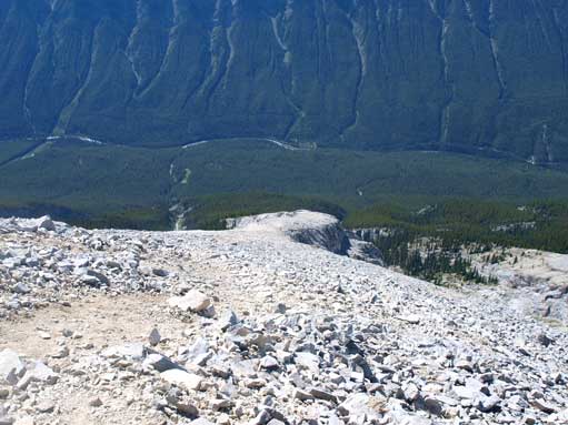
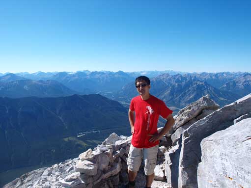
Dad was helping mom so he also fell behind quite a bit. Considering he had made through Dragon’s Back on our first try, I didn’t wait for him but continued by myself. By this point, I was speeding up quite a bit, and soon I reached Dragon’s Back. This is definitely the crux of the ascent and any scrambler who is not comfortable on exposure will find it challenging. The narrowest section is about 1.5m wide on slabby terrain, with shear drop-off on both sides. Because this was my second time up here, I quickly made through. Now what, endless scree slog. The higher I went up, the looser the ground was. No footing is solid, and I had to hands-down for balance regularly. Near the summit ridge, the terrain got steeper and a bit rockier. I sticked to rock to avoid further scree bashing, and soon I made to the summit ridge. I waited for about 20min for dad to show up. There’s a huge wind shelter and we stayed for about half an hour soaking the view. Towards east is a shear cliff down all the way to Bow River, one mile down. Cascade Mountain looks impressive towards north. The summit is an easy 5min walk from this point, but we didn’t continue. We were all satisfied and our goal was mainly too see the views. Considering the amount of effort I put into, I still call it a successful summit day, and this way, I don’t need to do all of these painful things again 🙂
Coming down the loose scree was much faster and easier. We quickly ran down the scree to the slabby Dragon’s Back. Going down that section requires more caution, and we made through with no incidence. We re-joined mom at lower slope and we slowly made down to treeline. Now, a not-so-pleasant hike brought us eventually back to car. I was extremely beat and I couldn’t even walk properly after dinner… Dad did most of the drive back home.

Near treeline

It was a bluebird day. Gorgeous view

This guy was coming down. He gave me some strategies on Dragon’s Back
Slabby terrain ahead
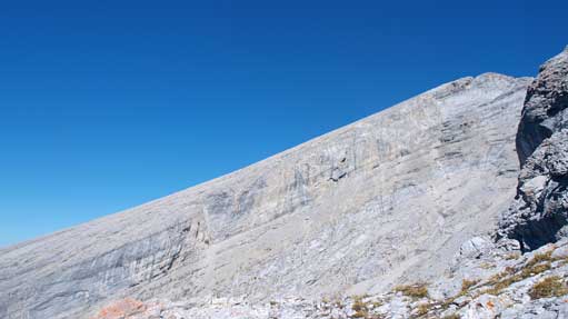
The slope on Rundle’s 1st peak.
Getting closer to Dragon’s Back, looking back
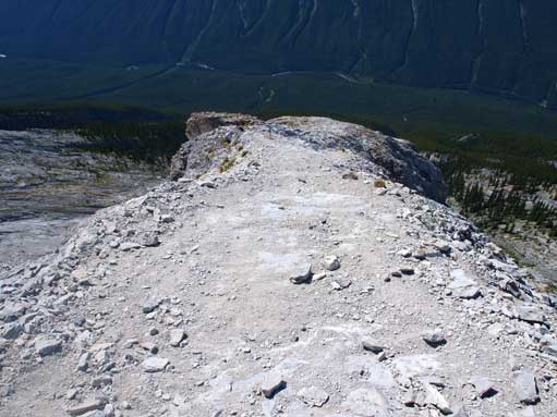
This is Dragon’s Back. I made through without a problem
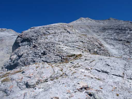
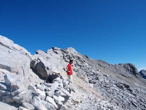
The typical terrain on upper mountain
Looking back
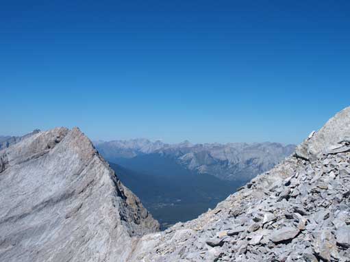
Looking through the col between 1st peak and 2nd peak
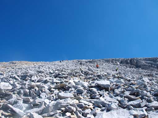
More loose terrain. And I had to dodge the rock fall induced by this big group
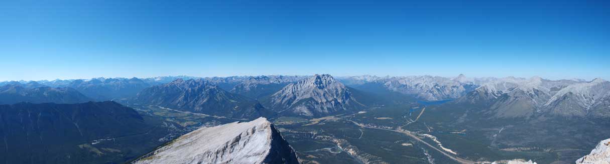
Panorama view. Click to view large size.

The other side is a shear drop. Bow River and Highway 1, at 1600 vertical meters below

Lake Minnewanka Area. The big mountain is Aylmer
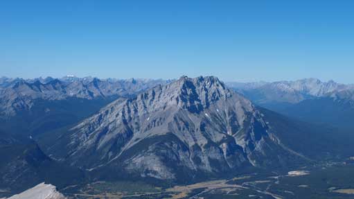
Cascade Mountain
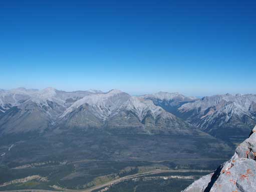
Fairholme Range across Highway 1. Mount Peechee at center

Mount Assiniboine
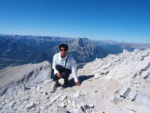
Dad
Me
As you can see, we didn’t make to the summit.

Descending / scree skiing. I was nervous on this too…
