Snowking Mountain
April 3, 2017
2266m
Cascade River / North Cascades Highway, WA
Within 4 hours of driving from my home at Vancouver, British Columbia the Cascade River Road branching off from SR 20 (North Cascades Highway) offers easy access to one of the most beautiful areas in the neighbouring Washington state. Most peaks around there are steep, glaciated and incredibly rugged making some of Washington state’s finest mountaineering opportunities. To name a few the immense icecap around Eldorado Peak is the most heavily glaciated region in the state apart from the volcanoes while the W. Ridge of Forbidden Peak is listed as one of the Fifty Classics that should be on every climber’s dream-list, and trust me there’s much more than just that. It’s difficult to believe that I hadn’t got around to visit this place since I moved to Vancouver in the fall of 2015. It’s always there in my to-do list and I knew I’d be ready as soon as the stars align.
In winter time there’s actually not that much to do, partially because of the rugged nature of these peaks and partially because of the access. The Cascade River Road does not get maintained beyond milepost 7 and that’s not very useful unless you want to spend 1-2 days just to approach. My inspiration mostly came from a recent post on “Washington Hikers and Climbers” Facebook group that the first 13 miles were good to go. This was not far enough for an attempt on the main prize – Eldorado Peak, but did put Snowking Mountain within our reach.
Although not visible from any major road and relatively low in elevation, Snowking Mountain forms its own glaciated massif that covers more than 10 square miles in its vicinity. The standard approach via Kindy Ridge is a long undulating plod with about 30 km distance and 2500 m cumulative elevation gain that usually requires two days if not three, but Vlad and I figured one long day should be sufficient for us. To make that happen our method was to car-camp in the previous night. Leaving home at 8 pm after work we made good progress down south across the border, onto I-5 and then SR 20. In about 3 hours we got onto the Cascade River Road and at around milepost 14 we correctly located the branch that heads down and across the river. We drove another 2 miles to the end of this spur road (a bit rough once across the bridge) and my brand new Toyota Tacoma got her first off-roading exercise.
Snowking Mountain via Kindy Ridge. GPX DL
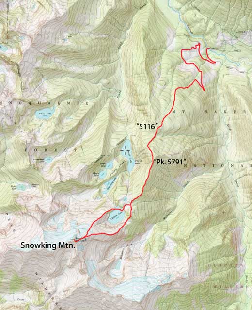
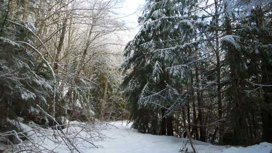
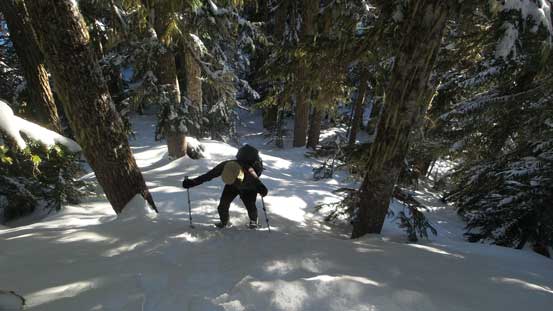
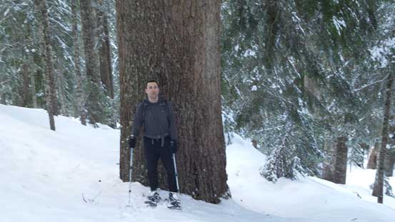
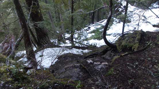
We woke up around 6 am and after a bit of slow-going things we eventually sorted everything out by 6:40 am. The road was no longer drivable beyond the first switchback (big barricade), and soon enough it started to get grown in. There’s nothing “bushwhacking” speaking the alders or other species that frequent the overgrown logging roads, but whatever presenting was wet thank to the previous few days’ of rain. None of us was equipped with rain pants and Vlad even forgot his gaitors so you know what’s going to happen. We both got soaked through even before hitting snow and that was not very motivating considering the long day ahead. In addition to the “very light bush” there were two major wash-outs that we easily negotiated. And then we encountered some deep, patchy snow that could not support our weight. The snowshoes were tediously strapped on and off for at least three times and in between we just carried them on hands. Eventually after what seemed like a long haul we came to the end of this forestry road. The trail was pretty easy to miss but Vlad paid more attention to details and spotted it on.

This is the second major washout along the forestry road
One of the stretches with snow that we had to don snowshoes.
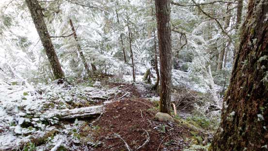
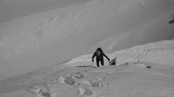
It soon became obvious that carrying the ‘shoes by hand was no longer the most effective way (so re-strapped to our backpacks). The trail was steep and rooty at places that required the use of hands for balancing, frequent by those intermittent patches of deep snow that never failed to give us surprises by those sudden waist-deep post-holing. The worst part came about half an hour later near the transition from “too little snow” to “too much snow”. We lost the trail and ended up in a tangled mess of dead-fall field, semi-covered by isothermal crap. At this point we just aimed straight up and a while later the snow finally became continuous and it’s time to finally don the snowshoes again.
Starting the steep trail which is more like a “route”. Note the fresh snow…
We lost the trail and this sums up the punishment…
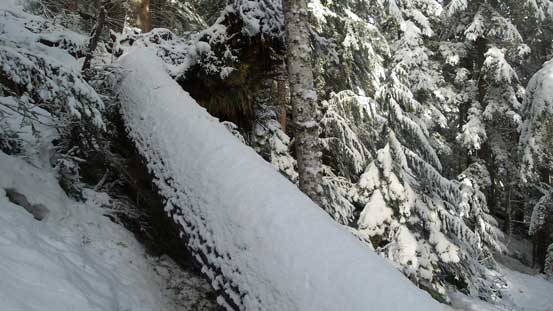
One of the many dead-falls we had to duck underneath or scramble over…

The snowshoes were finally strapped on again.
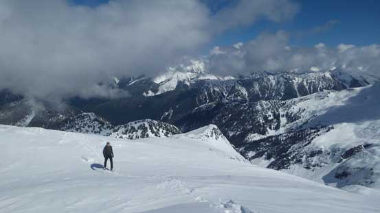
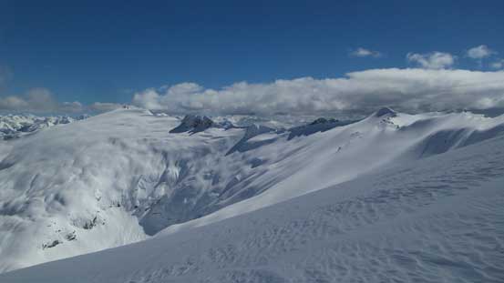
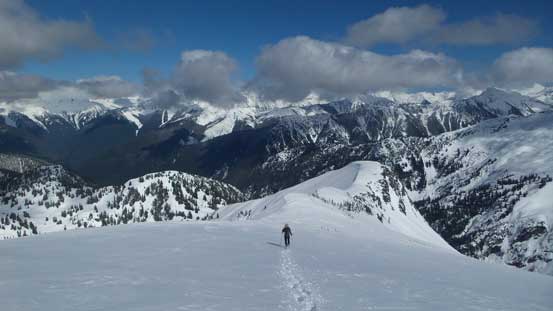
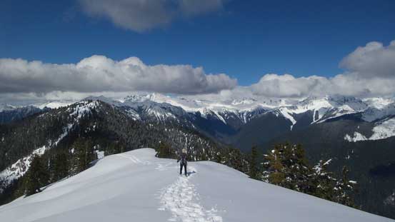
Beyond this point we kept a diagonally traversing bearing towards climber’s right and eventually crested the start of that broad, forested Kindy Ridge and that marked the start of a long plod towards the first highpoint of the day (“Pk 5116”). The grades were no longer steep, the snow was continuous and the forest was widely open, but the slog was very monotonous. Traversing the east side of “Pk 5116” we encountered some steep and crusty terrain which forced us to go back up to the top of this little peak, followed by another steep descent down to 5116/5791 saddle. Grunting up “Pk 5791” the trail-breaking finally took over but at the same time, the views finally opened up. We opted to not ascend to the summit and instead, traversed around it on west side near the top, and once around a corner we got a head-on view of the route ahead which not to our surprise, was still a long ways away…

Finally got some views near the summit of the first wooded bump – “Pk. 5116”
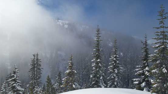
The mist cleared up briefly reviewing the next stage of slog – going up “Pk. 5791”
We found this path of the least resistance to go up “Pk. 5791”

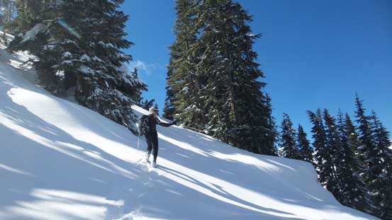
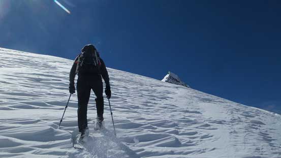
Vlad making his way up the slope
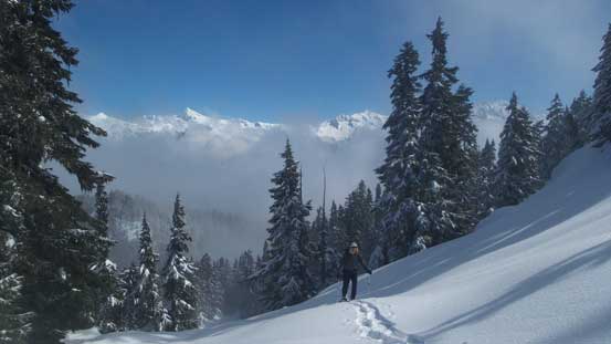
Vlad snowshoeing up with peaks nearby Cascade Pass behind

A zoomed-in shot of Eldorado Peak
The snow was deep. Our rough estimate was at least 3 to 4 meters deep…

Near the top of “Pk. 5791” we opted to bypass it.
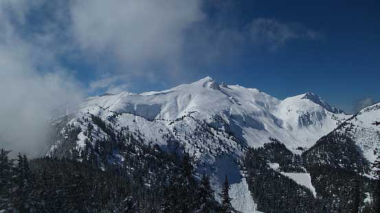
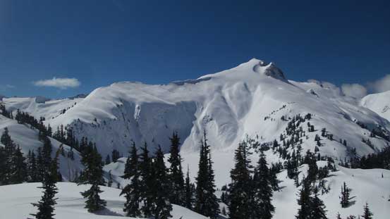
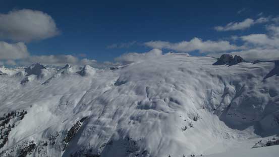
Finally, the massif of Snowking Mountain displaced in front.
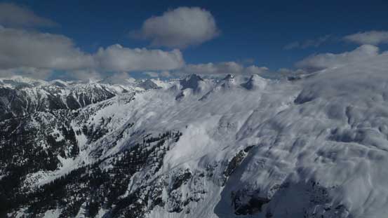
There’s about 150 m elevation loss to get down from “Pk 5791” and near the next saddle we found a nice spot to ditch some gears. The “up-and-down” theme continued as we traverse over the next highpoint (“Pk 5695”) onto some undulating ridge terrain. Beyond two routes presented and we opted to ascend the ‘NE Arm’ and descend the ‘E. Arm’ to make a loop. To access the ‘NE Arm’ our initial business was getting down to Cyclone Lake. This looked tame on paper but did involve fair amount of elevation drop along with some interesting micro-terrain near the bottom. Once down onto the lake we easily plodded across towards the outflow and found a line to get onto the ridge. The next stage would be nothing but putting one foot in front of another, for about 500 vertical meters of gain. Higher up we merged onto the north glacier and that led us all the way to the base of the summit pyramid.

Descending the south side of “Pk. 5791” we had to negotiate some huge boulders
Now, heading up “Pk. 5695” which is the next bump along Kindy Ridge

Looking back at the previous bump…

Another shot of looking back. This is near the top of “Pk. 5695” now.
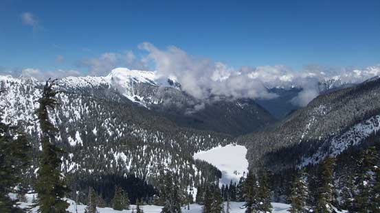
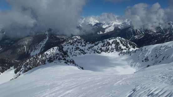
Looking down at Found Lake and the Found Creek drainage
Snowking Mountain rises behind Cyclone Lake

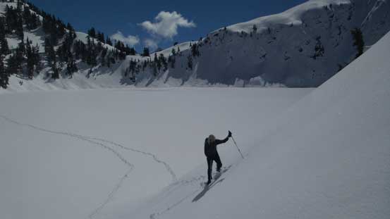
Finding a way down to Cyclone Lake

Cyclone Lake

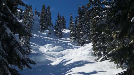
This is an absolutely gorgeous cirque. Any steep ski volunteers?!
Gaining the long NE Ridge now.
Starting to gain height again.

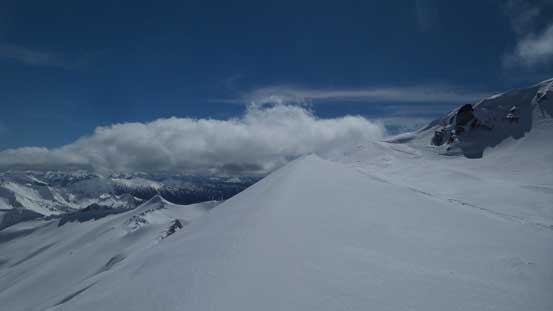
There’s no more up-and-downs (well, at least for the ascent anyway)..
Merging onto the north glacier now, looking across the slopes
Vlad breaking trail…

Another shot from this very foreshortening glacier.
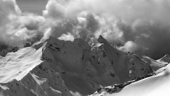
The glacial plod was surely a long one but at least we knew we were slowing getting there. The summit pyramid looked pretty steep but upon close inspection it wasn’t too bad. We decided to attack it from climber’s left (south side). Apart from one short steep section there’s not much worth noting. The last 10 m before the summit was incredibly ice though hence it was a good call to haul the crampons this far up. Unfortunately some clouds rolled in and most big peaks were already engulfed in especially looking towards the Cascade Pass group. After working so hard to get here this was downright disappointing but at least there were still plenty of blue skies so it was still acceptable.
High up on the glacier now, looking back down at Cyclone Lake

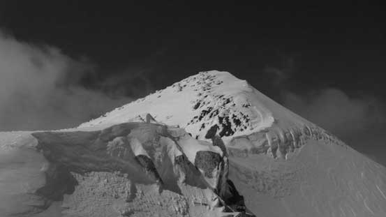
The summit is finally getting close

Massive glacier hanging on Mutchler Peak south-east of the massif
Traversing this bench to access the very upper S. Ridge to gain the summit
The upper ridge that we’d soon ascend

Another view from the end of this bench, looking back
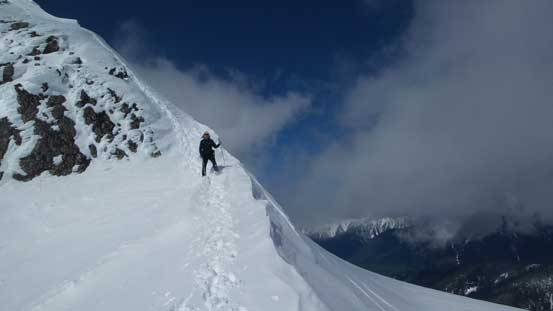
Vlad making his way across the bench
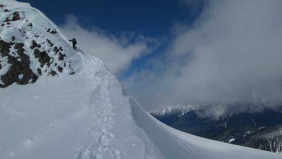
Vlad climbing up the last steep section

Summit Panorama from Snowking Mountain. Click to view large size.

This is looking south down Buck Creek drainage towards Suiattle River valley

Mt. Buckindy in the foreground and other giants buried deeply in Glacier Peak Wilderness
Mt. Chaval to the south-west

Another shot looking south

The other summits on Snowking Mountain massif

A shot showing other parts of the north glacier on this massif
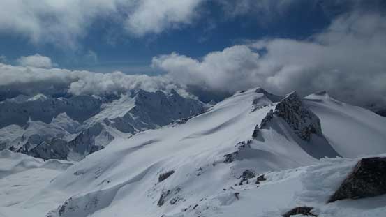
Another shot looking at the other summits as well as Mt. Chaval

Checking out the route that we’d soon use to descend.
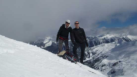
Vlad and myself on the summit of Snowking Mountain
Plunging down the north glacier was easy and fast and then the descent down the “E. Arm” was also more scenic than our ascent route. The downside was then another slog up and over “Pk 5860” with pretty substantial elevation gain and loss. Resuming the theme we retraced our tracks up and over “Pk. 5695” and then took a long break at the place where we ditched gears. Neither Vlad nor I had much water at this point but I had hauled some cooking gears just to save some weight on that, so after enough rehydration we continued the descent. Traversing up and over “Pk. 5791” was tiring and slow-going and then over “Pk. 5116” was not that inspiring neither.
Vlad down-climbing the steepest part of this ascent
Another picture showing this stretch.
Clouds lifted up for a few seconds and I snapped this shot towards Dome Peak massif
Mutchler Peak and its north glacier.
It’s a fast plunge down the upper mountain

We lost height in no time…

Mutchler Peak
Big terrain all around us. This is looking down at Mutchler Creek drainage

Looking back reveals our tracks down the E. Ridge
Looking sideways across our ascent route – the NE Ridge

Continuing down

The glaciers by Mutchler Peak in black-and-white
Can’t stop taking pictures of this peak…
One last shot of Mutchler Peak area. This is looking at the east side of it.

Time to grunt up “Pk. 5860”
Now back to “Pk. 5695” now.
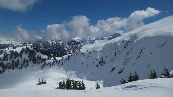
Clouds didn’t lift high enough for me to snap a shot of Eldorado Peak

Johannesburg Mountain was engulfed in clouds all day…

At “Pk. 5695/5791 saddle” now.

Grunting back up “Pk. 5791”, looking back

Traversing back across those car-sized boulders
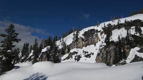
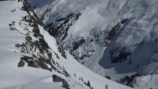
Cliffy terrain near the top of “Pk. 5791”

Vlad showing the scale of the terrain
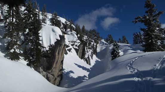
More about the cliffs around here.

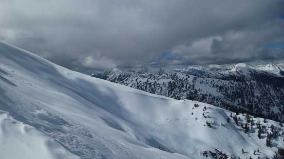
We traversed this bench so we didn’t have to gain unnecessary elevation

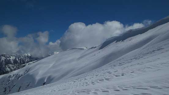
Very deep snow!

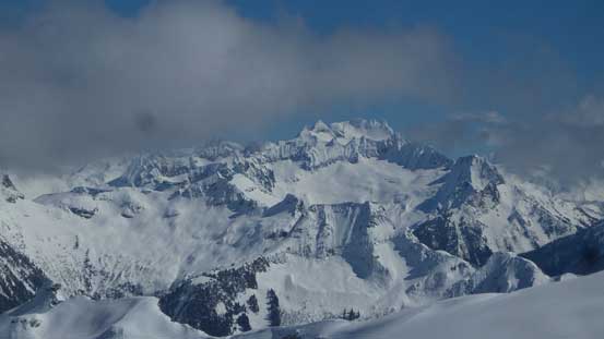
Mt. Torment and Forbidden Peak massif

Looking ahead, “Pk. 5116” in foreground with Hidden Lake Peaks area behind
Grunting back up “Pk. 5116″…

We didn’t bother to go all the way to the top of this little peak on the return.
Now we had finally done all of the up-and-downs and we still had more than 1000 vertical meters to descend. The rain crust in the lower forest surely did not help our speed and once the grade steepened up it was especially awful. Every step was on the knees. The bright side was that we managed to stick close to the trail and avoided that crappy dead-fall mess lower down. Overall the descent was faster than expected. Hitting the forestry road we decided to short-cut the uppermost switchback to avoid that “snowshoes-on-and-off” stretches. Nobody was in the mood to strap the ‘shoes on again and bushwhacking for 300 m distance was much more inviting. It turned out that the bush was pretty easy going. We thought about short-cutting the next one too but checking my GPS we abandoned that idea as the terrain looked steep and cliffy, so leisurely walked the few kilometers back to the truck.
That’s how you know it’s temperate rainforest…
Going down this section wasn’t as bad as I thought..
Our round trip time was exactly 13 hours and this was pretty much as expectation. The driving back home was pretty uneventful. I had pretty much no food in the truck so did a stop in the Subway in Sedro-Woolley while Vlad opted to wait until getting back. Overall this was a pretty classic “Type II fun” spring slog fest adventure. I surely wouldn’t recommend Snowking Mountain to folks looking for fun skiing but for those determined enough to make the push this is a very satisfying summit. And oh yeah, I’m looking forward to go back to this area sooner than later.
