Mount Richards
June 14, 2020
359m
Crofton / Vancouver Island, BC
I’m aware of another Mt. Richards next to the US/Canada border in Waterton Lakes National Park of the Rockies but this one is a lame and treed summit on the southern Vancouver Island. There’s a trail that runs up the western flanks from Crofton Lake all the way to the summit but there’s little to recommend about this hike beside getting some exercise. From peak-bagging point of view this is a complete dumpster-diving and totally worthless. The area is better known for Crofton Lake for a relaxed stroll among the locals. I opted to bag this peak because I got denied to board the 8:15 pm ferry from Nanaimo to Tswwassen so I was stuck on the island for one more night. Earlier in the day I had ascended Mt. McQuillan and Mt. Spencer further to the north.
I drove out of Duke Point ferry terminal and made to Crofton at 8:20 pm. I had done zero research besides browsing Gaia maps and thought I could have driven at least to Crofton Lake and maybe even higher, but the reality was disappointing. The roads were gated at the bottom and even after trying a different entrance point wasting another 10 minutes driving around. I did some quick Google research and indeed, the peak needs to be hiked from the bottom with about 10 km of round trip distance. This meant I would have to summit after sunset in the dark, but since I was already at the trail-head I was determined to bag it no matter what.

Mt. Richards hike from Crofton Lake. GPX DL
I made some quick work to Crofton Lake negotiating a maze of junctions by pure GPS navigation. The lake itself was quite beautiful but I had little time to linger. I opted to walk around the south side and picked up the trail after a bit of confusion. I followed the trails on my Gaia map linking up several connectors and made to an area of clear-cut on the upper slopes. At this point it was already almost sunset. I plodded ahead nonetheless linking up more trails and eventually made to the east summit, which is about 3 m higher according to some sources. The official name is labelled on the west summit which is about 1 km away, so I had to keep going. Dropping down from the east summit I came to a road and then picked up a deactivated spur that seemed to run towards the west summit. I had to turn on the head-lamp almost immediately after turning on this spur road. The last 10 m elevation gain to the summit involved some bushwhacking.
The typical view from the hike to Crofton Lake…

Arriving at Crofton Lake. It’s a neat lake but pretty averaged…
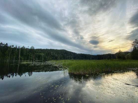
Some evening colours on Crofton Lake

Walking around the south shore of Crofton Lake

One more photo of the lake…

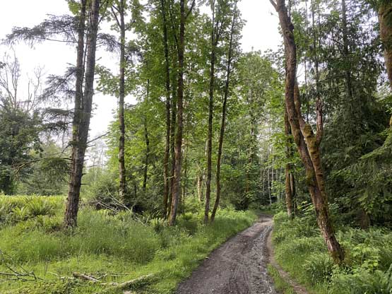
The typical trail conditions. You need a GPS to navigate the maze

Pretty much the only view from the clear-cut area higher up…

Me on the summit of Mt. Richards
After taking one obligatory victory shot I soon started the descent. I checked the map and decided to walk down the road instead of the trails. The quality of those trails was not very good. After a few junctions I joined the “Mt. Richards Mainline” and then picked up a connector trail lower down to get back to the shore of Crofton Lake. The rest of the descent was uneventful but felt quite lonely in the darkness.
I got back to the vehicle at past 11 pm and spent the next hour cooking a late dinner and relaxing. The place where I parked (on the street) was pretty quiet so I opted to catch up a few hours sleep, but without a sleeping bag it was pretty difficult to fall asleep. By 2:30 am I was fed up with the frustration and dragged my exhausted self northwards to Duke Point to wait. To my surprise there’s already a line-up but I did manage to get onto the 5:15 am ferry without an issue. The ferry was full by 4:30 am so that’s something to be aware of.. While sailing back to the mainland I fell asleep in the truck. I was completely dead after two days of minimal sleep. Others had to knock hard on my window to wake me up so that people could move… I got back home at 9 am and slept straight to 3 pm…
