Volcán Iztaccíhuatl
December 30-31, 2018
5230m
Mexico/Puebla States, Mexico
The third highest in Mexico and the 7th highest in North America – Iztaccíhuatl, is truly a unique volcano such that the shape of it doesn’t represent a typical volcano. In fact, the mountain forms a N-S ridge complex and viewing from the sides the shape resembles a “sleeping lady” with the summit being her breasts. The standard route (La Arista del Sol) traverses much of the ridge and the 4-km long undulating traverse above 5000 m altitude is something this mountain’s famous for. High up on the route one needs to traverse two glaciers and the summit is capped by three equally high bumps on the S, N and W edges of the summit field of glacier. I’ve heard a mixed bag of stories but most climbers vote Iztaccihuatl as “prettier” than Pico de Orizaba. After completing both climbs I personally would second the statement. In my opinion the climb of Iztaccihuatl is just as important as tagging the summit of Pico de Orizaba, and if one pays the effort travelling to Mexico to climb then he/she should put both on the must-do list.
Lily and I climbed it on the 6th day of our Mexico climbing trip after completing Cerro del Cuatlapanga on Day 1, Volcan La Malinche on Day 2 and then Pico de Orizaba on Day 4. The plan for the 5th day was driving around to resupply, obtaining the climbing permits in the park’s office at Paso de Cortes and then sleeping in Alzomoni Hut (4000 m) before waking up at 11:30 pm to start the single-day push. In the morning we had a somewhat decent breakfast in OMG hostel before starting the long drive to Ixtapaluca. The drive was fairly straightforward following the Google map’s direction, but the tolls were expensive. I remember paying at least 6-8 tolls on various stages, especially around the city of Puebla. Once arriving in Ixtapaluca we first stopped for gas using purely Google translation to communicate, and then bought food/water in the nearby Walmart. By around 1 pm we finally got everything sorted out and were on the road again aiming towards Amecameca. This part of the drive was the worst with a few intense merges but once hitting the main roads the drive became much easier. We did not stop in the city of Amecameca and went straight for Paso de Cortes (3700 m) to get the permits. The cost for the permits and a night stay in Alzomoni Hut was 200 pesos.
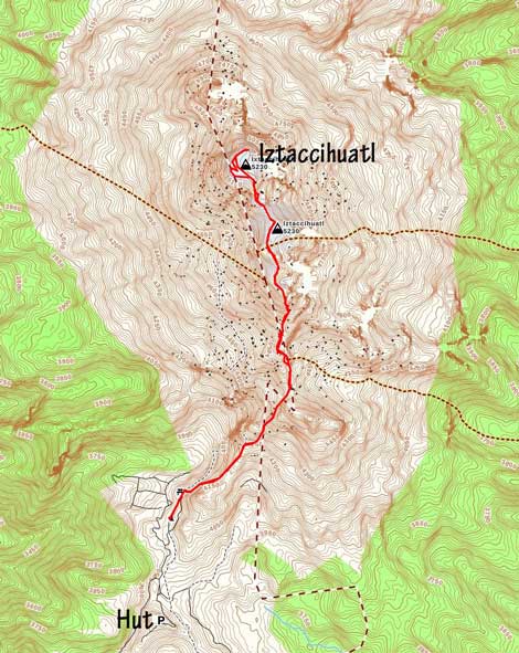
Iztaccihuatl standard route. GPX DL
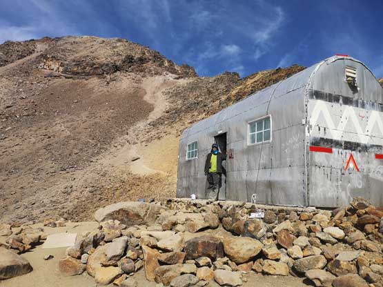
Once leaving the winding road to Paso de Cortes we had to negotiate around 8 km of rough dirt road to either Alzomoni Hut or the trail-head (La Joya). This road was worse than expected with big ruts everywhere. I was only used to driving on dirt road in a Tacoma and I was very concerning whether or not we could actually make there in the 2WD rental car. It turned out that the car’s ability to handle backcountry roads was much higher than my anticipation. The last stretch before Alzomoni Hut was extremely rough and steep that we were literally crawling on rocks but I got the job done without even scrapping the bottom for once… The scariest moment came when another car drove down as we drove up the branch immediately below the hut. Thankfully the other car wasn’t too far from a turning corner and managed to back up and let us (barely) pass… The hut was fairly luxurious but the downside was the crowds. We managed to get in a room with everyone speaking English, and that everyone was gunning for the summit on the following day, so the fact of crowding wasn’t a practical issue for us. At sunset time I spent around half an hour taking photos outside while everyone else tried to get as much sleep as possible. I knew I had zero chance of sleeping at 5 pm so why bother.. It’s not the altitude that affected me and in fact, by this point I had already fully acclimated, but rather my bad living habit that prevented me from catching the valuable hours of sleep. I almost never go to sleep before midnight ever since high school days and instead I often opt to waste hours and hours on the internet before going to bed. I learnt from this trip that my habit doesn’t quite work well with high-altitude climbing. In the end I only managed to sleep ~1 hour around 8-9pm. I killed the next couple hours by listening to music, until the alarm went off at 11:30 pm.
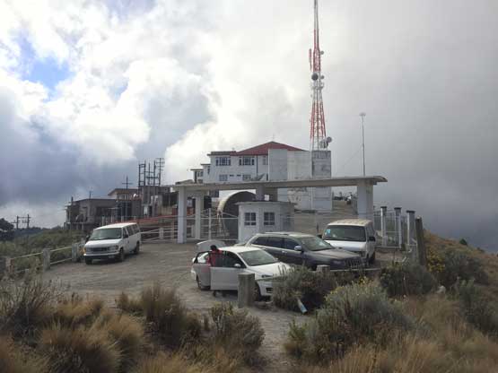
Alzomoni Hut is somewhere in this complex structure…
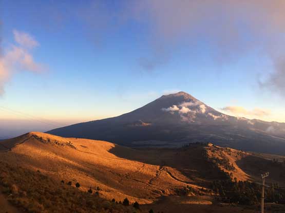
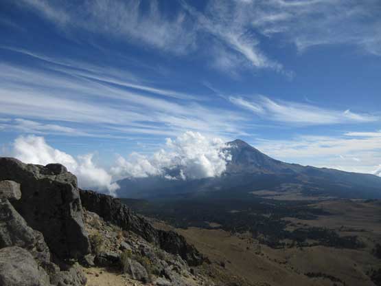
Popocatepetl from Alzomoni Hut

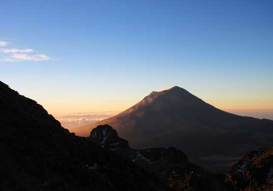
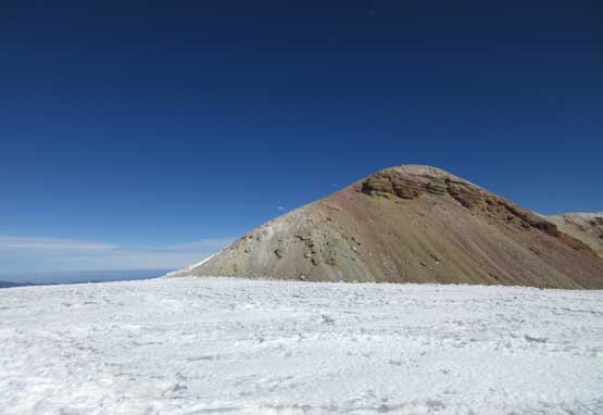
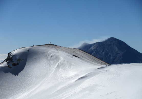
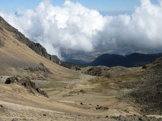
Iztaccihuatl from Alzomoni Hut. It’s a lot longer than appeared…
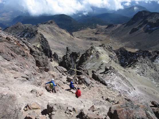
I thought we did a ton of unnecessary things in the morning but comparing to the guided group our routine was actually very efficient. I had absolutely no idea why people seem to take forever getting ready in the morning. Once getting out I discovered another frustrating fact that the car’s windshield was coated by a sheet of ice… Defrosting took at least 15 minutes because we did not have the scrappers. That sucked. I had some concern about the drive to La Joya but it ended up being not an issue at all. The car survived the road and we got our day started by 1:30 am, almost exactly two hours after “waking up”, as inefficient as it sounds. The trail had some confusing branches that even with the downloaded GPS track we still got off-route several times, including one major mistake above the first saddle. The ascent from first to second saddle was much steeper than the previous part. The trail traversed on alternating sides of the ridge. Once above the 3rd saddle (4500 m) we had to ascend a steeper zone to crest the next “saddle” feature. The trail then popped on the opposite side again, and then descended ~20 m elevation to Grupo de Los Cien hut (4700 m).
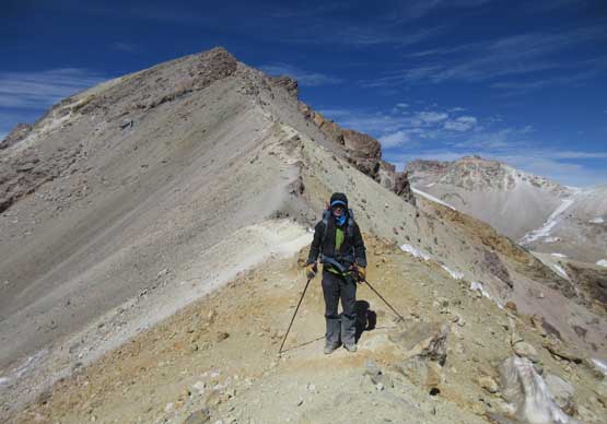
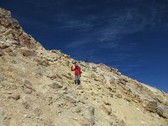
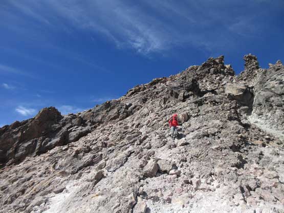
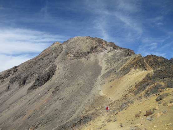
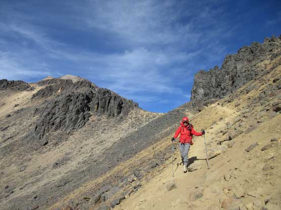
It was around 4:30 am with still a few hours till daybreak and the next section to gain “the knee” was suppose to be the crux of the trip – a 300+m grunt with route-finding and scrambling up to “class 3”. The wind had picked up and it was much colder than on Pico de Orizaba two days prior. I was tired from the lack of sleep. We had to make a decision here – to continue or to sleep a couple hours in the hut. None of us brought camping gears but we did come prepared with a ton of warmth clothing. The hut was dirty but seemed cozy enough to stay for a few hours so I started to bundle myself up. There were spare blankets in the hut (only two were sleeping there), but there were mice everywhere.. It was still cold though. The other guided groups that started later than us arrived in about half an hour and also opted to rest for a couple hours in the hut. Ironically I actually got at least two decent hours of sleep, and this confirmed that it wasn’t the altitude that kept me from sleeping, but rather my bad daily habit… I did not develop any symptom of altitude sickness from the two hours of sleep at 4700 m, neither did Lily. The two of us together with the guided group-of-three, as well as one solo Mexican climber all got out at around 7 am. With daylight the route-finding seemed straightforward. The first half was slogging on treadmill scree and the second half had some fun scrambling on generally solid rocks. I thought the scrambling was Class 2+ at the maximum by BC and Washington standard.
Started to see the morning horizon to the west.
Looking back at Popocatepetl the second highest peak in Mexico
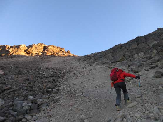
Grunting up the long scree run which marks the lower half to gain “the knee”
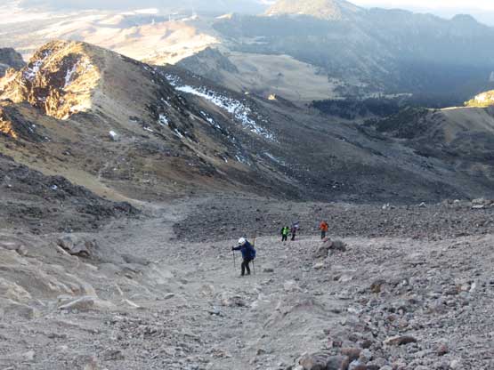
Looking back at the solo Mexican climber, and the guided group-of-three

After a long while we were hit by sunshine for the first time

Lily ascending into the sunshine and ready to scramble some rocks
Me scrambling up. Photo by Lily Q.
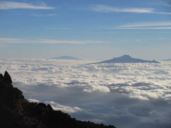
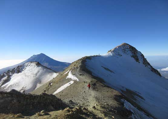
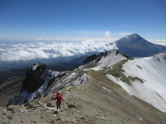
Volcan La Malinche poking above the clouds ceiling, with Cofre de Perote behind
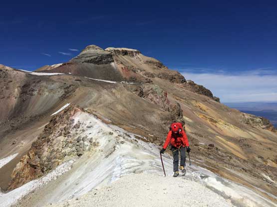
Lily marching up the upper portion of the ascent onto “the knee”
Another photo looking back towards Volcan Popocatepetl
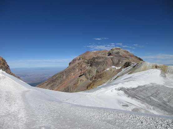
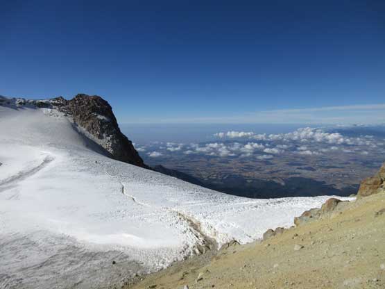
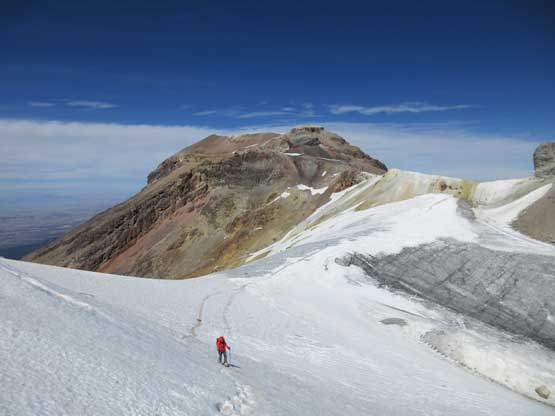
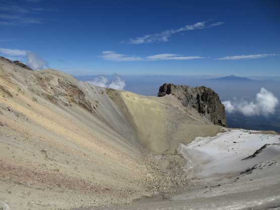
Once topping “the knee” at 5000 m altitude the fun was just about to begin. From here it was over 2 km horizontally to the true summit with a few major false summits to ascend up-and-over. The entire traverse was exposed to wind, but also exposed to some of the most incredible scenery a volcano could offer. The wind was very cold though that in no time I had donned the parka. I don’t remember the last time wearing a parka while climbing upwards. It must be in the ol’ Rockies days. The first hightlight was cresting “the stomach” seeing the first field of glacier. There’s about 50 m elevation loss but I wouldn’t complain. Earlier in the trip we agreed to reduce some weight from Lily’s pack by not carrying her steel ice axe. I would still bring my (aluminum) axe and I would give it to her in case she needed that extra bit of security. Based on my research I knew I would not need an ice axe for this climb. I was correct. Upon seeing the first glacier I immediately gave the ice axe to Lily, quickly donned crampons and plodded ahead. The route ahead seemed obvious enough to climb solo. Throughout the day up until this point I had tried my best to be patient but upon seeing the upper route I suddenly couldn’t bear the slow pace anymore. Lily’s pace seemed to match with the lone Mexican climber so at least they would climb relatively close to each other.
Upon topping out on “the knee” we could see the alpine ridges ahead
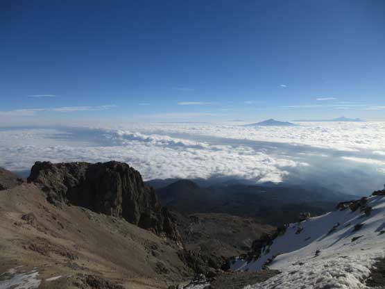
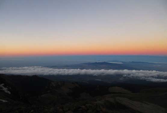
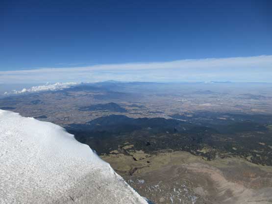
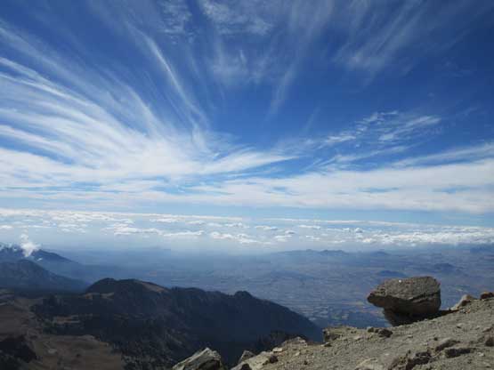
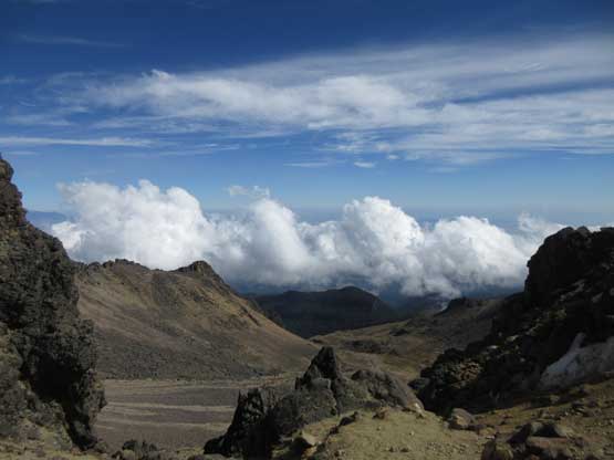
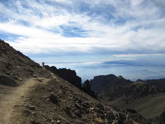
A sea of low clouds to the east in the states of Tlaxcala and Puebla

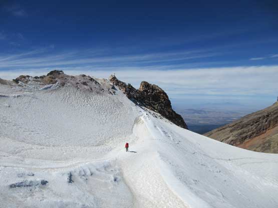
Just one of the many sub-summits along Iztaccihuatl’s south ridge

Plodding onward towards the second local maximum, with “the knee” behind
Plodding past the second local maximum and arriving at the next local minimum..
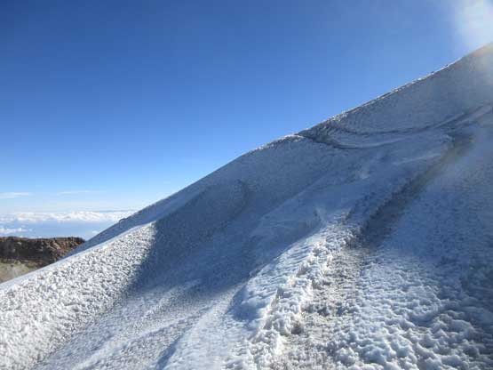
A steeper grunt lied ahead to ascent onto “the stomach”
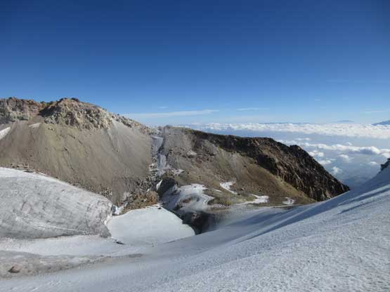
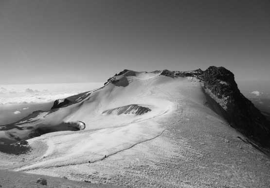
Panorama view of the first (lower) field of glacier. Click to view large size.
The two Arizonians with their guide were nowhere to be seen. This was their 3rd or the 4th day since leaving US and I concerned that they probably couldn’t make the summit with the lack of acclimation. It was only the three of us climbing on, battling the gusty wind that sometimes nearly knocked us off our feet. The strongest gusts occurred just after passing the first glacier, and on a narrow ridge I had to lie down in order to stay intact with the ground. Once the wind died down a little bit I quickly made my way across an exposed part of ridge. I had thought about removing the crampons but decided against it, and my decision was correct as any north-facing aspect was still coated with ice or rime. The steep ascent up onto the south summit took a long while and I believe I again went off route briefly, but that’s not relevant. I soon reached the south summit looking across the second field of glacier (the summit glacier). The north summit looked to have at least the same elevation so I had no excuse. This involved another bit of elevation loss followed by crossing an untracked glacier with route surfaces. The scramble up onto the north summit was very chossy. From the north peak looking back it seemed that the south summit was higher and in fact it was really difficult to tell. The north summit offered some unobstructed views of the north side and “the head” so as long as you have the energy then definitely go for it. Once resting for long enough I went back, traversing up and over the west summit just to be sure. I saw Lily topping out on the south summit but then saw her started traversing towards me. I immediately had some concerns. The Mexican climber had called it good on the south summit and now we were again the slowest climbers in the gang. This was not good. I rushed to her and this time I turned her around and it’s the time to get off the mountain.
Descending onto the first field of glacier. I went ahead and rushed for the summit
The first glacier showed some bare ice, but just a “hike”, literally
There’s a very unique frozen tarn in the bottom of this cirque…
At the minimum point of this glacial field and looking ahead.
Ascending onto the next ridge and off the glacier now.
Looking back towards the first glacier as well as the bump of “the stomach”

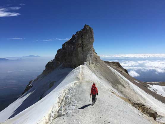
One of the very imposing spires I passed en route.

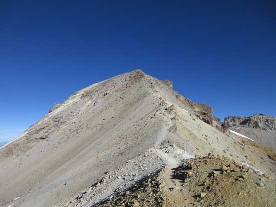
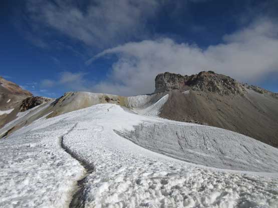
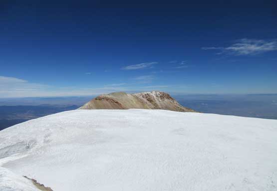
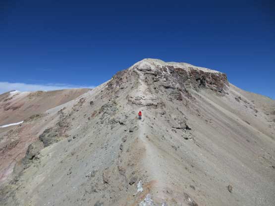
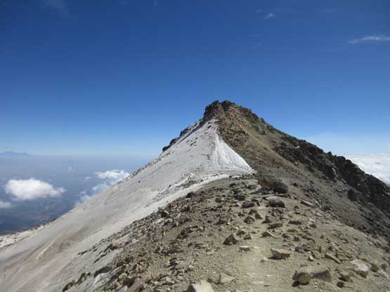
After a while I was finally looking at the south summit proper

I steadily ascended onto the south summit. This is looking back at the route.
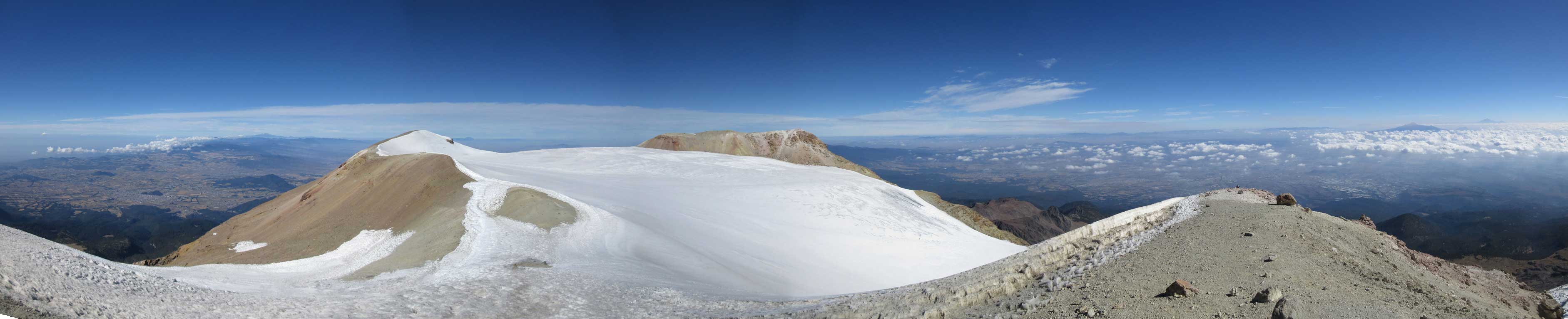
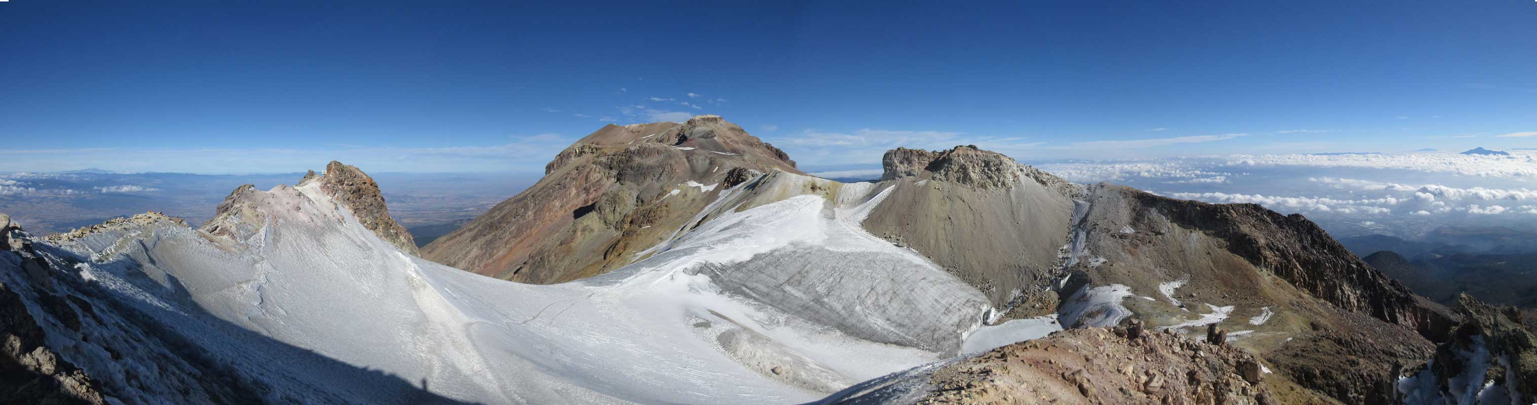
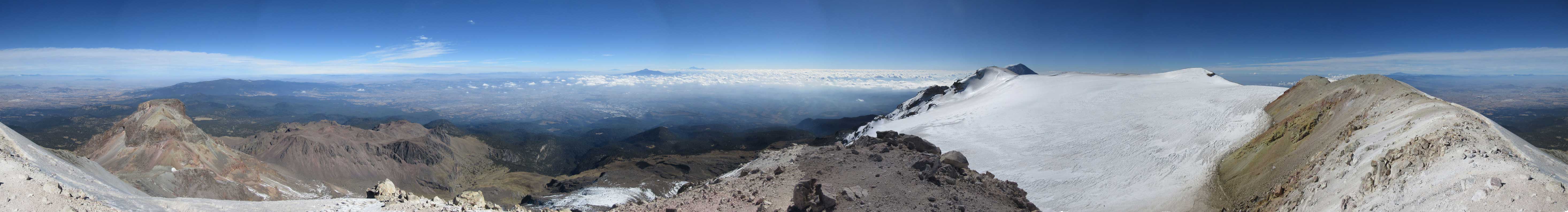
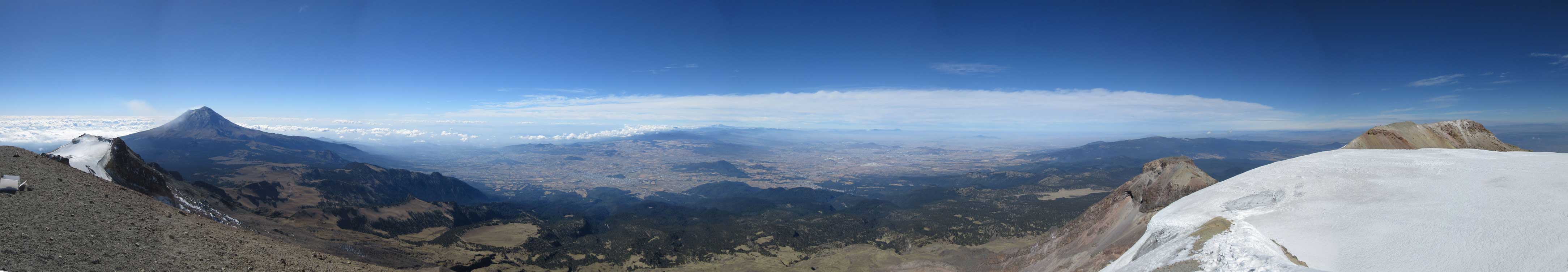
Partial Summit Panorama from the south peak of Iztaccíhuatl. Click to view large size.
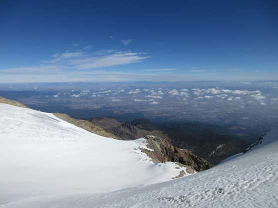
Looking beyond the summit field of glacier into expansive vistas
Plodding across the second (summit) field of glacier towards the far northern summit
Ascending onto the west ridge of north summit I got an unobstructed NW view
The bonus of going this far was seeing “the head” lying ahead
Summit Panorama from the north peak of Iztaccíhuatl. Click to view large size.
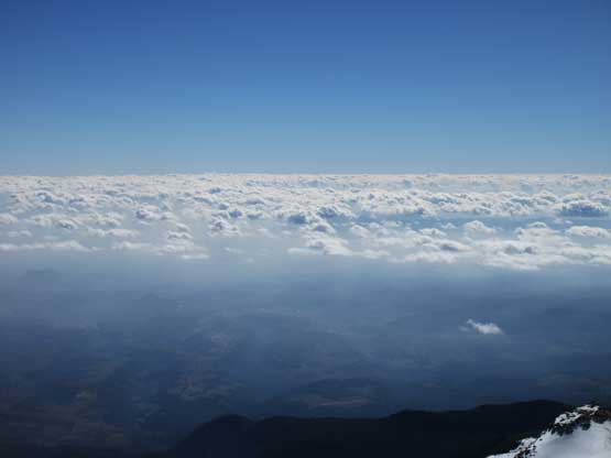
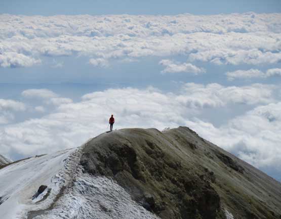
A sea of clouds that resembles a view from an airplane.
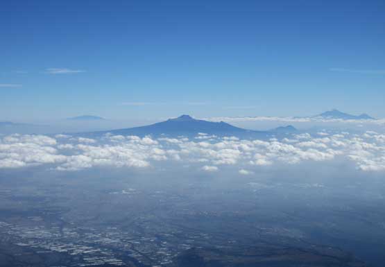
La Malinche now looks smaller
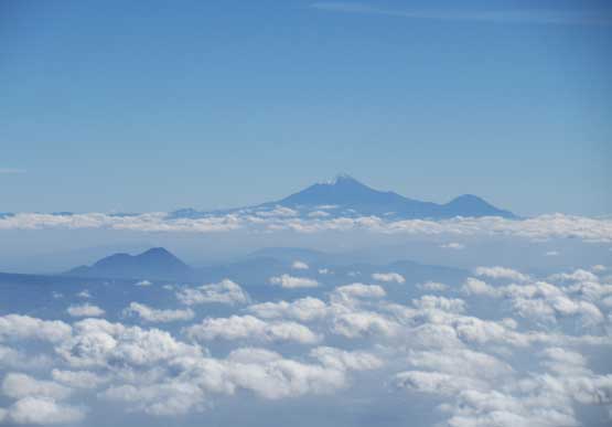
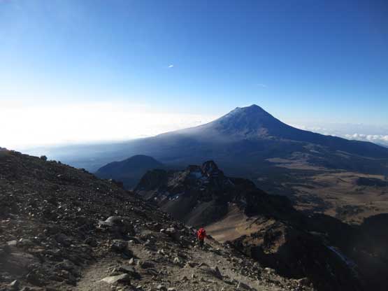
Pico de Orizaba dominating the eastern skyline, with Sierra Negra to its right
Another look at “the head”. Not a lot of people got to see this…
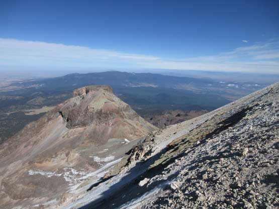
A zoomed-in view looking back at the south peak. Most climbers call it good there.
After a while of resting I traversed to the west summit just to be sure.
Partial Summit Panorama from the west peak of Iztaccihuatl. Click to view large size.
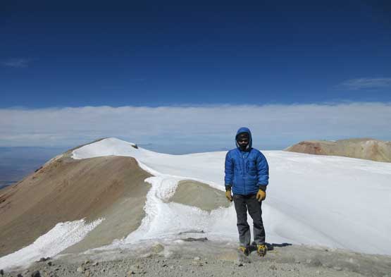
Me on the (south) summit of Volcán Iztaccíhuatl.
I was expecting a slow-than-normal pace on the descent but actual pace still impressed me. I was descending at below half of my normal pace had I climbed solo, but with the summit in the bag I was fine with that. My only concern was what laid ahead after the climb. There’s a time deadline to return the Alzomoni Hut’s key to Paso de Cortez by 7 pm the latest but it seemed like we could make it no matter what.. We had not planned what to do after returning the key, and it’s apparent that we wouldn’t be staying at the high altitude. The ideal plan was finding a hotel in Amecameca but there’s always unknowns. The earlier we could get down the better. There’s actually very little worth documenting about the descent, other than the view was pretty amazing throughout. I took a shit ton load of pictures for the sake reason of what else to do when I had to stop for every three minutes to wait. I did up my patience game and didn’t go ahead. Our round trip time was about 15 hours including the 2-hour stay in Grupo de Los Cien hut…
Descending the steep arete immediately below the south summit
A zoomed-in shot of another Mexican climber descending
Lily plodding back across the endless ridge stretches
This is one of my favourate shots from this trip…

Descending a loose ramp onto the lower field of glacier

Onto the first field of glacier. The path/trench is waist deep at places…
The 50-meter elevation regain off the glacier was the most exhausting part.
Finishing the elevation regain. This stretch sucked a lot of energy from us
Downwards again. The view is simply massive from this ridge complex
Me having a lot of fun on Iztaccihuatl..
This bit of terrain is very chossy.
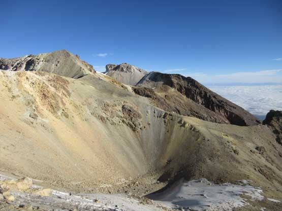
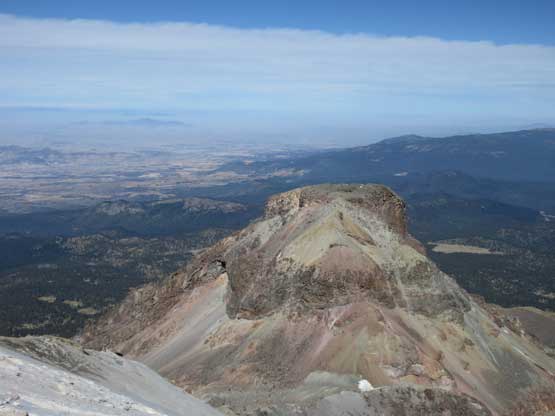
It seems like there are quite a few craters on this volcanic massif
Oh well. Another major elevation regain to get back onto “the knee”
I liked the cloud composition of this photo
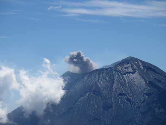
Popocatepetl was constantly erupting while we were climbing/descending
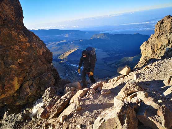
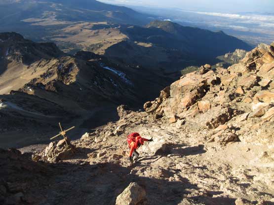
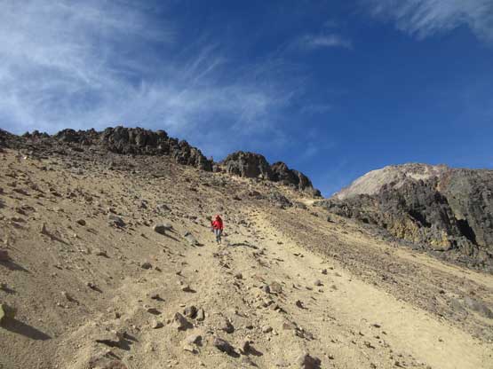
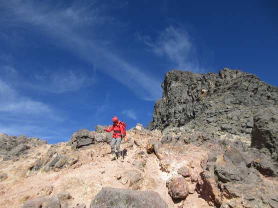
An inexperienced group of climbers struggling on Class 2+ terrain
Lily descending the same Class 2+ terrain. This part is considered as the crux.
Cool clouds formation to the east
Back to Grupo de Los Cien Hut. Photo by Lily Q.
Looking back at the long ass scree/scramble slog onto “the knee”

One of the many cols that we passed on descent
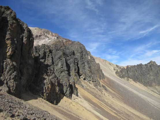
I was surprised to see some major cliff bands on this volcano
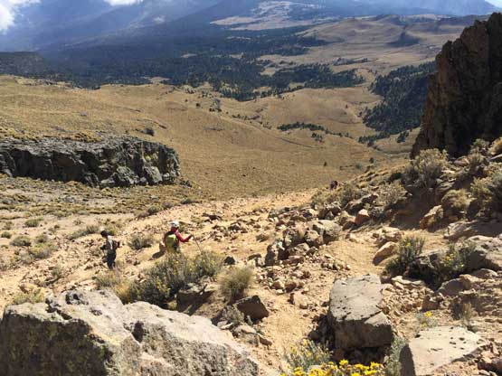
Plodding back towards the “third saddle”
Another photo looking eastwards showing some afternoon clouds
Plodding downwards from the “third saddle”
Traversing high above the desert floor.
From the “second saddle” looking down. This part is very steep.
One last look at Popocatepetl
The descent seemed to drag on forever…
At the parking lot at La Joya I found the Arizonian climbers who turned around at the first glacier due to the force of wind. They described the wind as “something they had never experienced before” so the decision was understandable. It was still impressive that they made that far up with the lack of acclimation so we gave each other congratulation before resuming each of us’s own way. Back to the parked car Lily just showed up, and I rushed to complete the post-trip parking lot routine in an amazing time. I was not looking forward to another slow transition so once the boots’ changed and the packs thrown in the car I immediately started the engine. I ate some food and fruits while driving down the rough dirt roads and another hour later we got back to the park’s office. Thankfully the staff was still there and we got the hut’s key returned and our ID cards back. Without doing any unnecessary lingering I immediately drove down the winding road and then into the city of Amecameca aiming at the biggest hotel in the city.
As frustrating as it seemed the GPS directed me into the downtown area with horrible local traffics. Trust me, I swore a ton. I abandoned the idea of staying in Amecameca because it seemed that I did not have the driving skills to successfully negotiate the downtown area, so we turned around. The next decision was to have some food in Ixtapaluca’s Walmart before deciding what to do next. We were losing daylight time now and the second half of the drive was done in dark. The Mexican roads sucked with lots of unexpected situations on the road surfaces – big speed bumps or potholes that kept threatening to destroy our car. I almost crashed into a truck at a merge because the lanes weren’t visible at all… It was such a gong show. By the time I finally parked the car at the Walmart I was glad that we escaped this stretch without an incident. The next problem arose soon as all fresh food in the Walmart was sold out because this was New Year’s Eve… I started to lose my patience at this point and started to swear a ton, but we had to make a decision. We frustratingly asked the locals where’s the nearest restaurant but the communication was done entirely on Google translation because none of us spoke any Spanish. What we got was more frustration. Back to car we simply pulled my Reactor out and cooked some Mountain House meals. As homeless as it seemed this was the dinner we had on New Year’s Eve, to celebrate our successful climbs of Pico de Orizaba and Iztaccihuatl… We still had to find somewhere to stay overnight. Lily found one hotel nearby and I managed to gather enough courage to drive another 10 minutes to get there. None of the staffs spoke any English to add to our further frustration, but Google translation did its job (sort out) again, and we got two rooms booked… I eventually turned in at around 11 pm after sorting all of the things out, after being up for almost 24 hours since we “woke up” at 11:30 pm in the previous night in Alzomoni Hut. My day wasn’t done yet as I made a long phone call to deal with some city-life issues, and didn’t fall asleep until almost 4 am in the morning.. Thankfully we could sleep in till 10 am and the checking out was 11 am the latest..
The trip continued with an ascent of Nevado de Toluca on Day 8, and Cerro Ajusco on Day 9.
