Mount Neilsen
June 18-19, 2021
2671m
Lytton / Kwoiek Creek, BC
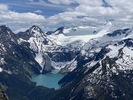
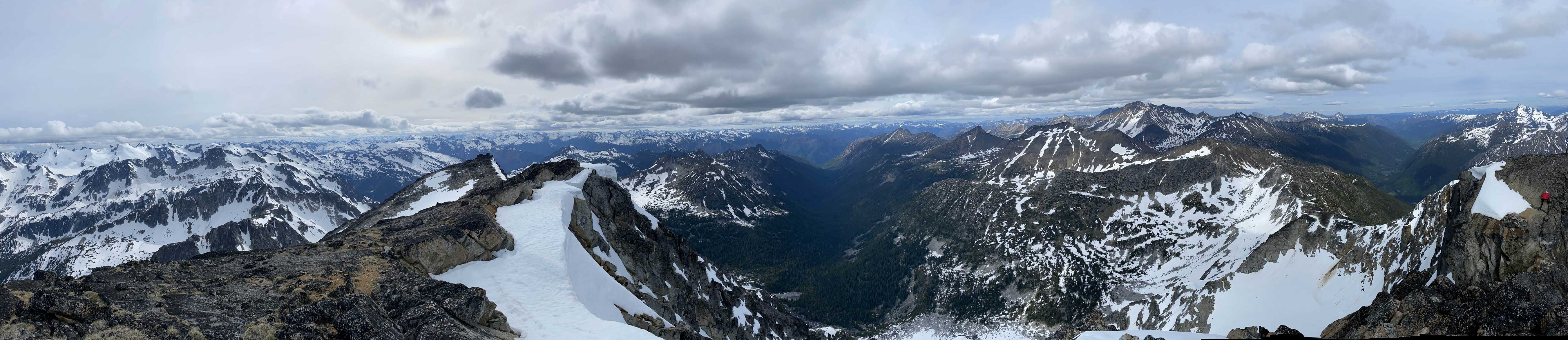
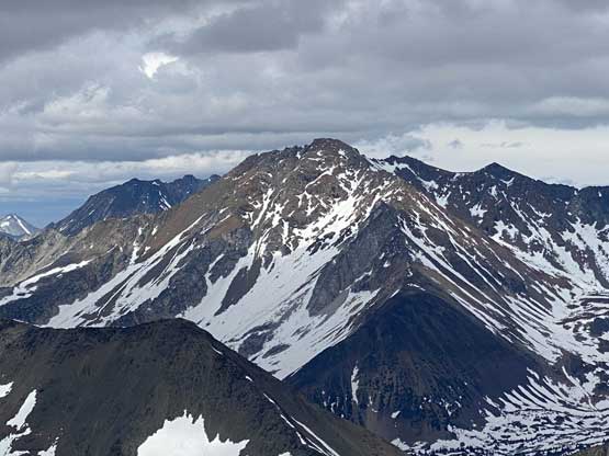
Mt. Neilsen is an elusive objective in the headwaters of Kwoiek Creek in the middle of literally nowhere. This area is extremely difficult to access since the deactivation of the access road including the pull of two key bridges that a foray into the upper Kwoiek Creek valley has now become a rare feat. The summit of Mt. Neilsen might have only a handful successful ascents in history. This peak boasts an iconic north face that’s recognizable from a lot of places but only die-hard peak-baggers would bother to figure out how to get in.
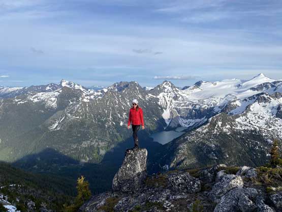
I would do Mt. Neilsen in its own over 3 days but the most logical way was to make a traverse from Skihist Mountain. The summit of Skihist Mountain, highest in SW BC, would be a much easier sell to friends and then it’s not that hard anymore to convince them to extend the trip by one day. That was the exact case how this trip had evolved. Vlad, Holly and I had four days of food to make sure we definitely could bag Skihist Mountain but things went too smoothly that we were far ahead of schedule. I threw out the idea to traverse towards Doss Peak and Mt. Neilsen during the trip and they agreed. I did not do my homework for this objective but I was more than enough confident that we could find our way up the east ridge. I was aware of one trip report on bivouac.com but that trip report was full of paragraphs of text with hardly any picture inserted in such that my eyes hurt to read. All I needed to know was the route they took (East Ridge) and the difficulty (class 3/4). I did not read the part that they didn’t make the true summit and in fact, to reach the true summit required down-climbing a notch with a few moves of mid 5th class (or class 4 by old school standard). I was glad of that because otherwise we would not have made this attempt.

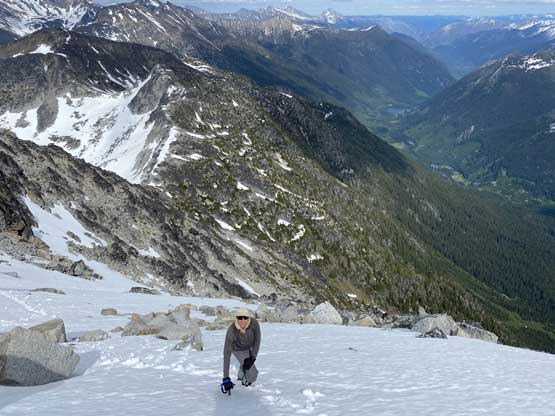
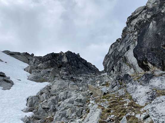
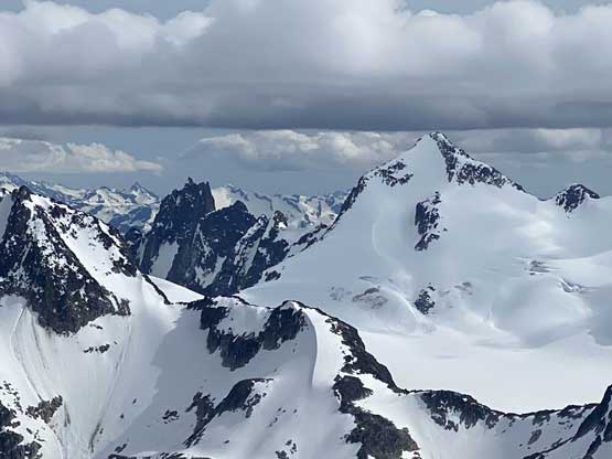
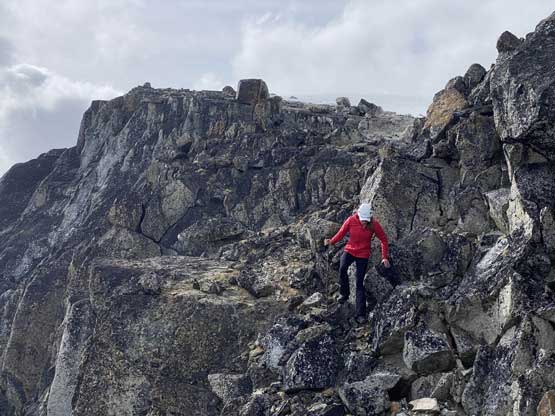
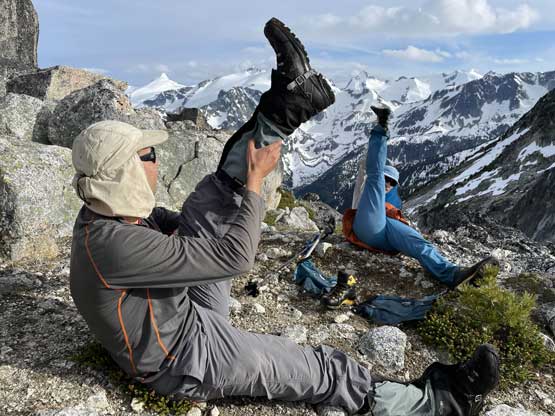
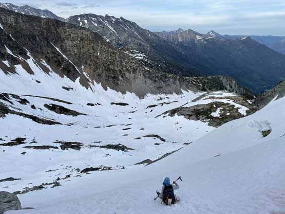
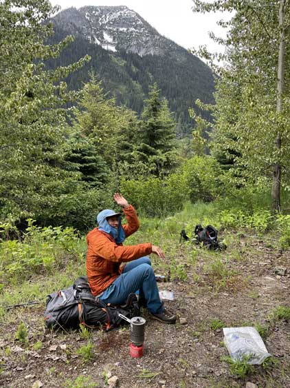
This was already 2 pm on the 3rd day of our trip. We had ditched overnight gears at an island of dry boulders and decided to only carry one backpack with some gears (ice axe, crampons, food and water). I volunteered to carry this pack and it’s just as heavy as my overnight pack. It turned out that we used all the gears and food we had brought so we didn’t waste any extra energy. To gain the lower east ridge Vlad led up snow chute (35-40 degrees) and from there we easily ascended to a subsidiary bump that must be traversed up and over. Descending this bump involved over 100 m cumulative elevation loss and route-finding in micro-terrain. The rocks were beautiful granite for a change. At this point we already knew that this peak was going to be harder than expected.


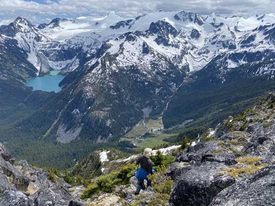


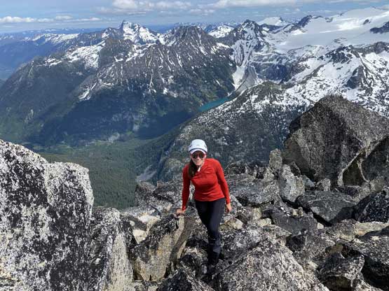
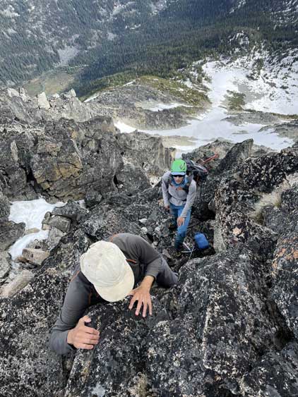
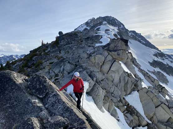
From the lowest saddle between the sub-peak and the main peak proper we then scrambled a series of snow fields and boulders for a few hundred vertical meters without encountering any notable difficulty until a steep section of the ridge forced us to bail onto a hanging (unsupported) snow field on climber’s left side. It’s possible to scramble the direct ridge line but with snow it looked hard. The snow slope however, was easy to traverse/ascend with ice axe and crampons, although the gear transition was kind of awkward. Once exiting this snow section we then scrambled easy albeit loose boulders to get back onto the ridge crest and immediately after that we encountered unavoidable 4th class terrain. Thankfully the steeps were short-lived. More 3rd class scrambling with route-finding was required to reach what appeared to be the summit but actually not.


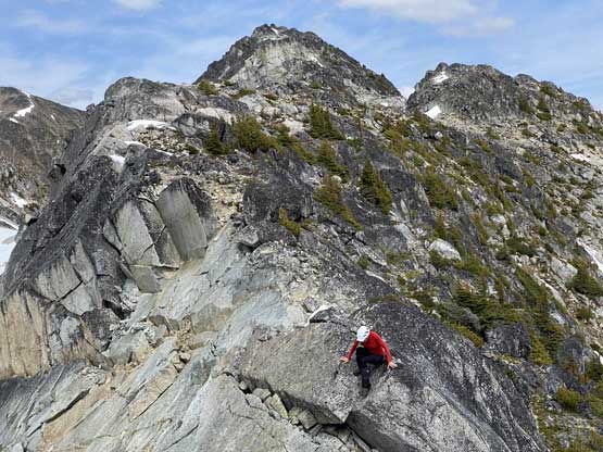
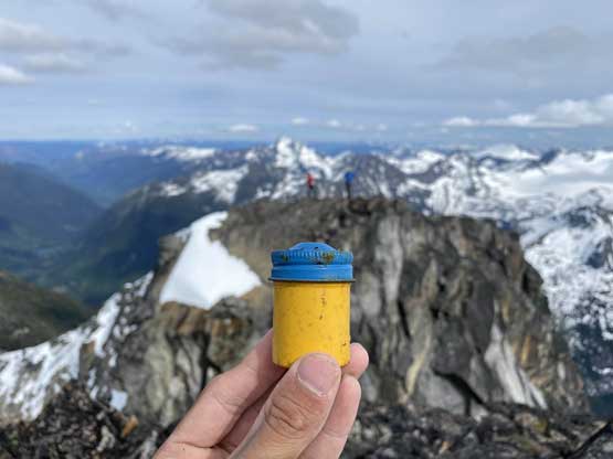
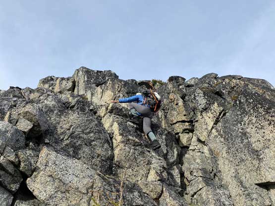
While staring down into the gap between the false and true summit I had a feeling that we might get shut down. I immediately dropped the pack and committed to the down-climb. A few moves later I lowered myself down an awkward step onto an exposed position. I tried hard to keep lowering myself but there appeared to have 1 m of air to reach the next “hold”. It was a tough call but I decided to scramble back up. Even getting up that upper step was not easy. I then looked around and decided to explore the south face side to see if there’s a possible way to work around this gap. It sure looked possible but a detour on loose terrain with at least 50 if not 100 m elevation loss would be involved. Vlad and Holly were happy with the false summit but I insisted on sticking my nose into the south face despite that I was already exhausted. Thankfully the descent into one of those south face gully was only class 3 on choss (which was exactly where my expertise was) but I did have to lose close to 100 m elevation. I then re-slogged the chossy gully to get back into that false/true notch followed by a 4th class scramble to gain the true summit. I found the first ascent register but could not open it. The cap was seriously rusted. I thought about to bring it back home but I decided to just leave it there for the next party to open (which would be in another 10 or 20 years or more).


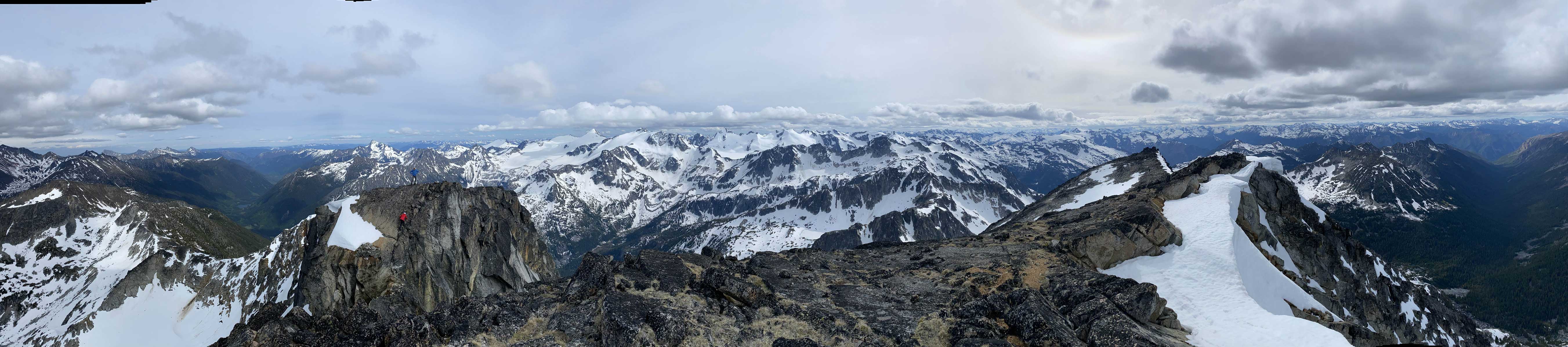

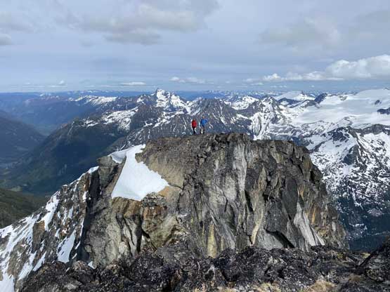


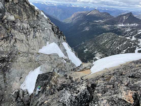
I gingerly down-climbed the summit block back into the notch and stubbornly decided to try scrambling out of the notch. I found out that one key foot hold was invisible from above but with that hold, the climb seemed to be possible. I felt like I must commit to at least two or three moves of mid 5th class but if I succeed I could save almost 100 m elevation gain. I spent about 10 minutes trying out the reach to make sure I definitely would make these moves because once committed there could only have two results: up-and-finish, or fall-and-be-rescued. In the end I gathered enough courage to make that initial stemming move using down-sloping friction holds and did manage to link up the next couple moves. Climbing up that upper step now felt like a joke and I got that done in a few seconds.
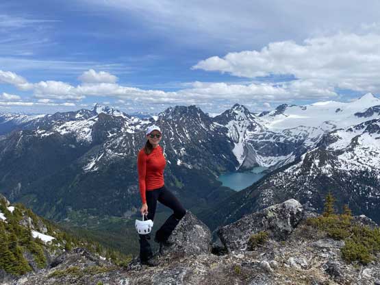
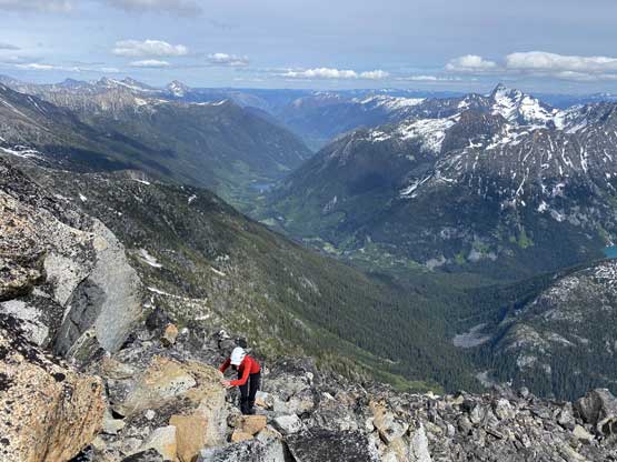
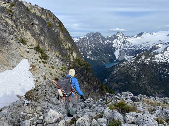
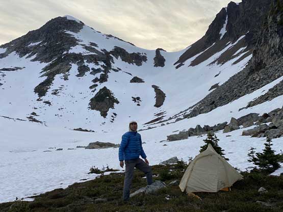
I took another break on the false summit and then the three of us decided to descend. There were still some interesting terrain that we must pay full attention including one challenging step and one exposed snow field. We more-or-less used the exact route we took on the ascent and the view looking back towards the main summit was pretty impressive in the evening lighting. We did however, take too long on this peak that a descent into the Kwoiek Creek valley was no longer feasible on this day, but that’s okay. We found a nice spot to set up camp just before dropping steeply into the valley. The night was not cold, but decently windy.


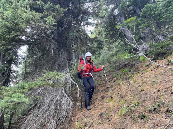
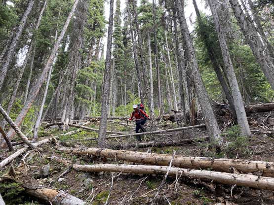
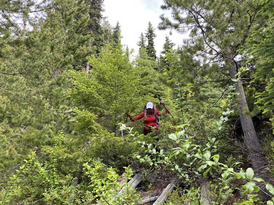
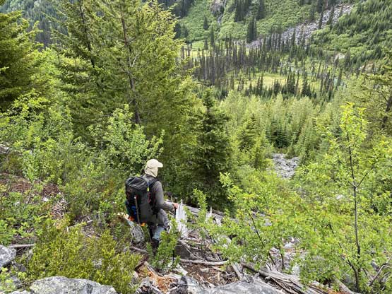
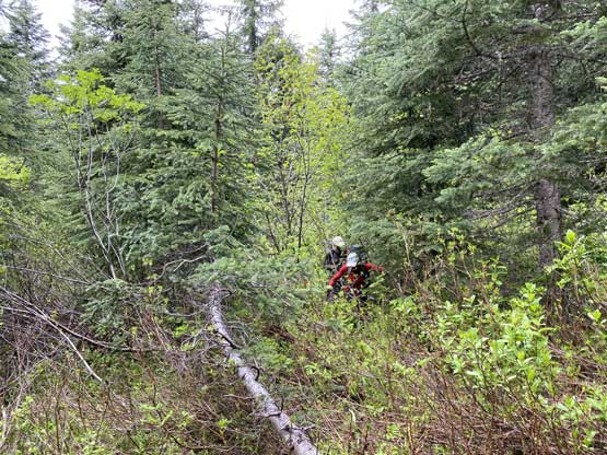
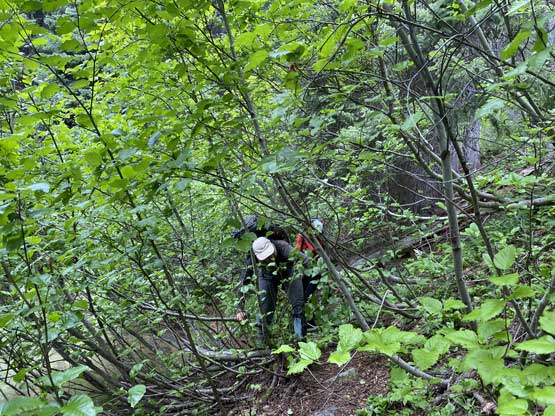
The next morning we woke up at around 6:30 am and it soon started to rain. I had concerns about Saturday’s forecast and it sure did not disappoint us. I thought this day would become a survival fair to bushwhack the whole way out in rain. We made the call to skip breakfast as cooking in rain and wind would be insanely miserable. Needless to say, our moods were not high when starting down that steep, 1000 m forest. The rain thankfully never became worse and stayed as “light drizzling” for a couple hours and though wet, the water did not seem to accumulate onto the bush to soak us. The forest was not too bad to descend but did involve fair amount of underbrush and pick-up-sticks that going up would be harder than the ridge we took on the way in. Lower down we also encountered some bluffs and boulder fields that required careful route selection. The upside was that we avoided any significant thrashing in alders nor bramble type of plants. And by the way, the mosquitoes were just horrendous as on the way in as soon as we dipped below 1800 m elevation. The bugs did not get any more merciful than a few days earlier.


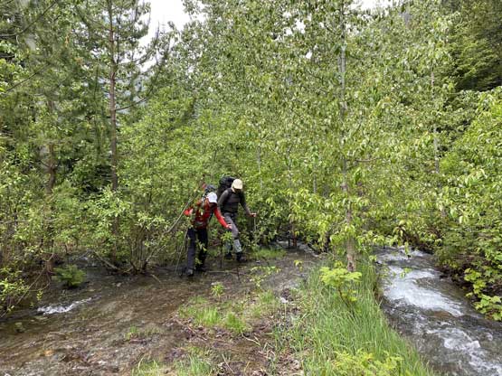
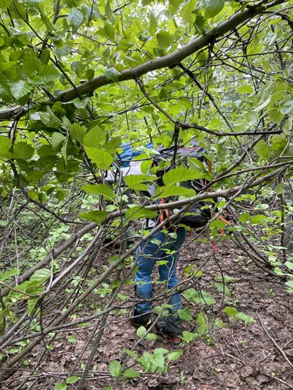
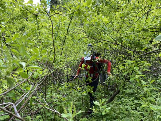
I had worries about this next few kilometers on Kwoiek Creek FSR being too bushy to walk on but it turned out not too bad. The rain had stopped and we cooked our delayed breakfast after crossing a creek despite the mosquitoes as we all ran low on food and energy. There were a few intensely bushy creek crossings but for the most part we were able to dash down the road without being slowed down by the bush. We did however, have to constantly touch the alders. A while later we passed the location of our first camp and the next notable spot was the end of FSR and the start of the horrible bushwhack back around Klept Lake. The initial few hundred meters felt like sustained BW4 even though we were pretty much on our ascent track. We must have felt really tired and desperate at this point. The rest of the return back around John George Lake also felt harder and longer than what we remembered. Near the very end I made a call to bushwhack straight towards our vehicle instead of repeating that bad section around the east shore of the lake. This new variation was literally shit and would not be recommended but that being said, that short east shore thrashing was also shit so pick your poison. This approach is not the worst I’ve done, but also not for the faint hearted.


After washing our faces in Kwoiek Creek at the spot where the bridge was pulled we immediately committed to the drive. We were still not home-free yet as I must get us out of this bushy road without encountering vehicle problems. I managed to only snag two pieces of alders into the wheels (one required to use a hand saw to cut it in half). After what seemed like eternity the constant pin-stripping had stopped and we were back at Kwoiek Lake and another eternity later we made to the junction with Keefers Road. The next section down Keefers Road was not as terrible as I remembered from a few days earlier probably because I just drove hours and hours on much-worse roads, but this stretch was still a slow show. I had to pull over a few times to take breaks for both myself and the truck. Eventually I did manage to get us out of the crappy forestry roads back into Boston Bar and the next stop was food in Hope. I ate one full length Subway in addition to a Chili soup in Tim Hortons and still felt hungry. This trip certainly involved massive physical and mental effort but pulling off Antimony, Claimpost, Skihist, Doss and Neilsen in a single batch of grab in the first try was also a massive success. I swore I would never drive this road again but now I’ve already started to plan the next forays.

