Gate Mountain
September 27, 2020
1430m
Boston Bar / Fraser Canyon, BC
“Gate Mountain” is the unofficial name of a rounded summit that rises abruptly above the Hell’s Gate not far from Boston Bar in Fraser Canyon. This peak offers some neat mid-elevation views of the canyon, but the peak itself is dull and forested that raises very little mountaineering interest. There is a “trail” that goes all the way to the summit from the highway, but the status has become very overgrown and difficult to follow in the recent years. It’s essentially a bushwhack now but with a path and flags here and there to mark the route. The abandoned status is very unfortunate as this trail apparently has some history and is included in Stephen Hui’s 103 Hikes in SW British Columbia. Another fact about this peak that attracts peak-baggers is the prominence. It’s a “P2K” objective in the BC Cascades.
Alex and I had been talking about to get out on Sunday even though the weather was not the most ideal. There had been a few days of downpour in a roll and Sunday’s the first day the rain would stop, but the clouds wouldn’t totally clear up yet. Ideally we would pick an objective that involved no bushwhacking, but it’s hard to come up with such objective that neither Alex nor I had done. I picked Gate Mountain fully knowing the overgrown status of the trail. Alex’s one partner who doesn’t mind suffering so I figured it’s better to tick off an objective that wasn’t the most enjoyable nor exciting. The driving direction for Gate Mountain was also easy as it’s entirely on paved roads. Alex picked me up at around 7:30 am in the morning and we made to the trail-head in just over 2 hours.
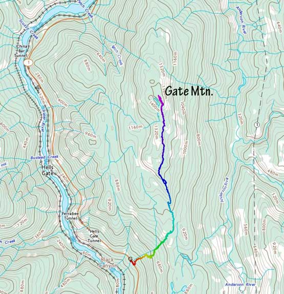
Gate Mountain hiking route. GPX DL
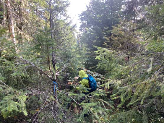
Locating the start of this trail was the first crux of this hike. This wasn’t that difficult nowadays with the GPS technology but I could see how difficult it was in the old days. The trail literally started at a spot that none of us expected it to start at, and the initial stretch was very faint. Asides the GPS track our only assurance was the occasional flags. The trail condition improved once we entered the mature forest, but only lasted for a couple hundred meters of gain. We lost the trail in a jungle mess just under 600 m elevation and were forced to bushwhack straight up. The vegetation was extremely damp with liquids weighing down the leaves that we were soaked to the bone in no time. I wore my snow pants and still got soaked to the bone. Once we regained the “trail” we still had to deal with a decent amount of “on-trail bushwhack” as well as confusing route-finding. Eventually we came to a junction with a “campsite trail” and turned left. The “viewpoint” was reached shortly after, but thank to the fog we couldn’t see a damn single thing.

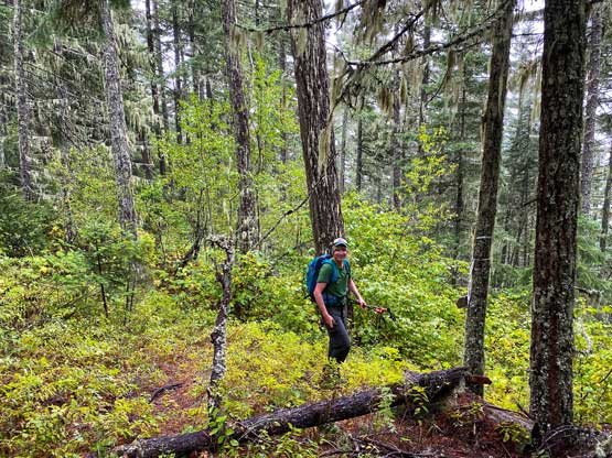
The typical trail conditions on the lower 500 m gain
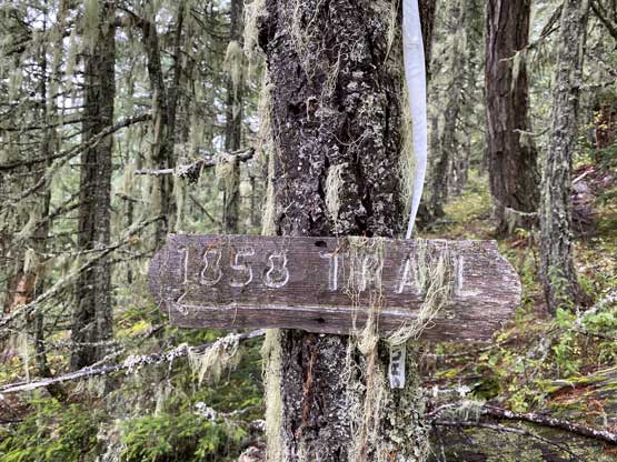
Not sure what this year meant here at the trail junction
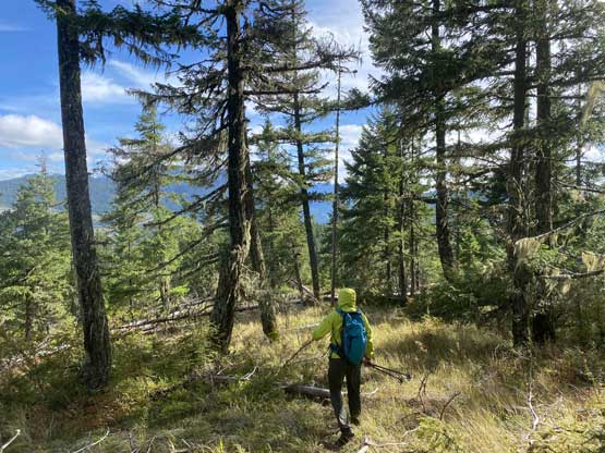
We got confused again immediately after that “viewpoint” but the GPS directed us back on track. The trail seemed to detour a ways climber’s right of the ridge/plateau but wasn’t too difficult to follow, at least for this section. The trail then joined the uppermost piece of an old and overgrown logging road and we followed the road to its very end. The trail beyond that old road stretch was still overgrown and confusing that we got further soaked and also lost the trail several times. It was downright miserable. At one point the trail no longer followed the ridge crest and instead, made a traverse to the east side of the undulating ridge crest and onto more micro-terrain and up-and-downs. The ridge seemed to drag on forever that my mind and body had both gone numb. On the last stretch to the summit we lost the trail again and just took a bushy route. The first thing I did when reaching the summit was to take my soaked shirt off. I unfortunately did not bring a dry shirt to change, but at least I had a rain jacket to keep me (sort of) warm. The sun did show up but the fogs didn’t quite lift to reveal distant views. I ended up shivering for at least half an hour before regaining some strength through eating food and drinking water.
Alex still trying to smile in the damp mess
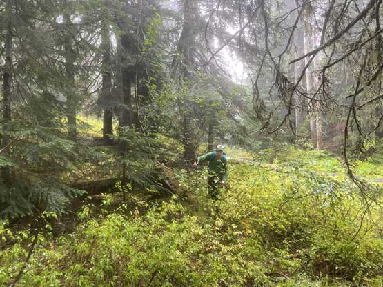
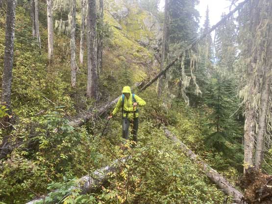
The typical conditions on the upper ridge section. This was shit

Me on the summit of Gate Mountain
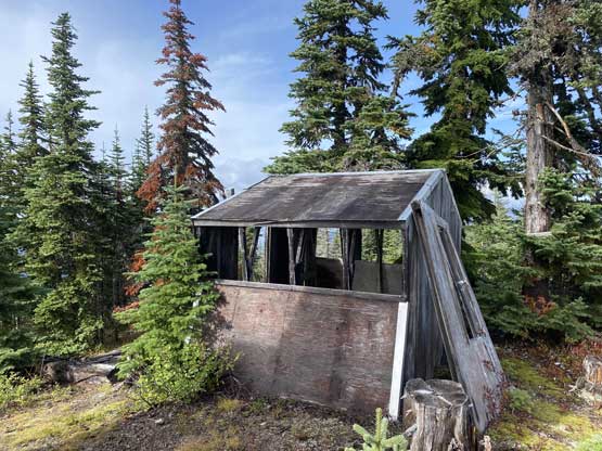
There’s an abandoned hut on the summit

A view from inside the hut
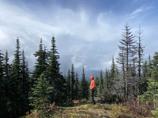
Alex on the summit soaking in the “views”

Some clearing towards north, but not enough to see distant peaks
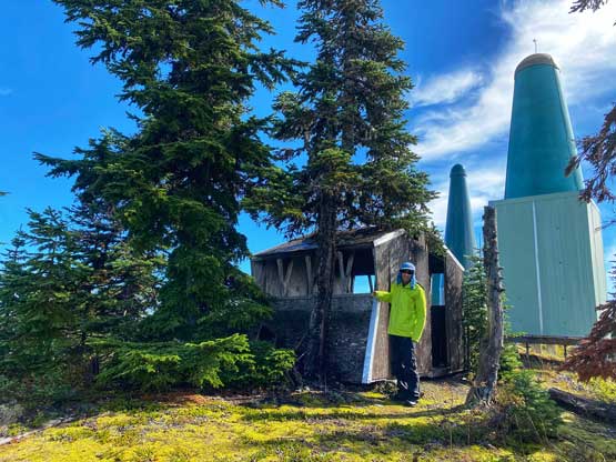
Me posing in front of the hut. Photo by Alex R.
We stayed on the summit for at least an hour hoping for some views but to no avail. We then committed to the descent. I wore the rain jacket for the whole way down and felt a lot better. We also managed to correct the few spots that we got off-route on the ascent. Lower down we got more views at the “viewpoint” so took another half-an-hour break. The rest of the descent was fairly uneventful. We tried to find the trail through that section under 600 m elevation but failed. That stretch turned out to be the only spot that missed the trail on both ascent and descent.

Alex starting the descent
One of the really shitty stretches. It was still very wet
A while later we came to a nice spot with views

Alex taking in the mid-elevation Fraser Canyon scenery

Back to that bushy old logging road connector
As you can see, this trail was literally shit…
The clouds had almost fully lifted now and it’s finally starting to get warm

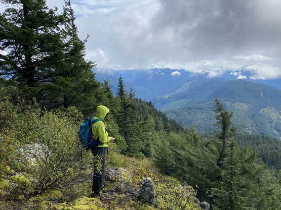
A view of Fraser Canyon

Alex taking in the views from that “viewpoint”..
On the way back home we made a tourism stop at Alexandra Bridge because we had some extra time to kill and none of us had visited that bridge yet. Overall would I recommend Gate Mountain? Hell no unless you just have to bag it… It’s especially not a smart idea in wet conditions. This peak is at least a Type 2+ fun kind of outing…

Alexandra Bridge

Another photo of Alexandra Bridge
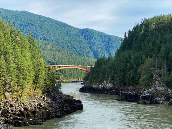
Fraser River from Alexandra Bridge
