The Battleship
March 11, 2017
1783m
Grand Canyon National Park, AZ
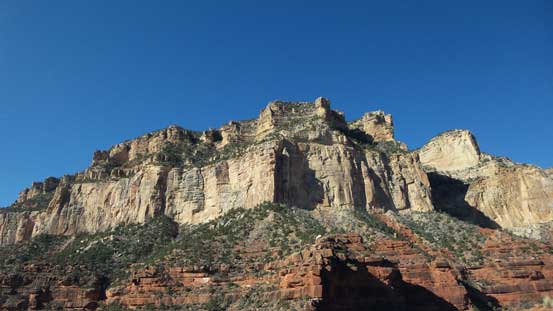
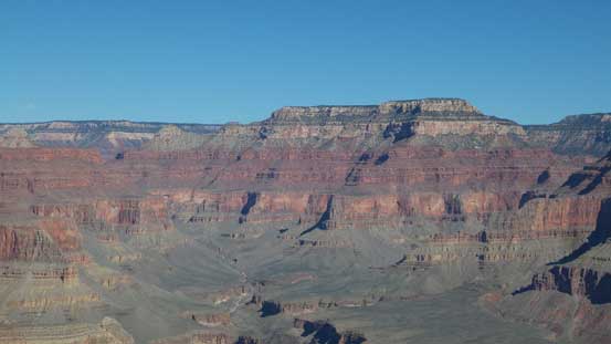
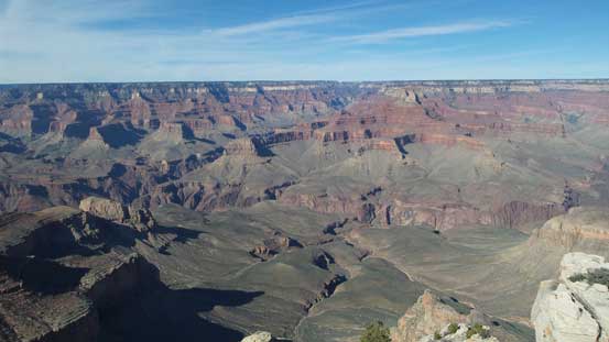
Simply gazing down from any viewpoint along Grand Canyon’s south rim one can easily spot hundreds of pinnacles, spires, buttes and castles that all seem pretty impossible even for the mountaineers. While most of them are indeed technical and probably yet unclimbed, there are some that make great scrambling ascents, and The Battleship is one of those. This is an impressive pinnacle dominating the backdrop if one hikes down the upper portion of the often-congested Bright Angel Trail. Among those who are curious about this peak, not many would bother to dig down on the routes and let along making a summit attempt. The easiest route goes at a mere Class 3.

The Battleship scramble route. GPX DL
This was my primary objective on the 2nd day of my Grand Canyon visit, also the 3rd day of this past spring break vacation. The day started from waking up at 5:00 am in the pitch dark in my car and after some quick breakfast in the MacDonalds in Tusayan, AZ I drove northwards back into the park. I was still very tired but at this point all I wanted was to see the sunrise over the rim of Grand Canyon. I parked in the visitor center and followed the gang to a nearby viewpoint called “Mather Point” and then waited for about half an hour. Unfortunately it was a little bit on the cloudy side so the sunrise wasn’t as spectacular as I was expecting.

Sunrise seen from Mather Point
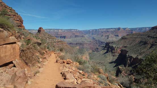
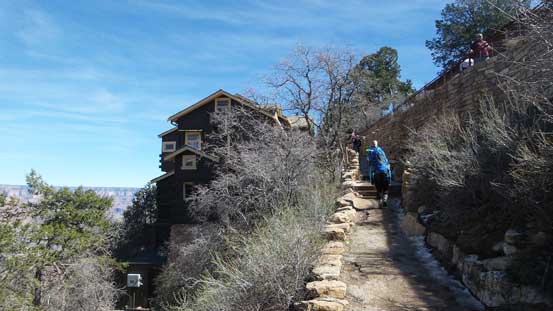
Once the sunrise show was over I drove to the far western edge of the village. The parking space by Bright Angel Trail was already full but I did manage to squeeze in a spot on a street not far from the trail-head. This trail was far well-constructed than what you would typically see in Canada. There were pavement, concrete walls, staircases, handrails, blasted cliffs, tunnels and you name it. It felt more like going to China for a hike although it wasn’t nearly as congested (in China you’d have to sneak through the hordes like in a supermarket). The upper portion of Bright Angel trail was icy and it’s interesting to watch the inexperienced struggling on the ice rink. I did fine on my sneakers without microspike and in short time the ice show was over. Passing at least 20 if not 30 folks I made quick work down to about 400 vertical meters below the rim where I was supposed to leave the trail.
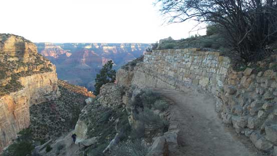
Starting down the Bright Angel Trail

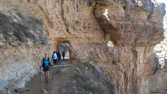
The first tunnel. Note the ice on trail.
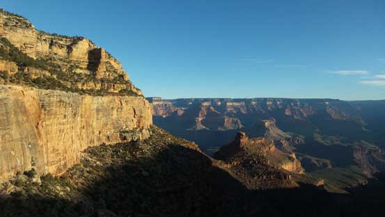
It’s going to be a gorgeous day ahead!!

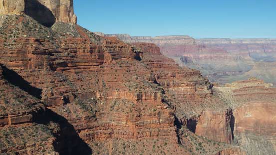
A zoomed-in view of my objective – The Battleship
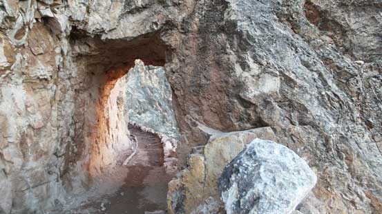
The second tunnel to hike through.

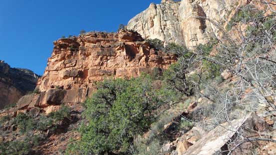
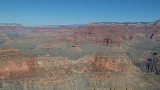
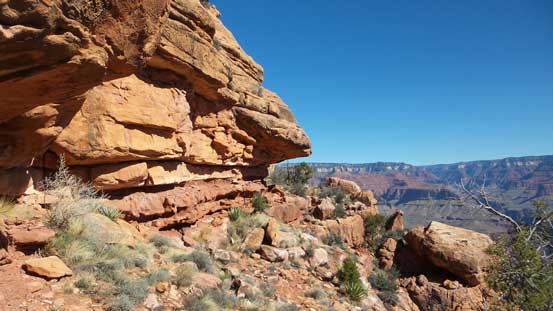
Impressive walls all around.

The Battleship.
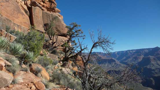
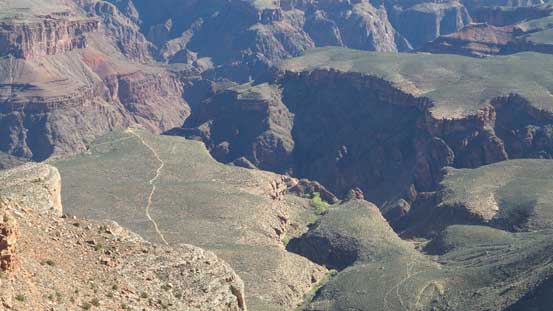
Here I took the first break of the day mainly to swap sneakers for mountaineering boots. The route would then follow a wide bench side-hilling for about 1.5 miles due north resisting to gain and lose too much of elevation. At this point I was expecting about an hour or two’s bush and scree fest but there’s actually a pretty good trail leading that way. The path along with the cairns made me impossible to get lost and on top of that, most, if not all of the bush and especially those prickly desert plants were cleaned. This was surprising as I couldn’t find much reference about this trail anywhere on the internet (are people here also have that secrecy thing to keep the goods “local”?). In any case, this section of side-hilling bash was far more pleasant than I was hoping for, although it’s still a long haul. There were about 5 or 6 bowls to traverse across and eventually it’d become a tedious process.

Starting the long side-hill haul.
This is the start of it. Believe or not there’s a pretty good trail to follow.
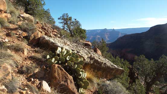
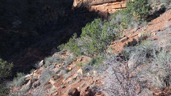
The typical terrain.
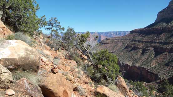
Looking back from one of the many bowls.
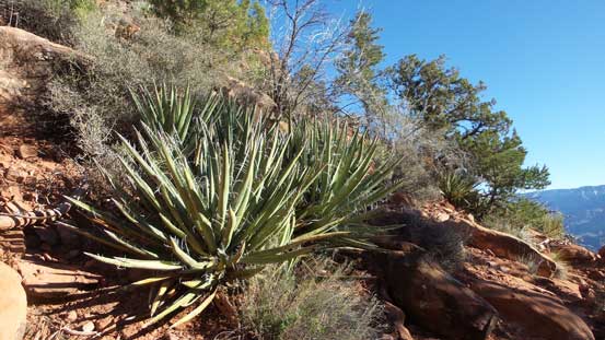
You don’t want to mess up with Agaves…

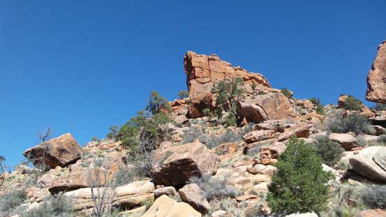
The Battleship is getting closer and closer.

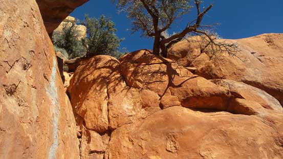
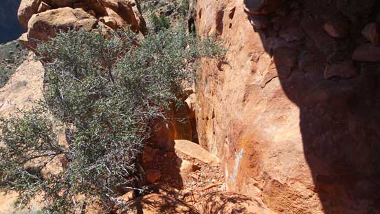
Ducking underneath an overhang.
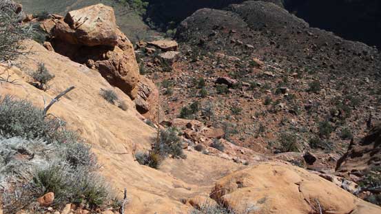
Finally at the base of the south ridge of The Battleship and here the correct route (also the trail) kept traversing the south then the south-east flanks without gaining too much of elevation. I discovered that on the return but on the ascent I couldn’t resist the urge to go high, so went more or less to the base of the cliffs from the south side. The downside of my route was more side-hilling along with some elevation loss traversing underneath the east-side cliffs. The correct ascent route is on the far NE corner so I’d have to skirt all the way around for nearly 180 degrees.

Finally made to the saddle
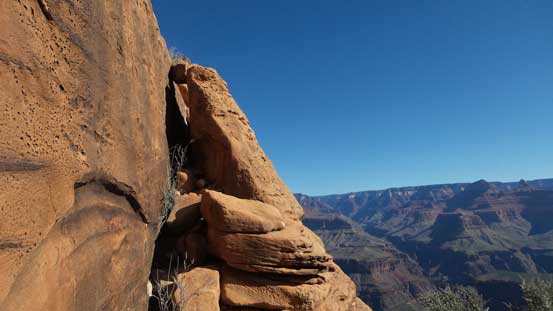
It’s obvious that I couldn’t go up the south side.
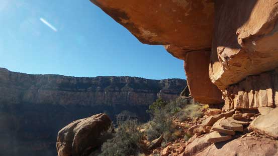
Looking back there’s great view of the cliffs underneath Powell Point
Traversing all the way to the far north-east side
Here’s the start of the route – the initial Class 3 step.
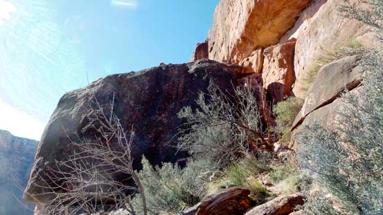
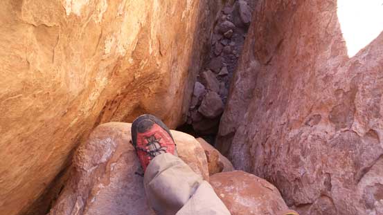
Eventually I located the route and then climbed up a short, but down-sloping 3rd class section. Right away I knew it’s not going to be an easy ascent as even just the start of it was not straightforward. Then looking back around a corner I spotted that tight chimney. The poles and backpacks were ditched upon inspection as there’s no way to fit them through. Apart from my camera bag which’s used to carry the camera, I have two pockets to carry anything. After deciding what’s needed and what’s not I opted to haul my GPS along with my tripod, then up the chimney I went. The lower part was pretty fun but the upper section pulling up that chockstone crux was not easy. It was rated “class 3” but some stemming techniques along with arm strengths are definitely required. Once the chimney was over there’s another short, but interesting 3rd class step before arriving at the “middle bench”.

This obvious “gap” is where I had to ascend.

Ascending through the tunnel.

This is the chockstone crux.
As you can see, it’s almost overhanging…
Exiting the chimney/tunnel.
On the “middle bench” I followed some cairns traversing a long ways due south ducking underneath some huge overhangs before the terrain eased off. Some easy Class 2 sections led me to the final obstacle – a smaller but narrower chimney. For this one I had to squeeze in and shuffle sideways across and then I arrived at the summit. I wondered around for a while and checked out that infamous north tower which was pretty inspiring to see..
Traversing a long way due south underneath this overhang
This is the upper and shorter chimney.
Almost there! I did not have to climb that crack.
It’s getting exposed at places…

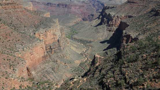
Looking down at the upper reach of Horn Creek draining into Colorado River
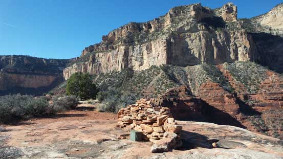
The summit “battleship” cairn and Maricopa Point behind
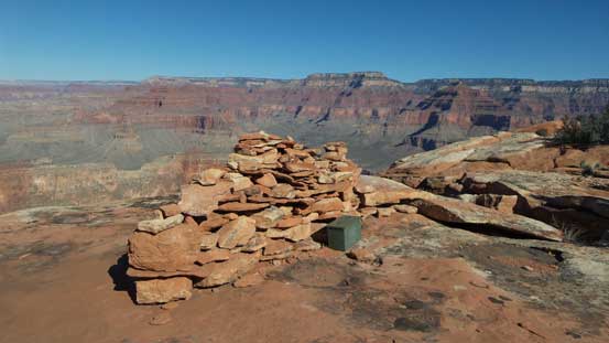
Another photo showing the summit cairn
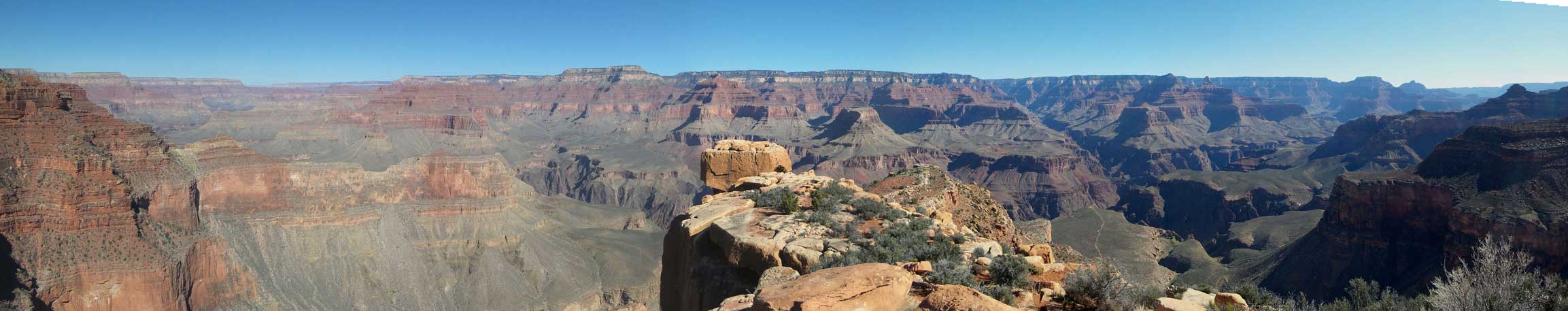
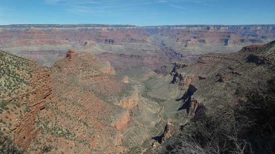
Summit Panorama from The Battleship. Click to view large size.

The head of the North Tower!
Looking sideways across the bands below Powell Point
Zooming-in far downstream into the Grand Canyon. Dana Butte in the lower foreground
Looking across the Colorado River towards the buttes on the North Rim side
You can clearly see a trail leading up Plateau Point
Cheops Pyramid in the foreground
This is probably looking at Shiva Temple

The summit register shows more entries than expected.
Me on the summit of The Battleship
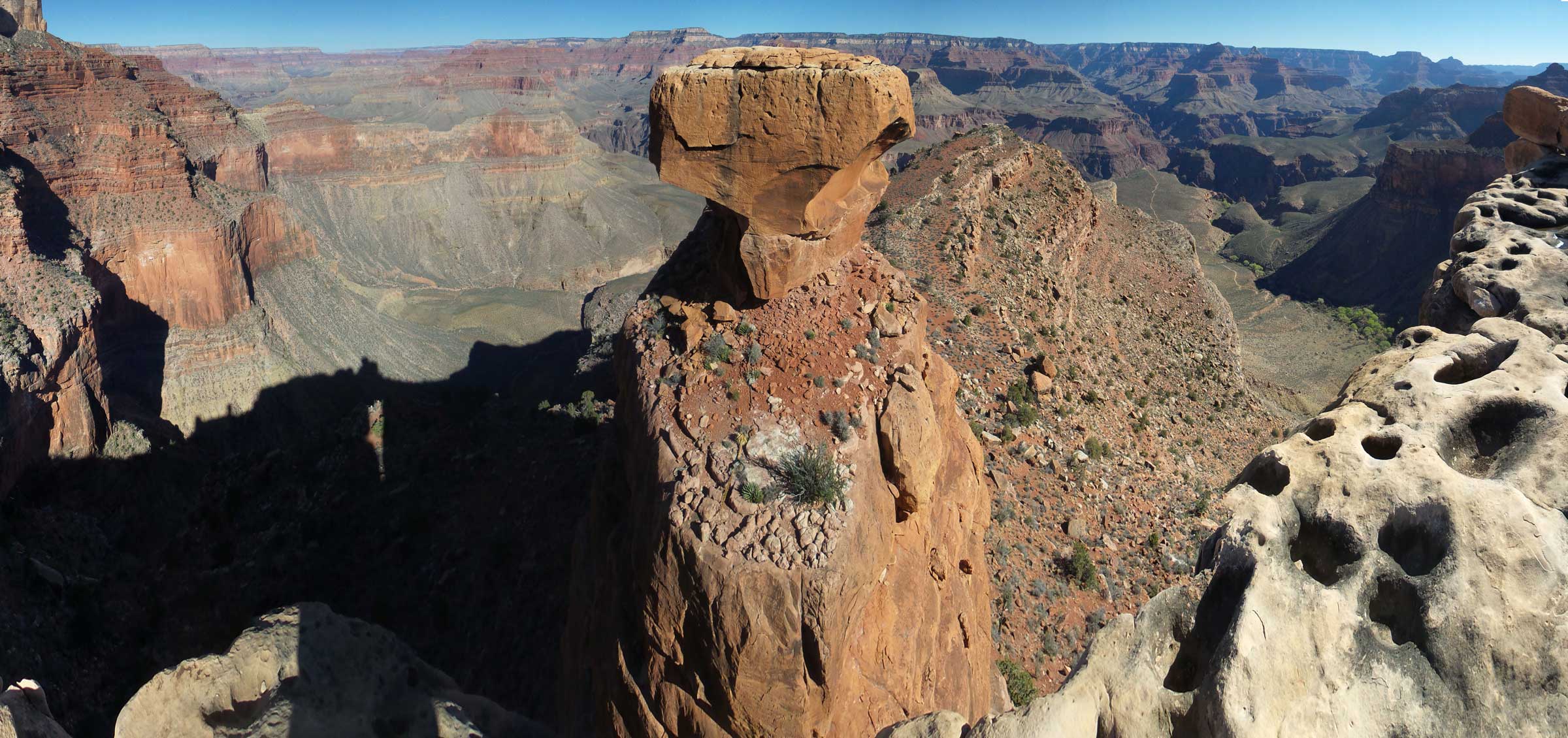
A full panorama showing the north tower. Click to view large size.
Having no food nor water meant I couldn’t linger too long, so after signing the register I started the descent. For the most parts I still had fresh memories where exactly I went up with the only exception near the upper portion of that chimney. It was a bit farther to the down-climber’s left (north) than I thought, but my GPS knew it better than I did, so got into the entrance without too much of wondering. Down-climbing the chockstone crux felt actually easier as now the gravity was on my side. Once back through the lower chimney/tunnel I picked up my ditched gears, down-climbed the initial step and then picked up the climber’s trail. I then followed this trail down and around traversing the south-east flanks of this peak rather than retracing my highline route. This automatically linked up the first portion of that trail. Going back across the 5 or 6 bowls was a quick process and then I was back on the Bright Angel Trail.

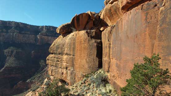
One of the pinnacles on the south ridge of The Battleship
Traversing back across that middle bench
Looking down from above the chimney
Then, skirted around the peak on a lower path than my ascent route

Back to the long side-hill bashing
The typical terrain..
Back to Bright Angel Trail now.
The final 400 vertical meters of grunt back to the south rim was not easy physically, but pretty fun actually especially when you pass all kinds of hikers on their way up or down. Park rangers also did their job maintaining this trail on a regular basis and I met two of them coming down just to dislodge an unstable boulder for everyone’s safety. Back to the south rim I then had to make a decision. The original plan was to ascend another similar butte but considering the temperature and my physical state I was not particularly motivated to push any further, but having the entire afternoon ahead I just had to do something. The first business was to cook my lunch (Turkey Tetrazzini, Mountain House package which I had brought down from Canada) as stuffs in the park are 3x more expensive.
Looking down, the lower reach of Bright Angel Trail goes down this valley

Grunting up…

The trail then switchbacks up through that narrow gap
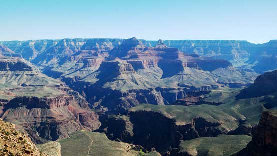
A wider view looking back down into the Grand Canyon.

Hitting ice again.

One of the many warning signs…

Up, up and up…
Through the tunnel.

Almost there!
The last few steps.

It’s lunch time…
Checking the brochure obtained at the park’s gate I noticed it’s actually possible (and free) to take a bus shuttle to the visitor center, so why not. From the visitor center I then took another bus shuttle to Yaki Point for some views. I wondered for about 1 km further just to get away from the hordes and settled for a 2-hour relax. I also took a nap there. Once I had enough of the views I took the bus back to the parking lot. I didn’t bother to watch sunset on this day and instead, drove to Tusayan for some much-needed food and rest.
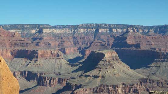
Expansive vistas from Yaki Point

Another view from about 1 km beyond Yaki Point. Vishnu Temple on the left skyline

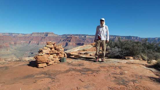
Me and Yaki Point views.
Overall for those scramblers happening to hike down the Bright Angel Trail I’d highly recommend The Battleship for a side-detour, although it’s not an easy one as those without climbing experience will for sure find that “class 3 crux” to be quite “interesting”… This peak also sees more visitors than what the simple Google search suggests, so I hope more could come to enjoy this little gem. Also, my impression for the tourism at Grand Canyon’s south rim is that 1-day is definitely not enough. There are simply too many things to check out and you’d want more time.
