Mount Folk
August 31, 2014
3085m
Bull River (East Kootenay), BC
Mount Folk itself is not an attractive objective. Buried deeply in the BC Rockies, one needs to drive about 100 km one way on logging road to access it starting from near Fort Steele (about 10 hours drive one way from Edmonton to the trail-head). So why would I do it? Well, it’s connected to the southernmost 11,000er, Mount Harrison by a high col. Obviously Mt. Harrison was our primary objective on this trip. We planed extra time to give multiple chances to attempt Harrison in case weather didn’t cooperate. Fortunately, weather cooperated nicely on the first day and we successfully had Harrison bagged. Now we had the entire trip ahead of schedule and on the second day we decided to sleep in till whenever we wanted. By the time we woke up it was cloudy but we still decided to go bag Mt. Folk because what else we could do… Technically it’s merely an off-trail hike so we shouldn’t have much of a problem reaching its summit.

Mt. Folk scramble route. GPX DL
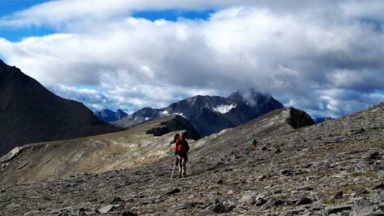
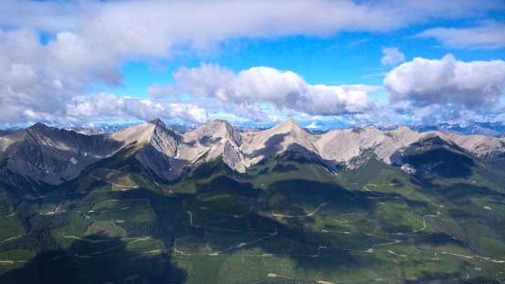
Slogging back to Harrison/Folk col did not sound very appealing so I listened to music to kill the time. Thankfully weather started to improve a bit as we got higher which also helped to boost up the motivation. Near the col we started to trend climber’s right steeply up some scree since all lines eventually would lead to Mt. Folk. Eric picked the smartest line staying low and further climber’s right. This line saved him about 10 minutes of time and some elevation gain. Ben, Vern and I stuck more or less on the ridge once our route joined the ridge proper. At this point we were treated with some great view of Mt. Folk itself, and looking back the north face of Mt. Harrison was impressive.
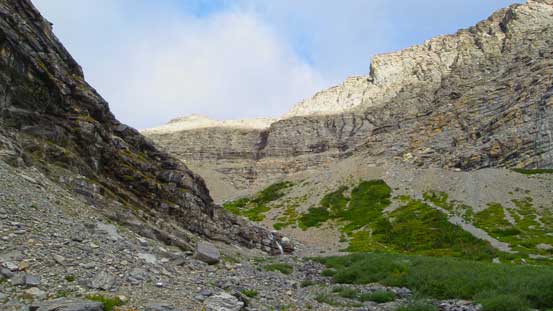
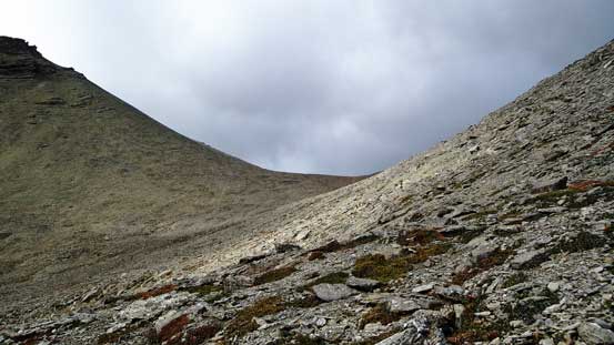
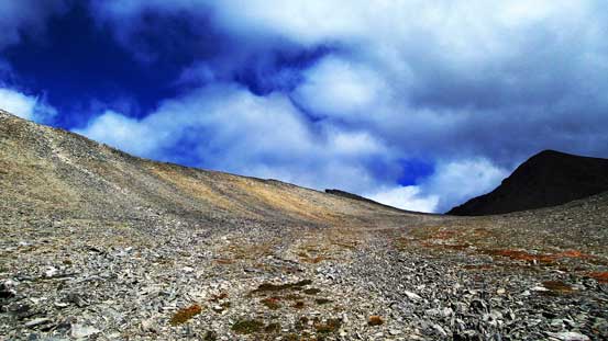
Leaving the camp and up towards Harrison/Folk col again
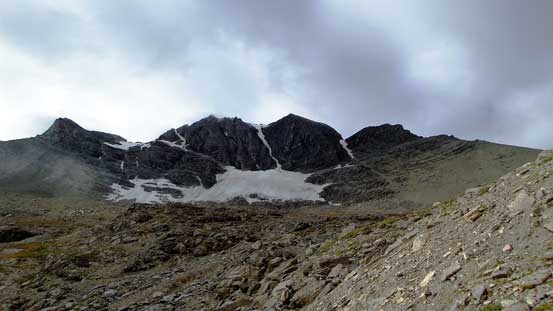
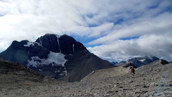
The north face of Mt. Harrison
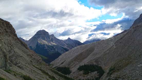
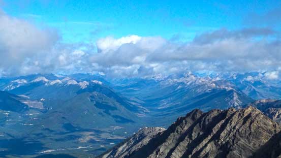
Looking back towards Mt. Splendid
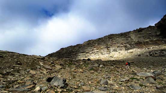
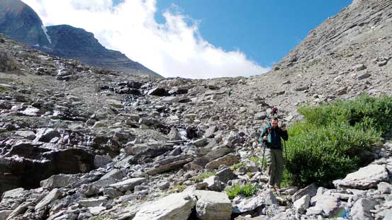
Typical slog
Ahead is the col, we didn’t go all the way to there
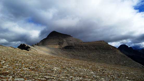
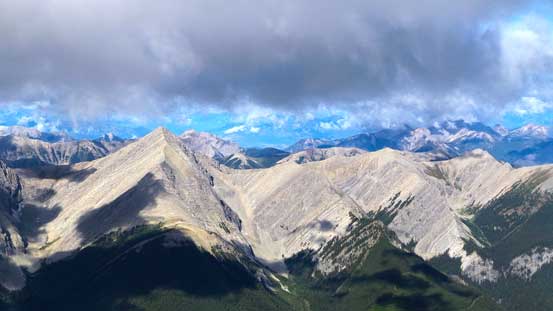
Veering right and slogging up a pile of scree, we started to see Mt. Folk

We gained the left hand side ridge
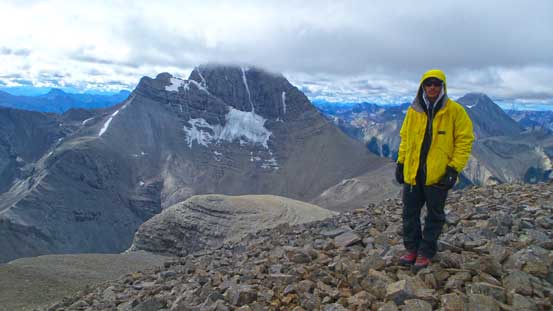
Harrison and Ben
Ben with Mt. Mike behind
A view of the range of unnamed peaks to the west
Mt. Mike again

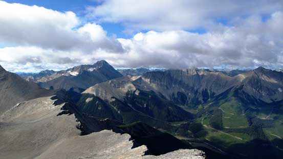
The best view from Folk is looking back towards the north face/couloir of Harrison
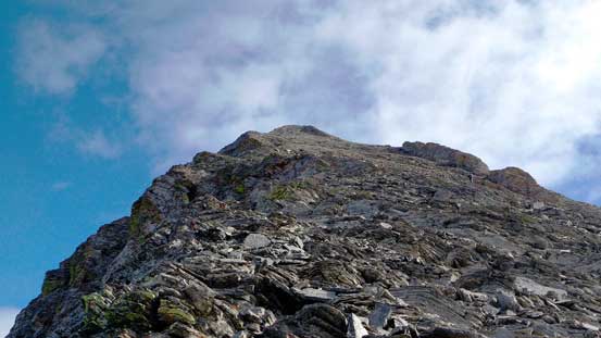
The last push towards the summit looked like a huge pile of horrible scree but wasn’t too bad. The slope was not as steep as it appeared but partway up Vern and I started to trend climber’s left towards the ridge anyway. We were treated with some good views and better rocks. The drop-off down the west side was huge! Our summit stay was short thank to the coldness.
Going up the typical terrain on the LHS ridge
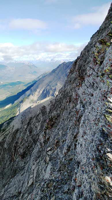
The west side was a shear drop-off

Vern on the edge
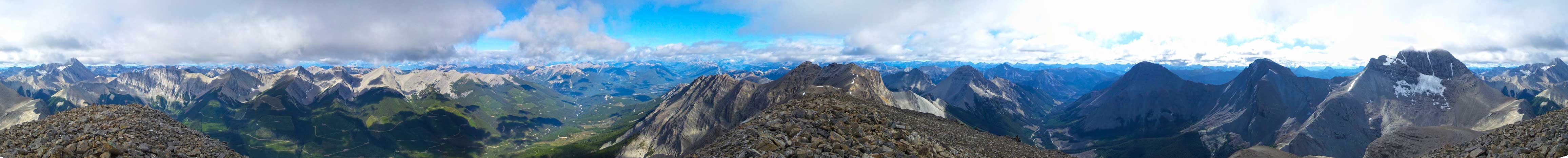
Summit Panorama. Click to view large size.
Looking north. The clouds blocked the view towards King George
The unnamed peaks again
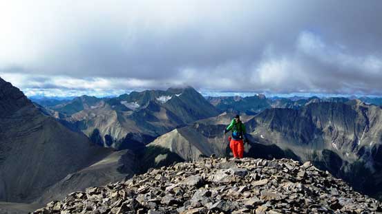
Vern cresting the summit plateau
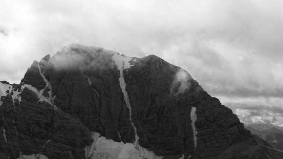
A zoomed-in view of Harrison’s north couloir
Me on the summit of Mt. Folk
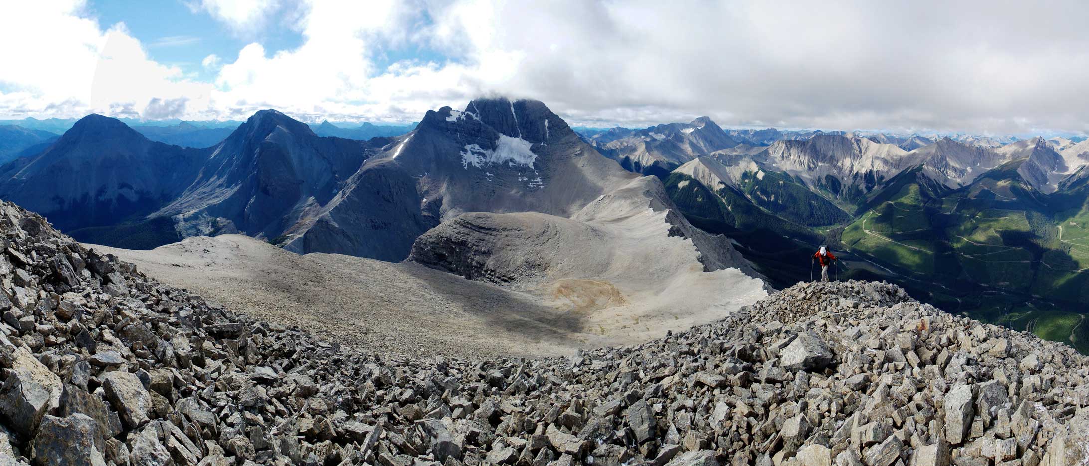
Panorama of Harrison and the approach ridge/slope. Click to view large size.
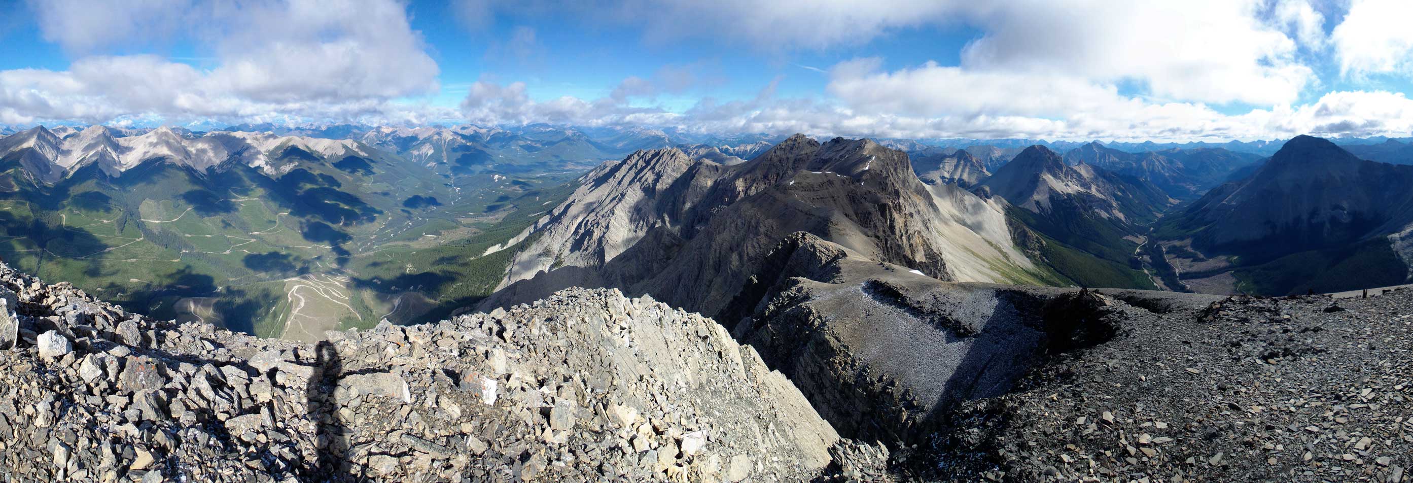
Another panorama from the summit. Click to view large size.
Going down we picked a different line following Eric’s route which saved us some distance and elevation gain. Than we leisurely walked back to camp. At this point we already made the decision to ascend Smith Peak on the following day and having the entire afternoon ahead of schedule we should knock the approach off on this day. After a well-deserved lunch we broke camp and started the return. While the return was not long it did involve some miserable bushwhacking. We thought we’d picked a better line by staying skier’s right of Harrison Creek but that avalanche debris field was huge. No matter what line we chose we had to deal with ugly dead-falls. Eventually we picked up the trail again and walked back to the truck.
Looking back from the descent
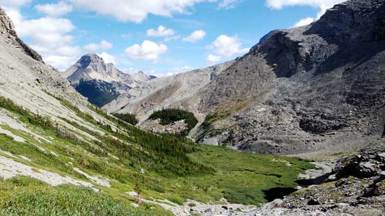
Our camp was down somewhere by the meadows/creek
Descending the typical terrain
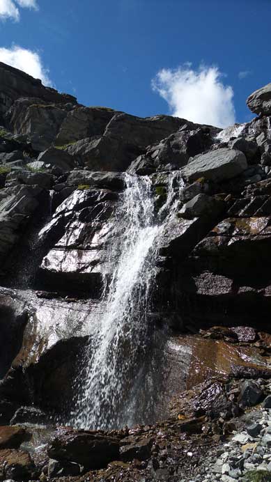
A waterfall

Now came the fun parts….
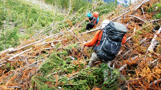
What a mess…
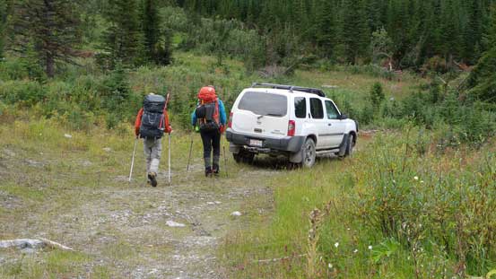
Back to the truck. 2 down, 1 to go!
The weather seemed to be stable at this point so it’s time to give Smith Peak a shot. Given what we just did in this past two days I was not expecting much in terms of views but rather just bagging a named summit. It turned out to be better than expected.
