Mount Alpha Centauri
July 6, 2015
3109m
Invermere, BC
This past week had been very busy for Ben and myself as we only had less than 1 day’s break between Ferenc’s Mount Victoria/Mount Huber 11,000ers trip and Eric’s ambitious week-long plan. There had gone a dozen changes for Eric’s trip slowly downgrading from the adventurous 6-day Tsar Mountain expedition, and at the last minute we settled on the Welsh Lakes/Catamount Glacier region in the Starbird Range, heart of Purcell Mountains just west of Radium and Invermere for some easy mountaineering, exploring and peak-bagging. This gem in the Purcells was also used as the previous destination for ACC general mountaineering camp. Our primary objectives would be Mt. Alpha Centauri and Gwendoline Mountain, two of the bigger peaks in this region.

Mt. Alpha Centauri ascent route from Welsh Lakes. GPX DL
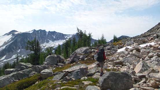
As usual for BC trips the driving is part of the crux, and this one isn’t an exception. The first 36 km along Horsechief/Forester FSR went by fairly quickly but the last 1.6 km up the side branch was not an easy task. It’s narrow, steep, rocky and very rough. Eric’s Volvo barely made it but got bottomed out once. A high clearance 4×4 is pretty much a must to drive this part. After wrapping around the Volvo with some brand new chicken wires we started the hike in – only 3.9 km to the first Welsh Lake on a well-defined trail so quite tame for our standard. The major bulk of elevation gain came towards the end up a steep headwall through some boulder fields.
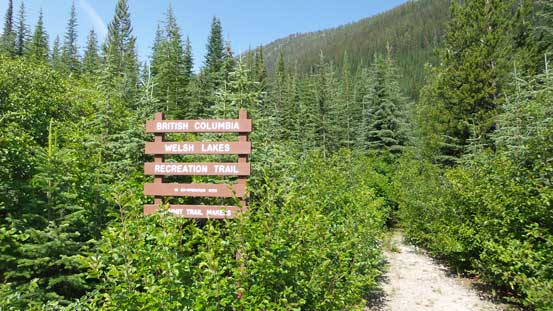
The trail-head sign

Ready to go. Note the chicken wires.
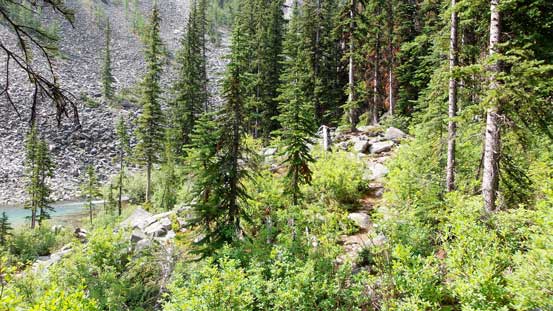
Following the trail up. I felt lack of energy so lagged behind quite a bit

Now came that boulder field. Thankfully there’s a path through it
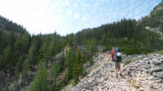
Following the path up
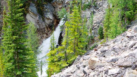
A neat waterfall
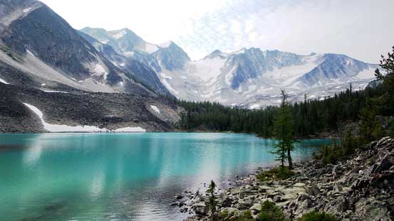
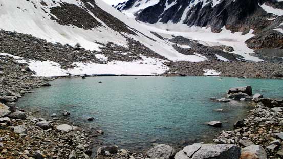
Finally arrived at the first Welsh Lake
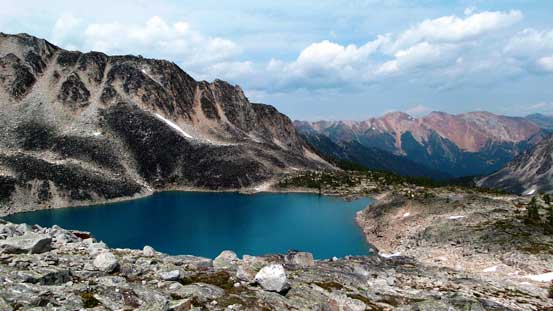
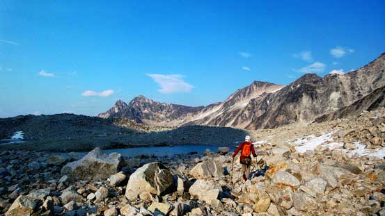
We were supposed to find a trail around the first lake leading towards the second lake, but for some reasons we couldn’t. We ended up gaining height steeply up climber’s right side on some game paths and checking my GPS I realized we were actually aiming for the higher Aberystwyth Lake. That was still fine though just with a bit of detour. From Aberystwyth Lake we contoured around on again, some game trails with occasional cairns here and there and eventually found our way to the upper Welsh Lake. The grassy platform just above the lake appeared to be an excellent place for a basecamp so that’s it. The only downside would be the mosquitoes (and other bugs).

Panorama of Aberystwyth Lake

Another panorama of Aberystwyth Lake. Click to view large size.
We contoured on a broad bench near treeline

Looking back from an opening area. Peaks behind don’t have names

Panorama of the upper Welsh Lake. Click to view large size.

Here’s my tent – very spacious as a solo tent.
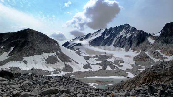
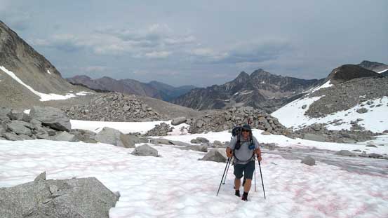
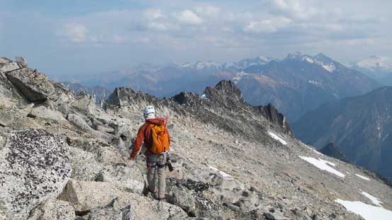
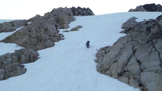
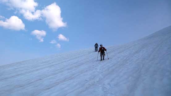
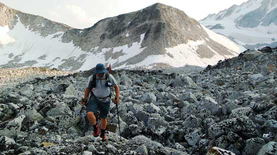
Due to the relatively short approach the decision was instantly made to make the summit bid on Mt. Alpha Centauri on Day 1, as usual for my trips. My reference was Golden Scramblers’ trip report but due to the lack of preparation time we didn’t study it in details. I knew we had to ascend Centaurus Glacier at some point leading towards Alpha Centauri’s SE Ridge so aimed towards that general direction, and soon enough we entered a gigantic field of granite boulders. Through this field and then passing a higher but smaller lake we reached the rock-covered glacier. The glacier was easily ascended with the bergschrund easily bypassed on climber’s left side. The snow was fairly soft so we didn’t need to bother with crampons. To gain the upper SE Ridge we had to ascend either a Class 3 rock rib (Eric and Ben’s choice) or a steep 40-degree snow slope (my choice). Both routes were proved to be fun.
Looking back towards the upper Welsh Lake

Eric negotiating the boulder field
Our objective ahead. We had to ascend to the far left, up a snow slope and then the back side
This is the smaller, but higher glacial lake

Centaurus Glacier already showed some bare ice. We went to far climber’s right before cutting back
Despite the rocks, we were on the glacier here

Easily ascending Centaurus Glacier
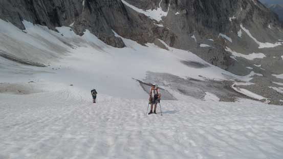
Ben and Eric following me up
After the snow slope we crested the SE Ridge
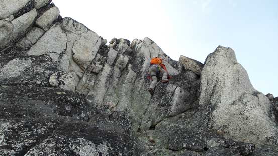
According to Golden Scramblers’ trip report once hitting the upper SE Ridge we should have immediately dropped to the SW side and keep contouring on a rising traverse line. We did drop down the SW slopes but only for a brief moment, and soon enough we went back to the ridge crest. One mistake we made was falsely identifying the false summit as the true one (Ben and I even ditched some gears below the false summit which proved to be a bad call). The ridge was proved to be more challenging but the rock quality was good. Once on “top” we soon realized there’s a higher peak immediately ahead, but getting down from the false summit was not trivial and required some dedicated down-climbing with exposure. The rest of the ascent to the true summit was not difficult, but again, it’s better to stay low rather than following the ridge proper. And thank to the forest fire our views were very smoky…

Looking over the broad SW slopes towards the distant Gwendoline Mountain
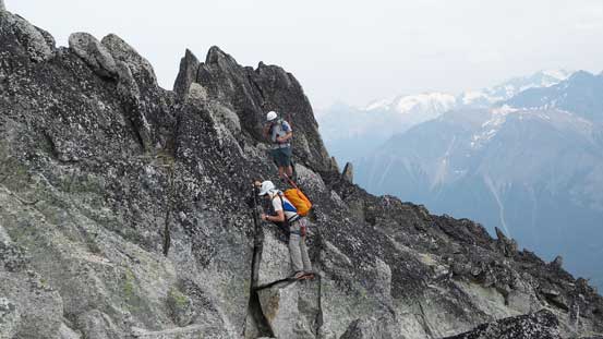
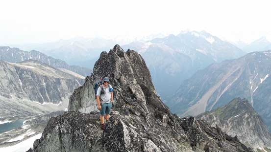
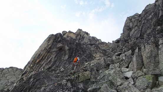
Typical scrambling near the ridge
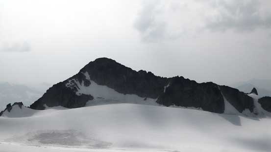
Here we thought the peak ahead was the summit, but Oopps..
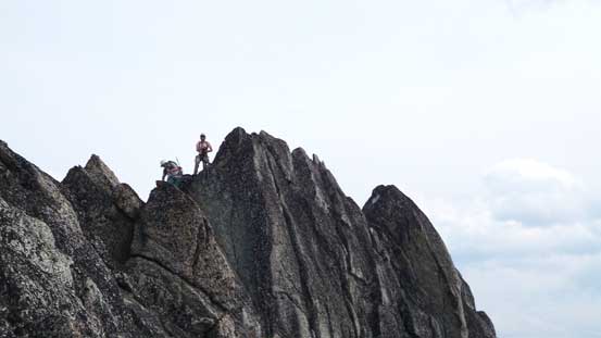
Tricky down-climbing from the false summit
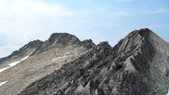
The true summit ahead

Still some interesting scrambling
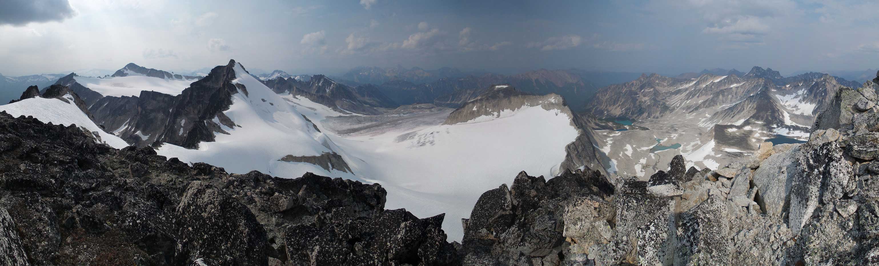
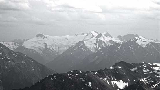
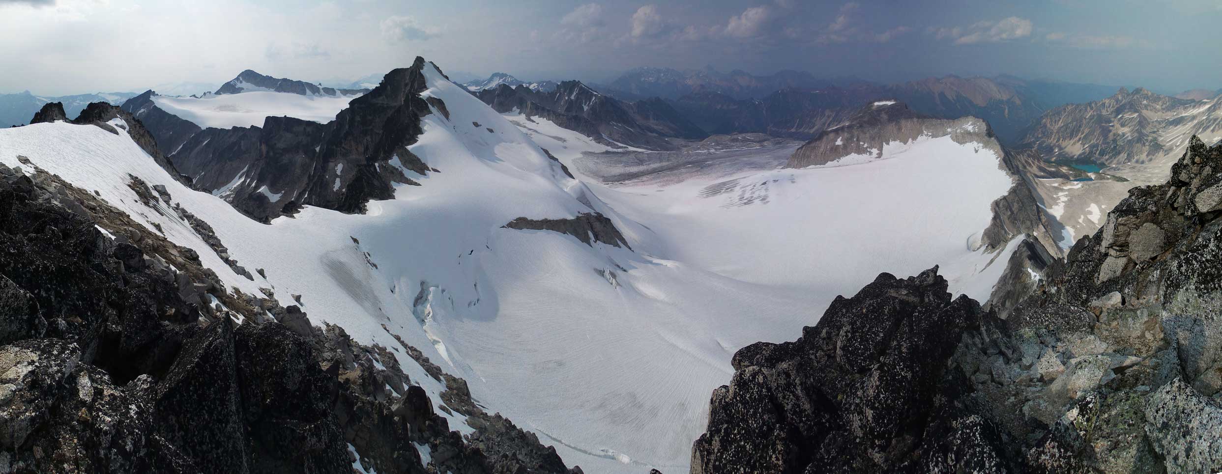
A smoky panorama view from the summit. Click to view large size.

Taurus Mountain
Gwendoline Mountain

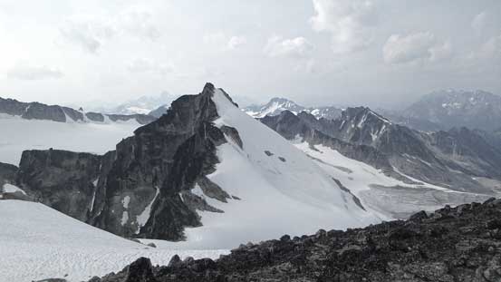
Donegal Peak and Connemara Peak. Both look fairly technical
Donard Peak rises behind the ridge of Killarney Peak
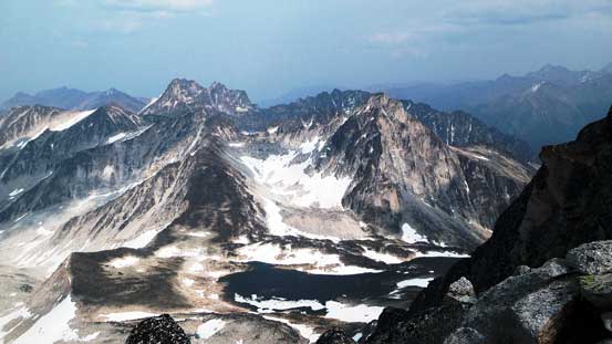
Behind this beautiful lake is Gelway Peak
The Commander Glacier and Jumbo Mountain group

Eyebrow Peak is the glaciated giant. To its right is Birthday Peak
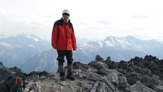
Me on the summit of Mt. Alpha Centauri
The beautiful North Star Peak. Too bad we didn’t get a chance to climb it in this trip
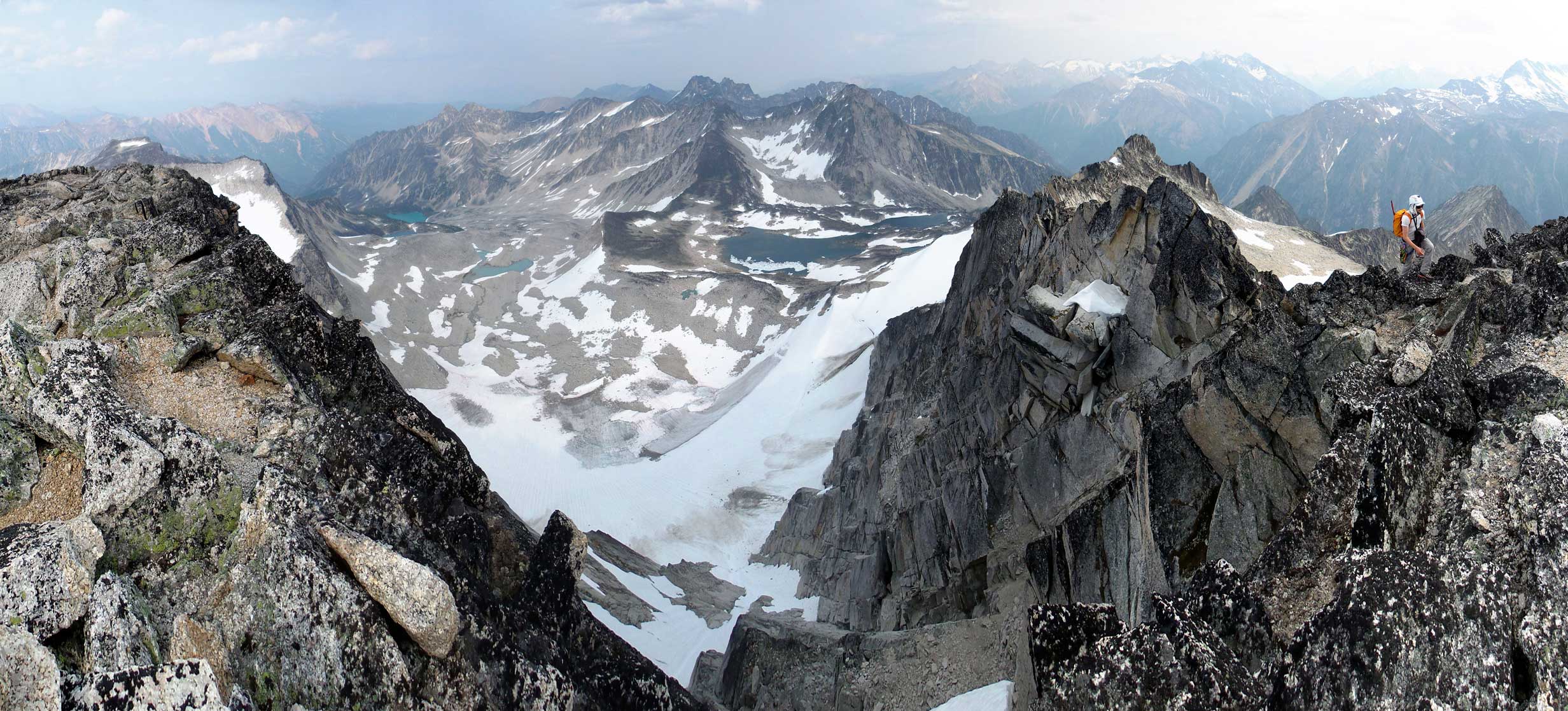
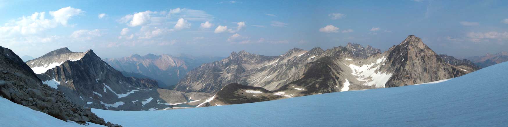
Another panorama from the summit. Click to view large size.
One more panorama from the summit. Click to view large size.
After some obligatory summit pictures we started the descent as it’s getting late in the day already. Eric stayed low on the slopes but Ben and I had to pretty much reverse our route up and over the false summit as we ditched gears just below the false peak. The rock was fun to ascend but we did have to deal with a few exposed moves. Back through the “key notch” we dropped down the NE side. Eric and I strapped crampons on and went down the snow slope while Ben down-scrambled the rock. After that it was a easy plunge down the soft snow on Centaurus Glacier, followed by balancing over that boulder field. And shortly after that we made back to the camp.
Time to head down

Ben reascending back up the false summit
And then, tricky down-climbing from the false summit.

A panorama view of Irish Peaks from the descent.
Another panorama view from the upper Centaurus Glacier
Eric down-climbing steep snow. It’s also possible to use the rock rib on left

Gelway Peak looks impressive
Descending Centaurus Glacier

Almost finished the snow slog
Heading back to camp with gorgeous evening views
Looking back, the sun was setting behind Alpha Centauri/Carmarthen col
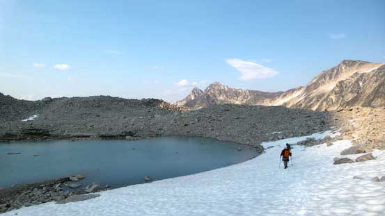
Walking around the uppermost lake on a snow field
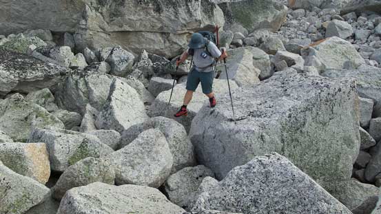
Oh here came the boulder field…

Still fair a bit of ways to descend
These boulders are painful. But hey, more to come in the next few days….
The weather forecast for Tuesday (Day 2) was some 60% chance of showers so we wouldn’t do anything aggressive on that day. We had no clue when the showers would come though, and figured the best case scenario would be ascending the supposed-easy Antrim Peak and Leitrim Peak before any afternoon thunderstorms.
