Pylon Peak
May 19-20, 2024
2481m
Pemberton, BC
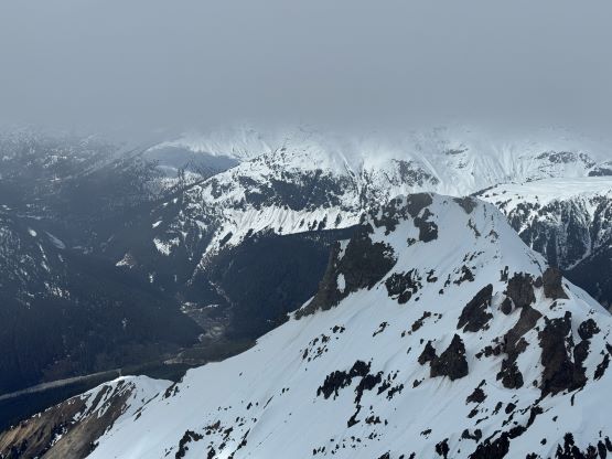
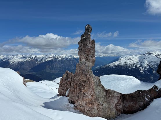
The triangular pyramid of Pylon Peak is not the tallest, but rather the most impressive in Meager Group and is also one of the hardest climbs out there (at least tied in with Mt. Meager). The north couloir/ramp is the only viable way to gain access to the summit ridge and is the only route that had been done on this objective. I don’t think this peak has been climbed for more than a few times, and the “beta” on the internet was next to nothing. I was able to dig out a few photos to show a bit of the terrain above that north couloir/ramp, but there’s literally only one way to know. Alex, Chris and I did it on the second day of our Meager Group slam, after having climbed Plinth Peak and Mt. Meager on Day 1, and Devastator Peak in the morning of Day 2. We decided to haul the 60-m rope, two snow pickets and a full rock rack from the camp and ended up using most of the gears brought.

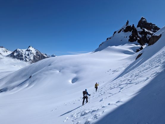
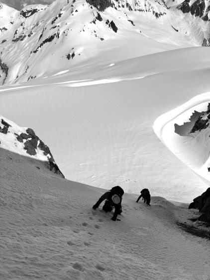
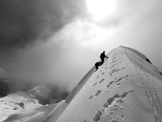
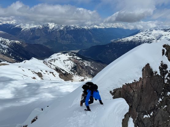
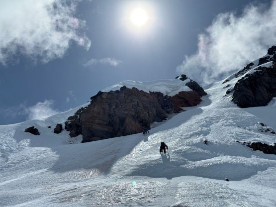
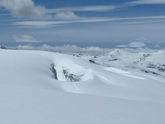
I led us staying as high as possible to traverse from Devastator Peak towards our intended route on Pylon Peak, dealing with more side-hilling though not as painful. The snow was mostly supportive and the route (couloir) appeared rather icy, though not as vertical but I knew it’s deceiving. We took one needed break at the base of the climb and I took my time tightening the shoelace. I had opted to wear the Trango Tech mountaineering boots in favour of a more pleasant approach, but those boots were far from ideal on long and steep front-pointing, so I needed to make sure the shoelaces and crampons were exceptionally tight. Chris and I took turn leading the bottom slope past the bergschrund to a nice rest spot on the climber’s left side wall. I led the rest of the way and there’s no more resting afterwards. For about a third of the distance we had to do some front-pointing, but we were able to kick in bucket steps elsewhere, especially the final 50+ degree wall below the summit ridge. This was a long and tiring snow climb. I suddenly realized that the topping on the summit ridge was on a separate bump and I couldn’t tell if the edge was on a cornice, so I traversed sideways below the ridge to the next sickle feature where I finally could take a bit of a break. This section reminded me of Atwell Peak but much shorter. I continued climbing the ridge until finding a perfect spot to bury a deadman picket. There appeared to have a vertical rock step so we needed to properly pitch it out.

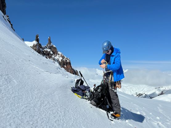


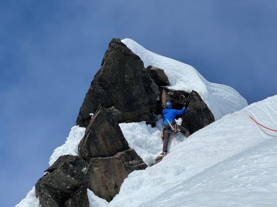
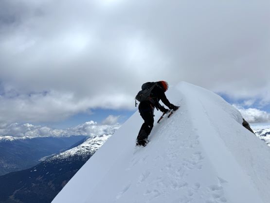
Alex, being the best rock climber here volunteered again to lead the technical pitch. There was some rotten snow to traverse to the rock step and then it involved a few proper mixed climbing moves. The snow was very rotten but the rocks were nowhere as bad as on Mt. Meager. The step was vertical and involved at least one very strenuous move. The finish was a vertical wall of snow and a mantle move was needed to get onto the summit. Chris climbed next using the rope as a fixed line, and I took the rear end to be belayed to the top. I had to climb while wearing the massive winter parka as I was quite cold standing at the belay station in the wind. There were a few blocks on the summit but none was perfect to be used as the rappel station, so we had to leave a picket behind.

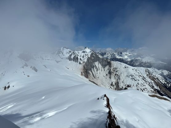
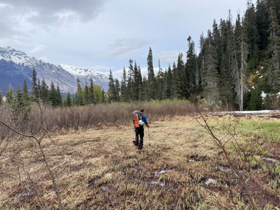
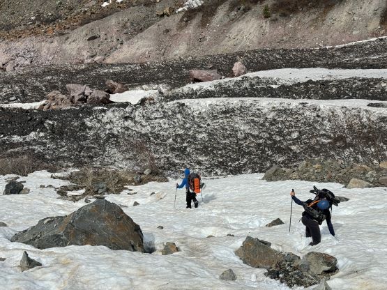
It wasn’t obvious where to set up the picket neither but the angle must be correct. I eventually opted to build a T-trench on the actual summit cornice. The rappel was a bit awkward to get into, and I continued rapping/down-climbing to the lower picket and our ditched backpacks. Once we all finished the rapping we packed the rope and gingerly down-climbed that entire couloir/ramp. The down-climb was not too bad, but did require some full concentration. We had on purposely made some bucket steps on the steepest parts and those steps served well on the descent. I was tempted to bag Capricorn Mtn. afterwards but there was no way for us to have enough energy/time for Mt. Job so we might as well leave them together for the next trip, and reluctantly walked 5 km back to camp. We had to swap crampons for snowshoes as the snow had become quite mushy in the afternoon heat.


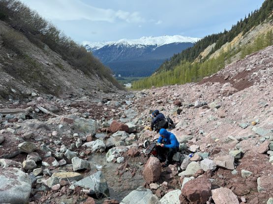
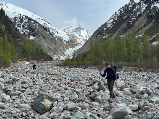
We all reached our physical limits by the time we slogged back to the camp at Plinth/Meager col. The goal was set to have dinner in Pemberton so we must keep pushing, and an hour later we shouldered the heavy packs and bolted down the 1300-m snow descent. Chris led the post-holing down that steep headwall and the post-holing was crotch deep at times. We were also triggering small wet slides as we plunged. Alex and I swapped for snowshoes afterwards. For the next 1000 m descent I went down as quickly as I humanly could ever do, trying hard to keep up with Chris. I had to take the snowshoes off once the snow became a little bit firmer because it was not possible to keep up with the pace on the snowshoes. Chris and I also tried several glissades but the slope angle wasn’t steep enough to pick up the speeds. I think we went from the camp down to the snowline, losing 1300 m elevation in a mere hour. After another needed hydration break we continued bolting down the boulder fields. Our faint foot prints were still visible so we didn’t actually need to check the GPS that many times. We were able to hop back across the creek at the exact same spot, and did the two annoying bushwhacking bypasses lower down while staying on the east side of the valley.


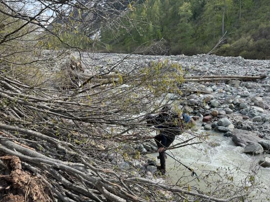

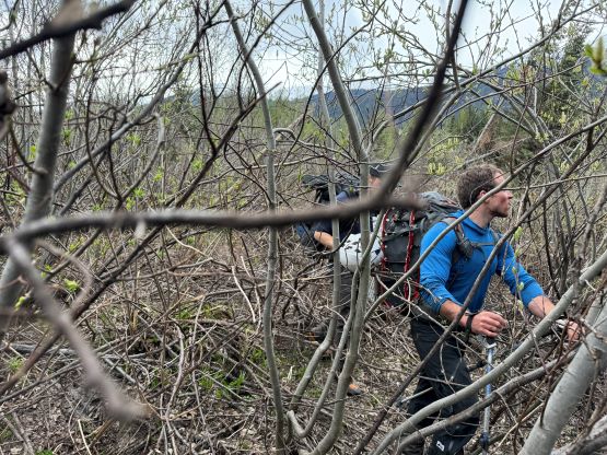
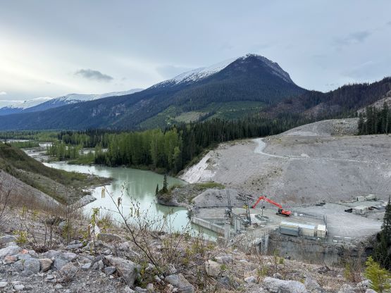
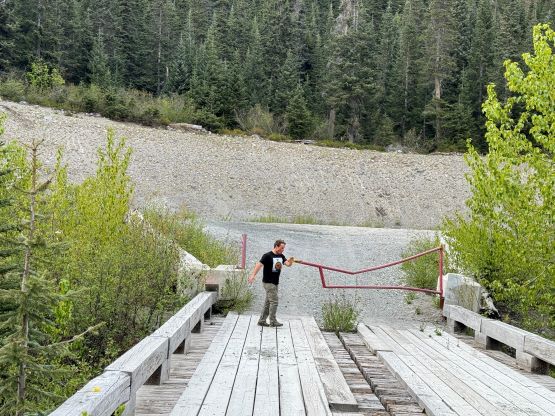
I took over the lead in the bushes because I was the only one recording a GPS track, and we took some variations here and there mostly to do some experiment. I think we won some and lost some. Trying to make a straight beeline across the two avalanche paths was a awful experience and pushing the sustained BW4 bushwhack with an overnight pack and un-contractible 135 cm poles was exceptionally difficult. We also did a few more gear transitions to use the snowshoes, and discovered that the ‘shoes provided excellent flotation to plod across that swamp. Overall this approach wasn’t terrible, but was tedious enough that I need a couple years to forget the misery before contemplating another trip into the area. The drive-out was uneventful as we encountered very minimal traffic. All of the gates stayed open and we got back to Pemberton at 8:30 pm, half an hour before the closure of the Mile One Club. I bought a 40-dollar meal and ate them all. I eventually got back home at midnight and I was able to stay awake throughout the drive. Overall these peaks are quite tough. Mt. Meager is harder than the true summit of Black Tusk, and Pylon Peak is harder than North Fee, and these peaks have a much harder approach.