Tolkien Peak
April 14, 2024
2380m
Pemberton / Phelix Creek, BC
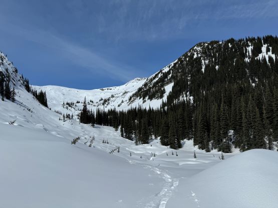
“Tolkien Peak” is a rather major summit in the Phelix Creek area but is nowhere as popular as the ones immediately to the north as it’s not included in Matt Gunn’s scrambles book and the access isn’t as straightforward. This peak can also be accessed in summer from Brian Waddington Hut but the route is contrived. The better way is to approach in the spring when the Phelix Creek FSR is partially or fully melted out but there’s still enough snow to cover the bushes on the overgrown spur roads and the forested valleys. I ended up doing it in the spring on snowshoes by a long and undulating traverse from Mt. John Decker and but my exit route can also be easily used for the approach.
Admittedly I did not do any “homework” as the decision to add this peak into the trip was made randomly in situ. Had I read Simon’s trip report I probably wouldn’t have gone for it because the true summit requires a somewhat exposed 3rd class traverse. Simon’s route involves traversing on the east side of an obvious notch but that route is very exposed in the spring conditions. I naively thought the summit would be a “walk-up” so ditched my backpack about 200 m from the top, carrying nothing but trekking poles and snowshoes (not even with my gloves). I almost had to turn around but managed to front-point my way up using snowshoes on the NW side of the notch. With crampons it would be straightforward but I did not have that option. In any case Francis and I climbed Mt. John Decker earlier in the day and then I led us traversing all the way to the west shoulder of “Tolkien S1” where we must make a decision. Francis had a deadline to get back home by 5 pm for a family dinner (no huge deal if being late, but not very nice), and opted to tag “Tolkien S1” instead. The deadline was made to get back to the truck by 2 pm and I was confident that I could manage that with an ascent of the proper “Tolkien Peak”, so I gave the key to Francis and we parted our ways.
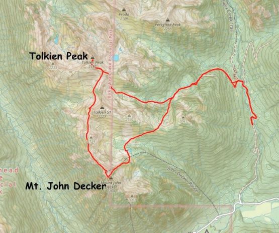
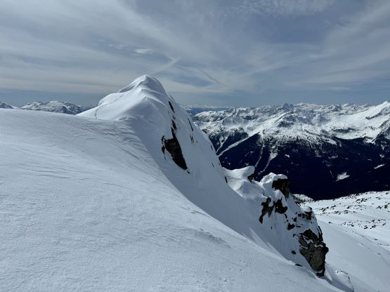
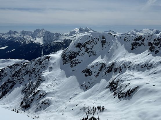
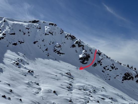
In retrospect I should have joined Francis to top out “Tolkien S1” and descend the narrow but manageable north ridge and it wouldn’t have taken much longer, but I had no “beta” about the best way to work around this sub-peak. I swapped snowshoes for crampons and traversed across several bowls on the west side of “Tolkien S1” but had to make another transition to swap the trekking poles for two ice axes. The only obvious way to drop into the bowl NW of “Tolkien S1” was to down-climb a steep couloir and that was 45-50 degrees. Thankfully the snow was powdery so it didn’t take me too long to down-climb. Francis was already on the summit of “Tolkien S1” by the time I made to the low point and about to slog the 350 vertical meters up the south face of Tolkien Peak. Looking back I could see the north ridge of that south peak was entirely covered in snow, albeit narrow and steep. In any case there’s no “no brainer” way to work around this southern subpeak. I had already lost some precious time doing those transitions so I ascended as fast as I humanly could to the broad SE ridge of Tolkien Peak. The decisions to ditch the backpack was also made to speed things up, but that shenanigan around that notch on the south ridge also costed at least 10 minutes. The direct attack of the notch would be 4th class that I was not comfortable to solo in the snowy conditions, so I went around and found a 40-degree snow route on the west face that was barely manageable with just snowshoes. It had taken me 1 hour 10 minutes to ascend Tolkien Peak from where Francis and I parted, exactly 10 minutes longer than what I promised to Francis.


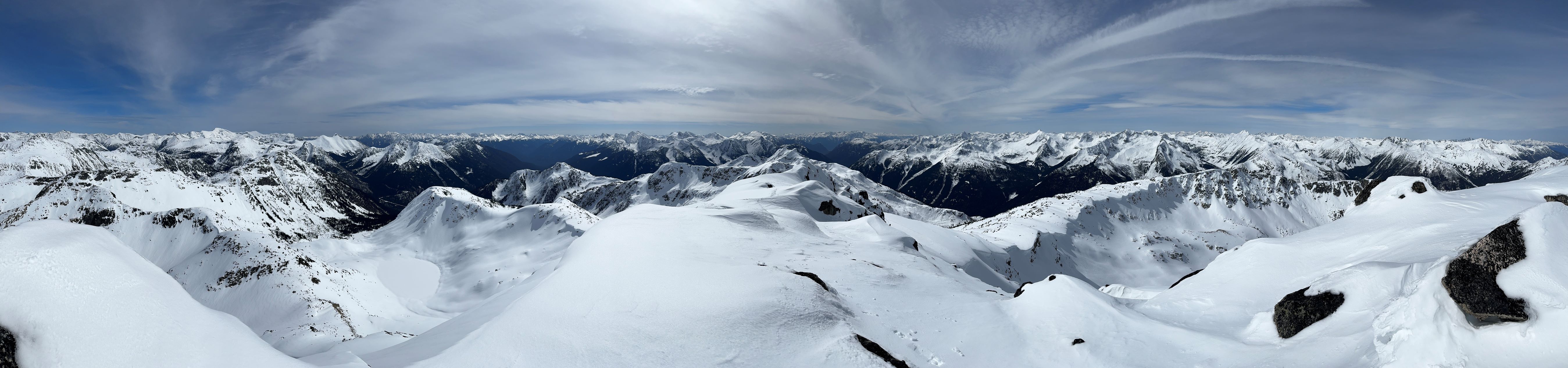


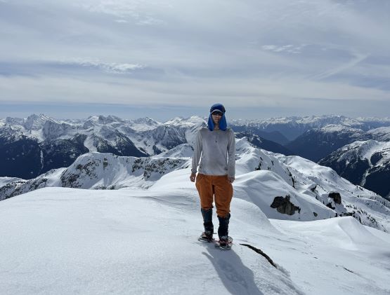
I only spent 5 minutes on the summit to take some mandatory victory shots and then quickly dashed down the same way. I was able to descend the west face on snowshoes without having too much trouble, and then quickly ran down to the ditched backpack. I opted for a long and quick glissade into the “SE bowl” even though I was wearing 400 dollars worth of Gortex pants. I normally would refuse to glissade on these expensive pants but speed was more important on this day. The descent of the valley between Tolkien Peak and “Tolkien S1” was without event that I was able to close in the loop in exactly 45 minutes after leaving the summit, and I earned myself 15 minutes in this stage. For the final stage of following our own tracks back to the vehicle I opted to again, dash as quickly as I could. I eventually ran out of energy on the final 2 km of dashing along the flat-ish Phelix Creek FSR so finally slowed down. I got back to the truck at 1:30 pm, about half an hour earlier than promised, and the round trip time of the two peaks was 8 hours, only minutes slower than Alan/Elise’s time for just Mt. John Decker. We earned ourselves enough time to take a break in a coffee shop in Pemberton but in retrospect we should have skipped that due to the horrendous traffics on a sunny Sunday afternoon. Long story short, we got back to the church at 5 pm but the 60 minutes of delay on Lions Gate Bridge meant Francis would be late by about an hour. I eventually got back home in time for my dinner and that was at 6 pm. Kate and Finn eventually got back to Metro Vancouver at around 9 pm after following our tracks up to Mt. John Decker.