The Dome
May 26, 2019
2736m
Rogers Pass, BC
Not to be confused with “The Dome” that’s often used as the basecamp when climbing Mt. Robson via Kain Face, this is an officially named summit along Asulkan Ridge near Rogers Pass of Selkirk Mountains. The name “The Dome” isn’t attractive nor inspiring but this is one of the higher summits along Asulkan Ridge and offers some good-quality scrambling on blocky quartzite. The shape of this peak looks rounded when viewing from the popular east side, but from a climbing perspective, the standard route (south ridge) actually forms a knife-edge blade that’s exactly the opposite of a “dome”. Hence in my opinion, this name is rather a misnomer and the peak deserves more attention than what it seems nowadays. The access is from Sapphire Col and there’s even a hut at the col to facilitate climbing and skiing in that area. There weren’t a ton of useful information online neither other than the south ridge goes at “3rd class”. The rating was made by parties from early 1900s so practically speaking it tells nothing other than “it can be scrambled”.
Upon seeing a high pressure ridge kicking in towards the last weekend of May I threw out a couple elusive objectives to friends and eventually I managed to convince Antonie to join, at the very last minute. Neither The Dome nor Mt. Jupiter was the primary objective of this trip. However, the “peak density” is high with half a dozen summits accessible from Sapphire Col and we’d let the story unfold itself. We had two days and one night up there so one way or another we’d climb several peaks. I drove out of Vancouver immediately after finishing work at 7:30 pm on Saturday evening and made to the Illecilleweat Valley trail-head at around 2 am and slept in my truck. To my surprise I managed to put down the drive in one shot without having to take any break other than at gas stations.
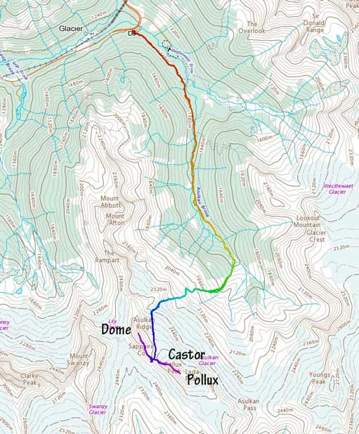
The Dome and Mt. Jupiter via Sapphire Col. GPX DL
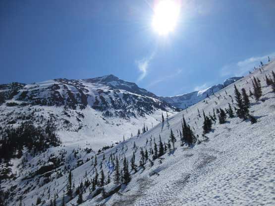
Antonie showed up at 7 am and we were on the trail soon. There were more snow on the ground than what’s suggested on the webcams. Once finishing the initial 1 km of walking on the service road we hit continuous snow. The trail was difficult to follow in the woods and we started sinking in weak spots so strapped the snowshoes on. The GPS app came out regularly. In a short while we crossed the raging Asulkan Brook on a bridge and then had to take snowshoes off traversing high above the river bank. The trail was dry on the steep spots. The next couple kilometers of trudging up Asulkan Valley was fairly easy but we did manage to lose the trail several times and had to take snowshoes off several times too. The mouse trap still had enough snow to snowshoe through the middle of it but it’s drying out quickly. The first major obstacle was to cross Asulkan Brook to the west side. There had no snow bridge left. I tried to cross on foot but gave up soon as I didn’t want to risk wetting the boots. The better solution was to cross with snowshoes on because the ‘shoes provide several centimeters of extra lift and at the same time, the bottom of the snowshoes allows water to move through rather than getting pushed higher onto the boots.
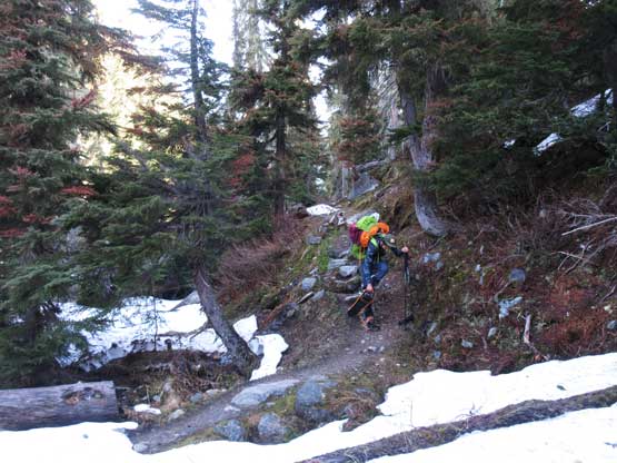
Sections of Asulkan Valley trail required taking snowshoes off

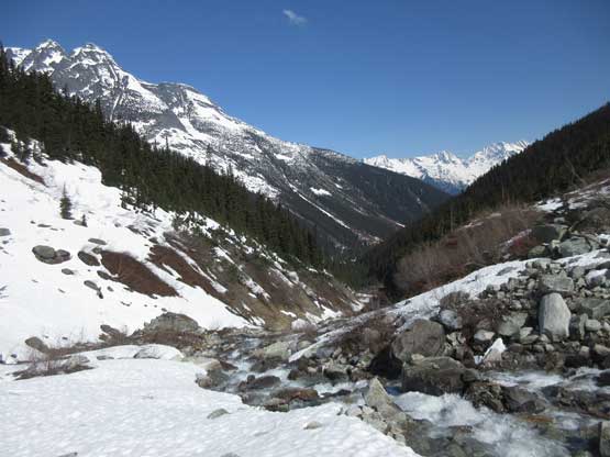
The typical travel in Asulkan Valley in late May conditions

A huge waterfall cascading down below The Rampart

Plodding through the “Mouse Trap”
Through the “Mouse Trap” now and looking back
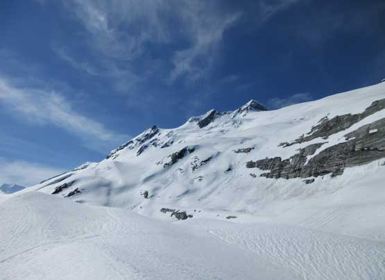
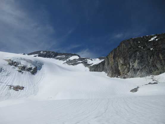
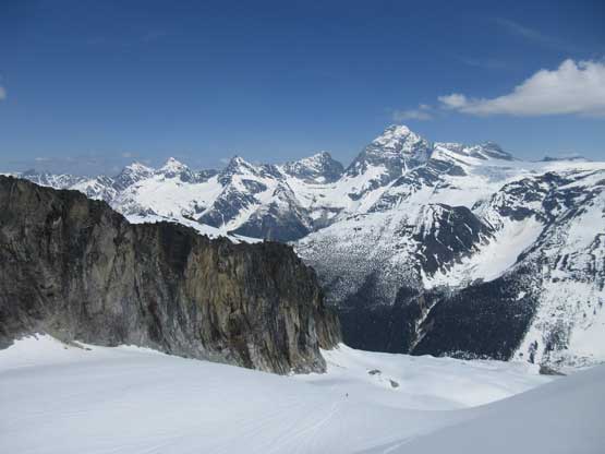
From this point onward there’d be no more forested travel, but the 1000 vertical meters of elevation gain on snow was no simple task neither especially with heavy overnight packs. We took our time and went slowly but steadily. For the lower slopes we picked a line ascending in between two lateral moraines trending towards climber’s right. The middle zone had a series of steep rises that involved some route-finding. The snow was very soft that even with snowshoes I sank past knee deep many times hitting shallow spots. One particular steep rise was troublesome but we did manage to zig-zag a line up without having to touch any real “steep snow”. The toe of Asulkan Glacier was very covered so we didn’t bother with ropes and harness. The ascent onto the glacier and all the way to Sapphire Col was actually straightforward. There’s one steep roll to ascend (35 degrees ish) but elsewhere was just a matter of plodding.
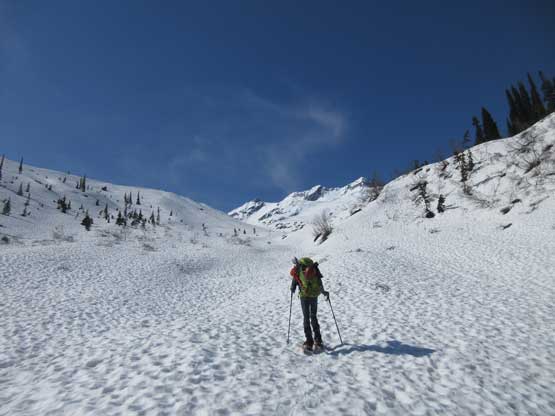
Antonie starting the very foreshortened slog towards Asulkan Glacier
A sideways view to show the terrain in between the two moraines
Above the moraine now, looking at the three summits of Mt. Jupiter
Antonie snowshoeing on the series of ramps/ledges below Asulkan Glacier
Time to gain Asulkan Glacier
Partway up the glacier, looking towards Youngs Peak

Looking back at Mt. Sir Donald
Same as above. Mt. Sir Donald from Asulkan Glacier

Plodding towards the distant Sapphire Col with Castor Peak in front

This is looking back from the upper Asulkan Glacier

Mt. MacDonald, Avalanche Mtn. and Eagle Peak
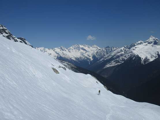
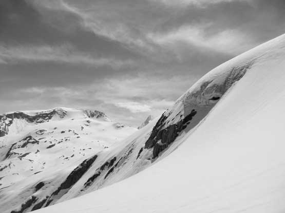
We took a short nap in the hut, dumped most of the gears and had some food. It was only 2 pm and we had to make some decisions. I had wanted to ascend The Dome and Castor Peak and possibly Pollux Peak but Antonie decided to conserve energy for our second day. The Dome was my first objective as the south ridge appeared dry. I naively thought that I could gain the ridge immediately above the hut by “boot-packing” but as soon as stepped on snow it was knee+ deep post-holing on isothermal crap. Near the rocks I sank to waist deep and had to spend fair amount of energy to dig myself out of a rock hole, so I turned around to grab the snowshoes. Even with snowshoes the ascent onto the south ridge proper was a shit show – knee+ deep wallowing on any spot that’s shallow… At this point I was already thinking that maybe we should abandon the primary objective, but The Dome first. I kept the ‘shoes on until running out of snow and then it’s an easy scramble to the “false summit”. The route ahead suddenly became intimidating..

Gaining the south ridge of The Dome now, looking at the east face of Mt. Swanzy

Looking back towards the NW Ridge of Castor Peak

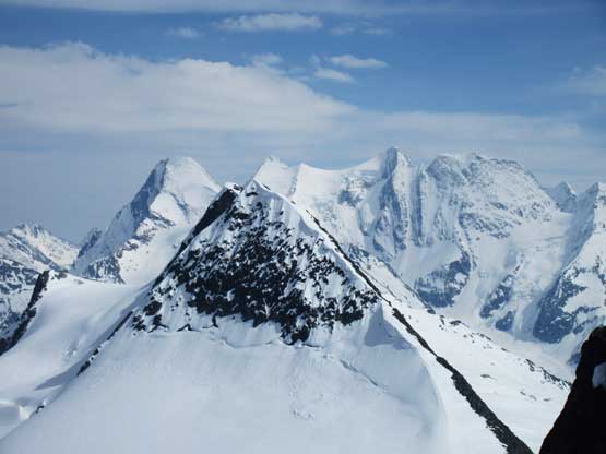
This is the summit block of The Dome separated by a notch
A steep notch separates the main summit from the false one that I was standing on. The direct descent to the notch seemed impossible so I backtracked and found a few cairns traversing fairly low on a couple ledges. Traversing across the ledge required briefly stepping onto exposed snow. The snow was soft as expected, but at least only three or four moves on snow were needed and then I was back onto rock. For the next while I stayed on the west (climber’s left) side of the ridge crest overcoming some 3rd class scrambling on ledges but soon the ledges appeared to run out, blocked by more crappy snow patches. The line wasn’t obvious so I scrambled back onto the ridge crest on then briefly detoured onto the east side on tiny ledges. One big mantle move was required to pull up a step with no foot placement and some au-chevalling later saw me getting close to the summit. Getting to where the cairn was required another stretch of knife-edge but at this point, nothing was troublesome. Unfortunately I wasn’t able to find a register.

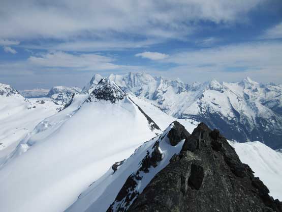
Descended down to the notch now, looking ahead to more route-finding
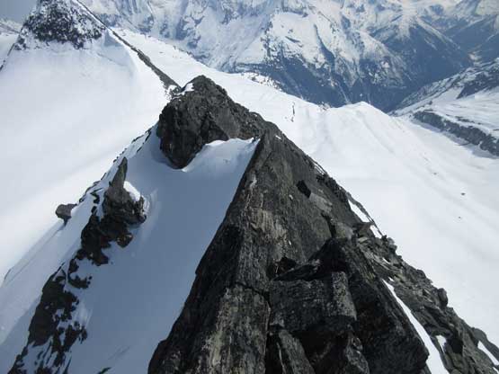
This is looking back at the crux knife-edge

More narrow ridges above the crux step
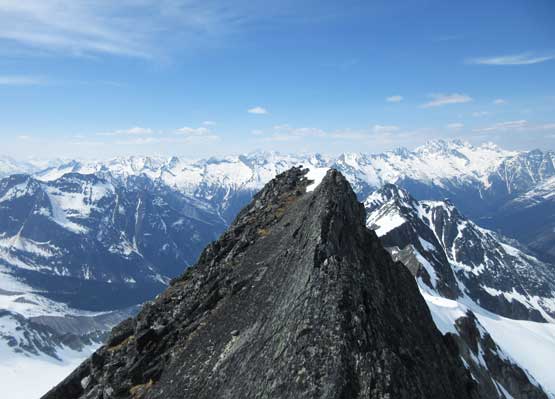
The summit cairn was on the far northern end so I had to traverse all the way there

Summit Panorama from The Dome. Click to view large size.

Looking north over Mt. Afton towards the massif of Mt. Rogers

Looking down onto Asulkan Glacier that we came up from

Mt. Sir Donald with Uto Peak to its left and Terminal Peak to its right

The iconic but elusive Mt. Sir Sandford showed up way to the north

A zoomed-in shot of Mt. MacDonald and Avalanche Mountain
Looking over the top of Castor Peak towards the massif of Mt. Dawson

Me on the summit of The Dome

The tiny cairn on the summit of The Dome, with Illecillewaet Neve behind
I didn’t linger any longer than absolutely necessary. I spent some time to look for an alternative descent route to bypass that knife-edge section and sure I found one, but getting onto it required down-climbing/traversing some steep snow on the west side. As soon as I touched the snow I gave up because the snow was just a thin layer of isothermal crap covering ice or rock. It was useless so I had no choice but to au-cheval back across the ridge and then down-lower myself using pure arm strength. To my surprise I found down-climbing that mantle step felt far easier than up-climbing. The rest of the descent was still complicated in the way of scrambling, but without crux steps thrown in. The snowshoeing on the lower south ridge was just as shitty as on the ascent. I sank further down even while using my own (knee+ deep) tracks. It was a bit of a slow and careful process but at least I got the job done.
Another photo of Castor Peak with the multi-summit Mt. Dawson massif behind

A wider view of Sir Donald Range and Illecillewaet Neve

Negotiating back across the notch.
It had taken me much longer than planned to ascend The Dome, but I still wanted Castor Peak and Pollux Peak so up I went again. Meanwhile Antonie was still taking a nap in the hut conserving energy.
