Gotha Peak and Coburg Peak
February 16, 2024
1645m
North Shore Mountains, BC
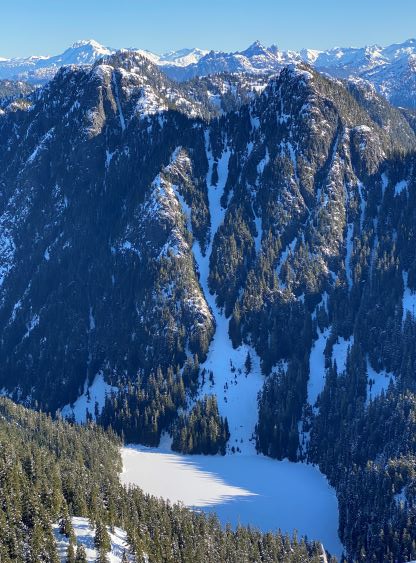
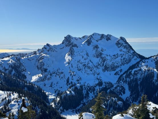
“Gotha Peak” and “Coburg Peak” are the unofficial names of two obscured peaks in the North Shore Mountains hidden behind the popular Howe Sound Crest giants. The original source of the names is bivouac.com but these had been widely adopted elsewhere. They are not so obscured now thank to the Bagger’s Challenge group. The scramble up “Coburg Peak” was used to be a challenge, but the entire way has been flagged and a fixed line has been installed on the crux (class 3, minimal exposure) so this has become a lot lamer nowadays. Most, if not all of the ascents were done in summer and the standard route goes up and over “Gotha Peak” to access “Coburg Peak”. For peak-baggers it makes no sense to leave one of them behind so I’m not splitting the trip report. About two years ago I ascended Hat Mountain in February and took a picture of the gigantic gully system leading up to Coburg/Gotha col from the SW, and I instantly decided to do them in winter as well. The challenge would be the lack of “beta” (virtually none) and the fact that Coburg Peak requires 3rd class scrambling. I had no idea of what exactly to expect in winter, so I needed a strong group capable of snow and mixed climbing along with some bomber conditions to pull the trigger.
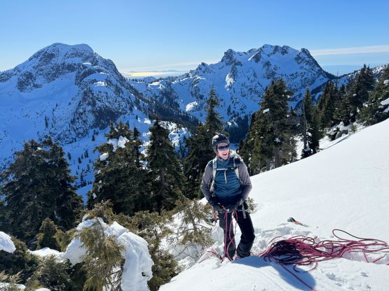
The condition leading to this upcoming long weekend had been quite tricky. It was initially very promising but had downgraded gradually, such that Noah, Chris and I decided at the last minute to bail the original plan. I formulated the last minute “plan B” to tackle Gotha and Coburg Peaks via this perhaps-new route that I had spotted from Hat Mountain. The main reason was to take advantage of the L/L/L conditions in the North Shore. To me it would make the most sense to stick to the area with the most stable snowpack. This new plan did not draw too much enthusiasm initially but they agreed eventually, and the plan was then made to leave the Church at 4 am. My apartment was still not accessible due to the fire damages so I made Noah to borrow/lend me most, if not all of the technical gears. I could not trust the rental mountaineering boots on such a long outing, so opted to carry and wear my 6000m high altitude boots instead. It might seem ridiculous to use 6000m boots on 1000m peaks but my only other option was to use the OlyMons 8000m boots, which would be even more ridiculous. The reason I had these boots available was because I stored them separately in my parents’ house as I do not need them regularly. I still paid a last minute visit to Langley’s MEC and bought a total of 500 dollars worth of gears, as it could be weeks before I’m allowed to move back.
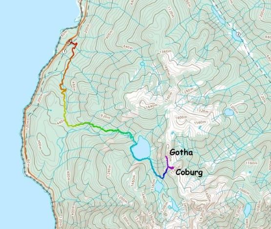
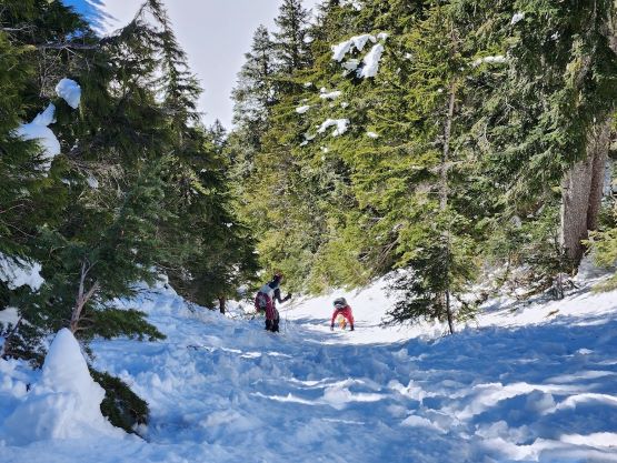
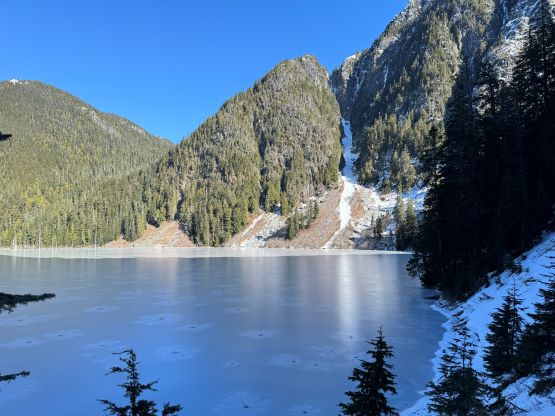
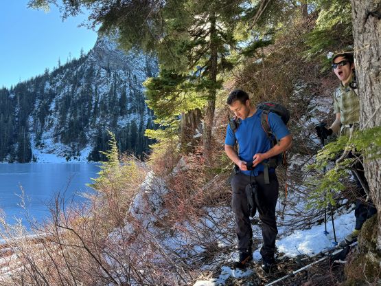
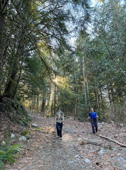
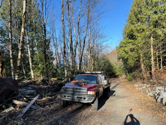
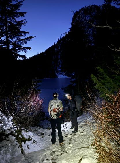
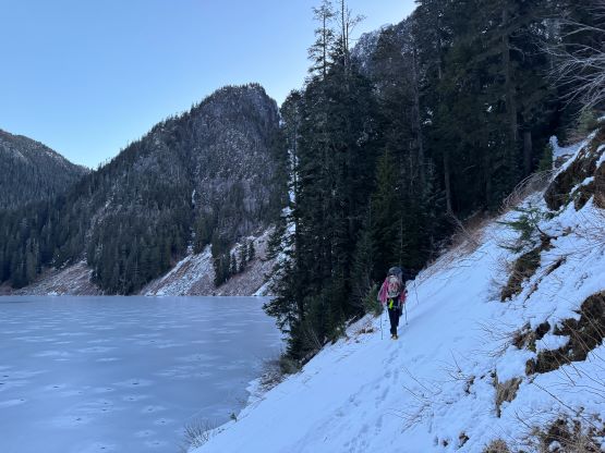
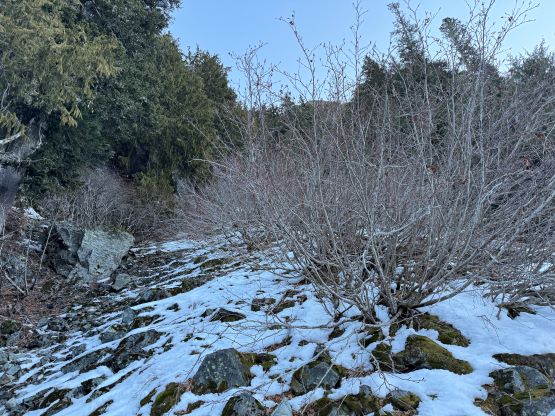
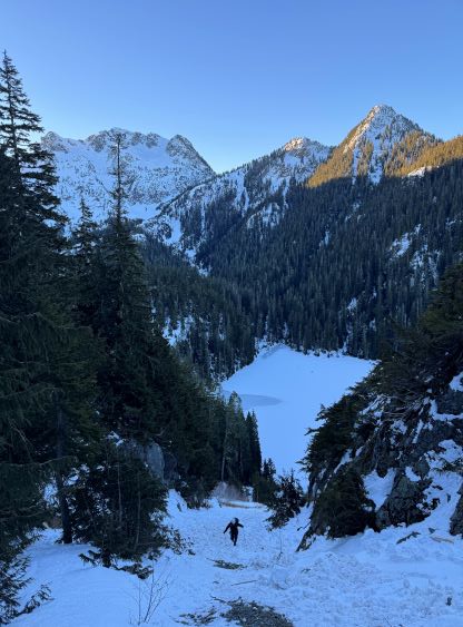
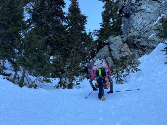
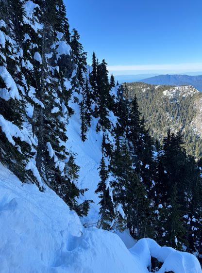
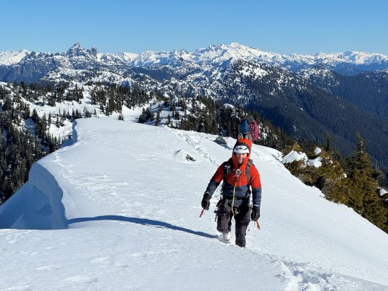
After spending ~15 min. at the Church to test out the rental gears I drove us to the trail-head in my Corolla. The drive was less than half an hour and the parking was obvious. The official start of the Howe Sound Crest trail was about 200 m south down the highway, but we decided to hop over the fence and plod up the quarry road instead. I always prefer the shortest possible way. There were a few confusing junctions that made me to check the GPS regularly. I did download a set of GPX tracks. The tracks were made by a party doing the standard route in summer, but the approach was the same. Chris and Noah are two incredibly strong climbers that I had to max out my uphill pace to keep up with these guys. I still fell a little bit behind on the steep grunt to Deeks Lake but I was also carrying the 60m rope. We made to the lake just when it’s bright enough to turn off the head-lamps. The lake was frozen but we could not trust the thickness of the ice, so we followed the trail to circumnavigate the lake in a counterclockwise direction. About 2/3 of the way across we came to a steep slope and decided to finally swap the trail-runners to mountaineering boots. I also gave the rope to Noah to carry as I was tired. We had been walking on snow and ice for a while and I worried about descending this section on trail-runners on the return. The boots did help a lot on the traction. While grunting towards the upper (more frozen) lake we located a downed foot bridge and hopped across the creek to the east side. A few minutes afterwards we followed Chris’ lead ascending diagonally up an open slope to cut into the SW gully. This slope was not the most pleasant with lots of Devil’s Club and boulders covered in no more than 30 cm of fresh snow.
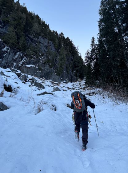
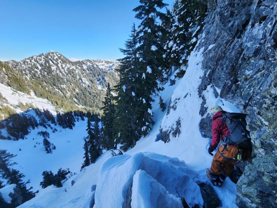
The bottom of the gully was more like a slide path and it was chocked with alders thank to the lack of snow. We took a break there eating some food, and the stoke level was not high. Thankfully we discovered soon that bushwhacking was not actually needed as the middle of the gully was nice and open. I led us up for about 50 vertical meters before making the decision to don crampons. I also left a trekking pole behind and took an ice tool (Petzl Gully) out, whereas the others managed this entire gully in crampons and two poles. The grade of the gully was mostly 35-40 degrees but the condition was icy and a slip could mean a long way down, so I did appreciate having the ice axe. Due to the lack of “beta” we all anticipated some “climbing” in this gully but the result was disappointing. It was mostly just a long slog to reach the col, and hardly any front-pointing on steep snow was needed.


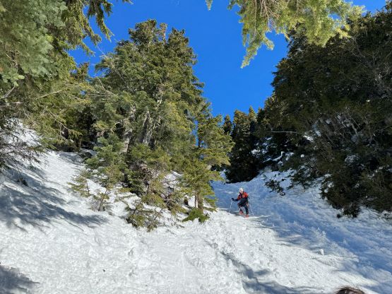
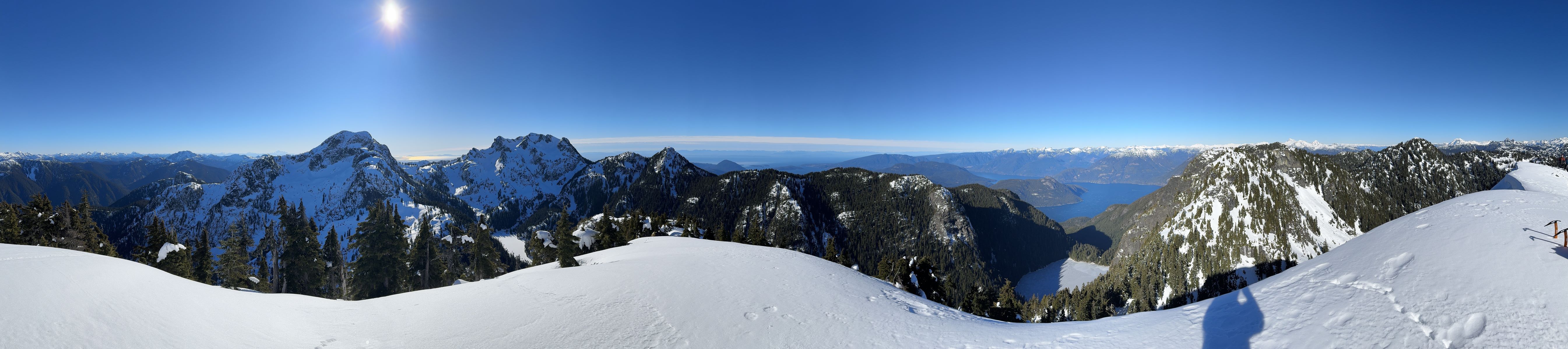
Coburg Peak was our primary objective but I suggested to do Gotha Peak first because by doing so we could see and plan our route up Coburg Peak. The nicest thing of ascending Gotha Peak from the south side was that we would reach the true summit first, so there’s no need to traverse that narrow and annoying ridge line. Those that came up from the standard (north) ridge all needed to traverse over a few bumps to reach the true summit. For us Gotha Peak was nothing fancier than a walk-up, but the post-holing was a bit annoying thank to the wind drifts and breakable crusts. We had made the decision to not bring snowshoes based on a few recent trip reports in the area. We could benefit from snowshoes on a few parts of this trip, but they were definitely not “required” after all, and considering the long approach we definitely made the correct call to leave them behind.

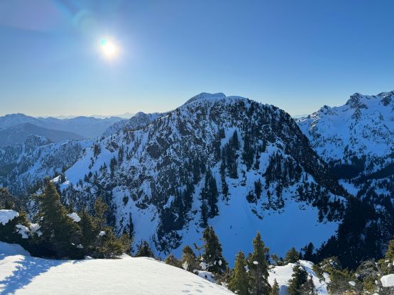
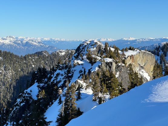

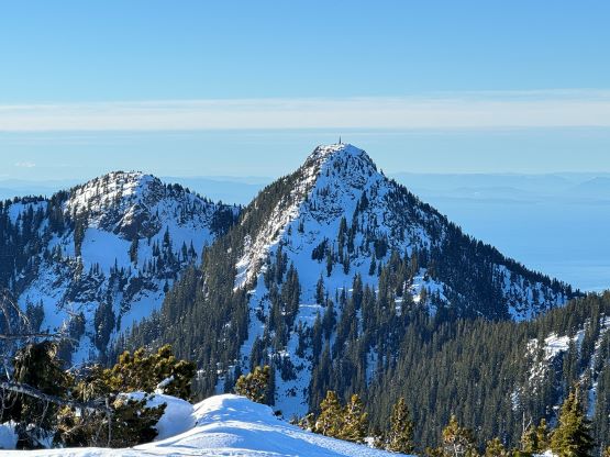
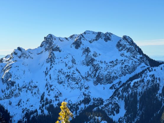
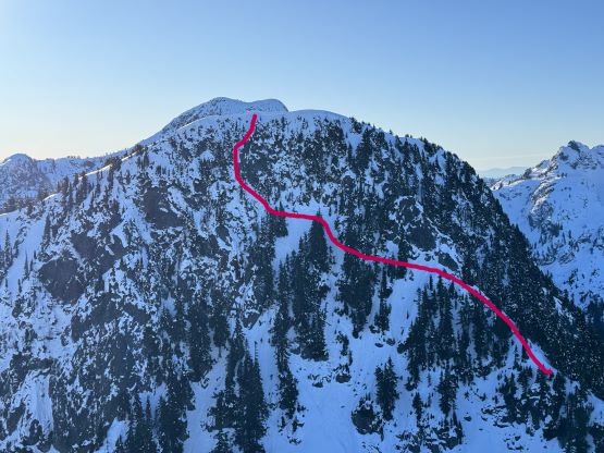
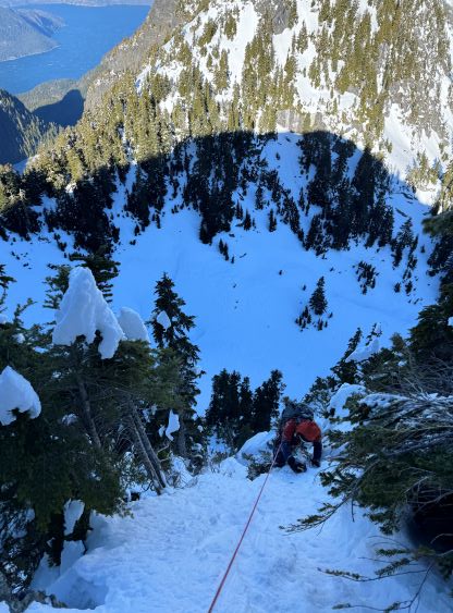
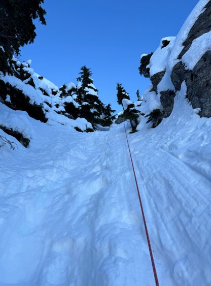
Throughout the ascent of Gotha Peak we kept looking back and we had formulated a few lines on the north face of Coburg Peak. The standard route looked a bit lame and we had brought a 60m rope and Noah’s capable of climbing M4 and WI6 so it made no sense to just plod up the easiest possible way. The condition was good, so we decided to try a “couloir direct” on the north face. To get to the couloir we opted to climb the NW ridge to the base of the standard route’s crux, and then do a long rising traverse across several steep bowls. Even the initial step out of Gotha/Coburg col required some shenanigans and I actually thought this step, though without exposure, was actually one of the cruxes. I then led us wallowing to the base of the standard route’s crux and it was there that we made the final decision to try the perhaps-new route on the north face. Noah and Chris was more keen, so I followed their leads traversing across the few increasingly-steep bowls. The last section of the traversing was quite exposed and had taken Noah quite a while to solo across. Chris and I gingerly followed, and we decided to pitch it out afterwards. The actual couloir was thankfully not too terrifying. Noah ran out the full 60 m pitch placing only one pro about 2/3 of the way up, and belayed us up from the summit. Aside a challenging mixed move the couloir itself was mostly just 50+ degree snow climbing. The top-out did require climbing through a small cornice. With a top-rope belay it was actually quite fun.


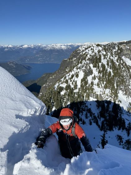


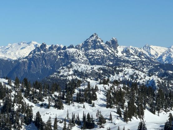

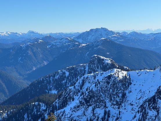


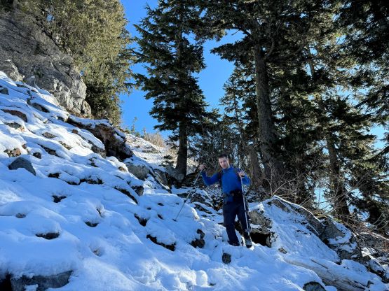
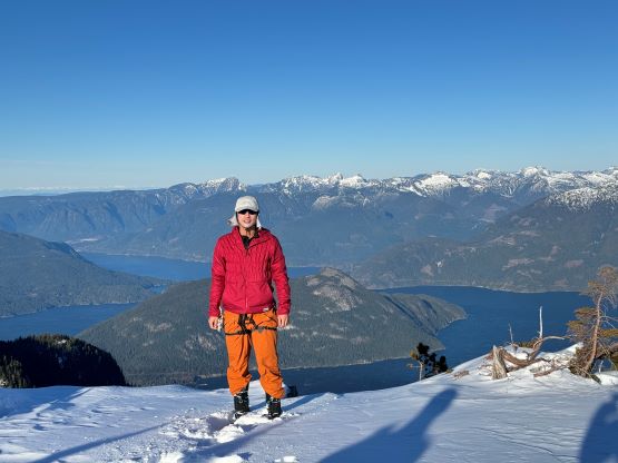
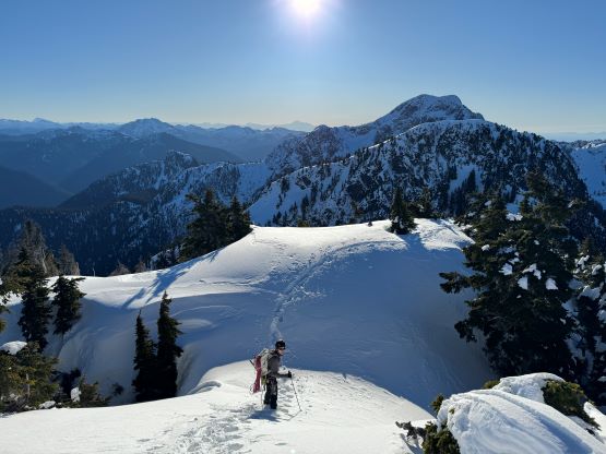
It had taken us 6 hours to get here including the ascent and descent of Gotha Peak, so we were doing excellently on time. We took a fairly long break on this sunny summit to soak in the views, and eventually made the decision to descend the standard route for simplicity. We anticipated a few rappels but were able to down-climb the entire way while doing the route-finding. It was not obvious where to go exactly, but it also didn’t matter that much. I simply led us down staying as close to the ridge as possible. A few drops forced me to down-climb skier’s left to bypass, and we eventually arrived at the top of the crux. We could see the fixed line frozen in the snow (not useable), but the crux looked doable so we did not bother to take the rope out again. The hardest was to down-climb that initial step above Gotha/Coburg col. The descent of the SW gully was not difficult but required some caution as the condition was still icy at places. A slip could still mean a long slide so I made sure to stay alert throughout the descent. We did most of the descent facing outwards and that required a higher level of concentration. The rest of the return was uneventful. We collected our ditched gears from various places and I did change my boots back to the trail runners. Chris opted to wear his boots all the way down to the trail-head. We jogged at least half of the trail distance and finished the round trip in just over 9.5 hours. Again, to keep up with Noah and Chris I needed to be 100% in my elements so I only took about 200 photos for the day, which was definitely a low record. I took over 150 photos in a day even on trash-bagging trips.