Needles Eye (AZ)
December 26, 2021
774m
Blythe, AZ
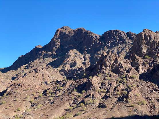
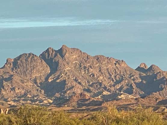
Needles Eye is a mysterious peak in Trigo Mountains not far from Arizona/California border about half an hour’s drive south of Blythe. This is the highest peak in the close vicinity and boasts a striking profile, but the route information is next-to-nothing on the internet. Judging by the register, this peak sees a few ascents in the past decade, but apparently nobody had put up a trip report online. Adam had tried Needles Eye two times in the past few years from the north side but this time we would try from the west. Adam had noticed a “Jeep Trail” on the topo map that extended fairly deep into the mountains but the status of that road was unknown and there’s only one way to find out.
Adam and I drove out of Blythe in the late afternoon in the previous day and made to the dirt roads with about an hour of daylight left. The start of the dirt road wasn’t too bad but things became increasingly rough after the road descended into a dry wash. This road was correctly marked on USGS topo map so the navigation wasn’t a problem. At one point we encountered a washed-out section that I thought we might have to turn around and park, but Adam managed to find a bypass to sneak through, so we drove another kilometer or two further. Eventually we decided not to risk a bad section ahead as we were only 1.5 km from the “best case scenario”. By now the first mystery, the drive-in was resolved. The evening and night on a winter day like this was long, so we had lots of time to kill. Asides the evening routine thing I also spent about an hour looking for rock climbing and bouldering oppourtunity on the nearby walls. In terms of gears we decided to bring a rope, rock shoes and cams/nuts as nobody knew how technical this ascent was.


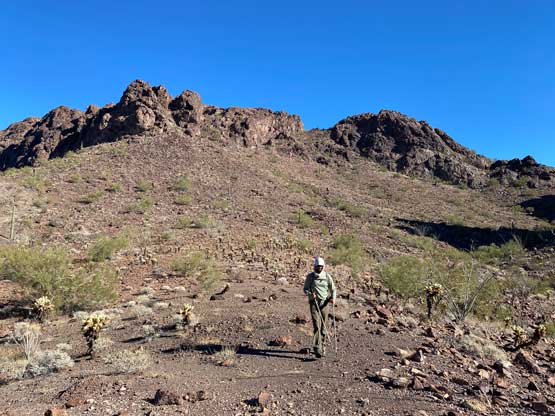
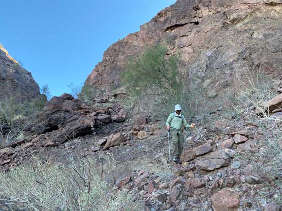
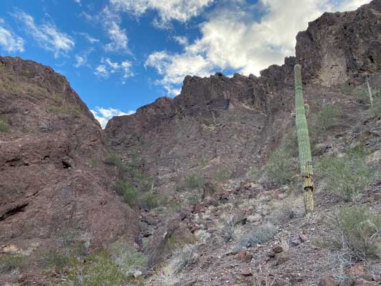
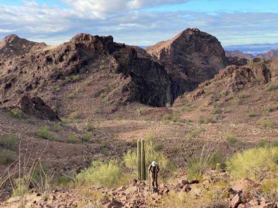
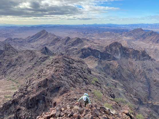
In the morning we started the ascent at around daybreak. Walking up the sandy wash was definitely more tedious and tiring than walking on solid ground. In about 20 minutes we had finished walking the “road” to where we originally planned to park. We then turned east and entered a mini canyon feature. A few obstacles could have been bypassed on either side but we scrambled over head-on for fun. Once the canyon gave way to open terrain we left the wash and went for a cross-country beeline towards a key gully that connected to the upper mountain. This section of the cross-country travel had lots of micro-terrain and up-and-downs, but was overall easy to navigate. The gully that led towards the upper mountain appeared steep and narrow from afar, but turned out to be “class 2” at most. We did have to navigate around a few dry falls and some brushy zones but nothing really worth noting.


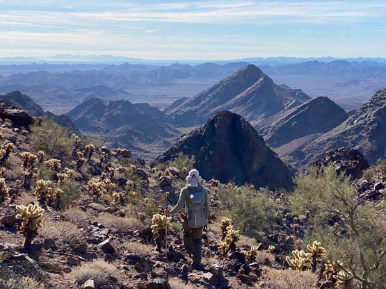
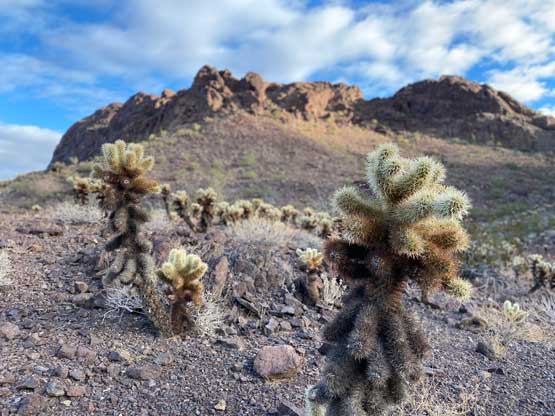
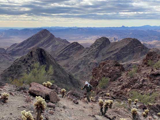
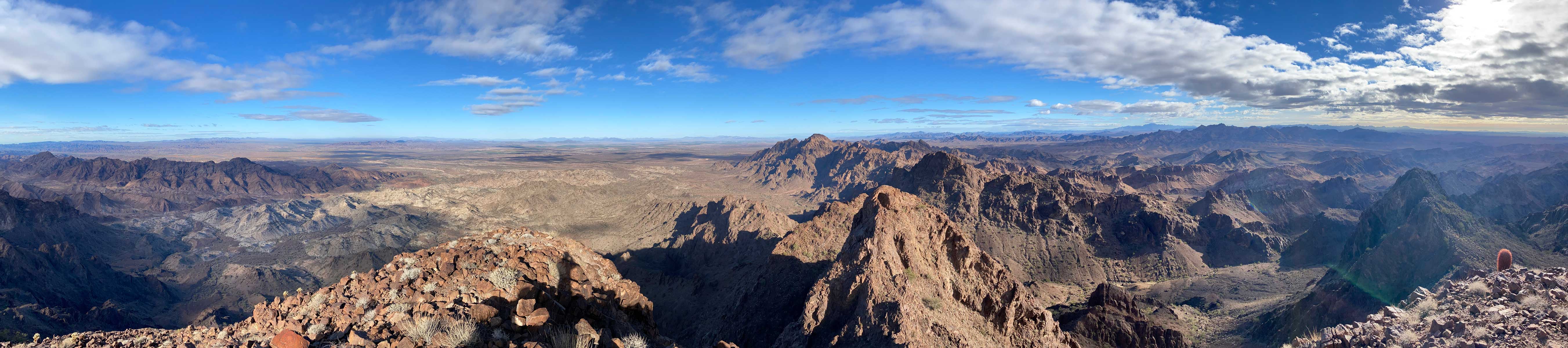
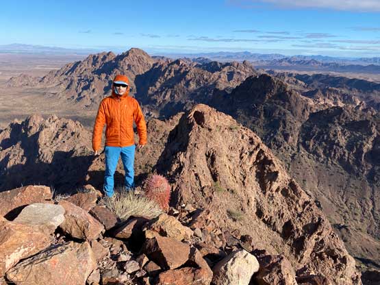
The top of this gully brought us to a plateau feature chocked with chollas that Adam called the “cholla garden”. This was my first time negotiating fields of this type of thorny plants. We took a break somewhere along this stage and then traversed/ascended a ramp or a shallow gully to access the south ridge of Needles Eye. Following the south ridge all the way to the summit looked to be rugged with some pinnacles along the way, so we traversed the east side of the south ridge all the way to the SE side of the summit block. This traverse felt tedious at times with more chollas and other type of cactus thrown in. The ascent of the summit block from the SE side was mostly class 2-3 and then the scramble up the uppermost south ridge had a section of class 3 with some exposure, but overall this ascent was much simpler than anticipated. We again, brought rope and gears for weight training…


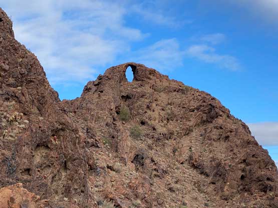

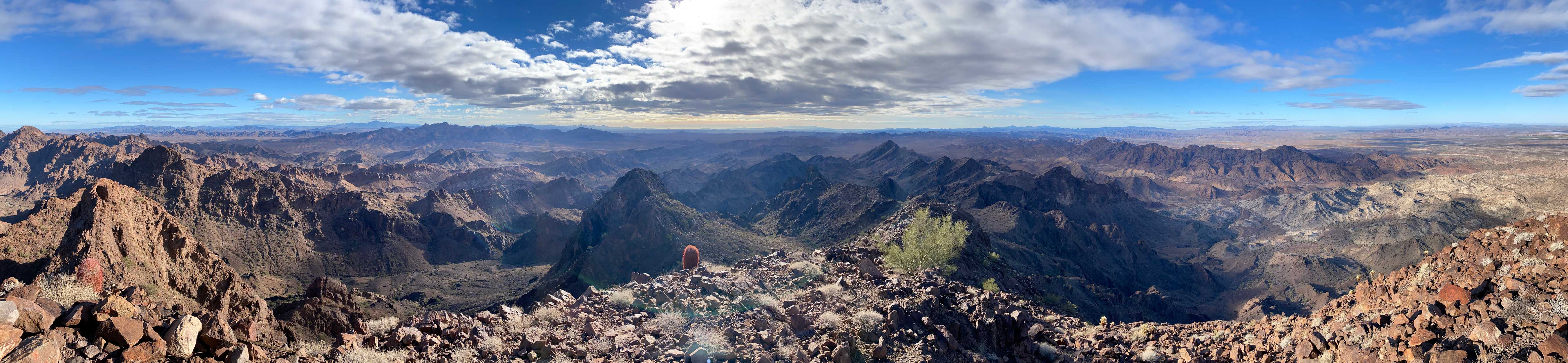


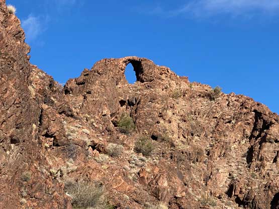
On the descent I spontaneously decided to scramble to the actual Needles Eye which is a arch feature on a lower summit to the north. The actual arch looked doable but the traverse towards that summit turned out to be complicated. I was sure that I could find a way, but not without some significant elevation loss. After about 10 minutes I turned around since that was overall not the summit of this peak, so not worth that much of extra effort. We then retraced the exact route we took down the upper mountain and back into that shaddy gully. The GPS came handy while traversing the open and rolling country back towards the initial canyon as the terrain there was disorienting at times. The rest of the descent was very much uneventful and the conclusion was that we surely found the most efficient way to tag this summit. It was only noon when we finished the ascent. The drive out of this “Jeep Trail” still required caution but we didn’t have to deal with the mental stress of the unknowns. The roads back across Colorado River back into California were confusing but we did find our way after a couple wrong turns. At this point we weren’t sure what exactly we would do next, but the general direction was to drive towards Picacho Peak area near Yuma.