Oakes Peak
April 19, 2018
1733m
North Cascades Highway, WA
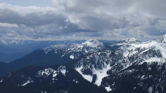
Oakes Peak is rather just a “treeline bump” but on a clear day the summit offers some unobstructed views of the North Cascades including icons such as Mt. Triumph. It doesn’t have a high status on any peak-bagging list but it’s getting increasingly more popular over the recent years. Again, this is because of the extraordinary summit views. The standard route is best done in winter or spring when snow covers the underbrush. The route starts at low elevation from Bacon Creek (NF-1060) and ascends parallel to Oakes Creek and then onto the SW Flanks. Much of the route is open forest and despite having some steeper stretches, the route is relatively free of avalanche hazard.
After about two weeks of dreary weather a brief winter appeared towards Thursday. Vlad and Lily were game for a day-trip. The avalanche conditions were questionable because of the massive recent dump of snow and we were also expecting some hideous trail-breaking. It makes perfect sense to do Oakes Peak is when weather is good but avalanche condition is non-ideal. To give ourselves plenty of time to summit we left Vancouver at around 5:30 am in the morning and then cruised down onto North Cascades Highway without much of a delay. The NF-1060 turn-off (Bacon Creek) was actually signed but by that point we already had multiple GPS devices turned on. Following the GPS lead we drove another couple miles down this logging road and parked just after crossing Oakes Creek. This NF-1060 logging road is very narrow and has plenty of pot-holes such that we were glad to have taken my Tacoma here.
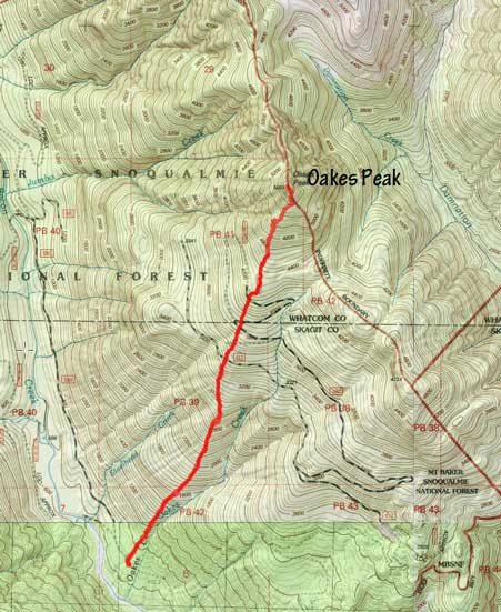
Oakes Peak standard route. GPX DL
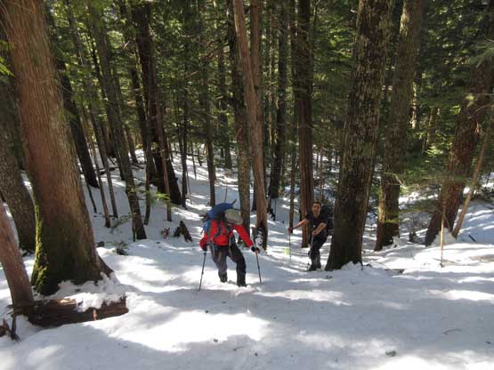
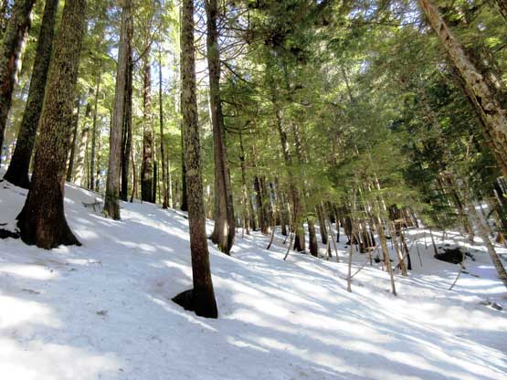
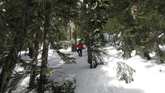
There isn’t much to document about the first couple hours’ mundane plod. The start had some dead-falls and then we entered the mature forest with some underbrush but nothing too annoying. Patchy snow appeared after elevation of 800 m and then quickly transitioned into continuous snow. The snow was supportive enough for boot travel until we hit the first leg of old logging road above 1000 m elevation. The snowshoes were strapped on and then the hideous trail-breaking began. The snow was heavy, wet and somewhat crusty and on some steeper stretches we would post-holing past knee deep. It was a slow going process but we all tried our best to keep the spirit positive.
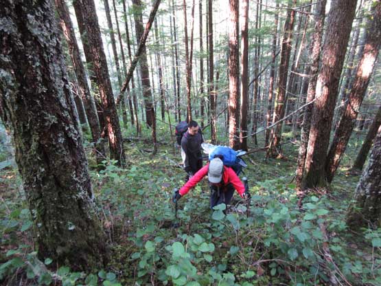
Marching up the lower forest. As typical as it gets…
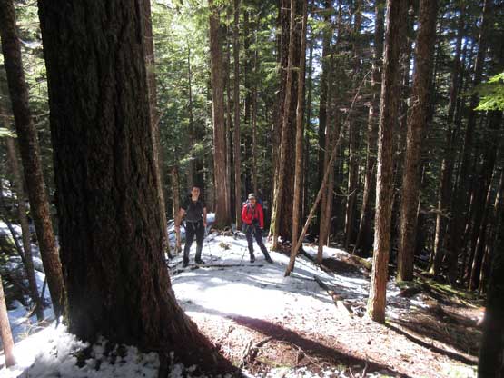
Started encountering snow.
It quickly become continuous snow. Easy boot-packing right now.
This is a view looking upwards. Just snow and trees…
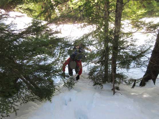
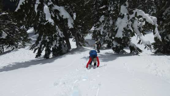
Shortly after here we strapped the snowshoes on…
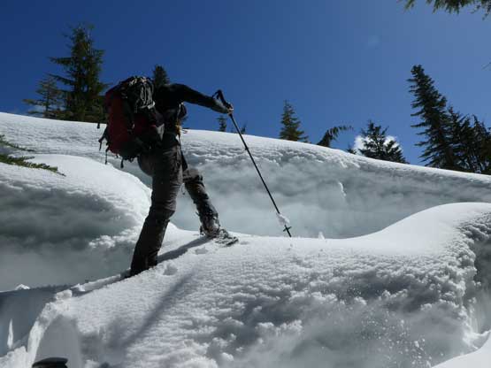
Me ascending onto one of the upper logging roads. Photo by Lily Q.
Lily coming up a steep step. This is very strenuous.
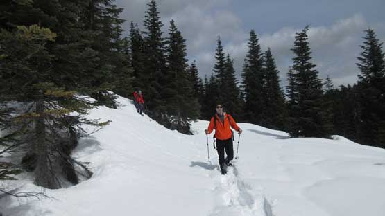
We crossed the upper logging roads for at least 3 or 4 times and then we hit a (sort of) plateau area where the terrain briefly levels out. Looking ahead we could see the steep summit block and we sure had a hell lot of work left to do. The actual ascent of “summit block” wasn’t as bad as it appeared except for one very steep stretch. The snow condition wasn’t the most terrible and we went straight up the open slope (~40 degrees).
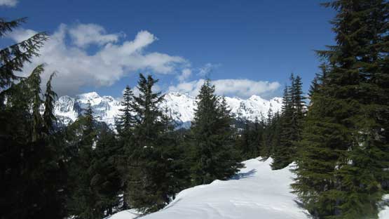
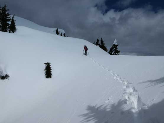
This is crossing another branch of the road. Finally had some views.

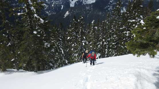
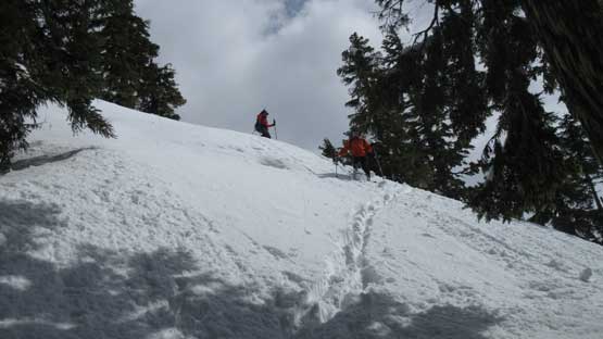
Vlad taking his turn breaking trail. It’s definitely team work.
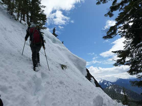
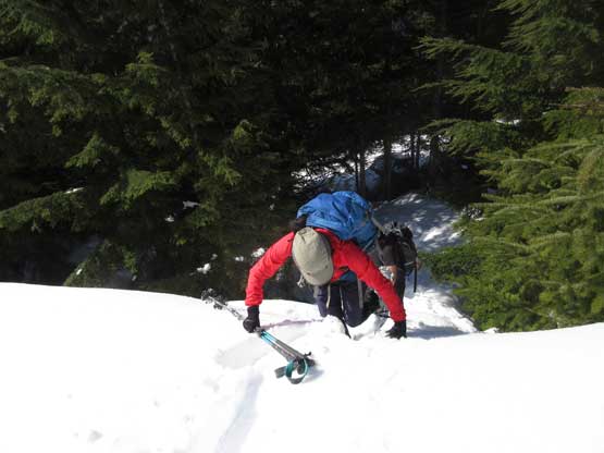
Me charging up the only steep pitch. Photo by Lily Q.
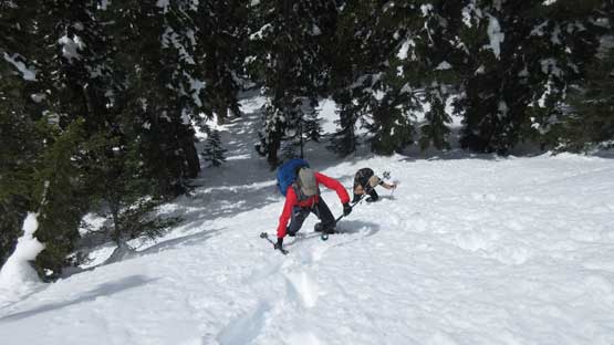
Lily and Vlad crawling up the steep open slope.
The route trends a little bit towards climber’s right and the theme of post-holing continued on. After another while we hit the uppermost south ridge and then the summit wasn’t far away. With perseverance we finally made there but the downside, the supposed “sunny” weather had turned into mostly cloudy, although we could still see the giants nearby. We stayed there for more than half an hour but realized the views weren’t getting any better.
Upwards and onward. It never ends…
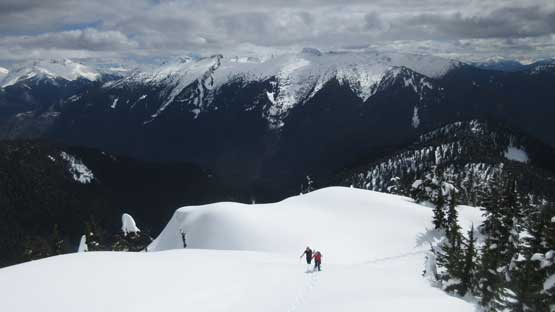
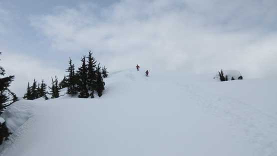
On the upper south ridge now. This is the typical terrain.
Me leading up the last slope. Photo by Lily Q.
Lily and Vlad just about to ascend the last slope.
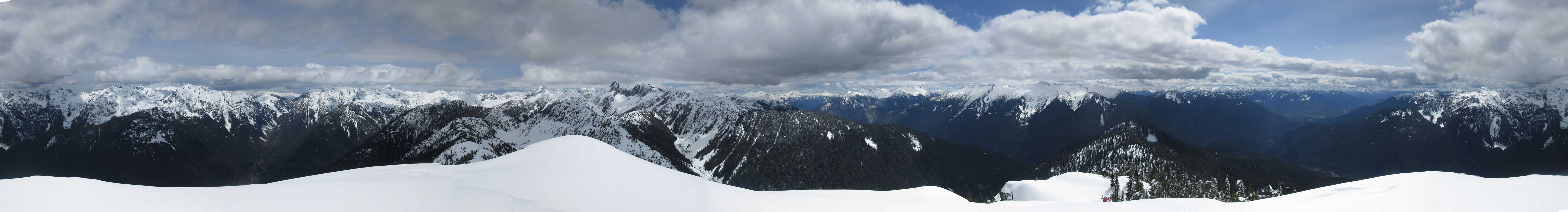
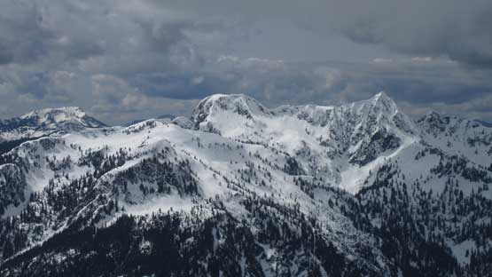
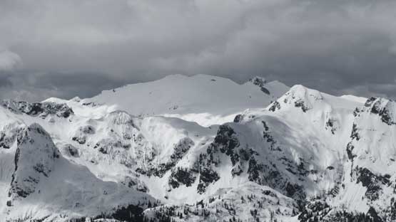
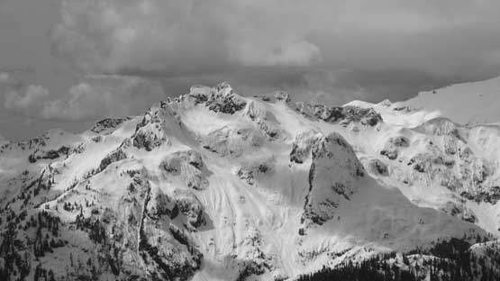
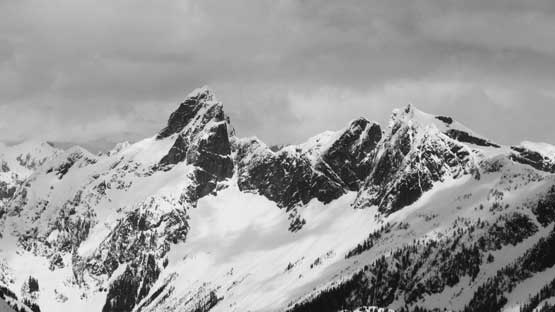
Summit Panorama from Oakes Peak. Click to view large size.
Helen Buttes at center shot.
Diobsud Butte.
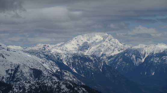
The broad peak in the background is Bacon Peak.
Electric Butte is apparently very difficult to access.
This is Mt. Blum
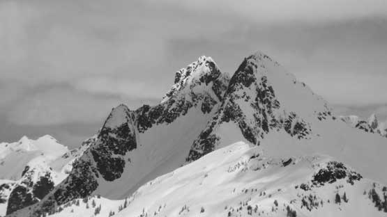
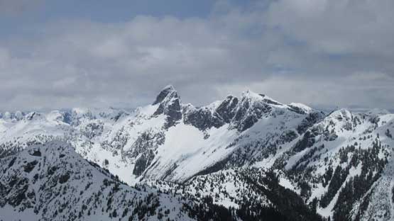
The iconic double-summits of Mt. Despair
The bulk mass of Jack Mountain looking east
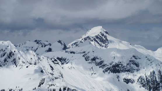
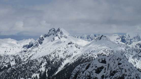
Mt. Triumph and Thornton Peak stealing the show
Another shot towards Mt. Despair
Another shot of Triumph-Thornton massif
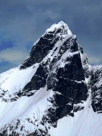
Mt. Triumph
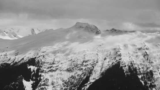
Looking south across the valley is Big Devil Peak – another tough one to access
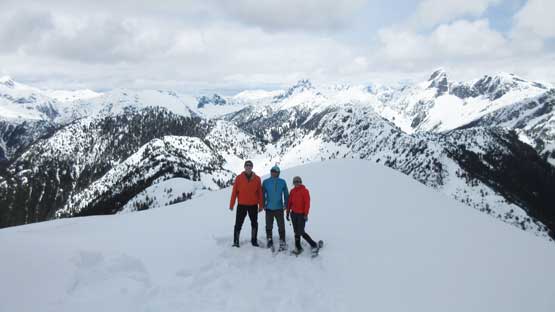
Vlad, Lily and myself on the summit of Oakes Peak
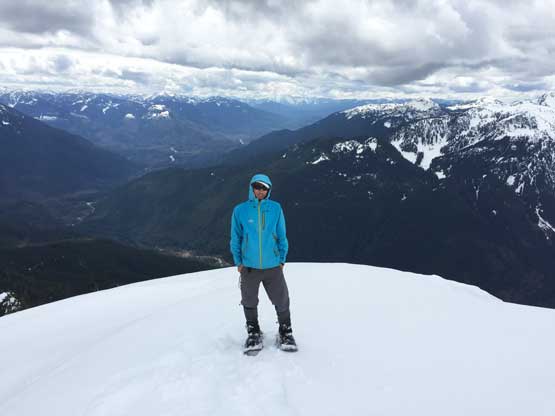
Another shot of me on the summit of Oakes Peak
Eventually we made the call to descend. Plunging down the soft snow was fast and fun and in literally no time we were back to the logging roads. The rest of the descent after removing the snowshoes was pretty easy going, but super boring as we were constantly repeating the same kind of motion again and again.
Time to head home. Easy plunging off the summit
We picked a slightly different line to get down that steep slope.
The typical forested descent (with snowshoes)
Back to the logging roads

Having so much fun
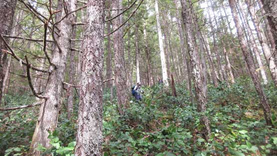
Just had to take a shot to show the typical descent in the lower forest…
In the end our round trip time was around 7 hours. This was slower than expected but that’s mainly because of the bad snow conditions. The trail-breaking was one of the worst I’ve ever done but at least the route wasn’t very long. All in all I would definitely recommend Oakes Peak for pretty much anybody but do save it for a good weather day.
