Lightning Ridge
February 22-23, 2013
2484m
Grande Cache, AB
This was our first trip to Grande Cache and after finishing Mt. Louie, Eric, Ben and I drove to Grande Cache townsite and had a good lunch in Subway. The unofficially named “Lightning Ridge” is the highest in its immediate vicinity and would be our major objective for this trip. The trail-head was the same as the nearby Mt. Stearn which Eric had already done a few years ago. The access road is gravel and thankfully the last 3 km was plowed and manageable in my 2WD car with only all-season tires. This would be my first time winter-camping. To reduce the weight, I brought only dehydrated food and energy gels for food, and we all left ice axe and avalanche gears in car. I still didn’t have proper winter camping gears, and I only brought up my summer tent and the synthetic -12 sleeping bag.
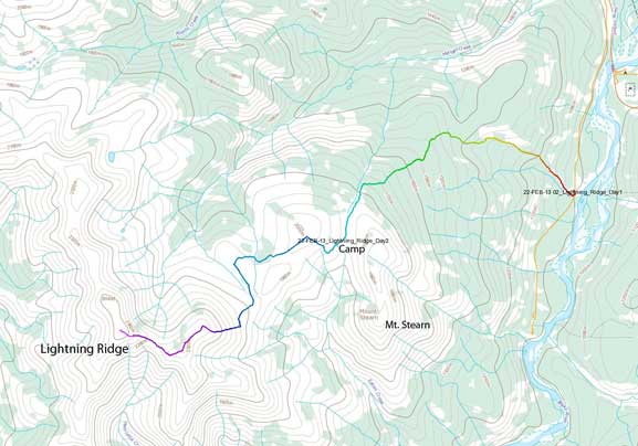
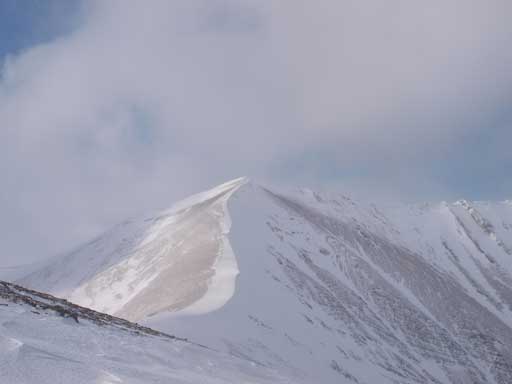
Lightning Ridge ascent route
Up we went in the late afternoon. The trail was easy to follow, and apparently it was broken by previous snowshoeers, maybe from a week or so ago. Like the trail on Mt. Louie, this one was also very long and boring. It took us forever to finally get some views through the trees. By that time it was already getting dark, but thankfully the sky had cleared up, and we were shone by moon light. It was a full moon, and we could clearly see everything without the aid of head-lamp. Eventually we made to the saddle below Mt. Stearn, and we decided to set up camp in the trees on the right side. By this time we had already gained 1500 m elevation on Friday combing Mt. Louie and this approach.
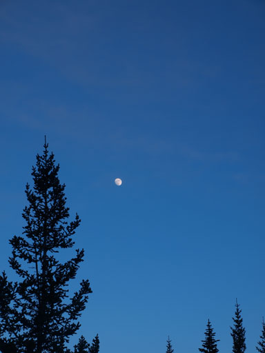
Glad we had a full moon guiding us in dark
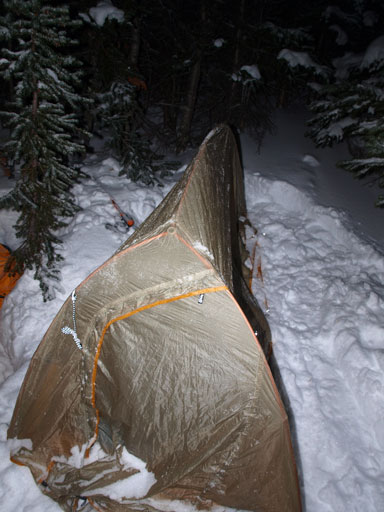
This is my tent… Not quite a winter tent though.

Eric and his bivy sack.
Apparently we were tired, and after a bit of dinner we went to bed. It was a cold night, and I didn’t get a good sleep. I constantly woke up due to coldness, and at 5 am, I couldn’t bear the coldness anymore and went outside for a while stretching my legs. The other guys were still sleeping so I went back into my bag, and we all woke up by 7 am. I couldn’t believe how Ben slept through the night in his -7 summer bag.. It take us forever to melt the snow and prepare for breakfast and drinking water, and we eventually started our day at almost 9…
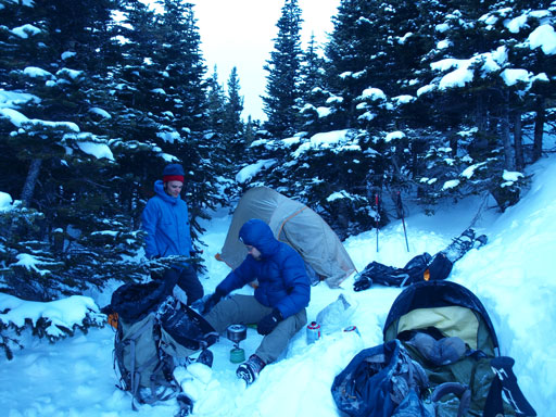
Preparing for breakfast in the morning. It was cold…

Nice morning colours
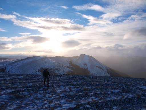
The route is supposed to go climber’s left of the first hill, but for us, to avoid the bottomless snow, we had to go up and over this hill. This was quite a good call, and we got some excellent morning views. The downside was the extra elevation gain/loss/regain but we felt OK with that.
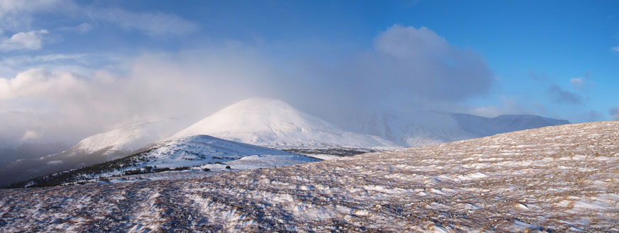
The “Big Hill” is clearly visible.
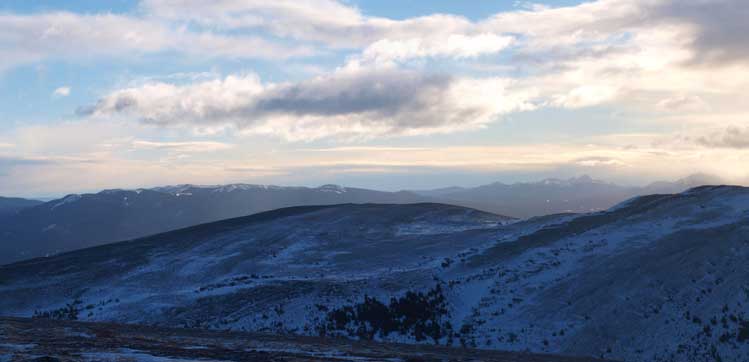
Morning view towards Grande Cache area
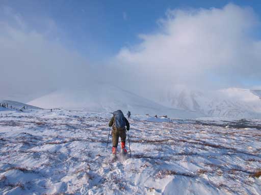
Eric going towards the Big Hill. We would soon enter thick forest…
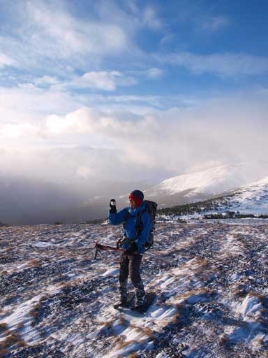
Ben enjoying the morning view.
Eric ascending this “wrong” hill. We had to do extra work to avoid more forest.

Some morning clouds went in and then passed by, providing great colours

Summit of Mt. Stearn
More about this gorgeous morning view
We should have followed the ridge line, up and over the second hill. But we somehow decided to use the forest on right side. Big mistake! We got punished by endless post-holing, tight bushwhacking, and more distance and elevation… It was very miserable. We still had to traverse left before the big hill due to an unseen trench and more forested slopes… Now what.. The big hill turned out to be a giant avalanche slope. We could find the least snowy lines but that would also involve crossing avi slopes at their base. Well, we decided to go up anyway, picking lines paralleling to each other. The hard slabs provided easy travelling, but weather started to roll in at this point.
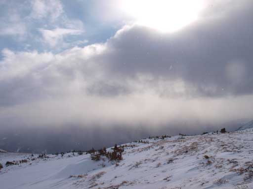
Weather was approaching as we were moving westwards

Ben slogging up the steep terrain on “Big Hill”
This slope was a lot longer than it looks. Once we topped out above, wind suddenly picked up to crazy. We ditched snowshoes, hoping the highpoint would be the summit. Wrong again!… The summit was actually the next highpoint on the ridge system, involving a lot more elevation gain and regain. The wind speed was actually tolerable, and we could keep our balance without being blown down. However, unlike the chinook in Kananaskis, the wind here was much colder. I soon took out my ski goggles and balaclava. I was very glad to have them on this trip. We kept trudging in a near white-out condition, being blown by the gusting wind and smashed by the ice crystals. We went up and over the false summit, and I ditched backpack at the last col. The final slog along summit ridge took forever, and once we topped out on the summit, the sky magically cleared up a bit, revealing some sort of views.. Well, that’s better than nothing.
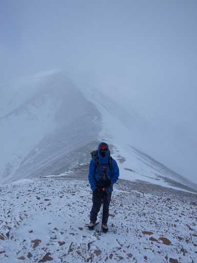
Ben on the summit ridge. Weather was quite miserable.

The summit mailbox

Me on the summit

View from the summit was largely obscured by the clouds
The fierce wind forced us to descend immediately. Retracing our steps back along the summit ridge was not as bad, mainly because the wind was blowing behind us. Weather improved a bit when we got back to false summit. We kept going down towards the big hill. Again, wind was blowing from behind and we were travelling fast.

Descending the summit ridge.
Looking back towards the false summit. Weather was getting better now
Snowshoeing down the big hill was fast and fun. Now the sky was almost completely cleared up towards east, and we could take time soaking in the views. We went up and over the bumps on the connecting ridge which proved to be much faster than our ascent route. Ben and I had some discussion whether attempting Mt. Stearn or not. We opted for not, as we didn’t want to survive another night here, and we were definitely running out of time and energy. Eric was behind us but I was sure he didn’t want to do Stearn neither, as he had already done it…

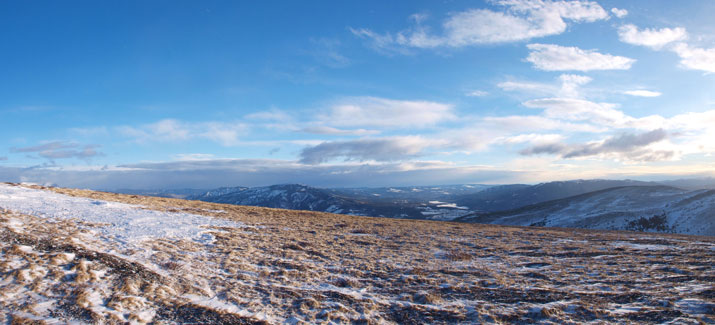
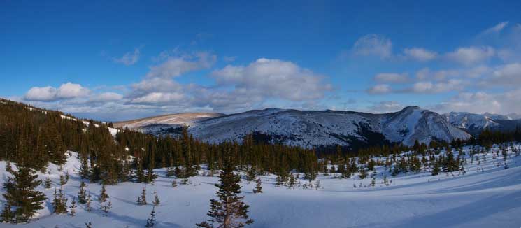
Panorama view.

Panorama view while we were still high. Mount Stearn looks small from here.
Weather was really clearing up

Almost back into the trees. We made a bad call of short-cutting through the forest here. Miserable bush was waiting for us.
Once we made back to the col before the last bump, we somehow decided to side-slope around the right side through forest… Big Mistake again!! Oh well, we got punished by even more post-holing and bushwhacking. This part was the most miserable non-alder bushwhacking I had ever done. Some tight spots were nearly impossible to go through… I was very exhausted and thankfully Ben could do most of the trail-breaking. He sank to knee deep even this part was mostly downhill. I had smaller shoes, and I would sank further down while using Ben’s tracks… Oh man, I couldn’t remember the last trip being as miserable as this one. The entire thing was just going on forever. At one point we could spot a tree-free line down, and we picked this line, and then regained elevation back to our camp… The sun had already set, and Eric showed up a few minutes later. We quickly packed our gears in, and started the even longer descent…
We lost the trail at the meadow area just after the saddle. After a bit of searching we managed to regain the trail. From here on it was a matter of perseverance. I didn’t remember how long it took us to exit this trail though. Overall, Lightning Ridge should not be taken lightly. It has net elevation gain of 1400m. There are lots of up-and-downs along the route, and it would be about 1700m if counting all of the regains. The round trip distance would be about 25km. And if you have to post-hole for a good portion, then it will be a real test for your physical limit.

Hi Steven,
Is there a way to get in touch with you via email?
Thanks,
Jenn
Sure. My email address is written on the “Home” page. icyicefield@hotmail.com
‘Post holing’ between Lightning and Stearn… oh, that brings back some memories! I heli-boarded Lightning Ridge with some friends in April 2007, and the plan was to walk/snowboard down to the Sulphur Gates road in order to not have to pay for the helicopter twice. The rotten snow and the thick bush between those two points was something one would have to experience in order to believe. And we weren’t out of the woods when we crested Stearn, we couldn’t find the trail down so bushwacked to the road. We were soooo tired when we finally popped out on the road.. lol
[…] who have lived the adventure: Steven from StevenSong.com Grant’s […]