Nevado Mateo
June 28, 2022
5150m
Cordillera Blanca, Perú
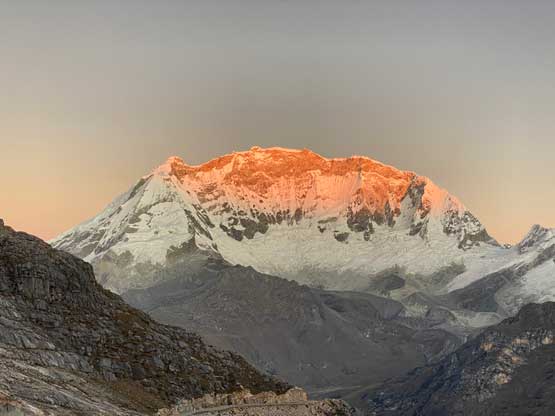
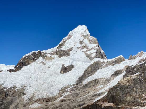
Nevado Mateo is rather just the least significant pimple on the long and complicated SW Ridge of Nevado Contrahierbas massif near Contrahierbas/Poroquingua pass which boasts the highest highway tunnel on earth. I have no clue how Nev. Mateo was named as this is NOT a peak looking from any direction other than from near the trail-head. The prominence above the nearest saddle is less than 20 m by visual inspection from the top. If looking at the topographic maps’ contour lines the saddle is not even shown so the “clean prominence” of this peak is zero… I think they named it because the real peaks around the area are too difficult to climb. They must “create” an easy 5000-m objective to boost the tourism but that’s just my guestimate. Nonetheless this is a short and fun climb and it wasn’t even as “easy” as we thought. This is still a proper mountaineering objective.
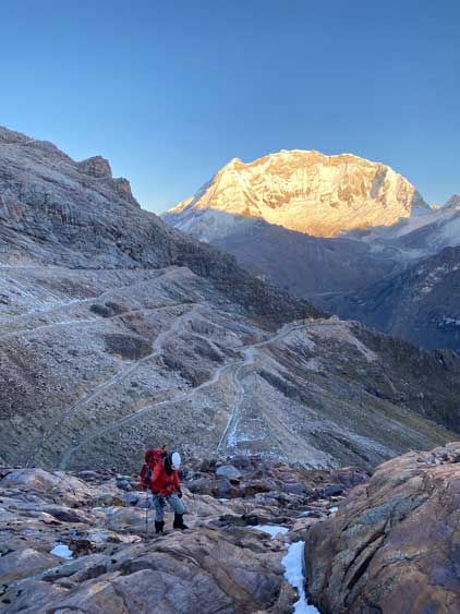
After hiking Laguna Wilcacocha and then Laguna Churup Lily and I still needed one more acclimatization hike/climb before tackling the main objectives in this trip, namely Yanapaccha and Alpamayo. I had extended the Laguna Churup’s hike to the summit of the nearby Co. Cachijirca at almost 5000 m altitude but Lily hadn’t broken 4500 m yet. I thought a day-ascent of Nev. Mateo would make the most sense at the moment. After talking to Sergio our guiding company’s director a plan was formed. To ascend this peak we did not need a guide nor a porter but we needed him to organize the transportation logistics. David who drove us to the previous two hikes was still available for the day and the plan was to get up at 2:30 am and start driving by 3:30 am. The drive was a long one past Carhuaz and eventually we made to the trail-head at 4700 m about an hour before sunrise. The last portion of this road was endless switchbacks but at least the road’s mostly all paved. I slept on the back seat for most of the time.

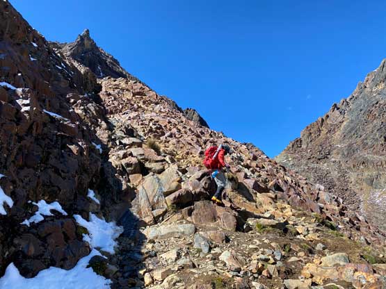
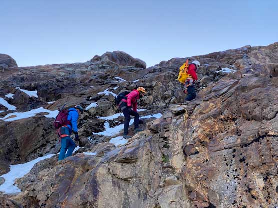
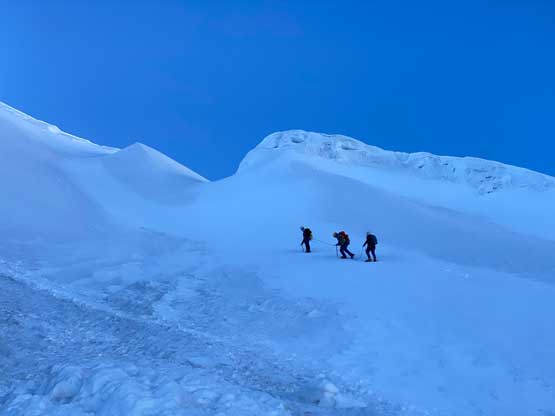
Gearing up in the dark and coldness was not easy especially considering I was feeling quite sick since the the airplane landed in Mexico City a few days ago. I even felt like I might be having a fever at the moment but I was still able to walk so we had to continue. We firstly walked down the deactivated portion of the road and then picked up a climber’s trail ascending steeply towards a wall. Ascending this rock wall was exposed 3rd class on down-sloping terrain. With our high altitude mountaineering boots and the heavy backpacks we decided to rappel later on the return. We then traversed another exposed 3rd class ledge with snow and ice on it. There were existing bolts for running belay but we didn’t feel the need to do such. We were already moving at a snail’s pace thank to the altitude and my illness so we didn’t want to fuss around with fancier operations. The sun’s slowly rising behind the horizon at this point and the views made the suffering worthwhile. We then ascended a long section of confusing terrain before taking a much-needed break at the edge of the glacier. I thought about to turn around but decided against it.


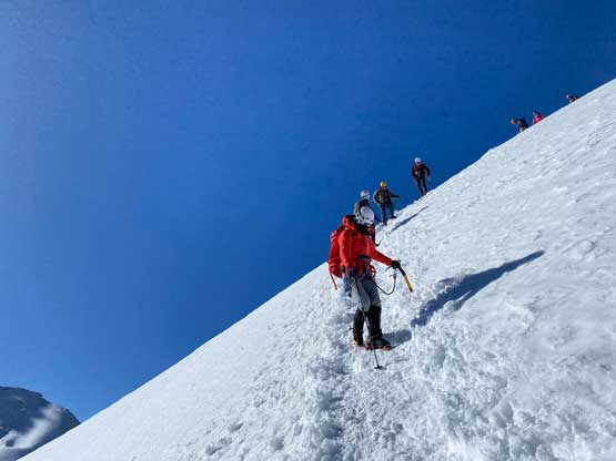
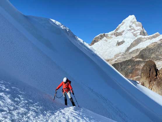
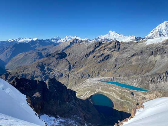
The glacier was rather a permanent snow field so with a very defined path we didn’t feel the need to rope up. We actually ditched the rope at the edge of the glacier to lighten up the packs. The climb was steeper than appeared with sections of 40+ degrees snow but again, there’s a trench of tracks to follow so the going was straightforward. I was really struggling on the final 100 m gain to the summit. Lily went ahead but I was never able to catch up until the very summit. I barely had the energy to take some pictures and eat some food so despite the good views the day had been extremely miserable for me. But I made the summit and that’s all what mattered.


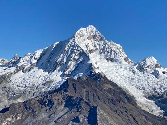
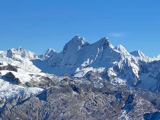

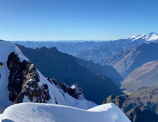


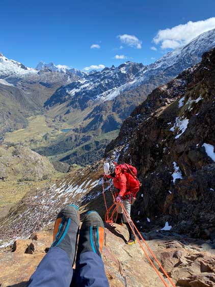
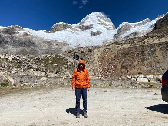
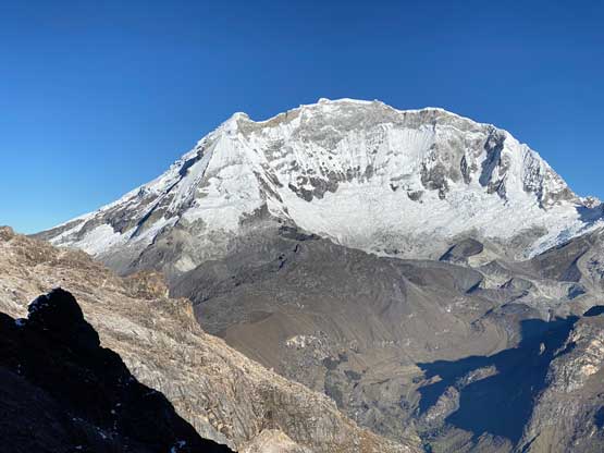
After about 20 minutes we decided to slowly descend. We were clearly much faster than most of the other groups while descending steep snow. I didn’t even bother to use the trench at most places as walking down on virgin snow was much simpler. We then shouldered the heavy packs and carefully descended to the scrambling parts. We down-scrambled the exposed ledge and then made one rappel off the bolted anchor. Lily had to lead the rappel as well as doing the rope management as I was feeling very shitty. The slight uphill slog back to the parking lot felt like forever. We then stopped numerous times to check out the various viewpoints, including making a detour through the world’s highest tunnel. We drove here at night so now we could finally see the surrounding giants.