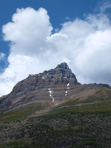
Mount Chephren
August 10-11, 2013
3307m
Icefield Parkway (South), AB
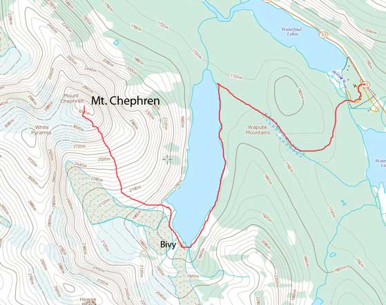
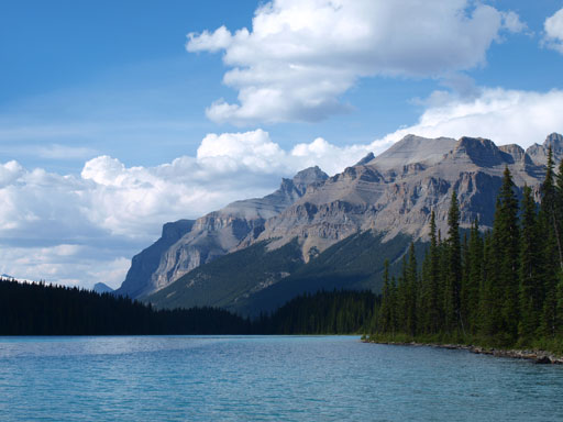
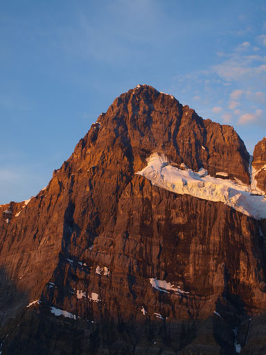
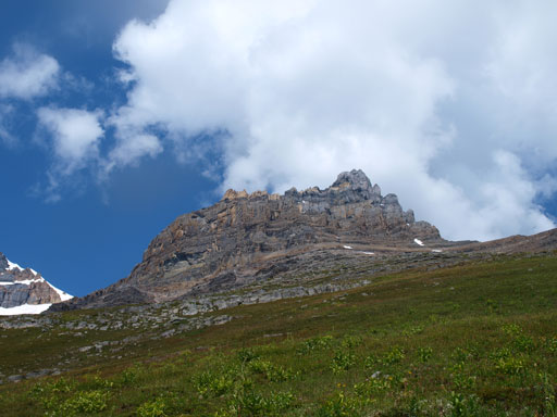
Mt. Chephren is one of the most impressive mountains you can see while driving up the Icefield Parkway. Rising 1600 vertical meters above Waterfowl Lake, it’s also one of the most photographed mountains in that area. The standard route up its south face is rated as a difficult scramble and it’s been on my “list” ever since I started scrambling. It was my primary objective in the summer of 2012, but due to various reasons it didn’t get realized.
Mt. Chephren standard scramble route
After summitting both Mt. Daly and Mt. Niles in a 15.5-hour long day, I was supposed to take the weekend lightly. Oh well… Andrea and I originally planned a 2-day ascent of Cirrus Mountain, but I changed my mind immediately on the drive in, after seeing Mt. Chephren’s dry south face. I pulled off on the shoulder of highway and asked Andrea if she’s interested in Mount Chephren. Of course yes… It was still early on Saturday and the approach to Chephren’s bivy would only take about 2.5 hours so we decided to do a short objective first. By the time we got back to Chephren’s trail-head, it was already late in the afternoon. There were some clouds building up but it seemed like the forecasted thunderstorms wouldn’t come in the next short while. So off we went..
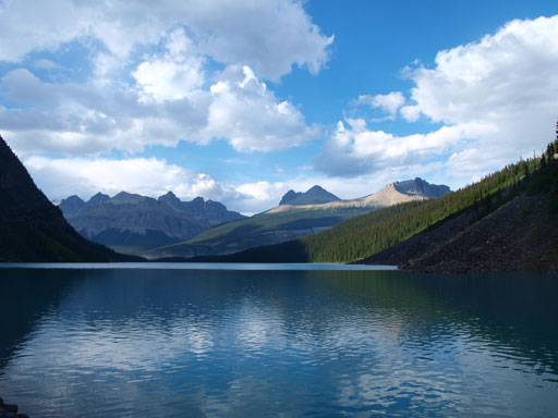
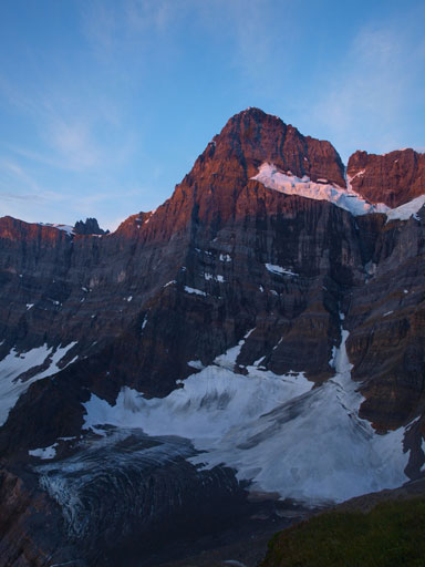
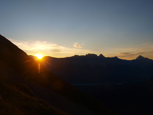
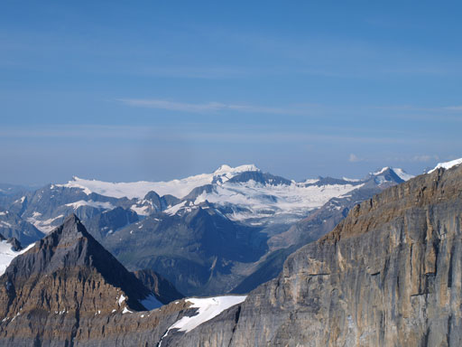
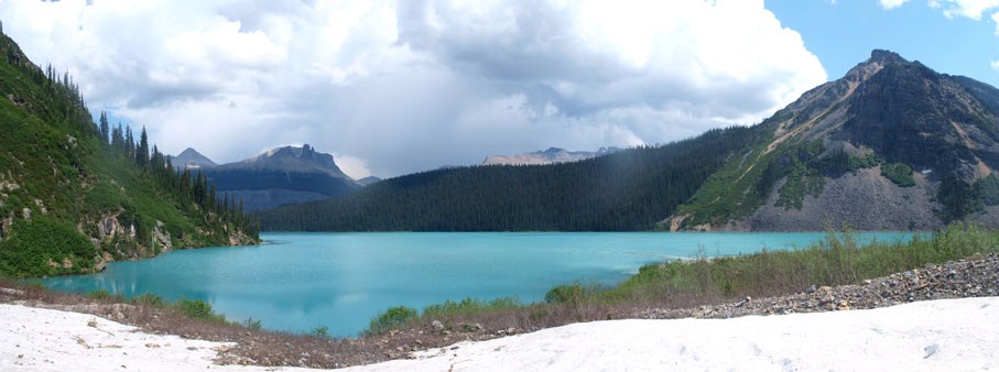
Mt. Chephren looms behind Waterfowl Lake
The first thing was to locate the Chephren Lake trail-head which is on the other side of Waterfowl Lake campground. The campground was closed due to flooding damage. The trail led us to a bridge crossing the raging Mistaya River, and then the next 3.5km or so was a boring hike on a well-defined trail. This trail went down-hill at the last bit. I wouldn’t complain right now, but I fully knew we would not appreciate the elevation regain at the end of this trip. The Lake was gorgeous but the sun was on the wrong direction for photography.
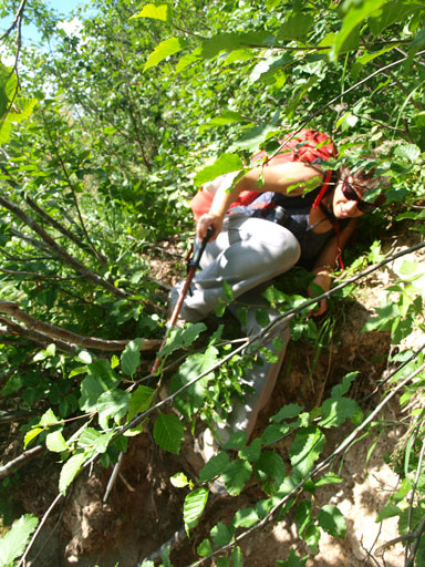
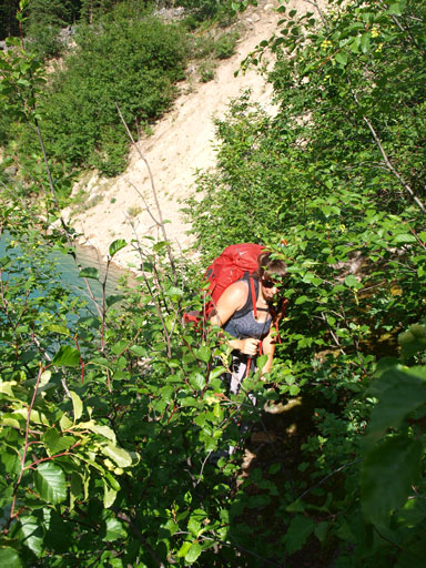
I had heard lots of stories about the bushwhacking around Chephren Lake being very miserable, but it wasn’t the case. Probably because I’d done enough bushwhacking earlier in this year, I found the bush being near non-existence. There’s a well-travelled path leading our way, and it was quite pleasant actually. We met a couple scramblers on their way out. They all had made to the top and informed us the perfect condition. No crampons needed.

The trail crosses Mistaya River
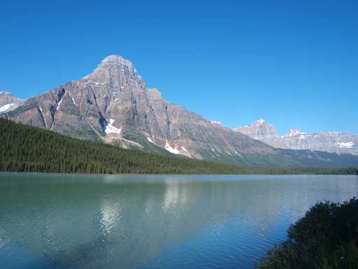
Finally got to Chephren Lake
Chephren Lake
The Murchison massive behind.
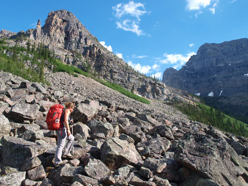
Things got worse dramatically at about halfway around the lake, not because of the bushwhacking though. There was a short very bushy section, but only for 10 meters or so. From here on it was all side-hilling on big boulder field, for maybe 1.5km or so. The boulders were generally stable, but it wasn’t very pleasant especially with a big pack on. What you need here is just patience.
Bush…

This short section was the worst part
Try not getting wet.
Bush again..
Now comes the boulders..
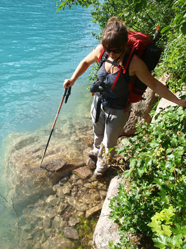
Once around to the other end of Chephren Lake, we decided to camp at just before crossing the first major inlet creek. There’re many lovely bivy spots at this end of the lake, and I think we did find a good one. We camped a bit early though and that would cost us 20 minutes or so on the summit day, but that’s okay. There was a brief shower at around midnight and thankfully it didn’t dump fresh snow higher up. At 4am, we woke up under millions of stars. It took us quite a while to get ready and we started our day at about 5am.
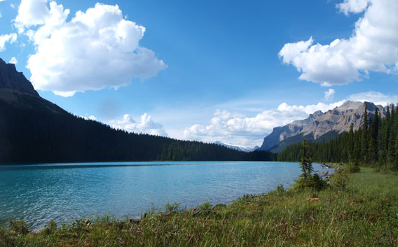
We set up our camp at the far end of Chephren Lake, before the first stream crossing

Surprisingly we had same bivy sack
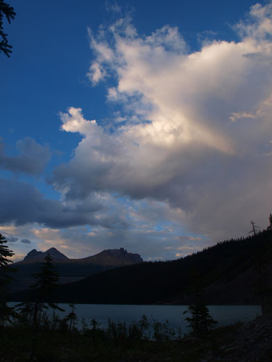
Gorgeous evening view
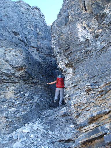
It wasn’t fun to negotiate the non-trailed terrain in a total dark. We hopped over the first inlet creek, but had to ford the second. We also got a bit too high on climber’s left and had to scramble up a short section of steep moraine to get back on track. But then we decided to follow the crest of that moraine up. It was a good practice at balancing on exposed terrain though, but don’t do what we did. Big mistake. The exposure was pretty sustained and the grip wasn’t very trustful neither. I was very glad that we eventually finished the entire moraine crest without slipping. The correct route which we discovered on the way down, goes up climber’s right of the moraine crest. It’s still on the hard moraine and this entire section was pretty miserable.
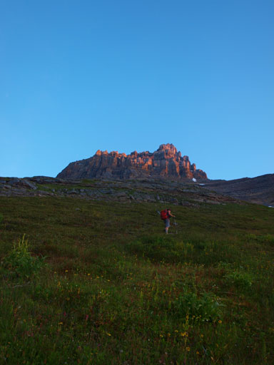
The next section was steep grass. By now it was already bright enough that we no longer needed head-lamps. We went a bit too far climber’s right but it was okay as all route would work. If you end up in the bush then you’re too far climber’s right. Hiking up the steep grass wasn’t as bad as expected, but oh man, that slope was freakin’ long… One thing to take note of was the mosquitoes. They followed us to pretty much the first rock band… They’re hardcore..
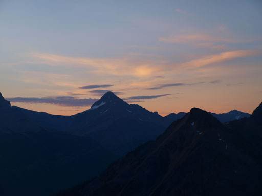
Morning light and Mount Weed
Howse Peak on alpenglow
Hiking up this gigantic slope

Panorama of the alpenglow view
Our objective is getting closer
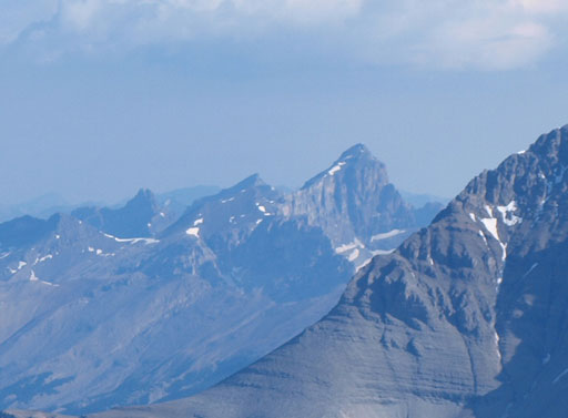
A zoomed-in shot of Howse Peak
Now, the sunrise!

Flowers

Another panorama shot
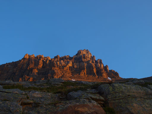
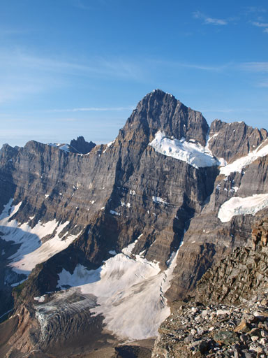
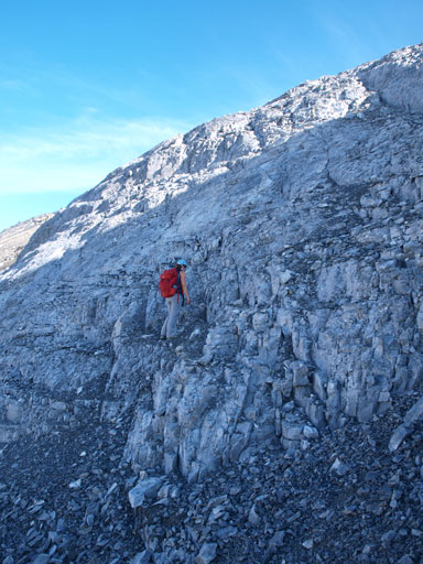
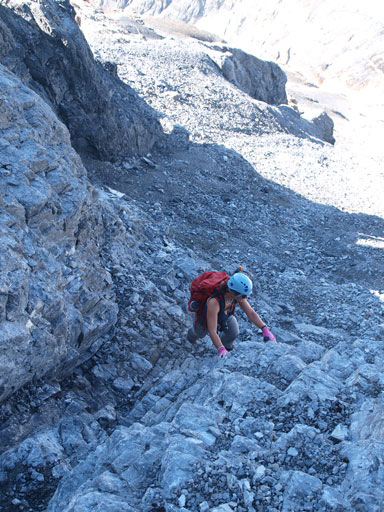
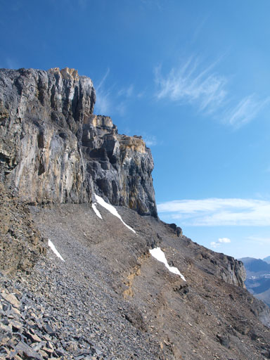
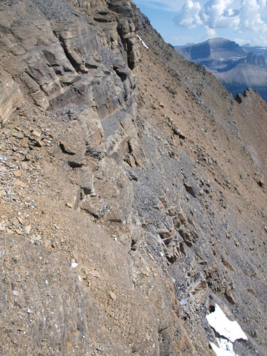
Terrain got steeper as we approaching the crux, the first cliff band. The terrain around this crux also reminded me the true summit of Rundle, difficult and loose. I had vague memories from Eric and Vern’s trip reports that the easier route exists on climber’s left, but by following my sense up I ended up on climber’s right of a fixed rope. Andrea went up climber’s left, while I continued my line up, right of the rope. There were 3 short steps being very difficult, but not exposed. Now after finishing a few classic 5th class alpine routes I can confidently say my route involves a few 5th class moves. We regrouped at above the first rock band. Andrea told me her line was pretty difficult too. Oh well..

Steep terrain before the 1st rock band
Yes another shot of Howse Peak
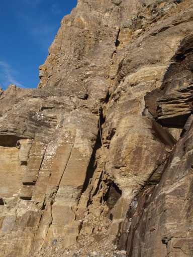
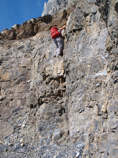
I went climber’s right of this fixed rope
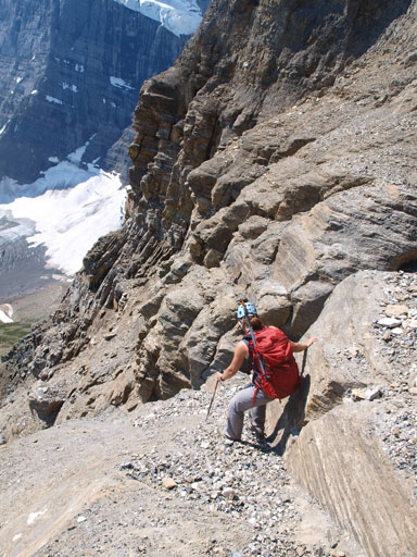
We separated at the 2nd rock band too. I again, went climber’s right following a big drainage up. It went easy until near the top where I had to do some difficult scrambling. This rock band was considerably easier than the 1st one and we soon cleared it. And then we had to traverse climber’s left aiming for a snow slope. A break through the next imposing cliff band exists on the top left corner of this snow slope. Andrea took out here ice axe and went direcly across the snow. Me on the other hand, was too lazy to change gears so scrambled through the moat. There was one sketchy move involved.

I kept following this big drainage towards the 2nd rock band

Terrain got easier after the 2nd band

There was one snow slope to cross

On top of this slope.
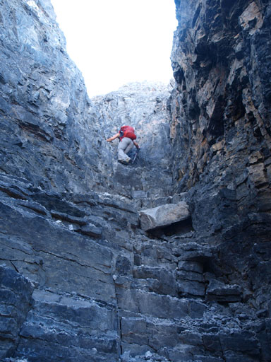
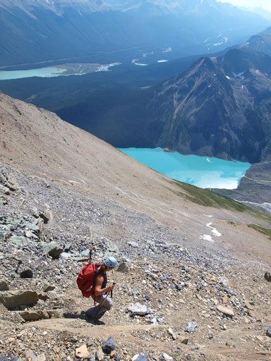
And then the terrain got easier as we kept traversing left. We would soon get a great view of White Pyramid. The route then swings back climber’s right following the ridge up. By following a beaten path we arrived at the base of a chimney. The rock was loose and the scrambling was difficult. Fun time though. This was the last difficulty of our ascent, and the rest was a slog on loose terrain. The summit view was great, but a bit smoky. Our ascent time was 4.5 hours from bivy site.
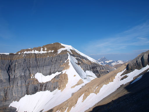
Started to see White Pyramid
Mount Mummery
The last difficult scrambling section goes up this gully
Terrain was still loose once above that gully
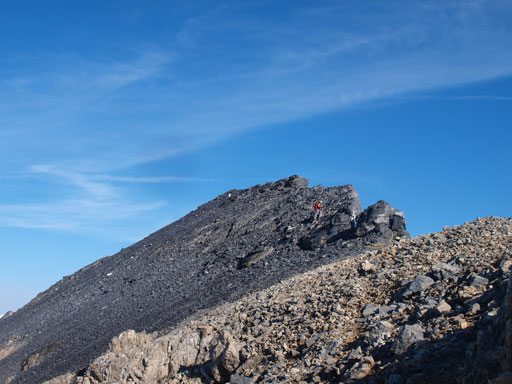
Near the summit
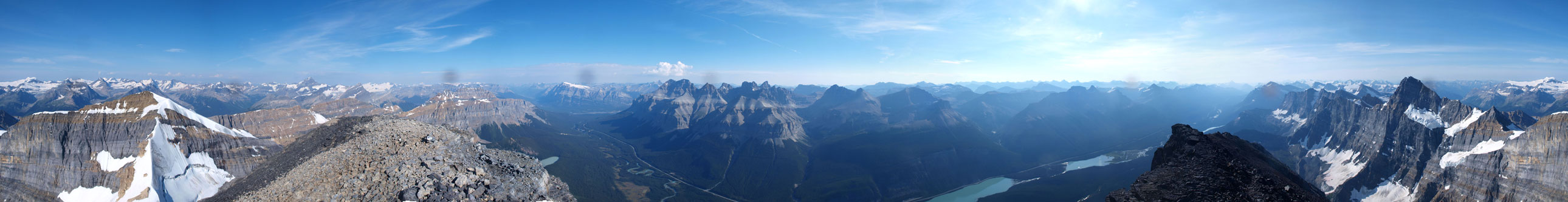
Summit Panorama. Click to view large size.

Smoky view towards the distant Mount Hector
Panorama looking south

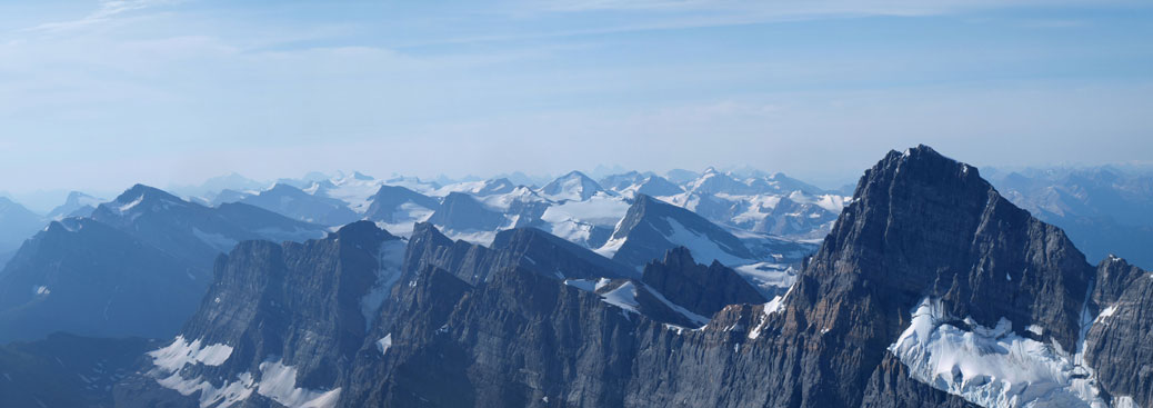
Panorama of Freshfield Icefield
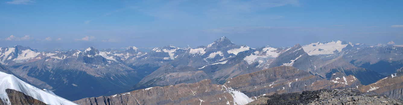
Forbes and Lyells
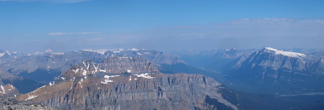
Monchy Icefield, and N. Saskatchewan River Valley, and Wilson
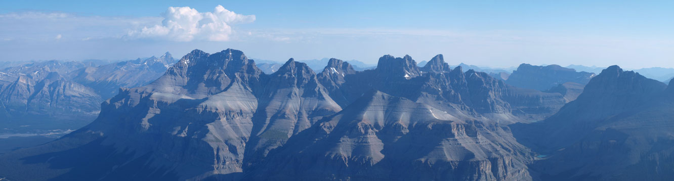
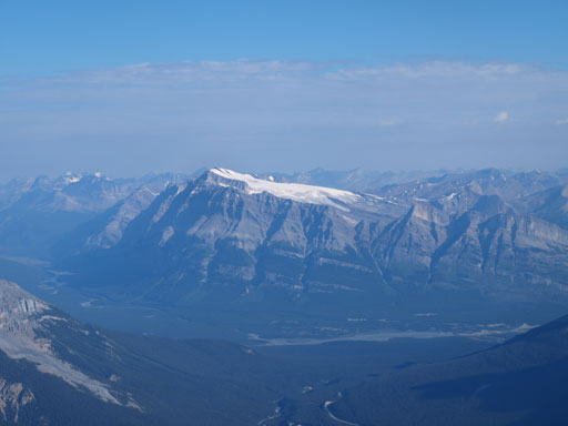
The Murchison Massive

Mt. Forbes

The 5 peaks on Mt. Lyell massive
Mt. Cline
Mt. Wilson
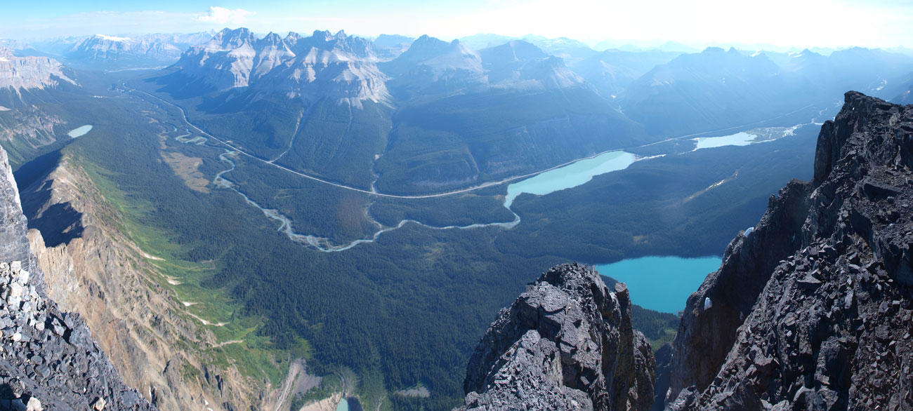
Panorama of Mistaya River Valley
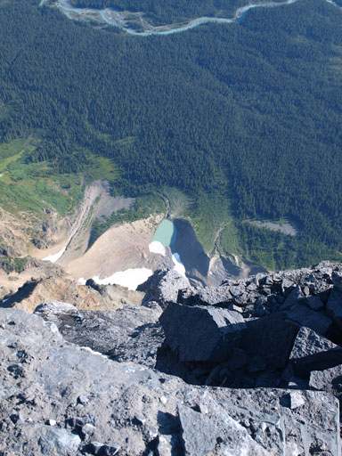
Looking 1 vertical mile straight down the east face
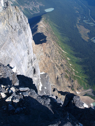
The East face!
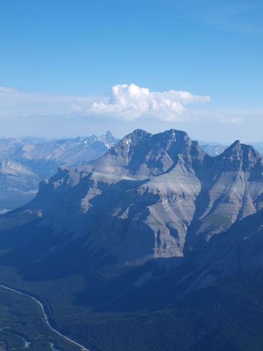
The twin summits of Mt. Murchison
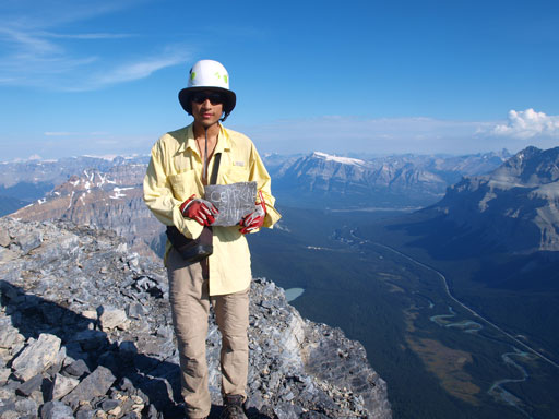
Me on the summit of Mount Chephren
By now I already started to feel the elevation gain I’d done in this trip, and I knew the descent would not be pleasant given how tired I was.. At the snow slope I took out my ice axe and crossed it, and after that we carefully descended through the second rock band at where I went up. At the crux rock band we decided to use Andrea’s route. We ended up going straight down between the two routes though. Andrea did a great job leading down through this steep and loose section. She was in a great physical shape and boosted down the big slope. My knees would hurt if I speed up on the descent, so I went down on my own pace, step by step down the gigantic grass slope. After eternity I merged to a snow patch on skier’s right and followed it easily down to the moraine section. The moraine was very hard on my knees and I had to go very slow. I followed the moraine all the way down to Chephren Lake, and by contouring around the lake shore I could managed to jump both inlet creeks without wetting my boots.
Descending the upper loose terrain
Down-climbing the difficult chimney/gully
Beautiful view from our descent

Down-climb the band above that snow slope

Crossing back the snow slope
Down-climbing the 2nd cliff band
Steep terrain just above 1st band
Andrea led the way down

It’s steep and loose.
Still a long way to go…
Looking back
Back down to Chephren Lake

Looking back towards this moraine. We went up the crest, and came down climber’s right side.
I was exhausted when I got back to the camp, but given the approaching weather we had to speed up. We wanted to be off the boulder field before the rain came. One word to describe the return, miserable… I’m pretty sure Mount Chephren would never see me again. After negotiating the boulder field for eternity, we were back to the path around the lake. This path also went on forever. Back to the trail, it kept going uphill.. Oh well, at least the weather held for us. The rain didn’t come until I got back to Waterfowl Lakes campground. It came pretty heavily though.
Looking back at the south face of Mount Chephren

Back to the boulder field..
Overall, I was very satisfied to finally get Mount Chephren bagged. It’s definitely one of my favourite mountains, but not even close to qualify my favourite ascent. You get what I mean. I wouldn’t suggest this objective to those of you simply looking for “fun”, but if you’re a hardcore scrambler or peak-bagger, this is a mountain you want on your resume.

Fantastic album and route description. Mt. Chephren was one of my favourites, in terms of scrambles in the Rockies. A huge day on a big peak with neat terrain and out-of this world views. It doesn’t get much better than this. ( I did Chephren in1998) The only downer is the long bushwhacked around the lake.
Keep on scrambling!
Jan Triska, Ottawa
wow! beautiful pictures. I am new to hiking and want to do this. Do you need mountaineering experience to get to the top? How long was the hike from the highway? Would you recommend an over nighter?
You don’t need mountaineering experience but you want to be a top notch Rockies scrambler and able to route-find in choss country, and able to ascend/traverse some steep snow (if needed).
You don’t need to overnight neither but then expect a long day. Longer than 13 hours for my pace.
the bivy area. can i pitch a tent there?
Oh yeah I think there’s plenty of space for a tent. I didn’t own a tent back in 2013 hence the bivy sack. I use tent almost exclusively these days.