Portia Peak
November 18, 2018
1870m
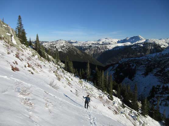
Coquihalla Pass, BC
Portia Peak is a relatively small summit in the Coquihalla Pass area that sees no more than a few parties each year. It does not boast much mountaineering interest, but attaining this summit is not an easy fair nonetheless. The approach involves a long, arduous but incredibly scenic ridge traverse from Zopkios Rest Area via Needle Peak’s approach, The Flatiron and then “Two Bears Ridge”. The recommended timing is “winter” but several stretches are steep enough to impose significant avalanche hazard. I’ve seen a mixed bag of reports and my decision was in November when there’s not enough snow to worry about avalanches, but snowy enough to warrant a proper snowshoe trip.
To put this trek down in a single day requires an early start. Vlad and I left Vancouver at around 6 am and were at the parking lot in just over two hours. Our first objective was The Flatiron as none of us had been up there before. To just do Portia Peak one does not need to go all the way to the summit of The Flatiron.
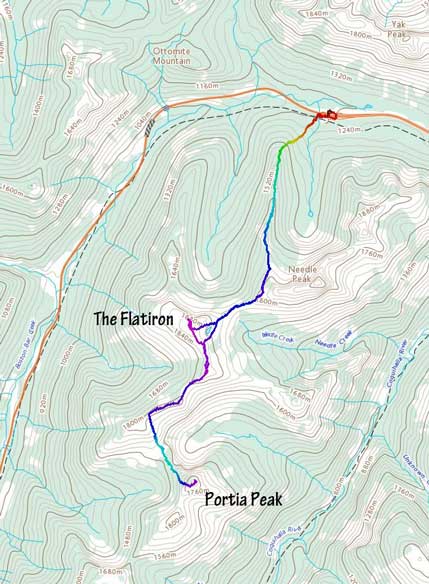
Flatiron – Portia Peak traverse. GPX DL
From the summit of The Flatiron we followed the broad connecting ridge due south. Two small, but steep-banked notches surprised us and we had to take the snowshoes off to down-climb into, and then out of them. We then strapped the snowshoes on our packs and booted the next section staying on the wind blown side of the ridge, all the way to the next major highpoint. By now we finally got some unobstructed views of the steep drop before Portia Peak and it’s looking depressingly far away. The strategy was to focus on one step at a time. Traversing south-westward across “Two Bears Ridge” was rougher than expected with some bluffs that required minor detouring, and once making sense we bailed off the ridge aiming directly at the low pass immediately north of Portia Peak.
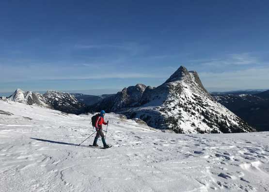
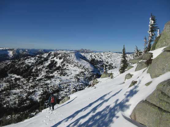
Me hiking southwards with Needle Peak behind. Photo by Vlad M.

Inside one of the two steep notches immediately south of The Flatiron

Vlad boot-packing out of the second notch

Then, continuing boot-packing on the dry ridge
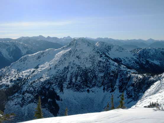
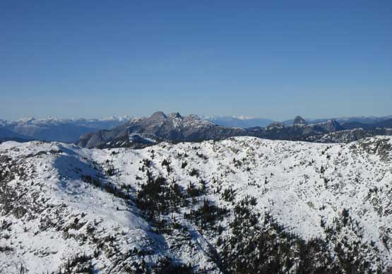
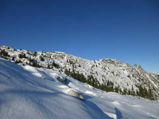
Over another subsidiary bump we got our first unobstructed view of Portia Peak

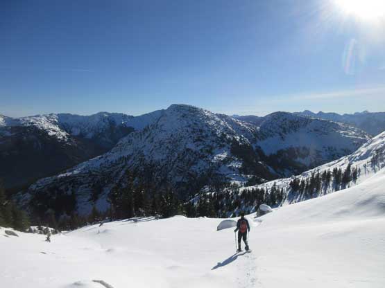
Onward along “Two Bears Ridge”

A zoomed-in view of the entrance of Box Canyon and Coquihalla Highway
Bailing south off “Twin Bears Ridge” with our objective in front
The descent off this south-facing slope was even steeper and more complicated than expected and the steepest stretch goes at 35+ degrees even with route-finding. The snowpack was fairly shallow but I was too lazy to do another gear transition. Vlad took his snowshoes off and plunged down while I gingerly cut some switchback tracks to be used later. Boot-packing was far faster but adding the two gear transitions our pace was about the same. Up the NW slopes of Portia Peak we soon encountered completely different snow conditions with sections very icy. There weren’t enough snow coverage to smooth the bluffs and bush out neither adding to the route-finding game.

Vlad gingerly snowshoeing down the steep south-facing slope

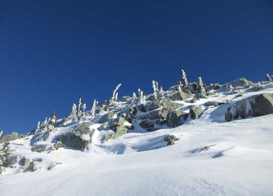
This is the typical steep terrain along this stretch.

Almost down to the low saddle. Portia Peak in front
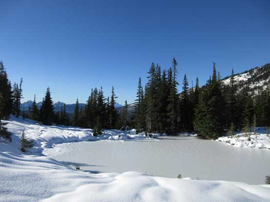
There’s a small frozen tarn at the low saddle

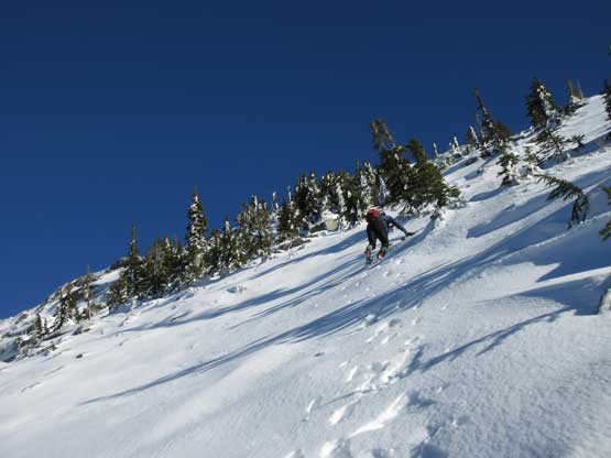
Upwards again, Vlad snowshoeing up

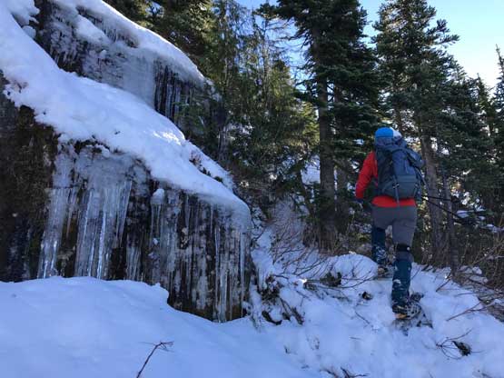
Gorgeous terrain albeit not the easiest

The NW slopes of Portia Peak is steep, bushy and bluffy…
Me negotiating a steep step. Photo by Vlad M.
Vlad “half-snowshoeing/half-boot-packing” …
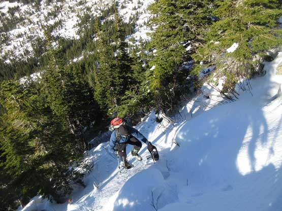
About halfway up the NW slope the terrain had become moderately exposed especially in the icy conditions. None of us brought an ice axe on this trip which turned out to be a mistake. Vlad decided to ditch snowshoes and don crampons while I continued stubbornly charging all the way up (35-40 degrees) in my Lightning Ascents snowshoes, and I have to say that at times I felt quite exposed with absolutely no way to arrest a fall in case the snowshoe crampons failed, but I had my trust on this pair of ‘shoes. The trade-off was no post-holing. After what seemed like a long haul the terrain sorta plateaued out and by this point we weren’t far from the summit. The views were excellent as expected.

On the upper slopes now, looking sideways to show the slope angle

Vlad kicking-step following my snowshoe tracks…
Almost there… It’s still kind of foreshortened
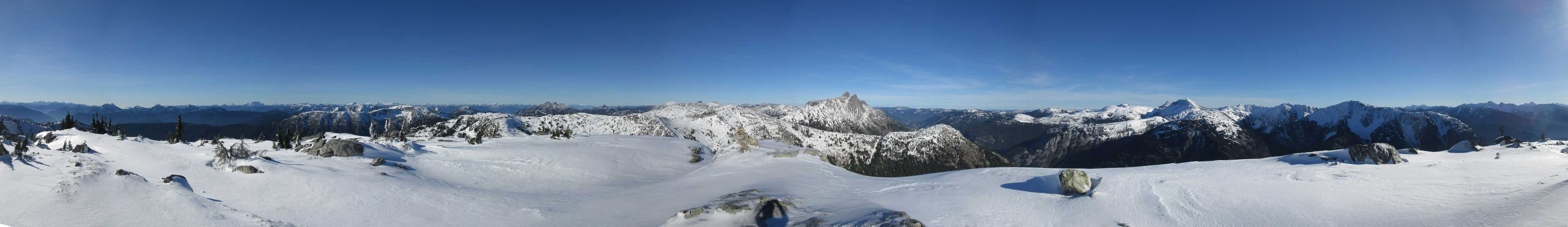
Summit Panorama from Portia Peak. Click to view large size.
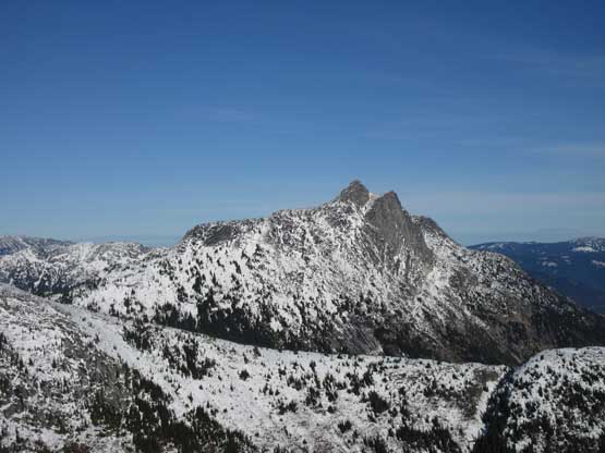
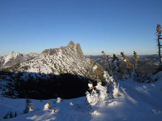
Needle Peak in full glory
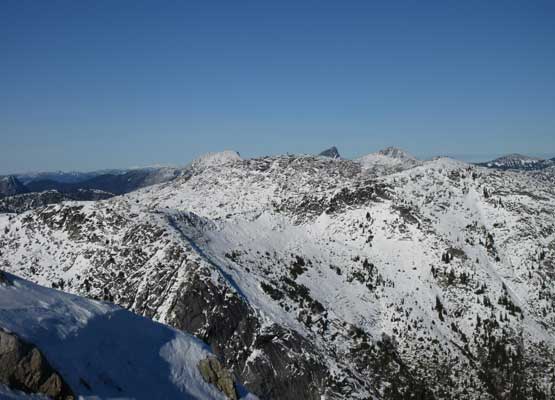
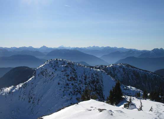
This is looking back across that broad, undulating ridge from The Flatiron

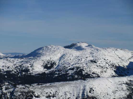
Coquihalla Mtn. and Jim Kelly Peak
Illal Mountain

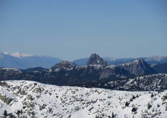
A zoomed-in shot of Needle Peak

The Old Settler

Mt. Urquhart

This is looking at a sea of peaks by East Harrison area
This is looking over “Two Bears Ridge” towards Anderson River Group

Steinbok Peak and Ibex Peak in Anderson River Group
Gemse Peak is apparently not an easy summit

A southern view with Cheam Range peaks on the skyline

Vlad and I on the summit of Portia Peak

Me on the summit of Portia Peak
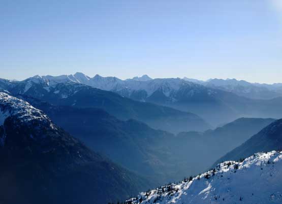
This is looking down Coquihalla River valley with some valley inversions
Just another view looking south to show the layers

Another panorama from the summit of Portia Peak. Click to view large size.

Just another panorama from the summit of Portia Peak. Click to view large size.
On the descent I took the snowshoes off and donned Irvis Hybrid crampons to test them out on my brand new Trango Ice Cubes. They performed pretty well together. On the ascent Vlad had done a great job kicking multiple times to get in some deep purchases so to down-climb I just needed to use his tracks. That was very easy. In no time we were off the steepest part of NW slopes and then the crampons were switched back to snowshoes and the ‘shoes were worn all the way up the steep south-facing slope to the crest of “Two Bears Ridge”. The 200-m regain was surely a tiring, but incredibly scenic grunt.
Time to head down.

Vlad down-climbing
Another photo of Vlad carefully down-climbing NW slopes of Portia Peak

Back to that 1600-m low saddle now

Me testing the ice strength. Photo by Vlad M.

This is our snowshoe tracks down the steep south-facing slope

Interesting rock formation in Coquihalla River canyon
Vlad following our snowshoes back up that steep grunt
The terrain levelling out now

Almost onto “Two Bears Ridge”, looking back

Me regaining the crest of “Two Bears Ridge”. Photo by Vlad M.
Once back to the crest of “Two Bears Ridge” we took our time traversing to the highest bump south of The Flatiron. This stage has more ups than downs with quite some micro-terrain to be careful with, but the views were just beyond breathe-taking, especially in the late-afternoon lighting. We bailed down into the cirque east of The Flatiron via a short-cut avoiding that two steep notches on the ridge. This short-cut involved again a section of 35-40 degree slope but the snow condition was more homogeneous. My technique was down-climbing facing into the slope but keeping the snowshoes on. This worked perfectly well. Lower down Vlad and I rejoined our path and then grunted that last bit of elevation regain to Needle Peak’s west shoulder, before bailing down Needle Ridge trail while watching a classic Coquihalla sunset. Once the terrain became steeper I strapped the microspikes on just so to justify the purpose of hauling them up, and I have to say that with the spikes I felt more confident on the steep, ice-covered trail. About half an hour’s use of headlamps later we arrived back onto the highway and instead of taking a roundabout way through the tunnel we just ran across the main highway to the parking lot.

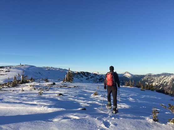
Me starting the ridge traverse. Photo by Vlad M.

Onward back across “Two Bears Ridge”. Photo by Vlad M.
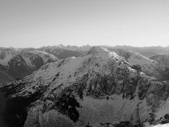
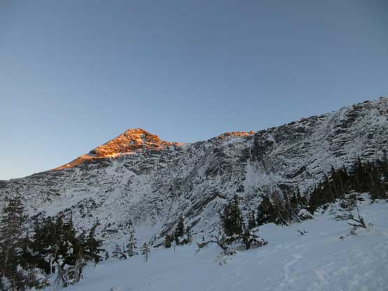
One last shot of the North Face of Portia Peak

Vicuna Peak and its shadow on Guanaco Peak
Rime-covered krummholz with Needle Peak behind

Another shot of Jim Kelly Peak and Coquihalla Mountain
Vlad plodding back. Almost time to bail down
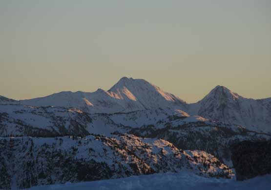
Tulameen Mountain at sunset time

The south face of Yak Peak
This is the north face of Needle Peak

Alpenglow on Markhor Peak
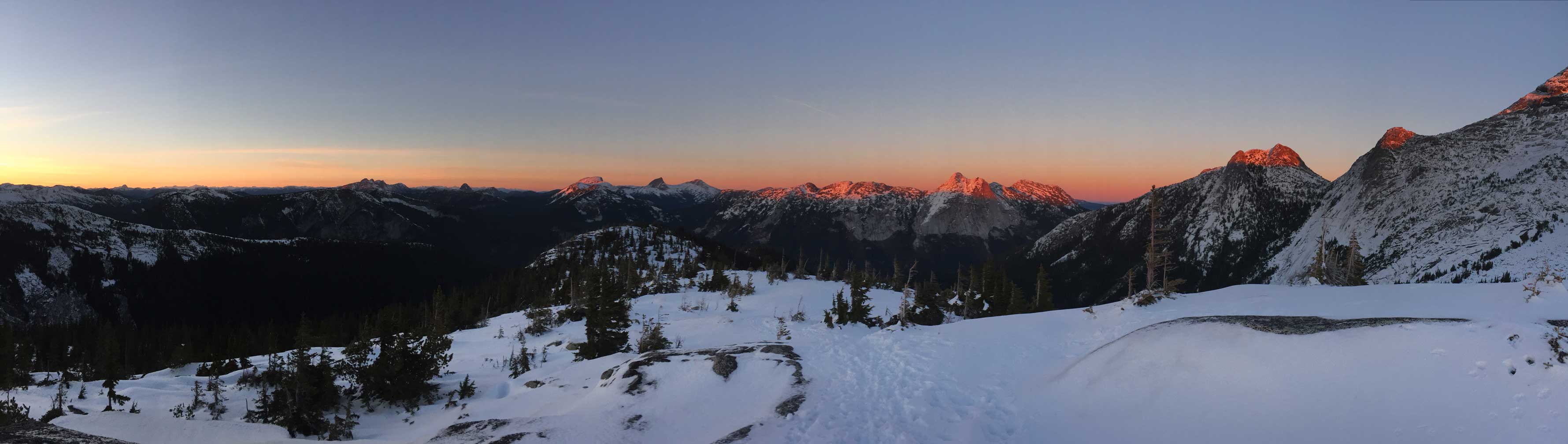
A panorama of sunset horizon from the upper Needle trail. Click to view large size.

Alpenglow on Yak Peak and Nak Peak

One last look at Yak Peak before turning on the head-lamps
Our round trip time was over 9 hours on a steady pace and given the conditions I think we did pretty well. This is indeed a great trip to be done in late fall or early winter conditions when there’s enough snow to enhance the scenery but not enough to cause avalanche concerns. The terrain was mostly open meadows and low-angled granite slabs so one does not need to worry about having to travel across partially covered boulder fields.
