Loquilts Peak
July 22-23, 2020
2170m
Sims Creek / Princess Louisa Inlet, BC
“Loquilts Peak” is the unofficial name of a reasonably prominent massif to the SE of Mt. Tinniswood, sandwiched between Sims Creek to the north and Princess Louisa Inlet / Jervis Inlet to the south. This peak is very round and broad and boasts some sizeable glaciers on all aspects. The summit is however, nothing fancier than a walk-up, but the access is extremely difficult. Alex, Vlad and I did it as part of a 10-day traverse from Clendinning Range towards the Elaho-Jervis divide. In the morning of the 5th day we climbed Mt. Tinniswood and now we were down at Loquilts/Casement col looking at the long and undulating NW Ridge of Loquilts Peak.
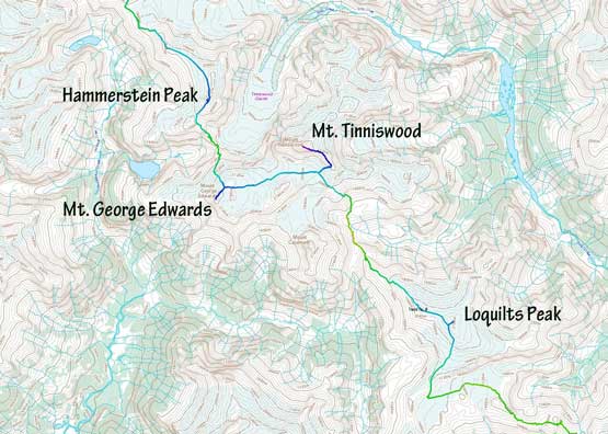
The section from Hammerstein Peak to Loquilts Peak
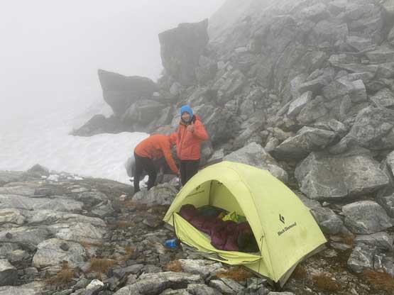
Our aim was the base of Mt. John Clarke where our foot cache was at, but it appeared there’s no short-cut around Loquilts Peak that we must carry our heavy packs up and over this summit. We could drop the packs for the very top section but that’s it, so we took a long break, shouldered the heavy packs and up we went. The plan was to go as far as the weather allowed us. The forecast was garbage for this day and the day after, but so far we hadn’t sensed any sign of immediate precipitation so there’s no reason to get lazy. The hardest section of Loquilts Peak was actually near the bottom where we must scrambled up through a series of class 3 cliff bands with some steep dirt and heather thrown in for a good measure. It was a bit of a team work effort in finding the line with several times of back-tracking. Once above 1800 m the grade eased off and we were mostly on snow. Ahead was several more kilometers of plod towards the false summit but the weather rapidly closed in. About 50 m under the false summit we were suddenly soaked in a blizzard and were forced to set up tents in the horizontal rain. It wasn’t impossible but definitely Type 2 fun.

Looking back towards Mt. Tinniswood

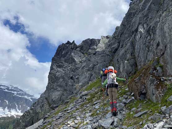
Alex thrashing up some bushy and steep terrain
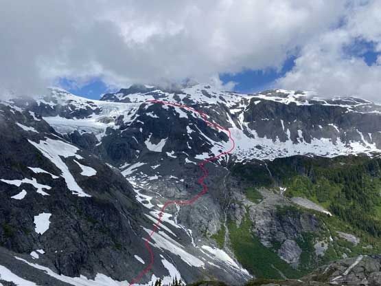
A review shot of the route we took to descend around Mt. Casement
We faced a series of cliff bands here and there

We had no beta so had to wonder around to find weaknesses

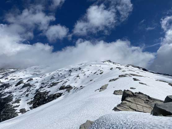
The typical scrambling on the lower NW Ridge of Loquilts Peak
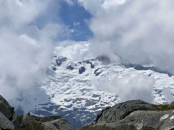
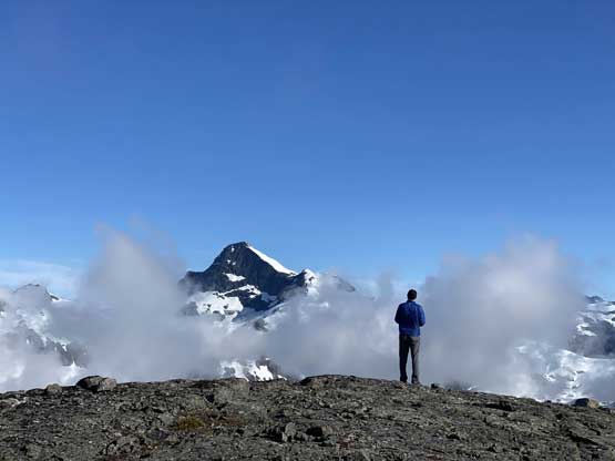
The NE Face of Mt. Albert almost showed up
Passing by a few tarns on the ridge

Vlad was gong ho to get further.

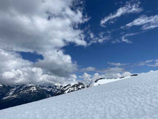
Clouds came in and out. We were mostly in a white-out
Brief clearing was deceiving. In half an hour we were in a blizzard
We then spent the rest of the afternoon in the tents riding out of the storm. The rain briefly stopped in the evening so we got out, made some dinners and actually got some views. We could suddenly see where we were as the visibility had been very poor earlier in the day.
Dinner time in the mist…

The weather finally cleared up at dusk.
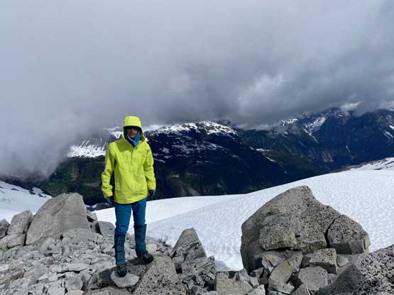
The next morning we woke up in some blue skies but the clouds soon took over. We broke camp and carried our packs up and over the false summit. Instead of ascending up and over the true summit we opted to bypass on the west side so ditched our packs and dashed for the summit. There were a few scrambling moves to gain the actual highpoint but it’s easy overall. The view was disappointing as we were again, soaked in clouds with no sight of other peaks.

Morning view of Mt. Casement and Mt. Tinniswood

Our camp under the false summit of Loquilts Peak

The view into the Clendinning area – Mt. Perkins et al.

Vlad drying out his sleeping bag..
Vlad taking in the views of Mt. Tinniswood
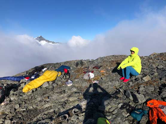
Me and our gear sale. Photo by Vlad M.

It’s breakfast time… Photo by Vlad M.

The valley north of Mt. Albert.

A closer view of Mt. Tinniswood

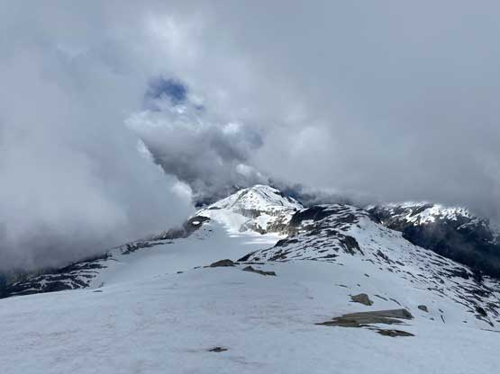
Plodding towards the true summit of Loquilts Peak now

Vlad and Alex approaching the summit

Partial Summit Panorama from Loquilts Peak. Click to view large size.
Me on the summit of Loquilts Peak
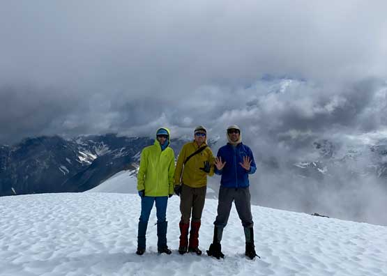
Our group shot on the summit of Loquilts Peak
We then navigated in the white-outs purely by GPS to descend the upper south ridge of Loquilts Peak. The visibility did not come back until we were back under 1800 m elevation. The aim was a ramp to get down onto “Bon-Bon Glacier” but to access the ramp we had some micro-terrain to content with including some up-and-downs. We had no beta about the ramp and we had little clue where exactly the previous explorers went in this section, but the satellite images suggested this short-cut ramp might work. It worked, barely.. The bottom section had some large and slippery slabs but with some route-finding we managed to get down onto the glacier without doing anything harder than “class 3”. Traversing across Bon-Bon Glacier was a pain in the ass with lots of sun cups and flat terrain. We then took another long break once exiting the glacier. The section ahead appeared ugly with again, lots of micro-terrain but again, we knew there must be a way as previous parties had done this section, and the trip continued towards Mt. John Clarke.
Descending the south ridge of Loquilts Peak out of the white-outs

Mt. Albert was still soaked in

I’m sure this valley hasn’t seen much human traffic, if any…
Looking back up the south ridge of Loquilts Peak

Alex at the bottom of our short-cut ramp down to “Bon-Bon Glacier”

The bottom section of our short-cut ramp

Alex leading down the Bon-Bon Glacier

Vlad descending Bon-Bon Glacier
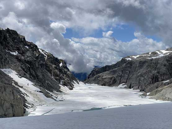
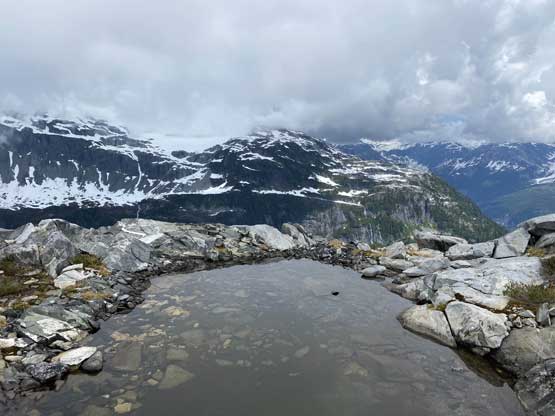
Most of the alpine lake lakes here were still frozen

Vlad regaining elevation above the glacier.
