Bukit Timah Hill
August 7, 2023
164m
Singapore
Bukit Timah Hill is the highest peak in Singapore, boasting only 164 m elevation but also 164 m prominence due to being an island’s high point. Singapore is a modern but small country off the coast of the very southern tip of Malay Peninsula. The whole country is basically one large city, and the highest peak is the only bump that boasts over 100 m prominence to qualify as a “peak”. The people in this country mostly speak English and Chinese, making Singapore one of the easiest countries for me to get by, from linguistic perspective.
Adam and I were about halfway through our trip in Indonesia but the VOA “Visa on Arrival” was only valid for 30 days for me. Adam somehow obtained a 60-day visa but he was flying in from East Timor and I had been told the policies are different for Oceanian travelers. There were only two options for me – to go to an immigration office to extend the visa or to fly to another country and come back. I did a shit load of digging about the former and I did not like it. In short words the former has the potential to be very easy and cheap, but also has the potential to be a major hassle. They don’t even open on the weekends but our days in or near Surabaya and Semarang somehow happened to be exactly on the weekends. When planning a trip I always prefer certainty even if that means to sacrifice some efficiency. In this particular case, the latter option was long (2 days), expensive (over 300 USD) and complicated (4 flights and 1 night away), but was certain. I knew exactly what I needed to do and I only needed to execute the plan. The easiest country to fly to would be Singapore, so I planned enough time there to do a brief visit in addition to bagging the country’s high point. There was no direct flight to Singapore from Semarang unfortunately, and I had to layover in Jakarta both ways.
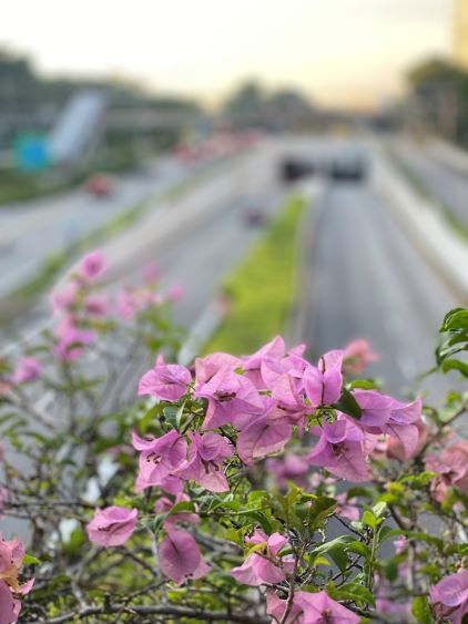
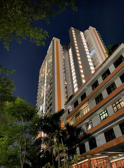
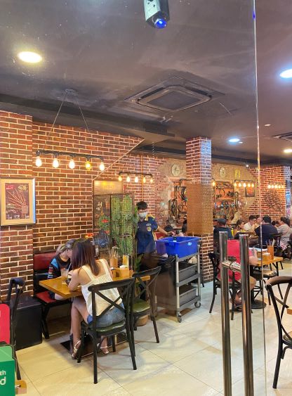
I also planned enough contingencies to take in account of the flight delays, which seemed to be the norm in Indonesia. For the outbound trip I had 6 hours layover in Jakarta and for the return leg I gave 5 hours. This turned out to be a complete overkill as all of the flights were on time, but again I needed certainty. I wanted the plan to work “no matter what”, and I could use the layover time to do research. There are infinitely many mountains that I want to do on this planet that probably will take 100 lifetimes, so I don’t think I’ll ever run out of research projects. The Citilink flight dropped me off in Singapore at 7:30 pm. The immigration was straightforward, and using the previously-studied MRT (train) route I was able to direct myself to the hotel (Ibis Budget Singapore Emerald) without data roaming. Finding a cheap hotel in this country was difficult if not impossible. I eventually decided to just suck up the price as it’s only one night anyway. I also opted to have a late dinner in one of the local Chinese restaurants as I had never seen such dense Chinese population anywhere outside China and Richmond, Vancouver.

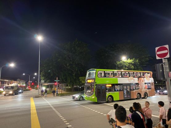

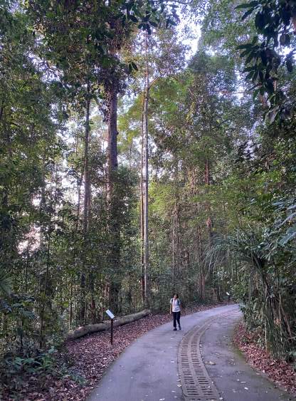
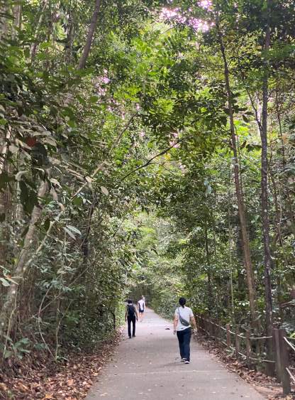
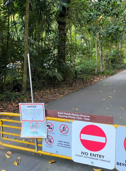
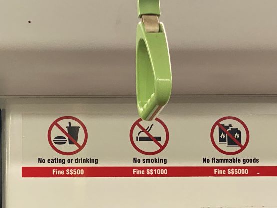
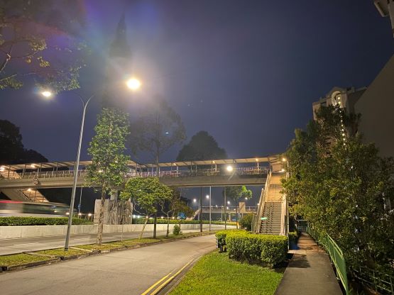
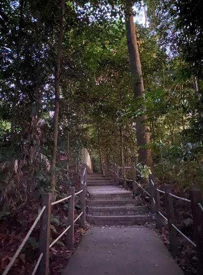
I did not give myself a ton of time to do the hike as it’s rather no-brainer. Doing backwards mathematics I decided to wake up at 5:30 am to catch the first East-West MRT (~5:50 am) from Kallang station. This worked out as planned and I transferred to Downtown line and rode to Beauty World station. The Google’s time estimate was slightly overkill, such that I arrived still in pitch dark. The Bukit Timah Natural Reserve was not supposed to open until 7 am, but I had read elsewhere (particularly in Eric Gilbertson’s trip report) that the locals go up early anyway. The walk to the trail-head was longer than I thought as I needed to detour to an overpass to cross the freeway. I got there at 6:30 am and opted to start the ascent nonetheless. It was still dark, but I was able to walk on the paved trail without the need to use head-lamps. The ascent was straightforward and took hardly any effort, but the weather was extremely hot, humid and unpleasant. For the upper route I decided to tackle the steeper east ridge on staircases, and descend the pavement that wrapped around to the west side. I also made the detour to check out the west peak and the true summit required a brief bushwhack in the jungles. It’s most likely that the east (official) summit is indeed higher, but my GPS read the west summit to be slightly higher, so peak-baggers who prefer certainty have to do both to be absolutely sure.
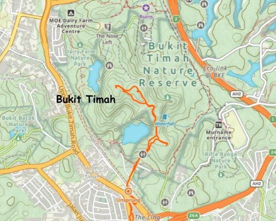


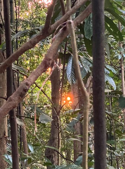
There were some mosquitoes that forced me to hastily retreat. There was also no view whatsoever so it’s pointless to wait for sunrise. I did meet a lot of local hikers/joggers but I think most of them were there for morning exercise. I did spot a “south view hut” on my Gaia map so I made that short detour on the descent, and to my disappointment there was absolutely no view. I then jogged down the staircases back to the urban areas. The fastest way to go to the airport would be hiring a taxi, but I thought I still had enough time. Taking the train system turned out to be not that bad. There are trains for every 2-3 minutes and I eventually got to the airport faster than Google’s suggestion. Two transfers were needed but with the ability to read both English and Chinese this was as easy as one can imagine. The flight to Jakarta went without event and I did successfully obtain my new visa-on-arrival, and now I’m waiting at the gate for the final leg of flight to Semarang to resume the Indonesian volcanoes’ bagging trip.