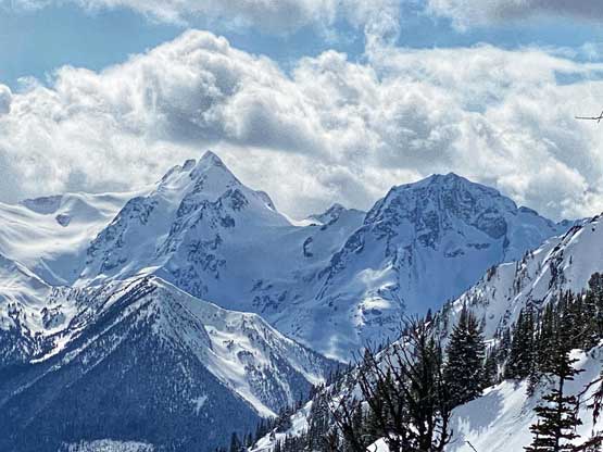
Hurley Silver Mine Peak
March 25, 2021
2266m
Duffey Lake Road, BC
This is by no mean a “significant” or “important” summit but it does catch the SW BC scrambling community’s attention. This peak is described as “Pk. 7400” and together with “Pk. 7500” about 2 km to the north, they are included in Matt Gunn’s Scrambles in SW British Columbia. These two peaks later gained the unofficial name “Hurley Silver Mine Peaks” thank to the proximity to the mine site. Between the two peaks “Pk. 7400” is more iconic and more visible from the road, while the other one is more connected to “Billy Peak” and hence doesn’t even boast over 100 m prominence. The site bivouac.com assigned the name “Hurley Silver” to this southern summit “Pk. 7400” despite that it’s marginally lower than the other peak.
Despite the inclusion in the popular guidebook the access of these peaks had deteriorated drastically over the past decade, that an ascent of “Hurley Silver Mine Peak” has now become a rare feat. The most common access is via the old Hurley Silver Mine Road but the status of that road had become 6-7 km of continuous alder bashing. This area locates on the dry side of the Coast Mountains so doesn’t receive as much snowfall as the more coastal region, that even in the winter months the road is a huge sufferfest. In addition to the bushwhacking there’s a native who lives at the bottom of this peak. It’s been reported that this person continuously threatens to vandalize any vehicle that attempts to park at/near the footbridge crossing Cayoosh Creek, at the start of Hurley Silver Mine Road. Another way to access these peaks is from Common Johnny Creek to the north but that’s a summer-only option and the roads in that drainage had also deteriorated making a long slog even longer.
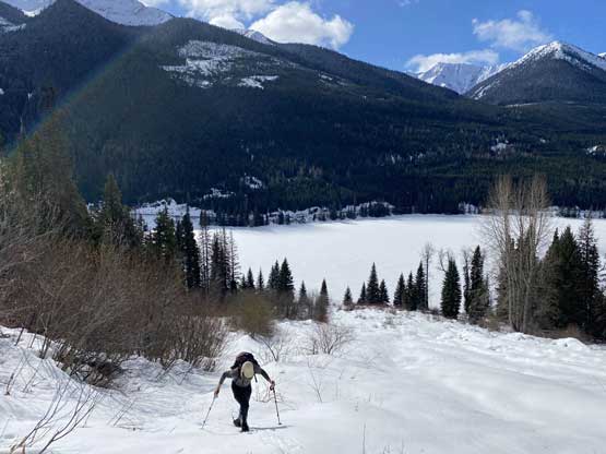
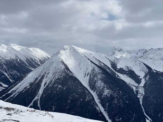
Between the two peaks my main interest was “Pk. 7400” as it’s more prominent and more visible, and personally I would agree with bivouac.com to assign the name to this lower one. The only reason I would bother with “Pk. 7500” is to work on the scrambles’ book list but it’s clear that I’m not interested in that list at the moment. For a few years I thought I just needed to suck it up and deal with the alders on that road (presumedly in winter), but upon closer inspection I came across a third solution, that was to ascend one of the south-side forested ribs to the SW Ridge. The access of these ribs required a crossing of Duffey Lake, so late winter or early spring is the only feasible time when the lake’s frozen. I pulled the trigger at the last minute after seeing a prime window forming on Thursday. This was the first day of a stretch of dry period. The avalanche danger wasn’t the lowest but the weather was the sunniest. Vlad wasn’t quite sure what to do but in the end he decided to join me making this a two-man effort.
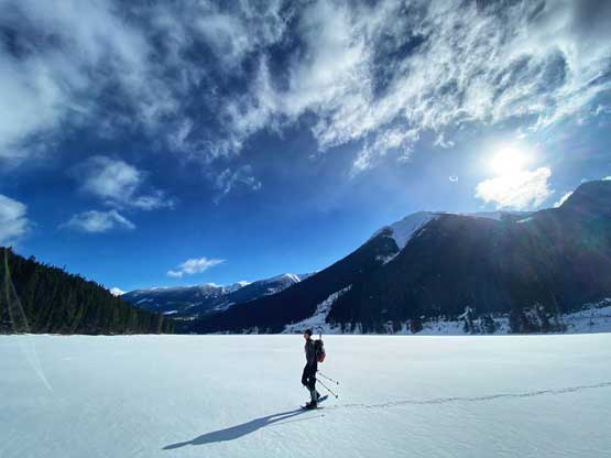
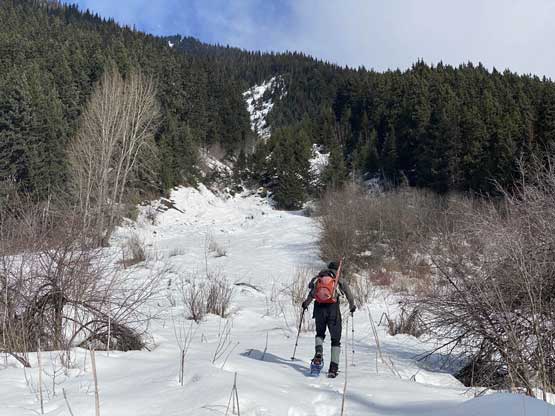
I picked up Vlad from Richmond at 6 am as we expected a fairly short outing. I had some clear view of this route from the ascent of Blowdown Peak a couple months ago. The bushwhacking and/or snow condition could potentially slow us down but the distance and elevation gain was quite tame. The traffic was a bit heavy through the city and I was unusually sleepy for some reasons. I took a nap in the truck in Pemberton as I was feeling shitty. The attempt to sleep failed but I did start to feel a little better, so resumed the drive up onto the Duffey zone. The parking was at Steep Creek’s starting point so there were quite a few vehicles parked.
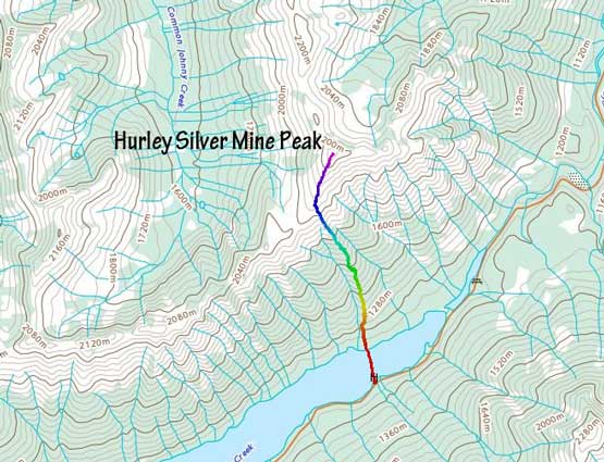
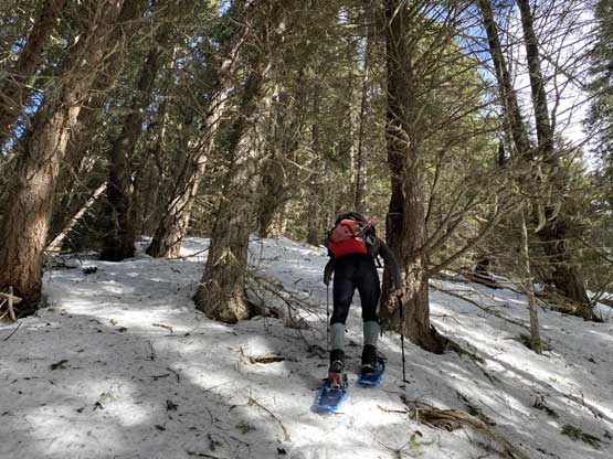
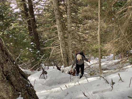
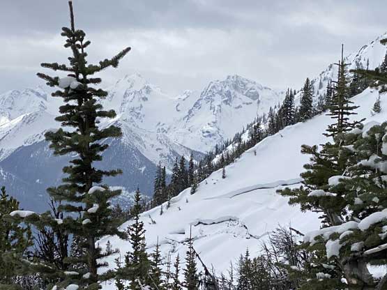
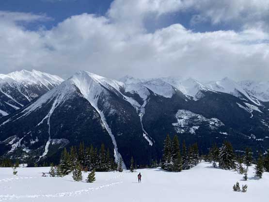
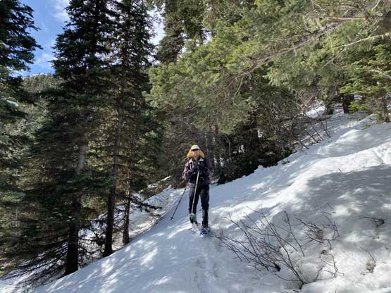
Right off the bat we faced a short but steep bushwhack to get down onto the lake. The lake appeared to be well frozen although there was basically no snow on the ice surface. We put our snowshoes on and gingerly slogged across. Upon stepping out of the lake on the far side we immediately found ourselves post-holing in soft snow. I was hoping to ascend one of those gullies instead of the ribs to minimize bushwhacking but the snow condition in this gully was horrendous, that after about 10 minutes we decided to bail into the forest on climber’s right. To get out of the gully path into the forest involved a short but stupidly strenuous stretch of waist-deep wallowing. The snow was pure facet and thin. Thankfully the snow under the thicker canopy was in a much better shape, that we were able to gain elevation steadily, albeit not on a fast pace. The bushwhacking in the forest was more or less as expected, not terrible but also not trivial. There were quite a few zones of annoying dead-falls and dense timbers. A combination of “high-stepping” and “squeezing” was required in addition to a keen sense of route-finding. Vlad did more trail-breaking job than me as I was feeling unusually lack of energy on this day.
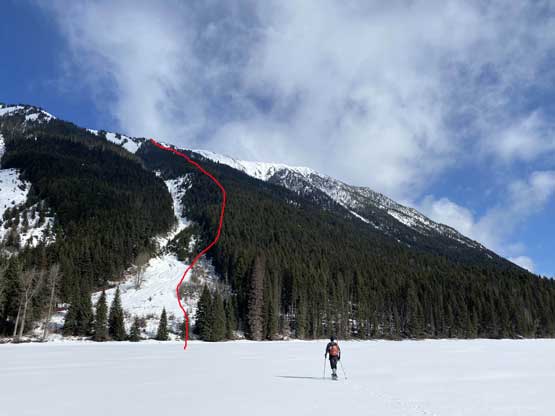


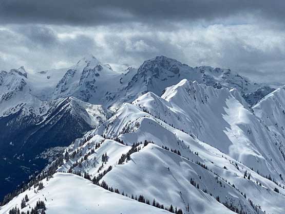
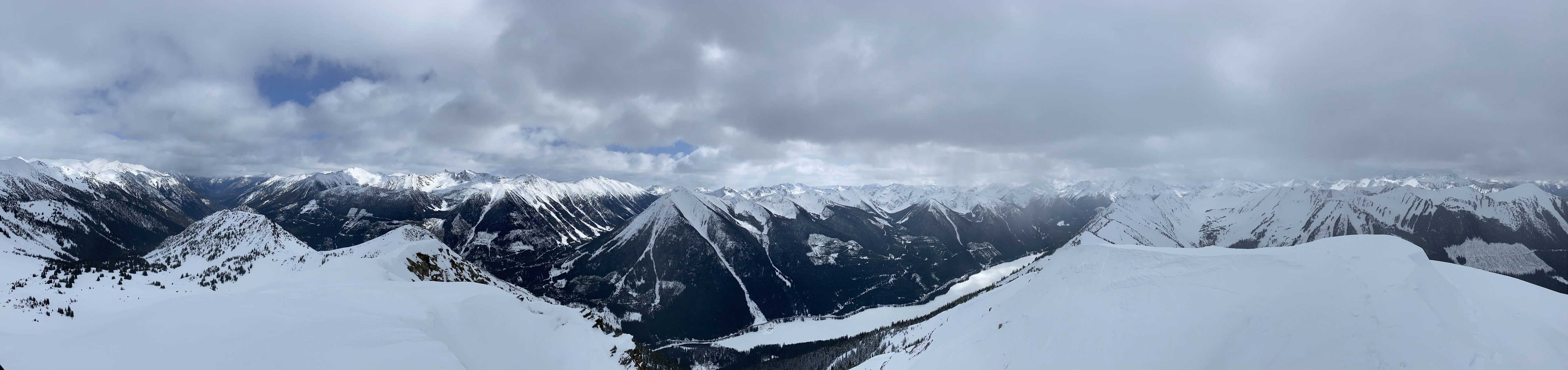
There’s more than 1000 vertical meters of grunting to get onto the SW Ridge so the ascent was very foreshortened. It’s a few hours’ worth of effort. The trees on this rib extended higher than the adjacent gullies so even though the sideways views showed openings we were still wallowing in the trees. By the time we finally came out of the forest we were pretty much on the SW Ridge already. The last 200 vertical meters of ascent was rather trivial on the wind-blown summit ridge. Unfortunately some weather blew in that we were treated by some blizzard conditions on the summit. Vlad wanted to traverse out and back to “Pk. 7500” but I was not keen on that, especially given the weather conditions.


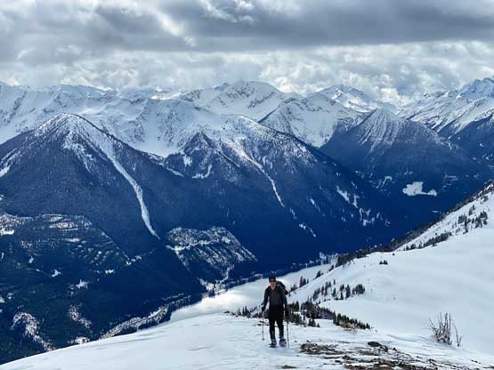


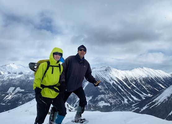
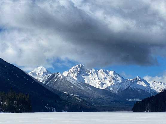
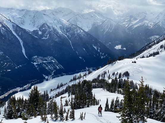
After some obligatory photos we immediately started the descent. Half an hour later the sunshine came back. At this point I regretted a little for not continuing to the higher peak. The weather helped to boost my mood a little bit but I was still feeling not super well, so we resumed the descent. The descent back down through the forest was easier than I thought. Some parts were definitely hard on our knees but the majority was an enjoyable plunge. The snow had turned completely isothermal near the bottom that wallowing out of the gully section was quite a tiresome game. The slog back across Duffey Lake was rather scenic though.


Our round trip time was just over 5.5 hours on a very leisure pace. We talked about the possibility of doing another hike but this area lacked dumpster-diving oppourtunity, so we reluctantly decided to drive home. I had to stop in Whistler for a nap and this time I did fall asleep. I woke up about 20 minutes later and I finally felt like the energy’s back, such that the rest of the drive home was rather enjoyable and not tiring.
