Snazzy Peak
July 30, 2017
2286m
Manning Provincial Park, BC
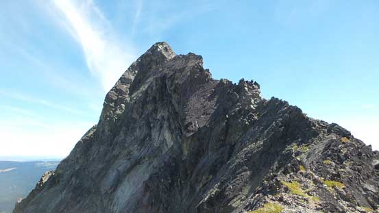
About two years ago I hiked up Snass Mountain there’s a dark and prominent rock horn immediately to the north-east that caught my attention. I had no idea what that peak was as it’s not officially named on the topographic map. I did some homework afterwards and found its name reference. Both Culbert and Fairley’s guides refer it as “Snazzy Peak” and the name along with the peak’s profile is snazzy enough to assure an attempt. There’s very minimal route beta out there on the internet but Dru’s trip report on ClubTread does make it sound like a mere “difficult scramble”.
Because of the fact there’s a paved highway and a maintained trail I knew the access would never fall apart. After two years of peak-bagging in the BC west coast I had come to a realization that the “number 1” difficulty out here in the access/approach rather than the technical challenges. This is contrary to the Canadian Rockies or even the Washington Cascades so when I pick objective(s) my priority goes to the ones that I think the access might fall apart one day. Snazzy Peak does not belong to this category but that being said, the striking profile along with the lack of information is too snazzy to give a pass, so when Alex wanted to do a short day-trip I instantly threw out this objective.

Snazzy Peak via west ridge. GPX DL
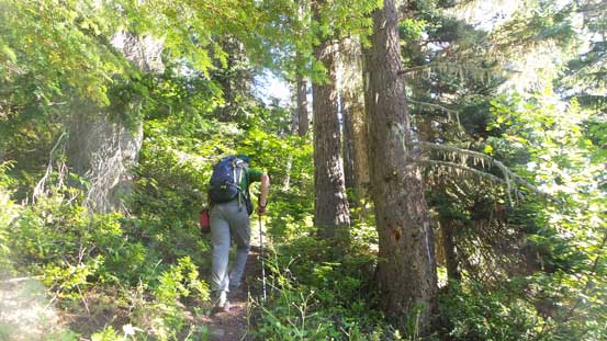
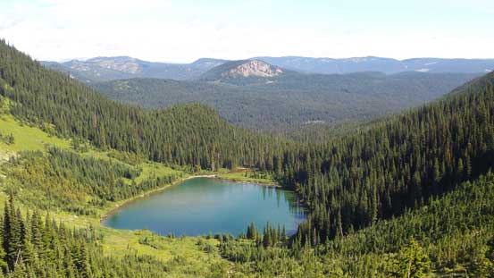
After some mapping I realized it’s not as short as I might think so a 5 am start was still needed. Ben got us to the trail-head in a good time and then shortly after we had started the long trailed plod. About 3 km into the main Dewdney Trail we correctly picked up the branch heading down and across the creek. This is the narrower, steeper and rougher Whatcom Trail but the condition was still prime for using a pair of Nike runners while carrying my Trango Ice Cube mountaineering boots. Alex led a blistering pace up the entire stretch of this trail and it seemed like we didn’t spend much time before topping out at the pass and then looking down into the Punch Bowl.

As typical as it gets on this approach trail.
Alex charging up.
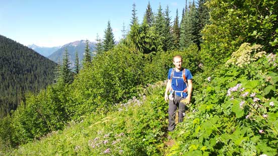
Ben coming to an opening area. Trail is a bit overgrown at sections

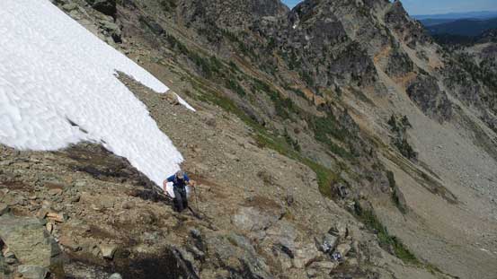
Almost made to the pass now
Crossing over to the north side of the pass
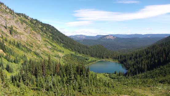
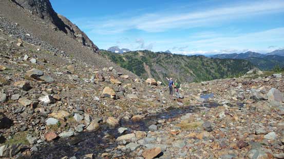
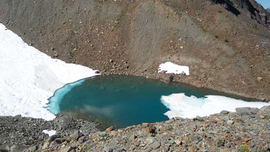
Looking down into Punch Bowl with a lake
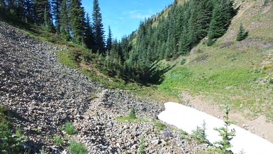
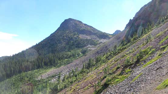
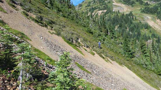
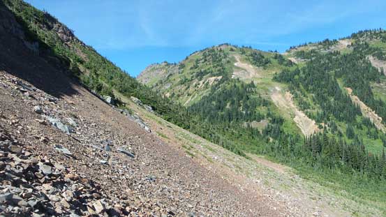
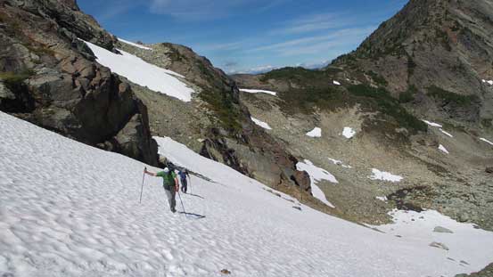
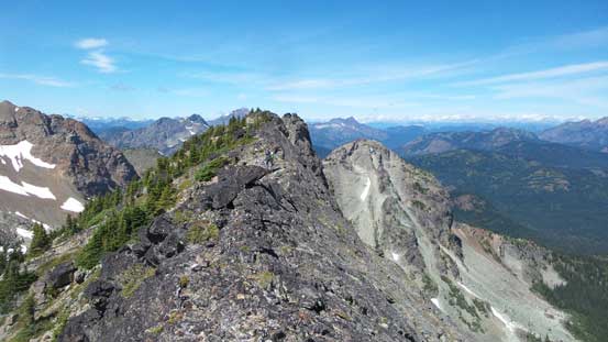
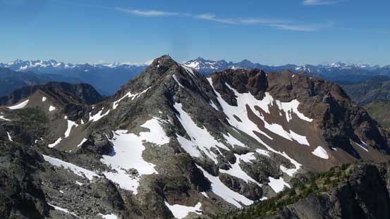
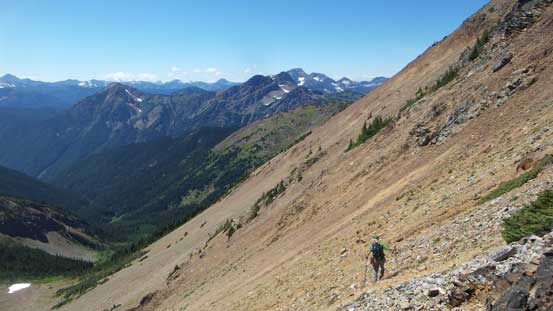
The next section was the most experimental as we must traverse some bushy terrain due east in order to not lose too much elevation. This brought us into the drainage north of Snass Mountain. We did manage to not lose much elevation but did have to cross a few krumholtz fields. Once into the valley it’s a long grind on various type of rubble and boulders to a broad pass. This section has some incredible views which none of us was expecting. After the pass we dropped some height and then traversed a few snow slopes and then the next stop was right at the base of Snazzy Peak.
Starting the long traverse into this valley. Peak ahead is unnamed
Ben just finishing a section of ugly bushwhack
Another view into Punch Bowl and the lake
More about this traverse
There are plenty of water sources so you don’t need to bring much water
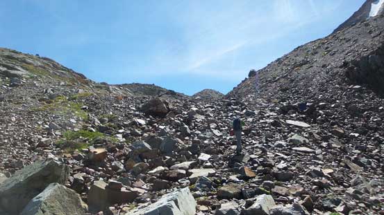
The typical rubble slogs..
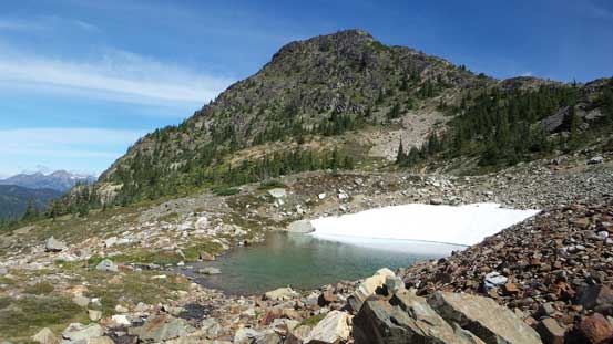
One of the many small tarns from snow melts
Arriving at the pass now. Great views
This is another small tarn
Traversing across some snow slopes for variety
Another look at this unnamed peak north of Snass Mtn.

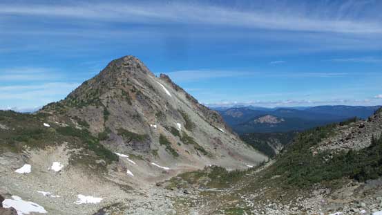
This is Snass Mountain
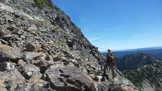
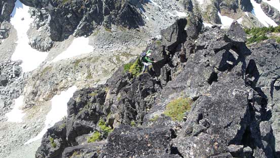
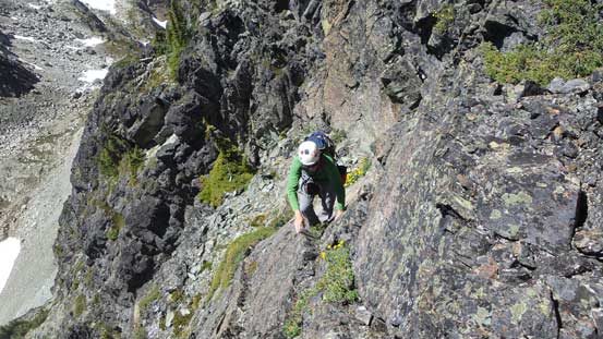
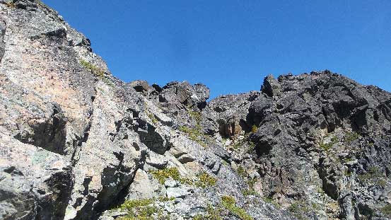
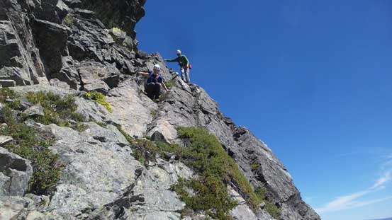
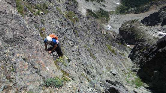
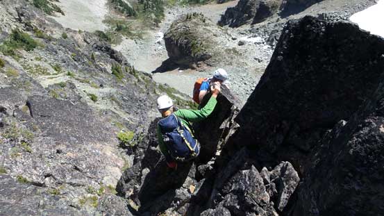
After a short break we scrambled up the broad south slopes which consists of mostly Class 2 ledges and bushes. This slope brought us to a broad section of the west ridge and then after a short traverse things suddenly became interesting. The poles were ditched in no time as the terrain transitions into 3rd class. For a while we managed to stay close to the ridgeline but a few obstacles were bypassed on the right (south) side with considerable amount of exposure. The rock quality is mediocre as far as the coast standard goes. Upon reaching a super exposed slabby step I concluded that it’s no longer “scrambling” anymore so bailed into a ledge system on the south side. Traversing across this ledge was very awkward at a couple spots (4th class) as my backpack just kept catching the wall.
Alex started the scrambling up this broad south slopes

The typical terrain looking up the south slopes
Hitting the west ridge now.
The initial traverse on the west ridge. Easy peasy..
Things gets harder in no time. This is Alex negotiating an awkward step
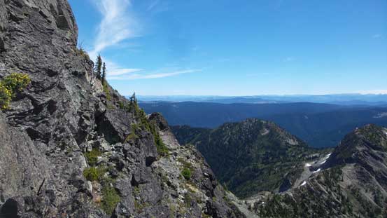
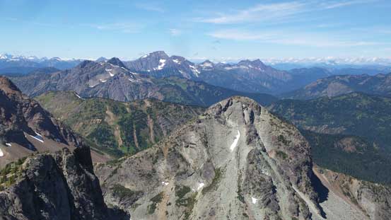
The views were great throughout

Traversing ledges like this are the key to avoid technical terrain
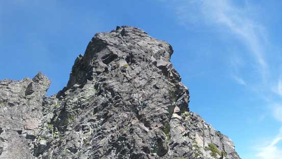
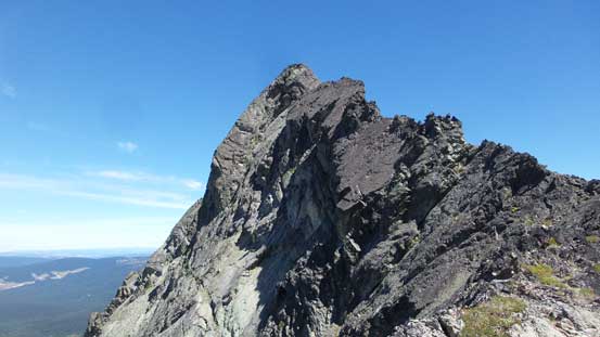
The summit block must be attacked from the opposite side.
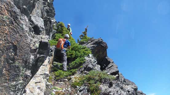
Meanwhile Ben had picked a higher line and he reported it being “better” so we knew there’s another option for the return. Looking ahead it seemed obviously that attacking the summit block directly from west ridge was not an option, so following Dru’s vague description we descended a loose gully and then went around the south side looking for “scrambling terrain”. There’s an obvious diagonal ledge with a couple bushy steps. I had no idea whether that was the one Dru talked about but what else could it be. After an awkward step, bashing up the bushes using vege belay and then another bit of 3rd class climbing I got around a corner. Ahead looked tame and easy so the route did go. About 15 minutes later all three of us were joined on the summit soaking in the 360-degree panoramic views.

Alex hauling up bushes on an exposed move

Looking back at the narrow ledge that we just traversed across.
Another 3rd class section
Around a corner, things are getting easier now
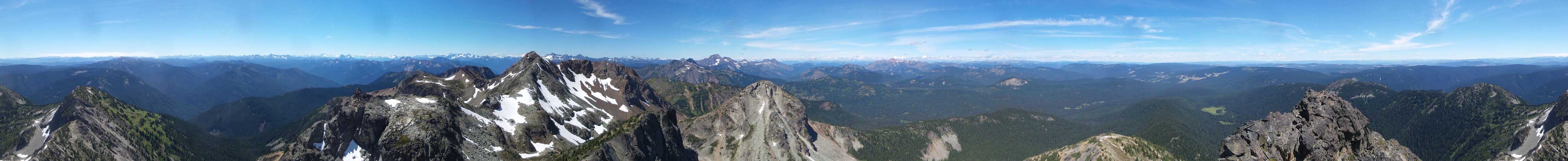
Summit Panorama from Snazzy Peak. Click to view large size.
The NE aspect of Snass Mountain
Looking over an unnamed peak towards the distant Outram group

Tulameen Mountaon on the horizon
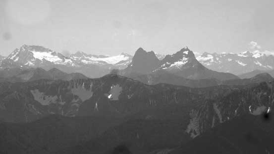
This is the iconic Hozomeen Mountain

Silvertip Mountain looks big from anywhere
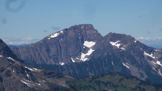
Mt. Outram
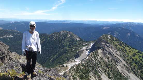
Me on the summit of Snazzy Peak
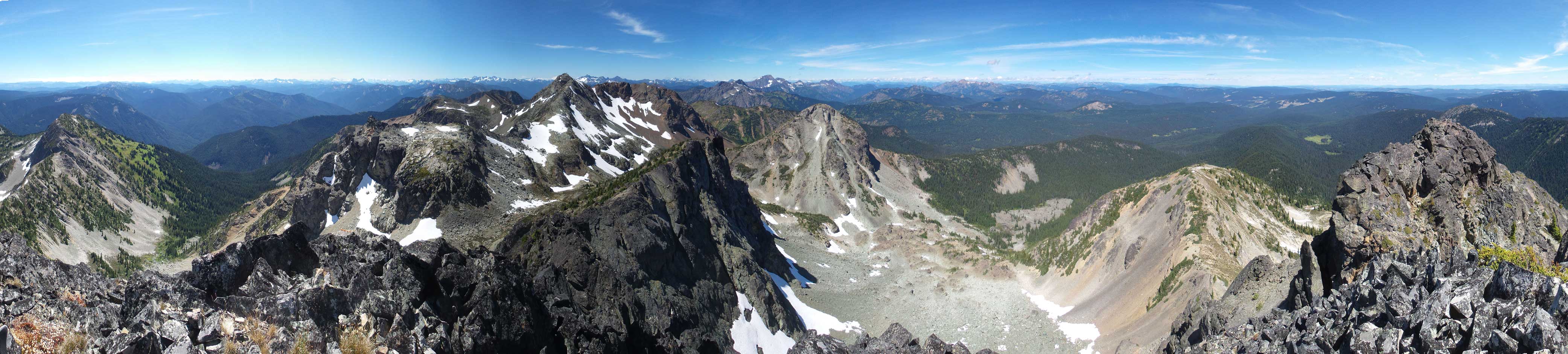
Another panorama from the summit of Snazzy Peak. Click to view large size.
On the descent we gingerly down-climbed that treed ramp/ledge and then into the loose gully separating the main summit tower with the rest of west ridge. To avoid that awkward 3rd/4th class ledge traverse we climbed up this gully all the way to the top with Ben leading. This turned out to be a little bit easier although the route itself is more contrived. For the rest of the down-climb on west ridge we all carefully reversed the exact route, took a break at the shoulder and then descended easily down the south slopes. At this point we made a call to traverse the east/south side of Snass Mountain to make a loop instead of going back the same way. Part of the reason was for Ben to grab Snass Mountain as well since he’s the only one hadn’t done Snass Mountain yet.
Ben and Alex down-climbing the upper 3rd class ramp
Descending the vege-belay step
Ben traversing an exposed step into the loose gully

After a contrived route we had to get down onto that ledge anyway
This is that awkward corner around a boulder

Me au-cheval across a knife-edge. Photo by Alex
All the difficulties are behind now. Looking back at the west ridge

Another view looking north
The first part of this traverse went easily on a snow slope and then things started to look a little bit “interesting”. The stretch across the east side of Snass Mountain wasn’t smooth, but at this point we were determined. It turned out to be not bad at all with a bit of route-finding here and there. We had to cross deep gulch near the end before cresting the south ridge. Ben rushed up to tag the summit while Alex and I would descend on our own. Working down the S/SW slopes of Snass Mountain was experimental as well but at least this is the route Alex and friends descended 7 years ago. Route-finding, a bit of bushwhacking and lots of GPS navigation was required to get us back to the trail. The rest of the descent was uneventful except for we almost trail-ran the whole way down..

Aiming for that obvious pass. We managed to stay on snow here.
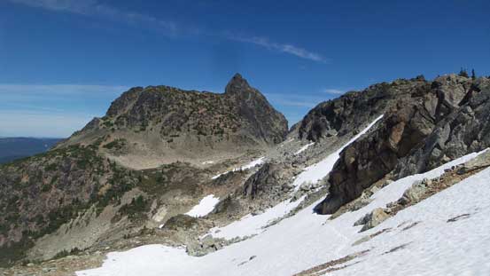
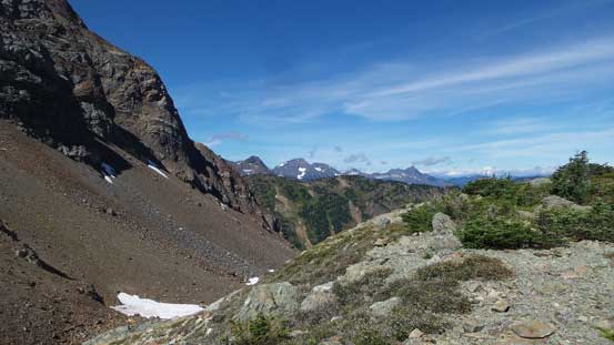
Looking back at Snazzy Peak from the pass
The next long stretch of traversing was on this kind of typical terrain
Around the south side of Snass Mountain now, time to head down

Back to the trail now.
The driving back home was the crux of this day.. The whole stretch of Highway 1 from Chilliwack onwards was a massive gong show. There’s no major accident but just the volume of the hordes rushing back on a sunny Sunday afternoon. There’s a reason why I like to work on weekends and go out on weekdays.. Oh well..
