The Triad
October 19, 2022
2292m
Cascade River, WA
The Triad is a rugged summit on the SW Ridge extension of Eldorado Peak but is rarely ascended. There wasn’t a detailed trip report on the internet, but Franklin Bradshaw’s few words along with the most recent GPS track published on peakbagger.com was sufficient enough to get the job done. The approach is rather from Hidden Lake side and traverses across some rugged terrain that resembles the “Doug’s Direct” route on Johannesburg Mountain. There’s even a small glacier to traverse across and in this time of a year I anticipated the bare ice on that glacier would necessitate ice tool(s) and steel crampons. I had been wondering about this mysterious summit ever since I did Eldorado Peak in June 2017 but never put in much effort to research. I made a random decision in October 2022 to look for its “beta” again on peakbagger.com and I came across that set of recent GPS track. I think my inspiration was from flipping through Beckey’s Cascades guidebook in Elise’s parent’s home and it’s there that I came across The Triad again, as previously I mostly forgot there’s this peak that I wanted to climb. I immediately threw out this idea to Elise to make use of the last warm, summer-like day in this season (Wednesday) and she’s game.
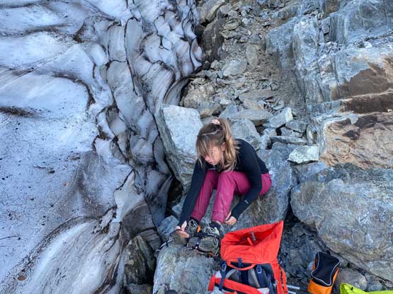
Elise decided to drive south to do some climbing in the afternoon whereas I couldn’t leave home until 8 pm in the evening. I eventually made to Marblemount at 10:50 pm and drove her up the steep and winding access road in my Tacoma. I anticipated worse road conditions but it wasn’t actually that bad. I think we could have made the trail-head in Elise’s Subaru but I wanted the Tacoma to be 100% sure. There wasn’t anyone there but one guy came and slept in his car minutes after we set up the tent. We opted to wake up at 5:30 am and do the approach hike in the dark. In terms of gears we opted to bring a 30m rope, a 30m tagline, a small rack, lots of alpine draws, mountaineering boots, steel crampons and ice axe. I decided to bring a Petzl Quark ice tool as I really thought we’d be dealing with blue ice. I thought we definitely brought “too much” equipment because I needed every bit of contingency on unknown missions like this, but we actually ended up using most of the stuffs. The Triad was actually more involved than I thought.

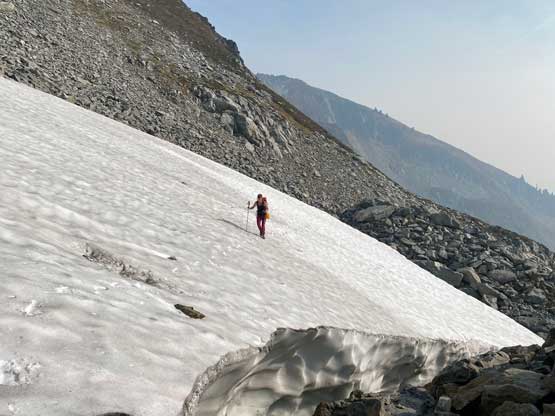
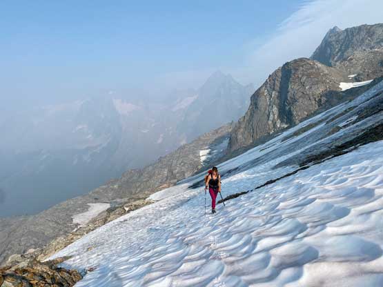
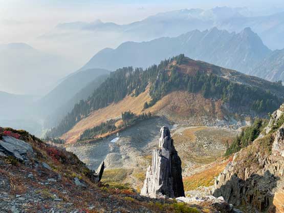
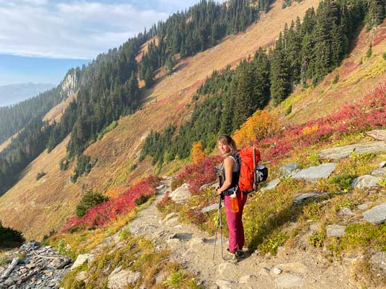
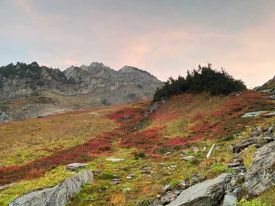
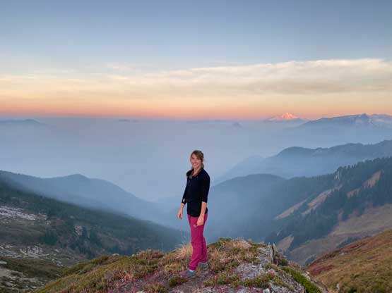
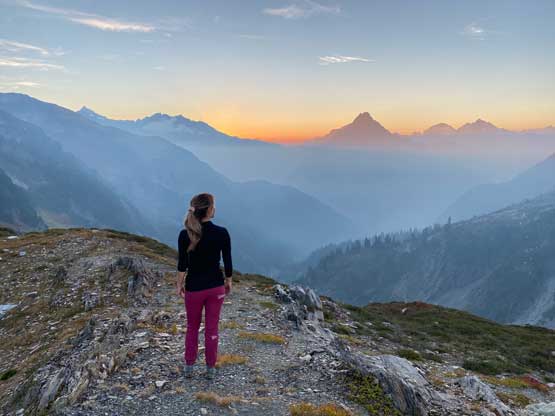
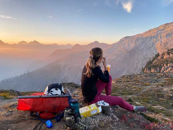
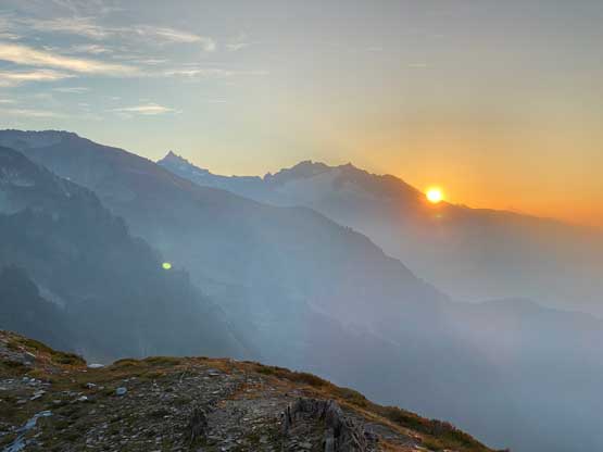
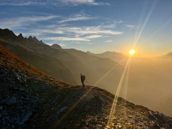
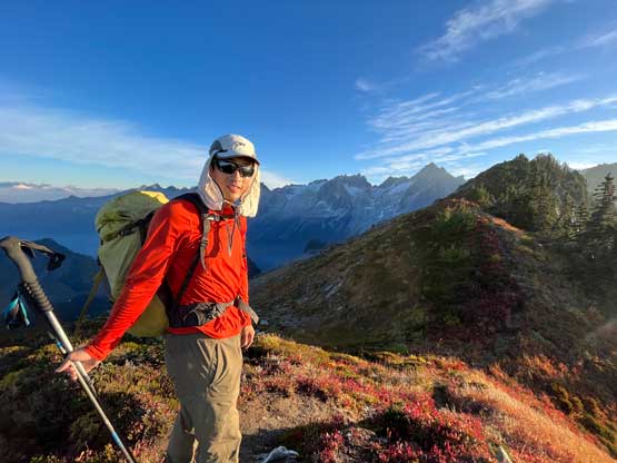
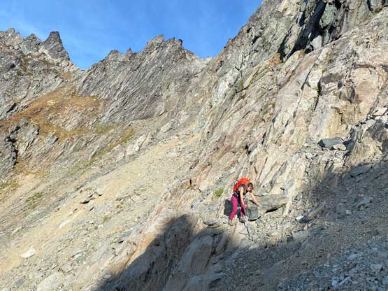
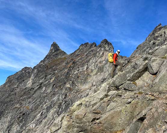
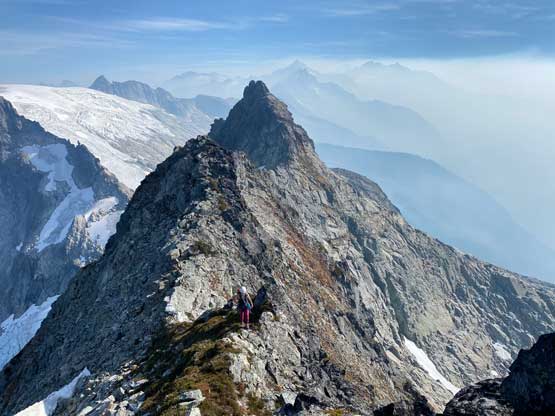
I opted to wear approach shoes for the first few kilometers on Hidden Lake Peaks trail while carrying the mountaineering boots. The trail condition was rather excellent and we made progress more rapidly than I thought. We made to the spot where we supposed to leave the trail minutes after turning off the head-lamps. The spot to leave the trail was quite obvious where a dry gully/drainage drops down to the trail. We mostly just ascended this drainage (steep and slippery at places) for about 200 m elevation gain to the col in between Hidden Lake Peaks and the ridge connecting towards The Triad. It was about 10 minutes before sunrise when we got there, so we took a long break to do the photography thing. At this point we were well above the thick smoke layer and the views were rather dramatic.
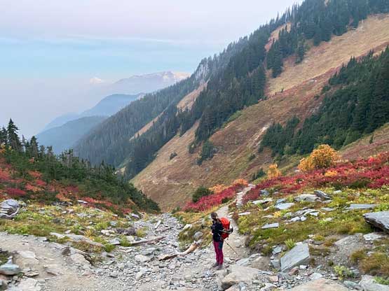


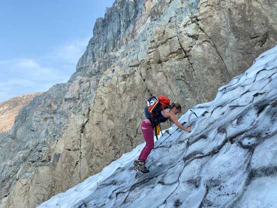
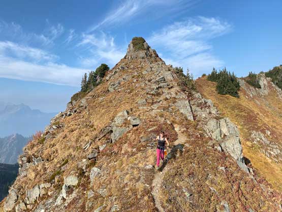
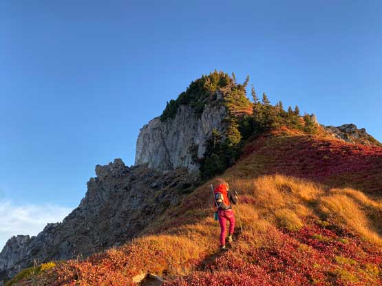
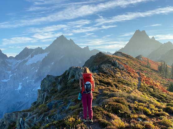
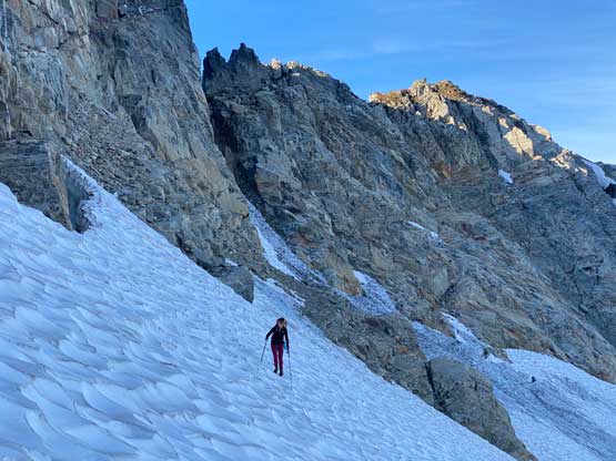
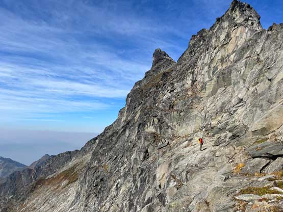
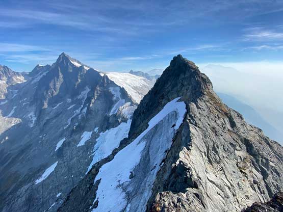
I did not come here with much “beta” about the connecting ridge asides the GPS track so I was surprised to see a trail/path on the ridge, continuing towards the direction we wanted. We appreciated this trail as the next stretch of the ridge had some steep heather that could otherwise be treacherous. The ridge-walk over a few bumps was very scenic. Nearing the spot where we needed to leave the ridge descending to the glacier on the north side we started to counter scrambling steps and one short stretch needed to be bypassed on the south side. There’s a cairn to mark the col where we needed to leave the ridge but honestly with a GPS track the route-finding was obvious. We descended some compact dirt type of choss and made an awkward transition to put on crampons. There’s an ice tough that we must traverse across. It’s only a few meters across, but steep with blue ice. I definitely made use of the ice tool that I brought up here and handed it over to Elise after I made across. The rest of the traverse across this glacier was simple as the slope angle was mellow, but did involve fair amount of crampon action on bare ice.


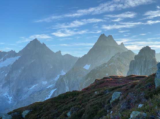


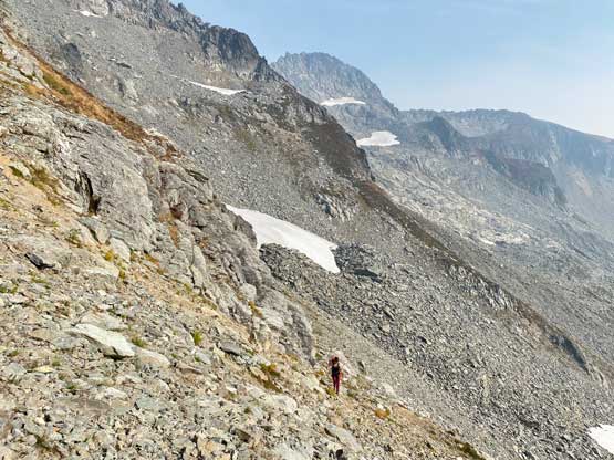
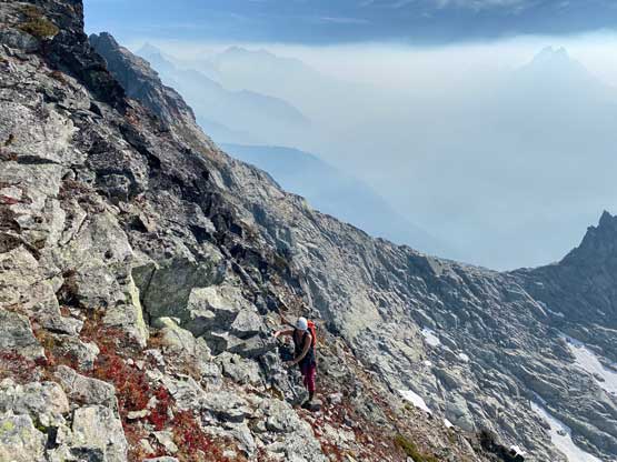
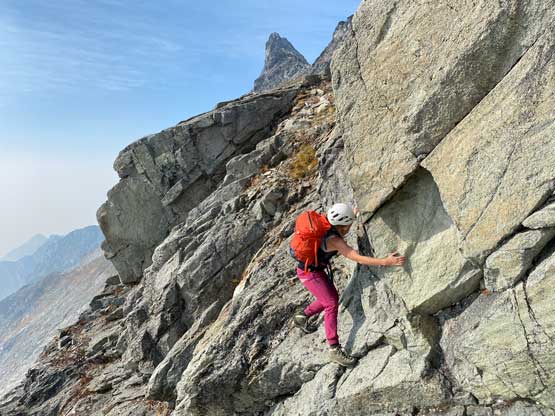
The next stage involved a section of scrambling above the glacier to the next “key col” on this route and this col greatly reminded us the high point of Mix-up Peak on Doug’s Direct route that we did a few weeks ago. On the ascent we didn’t pay enough attention to the track and went to a wrong spot and as a result the opposite side appeared impossible to down-climb. Thankfully the traverse to the correct col wasn’t difficult, but the descent off the south side was still far from trivial. We encountered some slabby 3rd class terrain on heather slopes with exposure. The route-finding wasn’t obvious neither so it took us a while. After descending this stretch of sketchy terrain we no longer had to deal with exposure, but we had to traverse across a couple choss bowls separated by some chossy gullies and ridges. It’s shame that at this time of a year there’s no snow to facilitate the travel.


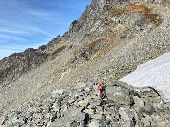
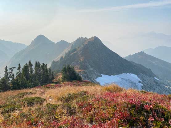
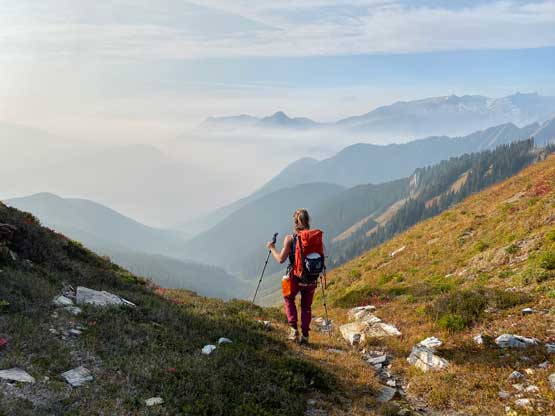
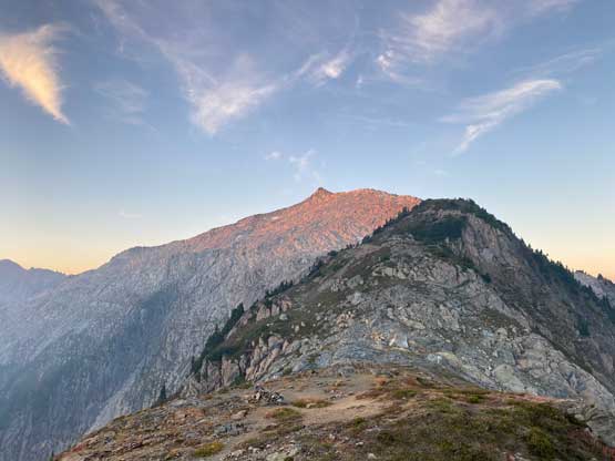
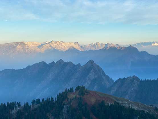
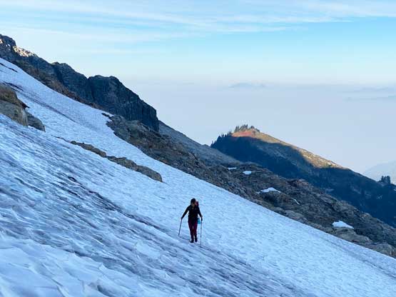
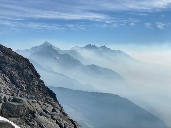
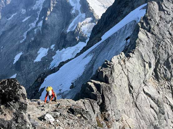
We eventually traversed to under a permanent field of snow (or a small pocket glacier) on the south side of The Triad. There’s running water finally and we loaded up the water bottles. This glacier was mellow enough that crampons weren’t needed. We then ditched the snow gears. The ascent onto the shoulder south of the summit was straightforward but we did have to pay attention to route-finding in the small scale. We also crossed a few smaller patches of snow after ditching the crampons but they didn’t impose any problems. The view after gaining this south side shoulder was incredible with Johannesburg Mtn. stealing the show, poking above the rising smoke layer.


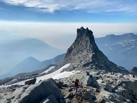
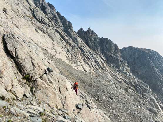
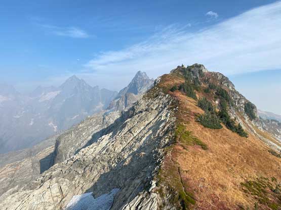
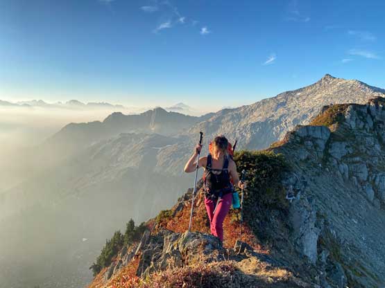
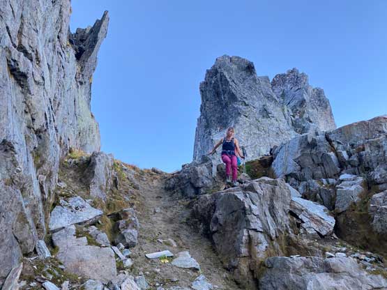
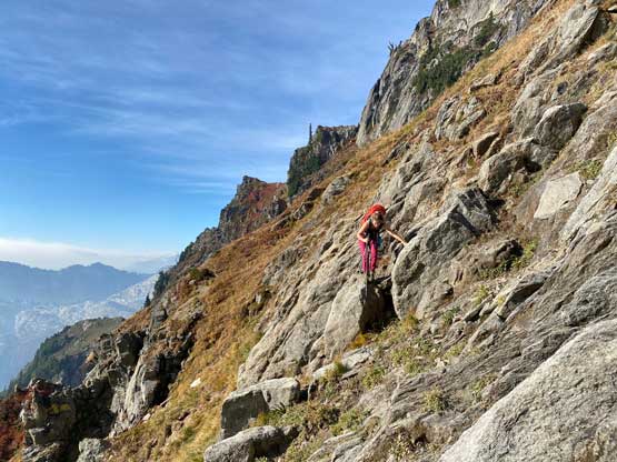
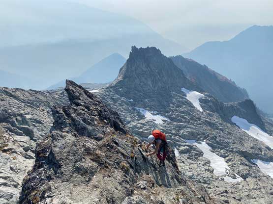
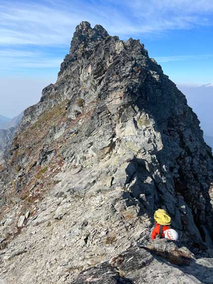
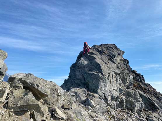
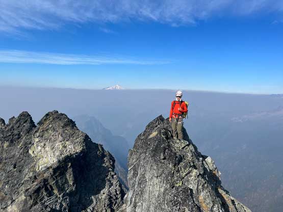
We noticed the smoke started to fill in the area so we hurried up to tag the summit before we got completely soaked in. The route was actually quite obvious. After scrambling up some broken terrain we located a wide ledge that would lead us to the east ridge of The Triad. There’s one or two tricky moves somewhere across on this ledge, but that step could be bypassed by climbing up and around. The GPS track justified that, but we opted to tackle the awkward step-across move. There were also cairns here and there to mark the route, which was to our surprise. The technical crux might actually be to gain the east ridge from this ledge as a pitch of stiff 4th class must be climbed. There’s one move that took me a minute or two to commit to without being roped up. Once making to the ridge I located a rappel station but the block immediately in front of me was easier to use as an anchor. I immediately slung it around and dropped the rope down to Elise to make the slippery terrain a bit safer. Elise then led out the next pitch placing no pro. After hearing that the climbing was easier than appeared I untied while she dragged the rope up. I then soloed this exposed pitch.


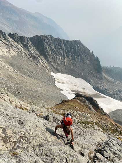
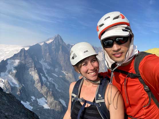
We probably should have stuck closer to the ridge crest but gendarmes after gendarmes made us to consider traversing lower on the south face side. The punishment was some 4th class and exposed heather ledges that took all of the concentration out of us. After bypassing one or two gendarmes we eagerly scrambled back up onto the ridge crest and then easily walked over to the summit. There are two towers of equal height so we made sure to tag them both. We could not find a register and that’s a shame, as I was very curious about who had actually made this summit.


Minutes after leaving the summit the smoke completely filled in the area and we lost visibility in the next few hours. We down-climbed around a few spots including making some treacherous descents on some steep heather ledges, but then did two rappels to like up two stations that we found. The rappels were 30 m long so both the rope and the tagline had to be used. We then scrambled back across that wide ledge including making that awkward step-across move, and then easily descended down onto the south side pocket glacier.


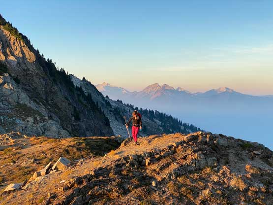
We picked up the ditched crampons and ice axes and continued the descent following the route we took. I made sure to check GPS regularly to stay on the exact path that we took. In short time we finished the traversing across the few choss bowls, and then made the sketchy re-ascent onto the high col. This section of the steep grass near the top did not feel to be any easier than on the way in. We then carefully reversed that glacier traverse including front-pointing across the ice tongue, and leisurely made our way back to the first col. Seeing trails on the heathery ridge was a sign of relief, and the smoke also started to dissipate, allowing us to see more views. The descent from that final col down to the trail was slippery on the grass that we both took numerous spills, but the final few kilometers of jogging on the approach shoes was very fun. Our round trip time was somewhere between 9 and 10 hours. Wasting no time I immediately drove us down the steep roads and then dropped Elise off in Marblemount. My plan was to rush back home for an hour of work at 8:30 pm but I needed to take a nap. I ended up still getting home in time for work, but did not earn myself enough time to have a dinner. Instead, I stopped and grabbed some fast foot and simply ate them in the truck.