Metal Dome
January 23, 2016
2010m
Whistler, BC
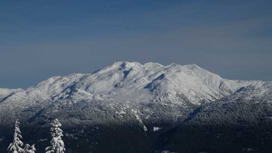
Metal Dome is not an objective that boasts much “mountaineering interest” as it’s merely the lowest bump on Brandywine Mountain’s long SE Ridge. However, it does offer some good skiing opportunity. The NE Glacier from Callaghan Valley documented in John Baldwin’s Exploring the Coast Mountains on Skis is obviously the more fun and aesthetic route but does require good stability. There’s another route that goes up the broad south ridge and is more often ski’d as an early-season opener when the lower Brandywine FSR is still drivable. In the mid-winter this route is considerably longer and requires hours of skinning plod in active snowmobile country.
With a “Pineapple Express Light” swapping across the South Coast in the past few days the avalanche condition was boosted up to the most extreme I’ve ever seen. It did drop down quickly and by the weekend it was mostly in the “considerable/moderate” range across the region, but there hadn’t been much field observation going on. The weather was also not the greatest – not much precipitation in the forecast but “a mix of sun and clouds” could easily go either way based on my experience in the past few months. The decision was easily made that Alex and I wouldn’t venture into big terrain and the objective was selected to be either Metal Dome or Mt. Sproatt. After some debate we felt a little bit more excited about Metal Dome and the south ridge route was chosen.
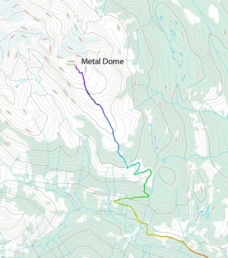
Metal Dome ski ascent route via south ridge. GPX DL
The parking lot was at the snowmobile club’s place (the first left-turn along Callaghan Valley) and I was surprised that we got charged 5 bucks each for just “touring”. Hordes of snowmobilers were gearing up and we knew it’s only going to get busier. And we were right… The Brandywine FSR was well groomed and within the next few hours we got past by at least 100 of sleds and some were travelling super fast. The noise was tiring and the smelling was shitty, but at this point all we could do was sucking it up and plodding as quickly as possible to (hopefully) exit the snowmobile country at some point. There were some confusing branches along the road but I did do my homework drawing a track on scribblemap.com so we were good. The most travelled path led to the correct direction and eventually we made a right turn while the rest of the hordes all went straight into Brandywine Meadows. A few minutes after the turn we arrived at a cat ski cabin and the terrain beyond was closed for snowmobile travel, thankfully.
Mt. Fee looms impressively

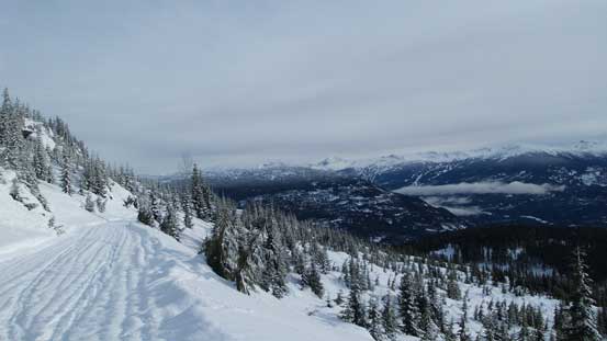
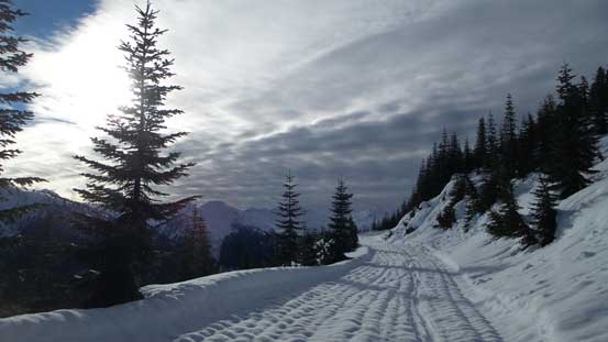
Typical skinning up the lower Brandywine FSR
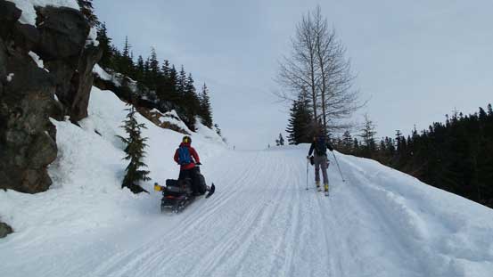
Lots and lots of snowmobiles…
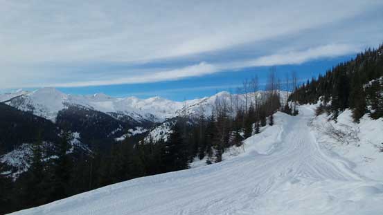
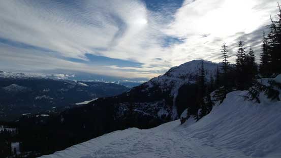
At least the weather was clearing up from the west
But another problem arrived. At this elevation (~ 1300 m) the snowpack was still saturated from the rain event and adding to the re-freezing process a crust had formed. We knew right away that skiing down this portion would be horrible, but condition would change soon again. As we slowly gaining height the crust had gradually changed to the classic “west coast cement” from elevation roughly 1500 m onwards and that created another problem. While skiing down this type of snow would still be terrible, skinning up this heavy shit required horrendous work of trail-breaking. We sank more than knee deep and snow balled up under our skins making some extra tedious process. The bright side was the improving weather, along with the lack of bushwhacking as opposed to what we expected. The cat ski company had cut a road all the way to treeline and that was not shown in the Google satellite images.
Continuing up the forestry road beyond that cabin

Onto the cat ski company’s road
Looking back. It was HOT under the sun…
Massive trail-breaking through the heavy and wet cement
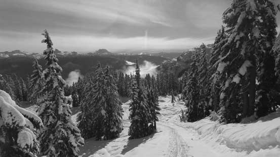
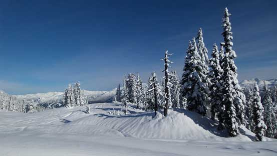
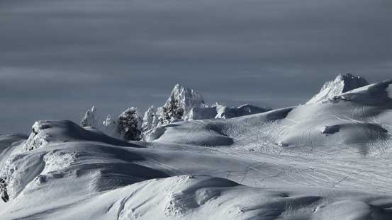
Finally arrived at the alpine
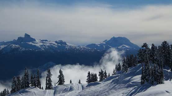
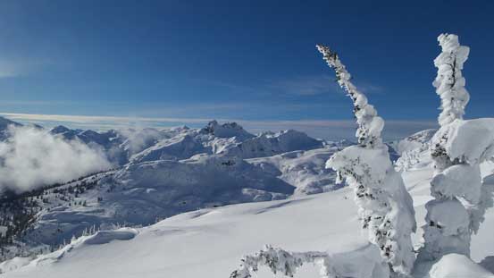
The weather had almost completely cleared up by the time we reached treeline, and thankfully the snow condition also improved dramatically. While there’s still fair amount of trail-breaking work, the “west coast cement” had changed to the good alpine snow from elevation of 1800 m onwards. We eventually left the cat ski company’s marked route and the rest of the ascent appeared nicely wide and open. The only steep section was near the summit but that’s relatively short-lived. The view was expansive with the striking Mt. Fee stealing the show.
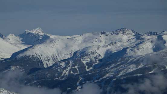
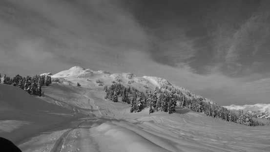
Reaching treeline, the views opened up
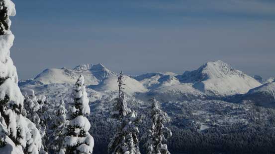
A look at Mt. Weart and Wedge Mountain, two giants in Garibaldi P. Park
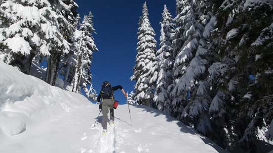
Alex leading the way
Looking back..
Rainbow Mountain is a massive peak…
The Black Tusk and Mt. Garibaldi massive – two of Sea-to-Sky Country’s icons

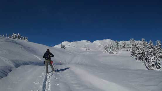
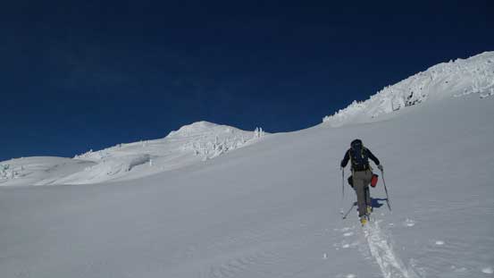
Marching up
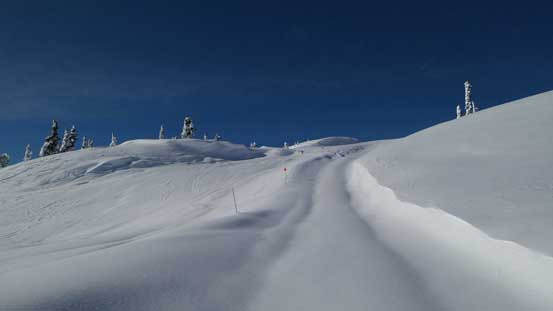
At this point we were still following the cat ski runs

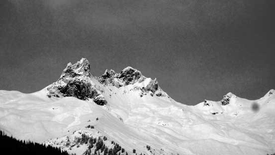
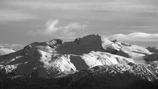
Mt. Fee – true summit is probably out of my league while the north tower is on the “list”
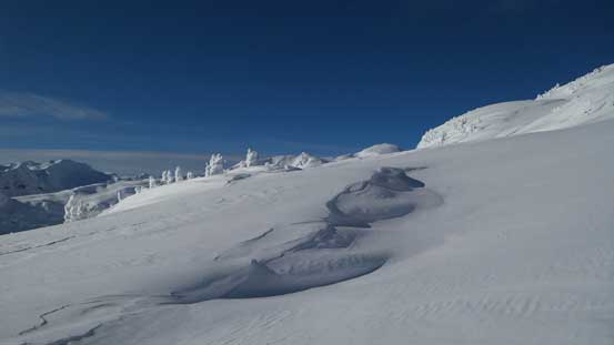
Snow texture on the alpine. Very glad the snowmobiles weren’t allowed here…

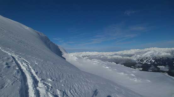
Looking back towards where we came from
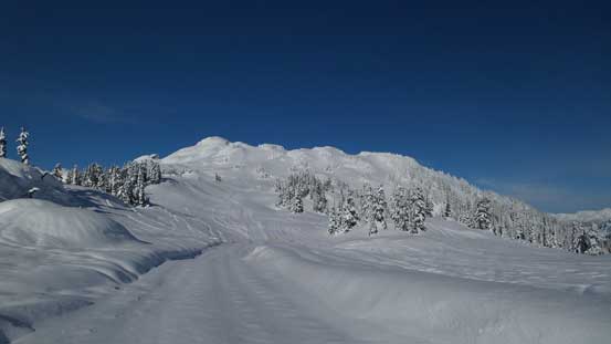
Getting closer and closer.
Can’t get rid of the views.

The summit block ahead

A bit steep at places

Looking back from halfway up the summit block
Almost there!
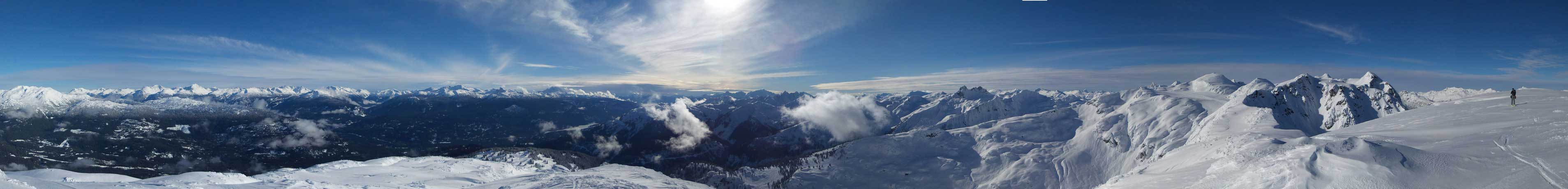
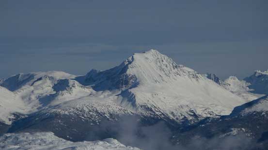
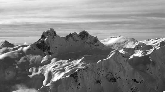
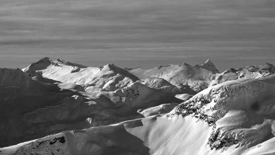
Summit Panorama from Metal Dome. Click to view large size.
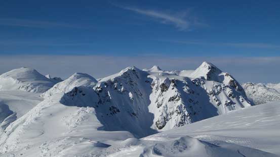
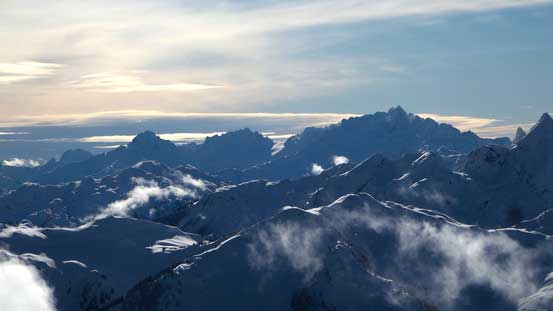
The multiple summits of Brandywine Mountain
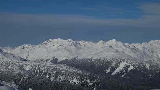
Mt. Callaghan is the big one left of center.

A view towards Mt. Currie – Hibachi Ridge – Ure Peak divide
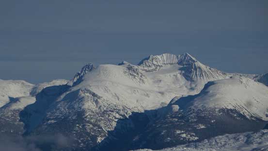
A closer look at Mt. Weart
And, a closer look at Wedge Mountain
Phalanx Mountain with Mt. James Turner pokes behind on left skyline
The triple summits of Castle Towers
The mighty Mt. Garibaldi

The Black Tusk
From L to R: Niobe, Alpha, Serratus and Tantalus on the rugged Tantalus Range

Tricouni Peak and Cypress Peak in foreground with Pelion/Ossa poking behind
The two towers of Mt. Fee in foreground with the glaciated Pykett Peak behind on right
The pointy Mt. Ashlu pokes behind on right; the glaciated Amicus Mountain on left
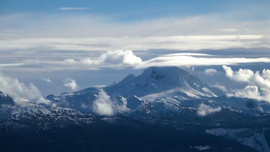
From L to R: Vulcan’s Thumb (yet unclimbed), Pyroclastic Peak and Mt. Cayley

One of the many sub-peaks of Brandywine Mountain

Me on the summit of Metal Dome
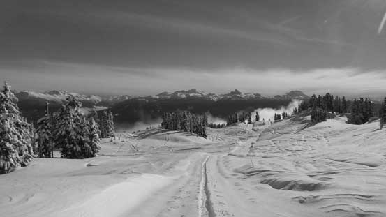
Although it wasn’t getting particularly late, it did take us a good while to reach the summit. Considering the skiing could get very shitty we didn’t linger much longer than necessary. A cold breeze also helped us get going soon. The alpine slope was a bit crusty at places but good in general and we were able to make some turns. Lower down into the cat ski country it was a different game though. Firstly came the wet snow balling under our skis and we had to remove them in a regular basis to clean off the shit, and then there came the steep, heavy and crusty road/cut blocks. Lots and lots of survival skiing and my legs were super tired when we eventually got back to the cabin. Thankfully the rest of the skiing down the groomed road was fast and fun. Meanwhile it was getting cloudy again and I think we did a good timing to catch the brief weather window.

Me skiing down the summit block. Photo by Alex
Back to treeline, looking back

The snow quality here was super shitty…
And the clouds were moving in again..
Almost back to the cabin. Malt Peak (near Brew hut) in front.
Overall this was a perfect objective given the weather, the shitty skiing quality and the questionable avalanche conditions. The popularity of snowmobiling in this area did impress me though. I think my previous worst experience with snowmobiles was on Mt. Milton near Valemount and this day could easily triple the amount of sleds I’d seen in that trip.. One hundred snowmobiles could be an understatement as there were many more that we didn’t encounter during the day and there were still sleds going up by the time we came down…
