Mount Rainier
May 11-12, 2016
4392m
Mt. Rainier National Park, WA
Rising 14,000+ feet out of nowhere the mighty Mt. Rainier is the highest in the Cascade volcanic belt in the Pacific North-West, and easily the biggest mountain I’ve ever seen. It’s hard to picture how huge it is but here’re some facts. Its ultra prominence ranks #21 in the world and #1 in the entire “Lower 48”. Folks in the Seattle-Tacoma Metropolis often refer this gigantic massif of rock, snow and ice as “The Mountain” and needless to say, as a mountaineer a successful ascent of Mt. Rainier has been my dream ever since I moved to Vancouver, BC. last year.
This is also the most heavily glaciated mountain in the Lower 48 and boasts about 26 major glaciers with more than a dozen classic mountaineering routes ranging from “intermediate” to “ultra-advanced”. The aesthetic Liberty Ridge on the N. Face is even written in the Fifty Classics but as someone lacking experience in volcanoes and altitude climbs I’d be going up the easiest route. The most popular one is by no doubt the Disappointment Cleaver from Camp Muir on the S/SE side of the massif, and with guides putting up fixed lines, fixed pros and ladders thousands of folks (with and without experience) opt to attempt it every year from May to September.
As usual all trips of mine are very last-minute decisions and this wasn’t an exception. I made the call of putting up an ascent of Mt. Rainier a mere 2-day in advance and to my surprise, I actually managed to convince Al (Spectrum) to join, especially considering the Wednesday-Thursday time frame. Not liking to take chances on Thursday’s high winds we had to push super hard to summit this giant on Day 1. And of course that meant an over 3000-m elevation gain in one single push from the trail-head so to make it happen an “all-nighter” drive was in the order.

Mt. Rainier ascent route via Disappointment Cleaver. GPX DL
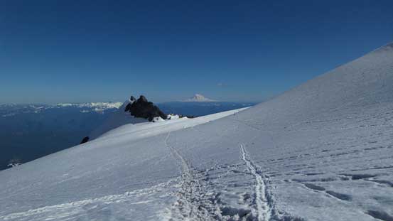
Not doing any sleep I managed to put down the entire drive and by 3:30 am we had started the plod from the “overnighter” parking lot in Paradise. The initial 5 minutes or so was walking up the road to the climber’s Information Center and from there we correctly located the beaten path heading upwards. No snowshoes nor skis was required thank to the very packed down trail (nor did we have those gears) but the lower section was a little bit confusing thank to all the side-tracks. We managed to maintain a general direction by pure GPS navigation and the next while was spent to gain a steep head-wall below Panorama Point. Later I knew this was considered the “winter route” but who cares… Above the slope we scrambled up some rocky terrain and the next thing we’d made to Panorama Point. No elevation loss was required to get off that thing as we kept plodding upwards towards McClure Rock.
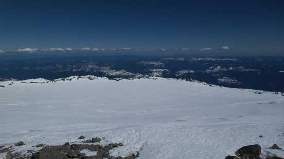
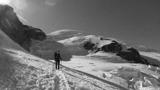
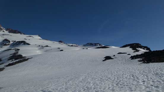
I don’t consider these features as separate summits for simple reason that they don’t even have 10-meter prominence, so we bypassed McClure Rock on its left side. After some traversing on again, packed down trail we gained the (very foreshortened) Muir Snowfield. The next 2 hours or so was a simple mind-numbing plod up the never-ending snowfield, but we did get some bonus thank to an incredible alpenglow over the horizon. The north side of Mt. Adams looked exceptionally impressive. We again, bypassed the next named feature (Anvil Rock) on the climber’s left side and then the next thing we had made to Camp Muir at 10,000 feet.
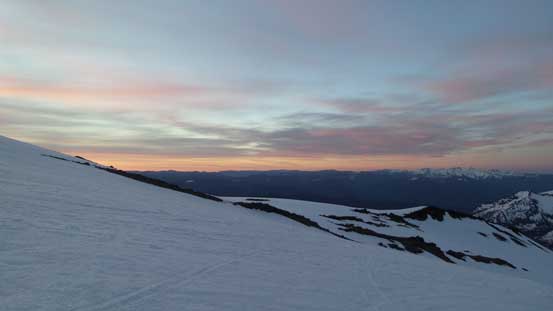
Morning colours over the southern horizon

The mighty Mt. Rainier casting a huge shadow
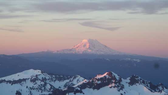
Mt. Adams (3700+ meters high) on alpenglow

Another look on the southern horizon in morning hours
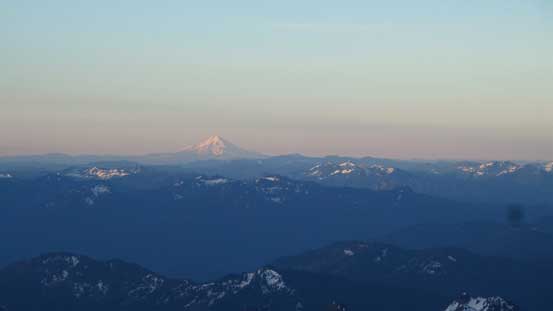
Even Mt. Hood was visible!
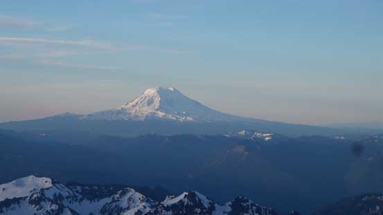
Mt. Adams
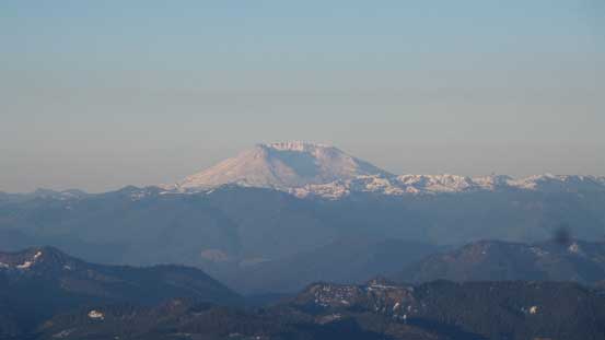
Mt. St. Helens
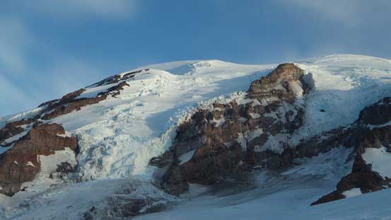
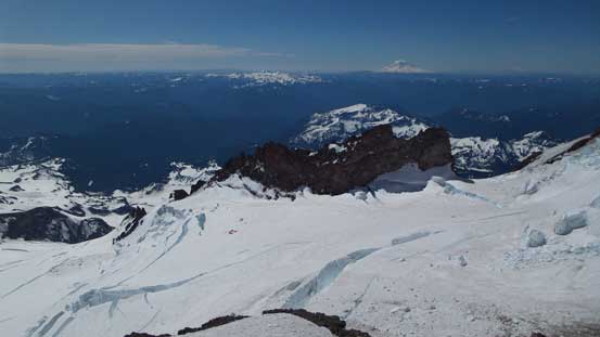
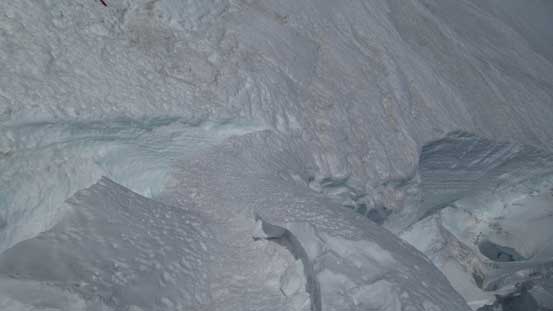
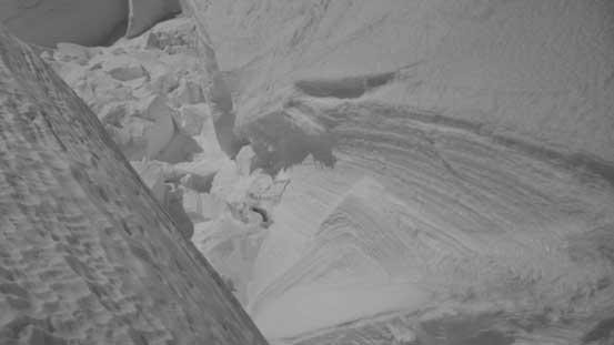
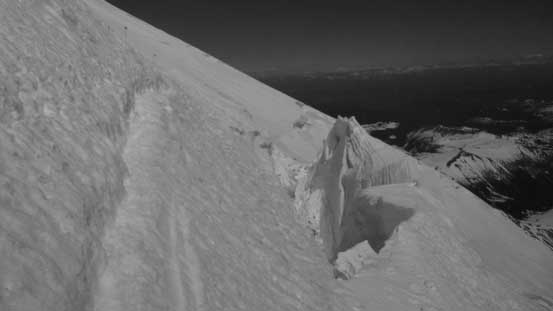
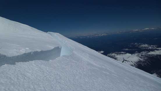
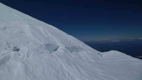
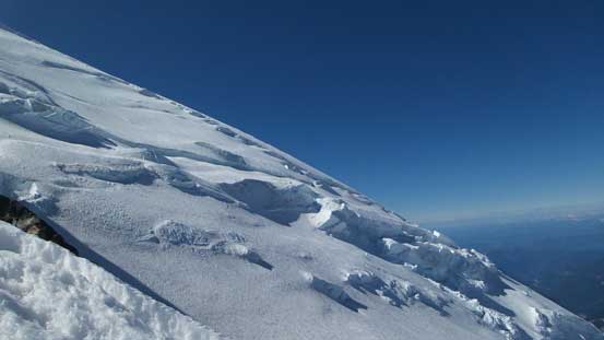
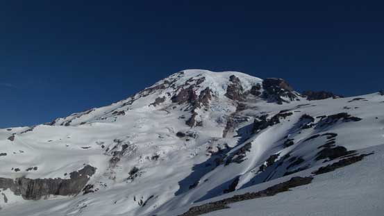
Icefalls on Mt. Rainier are gigantic !
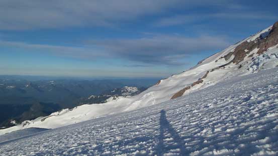
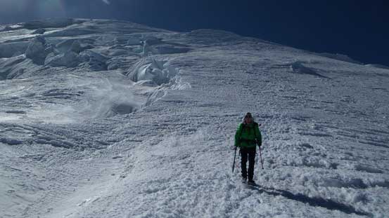
Plodding up Muir Snowfield
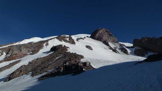
After a long while we arrived at Camp Muir

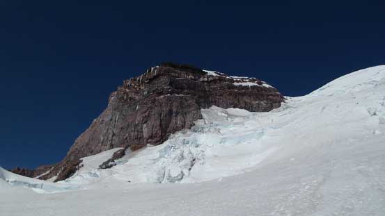
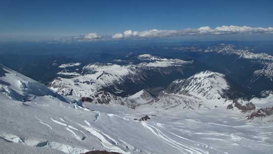
A look over the lower Cowlitz Glacier towards Little Tahoma
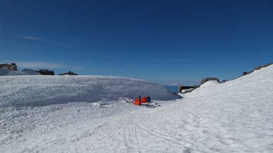
Lots and lots of tents around. Here’s some guided group’s
About half an hour was spent dumping gears in the climber’s hut and then we were out again. I was relieved that we did manage to find 2 spots in the hut (normally super duper zoo) as we didn’t haul tents up high. By this time every other group was already high up on the mountain but we just started the leisurely plod across Cowlitz Glacier. This tame glacier led us to the entrance of “Cathedral Gap” – which was still mostly filled in by snow. The Gap was a bit foreshortened and we did gain fair a bit of elevation in this stage.
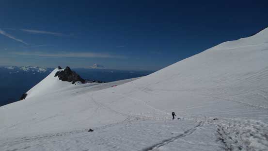
Plodding across Cowlitz Glacier

From above the Cathedral Gap, looking upwards

Al cresting Cathedral Gap
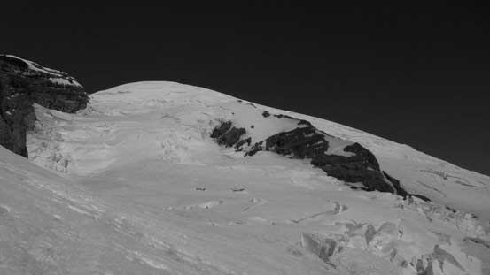
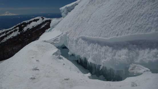
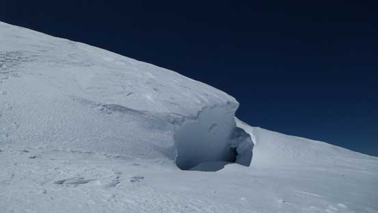
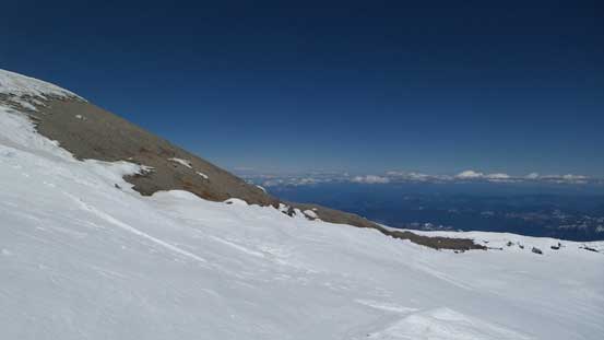
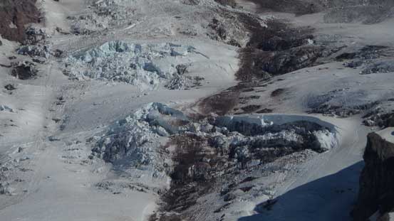
Upon cresting the rib we followed the “highway” of track turning left on a mix of rock, dirt, snow and ice, traversed underneath a rockfall zone and then merged onto the Ingraham Glacier. Impressive crevasses were starting to displace in front of us at this stage and would be the theme of the rest of this ascent.. The track brought us to the “Ingraham Flats” where some REI guided groups perched their tents. We resumed on and went fairly high towards the Ingraham Glacier’s icefalls before taking a sharp right-turn aiming for the distant Disappointment Cleaver. Here the track crossed at least two monsters on snow-bridges in addition to a long section of “drop zones” (serac falls). The entrance of D. Cleaver was also exposed to rock fall so we moved quickly. A fixed line helped a bit speeding up the process and the cleaver wasn’t nearly as steep as appeared from afar.
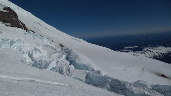
Huge crevasses on Ingraham Glacier. We were slowly merging onto it.
The route ahead. D. Cleaver on right
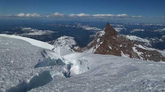
Cathedral Rock
Al plodding up the Ingraham Flats
Huge cracks that we had to cross (on snow bridges)

Plodding across a drop zone

The initial bits gaining the Disappointment Cleaver was rocky

Then it’s filled in by snow. Note the fixed rope
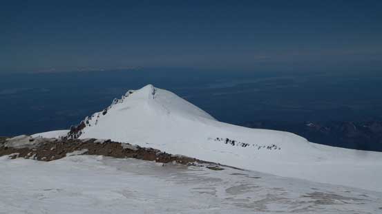
The D. Cleaver proper was still mostly filled in by snow and the previous parties did a good job zig-zagging up the rib which eliminated our route-finding. We passed a few roped parties (on their way down and moving extremely slow) around this stage and resumed our ascent onto and above the D. Cleaver. This whole process was very foreshortening and once above the cleaver we were closed to 3700 m high. The mountain never seemed to give up as we still had more than 700 vertical meters to gain, and the altitude was starting to approach the highest I’ve ever been to. Part of me was nervous since I didn’t do any sleep in the previous night nor did any acclimatization but based on previous experience I knew I’m just as a machine at 3750 m as “normal”. I felt exceptionally strong but Al was slowing down already. We took a few breaks and I managed to convince him to go “a little bit further and see”…
Up and up the Disappointment Cleaver
Looking back down at Ingraham Flats. We were above 12,000 feet at this point.
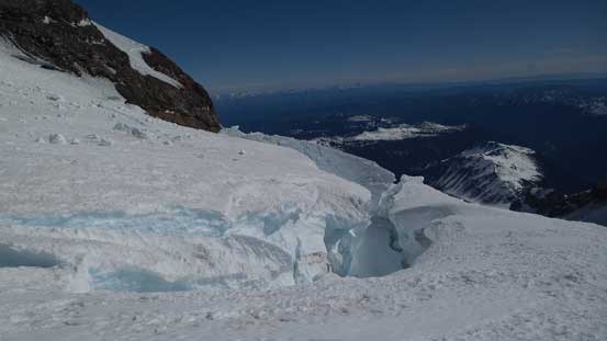
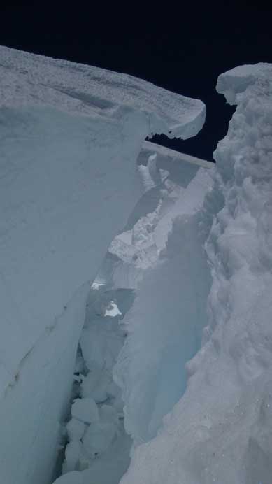
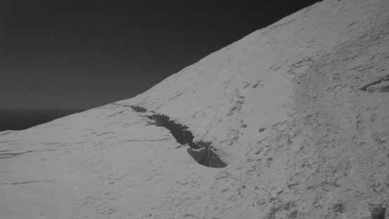
Normally the route would take a rising traverse to the climber’s right before cuttin’ back left along “Emmons Shoulder” but thank to the early season the guides put up a route aiming more or less straight up the slopes. And of course that dumped us into some steep and complicated terrain with huge monster crevasses all over the places. At least 5 fixed pickets, if not 10 were encountered, a few (very steep) traverses was made and the next thing – a down-sloping ice bridge narrowing down to within 1 feet with bottomless crevasse threatening to consume us. The terrain was by no doubt the biggest I’ve ever seen (way more impressive than the Athabasca’s icefalls). We gingerly crossed the bridge (hoping it’d hold). It did hold but the game was not over yet as we still had to traverse directly above another monster (a slip would kill for sure) followed by stepping across another bottomless guy.
Bergschrunds everywhere…
Huge…
Steep… Below on bottom right was a big hole
Yep, that’s the piece of bridge we had to put our fate on…
Very careful work was required
Gigantic…

Al stepping across the bottomless gap
Looking back at the sketchy stuffs we just did…
Not over yet. Another no-slip zone…
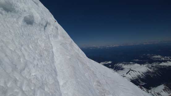
We kept plodding another 100 vertical meters once the intense section was over and Al eventually made a call to quit, at elevation roughly 4050 m for various reasons. I wouldn’t mind slowing down as we still had lots of time but the full-on mountaineering terrain was a bit over his head, so he agreed to wait for me sitting on a flat ledge next to a big bergschrund. Above the terrain was still steep, but very foreshortening and felt super tedious. I checked my altimeter at least 10 times and it never seemed to get any closer. 4100, 4150, 4200, 4250, 4300, … At least I knew I was getting there, and in addition to that, 4 or 5 more bottomless monsters was crossed on sketchy snow bridges with the final one being only around 1 foot wide…

Unfortunately this was as far as Al made to
I continued up solo. This was the first monster
This one had to be crossed too…
So did this one. Although not wide, I couldn’t even the bottom of it… Not at all…
And this one. Partially covered. ..
Eventually I could see some rocky terrain ahead and yes, that’s the crater. My energy suddenly boosted up again and then it’s the long plod across the crater aiming for the “Columbia Crest”. This section was also longer than expected with fair a bit more elevation gain, and the final summit wasn’t obvious (I went to check out 2 high points just to make sure). Not too much to see from up high and it was quite windy so I didn’t do any unnecessary lingering but immediately focused on the descent.
Plodding across the crater towards Columbia Crest
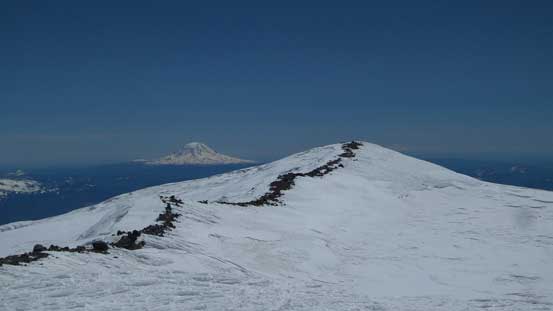
Liberty Cap from the summit of my first 14,000er!
I had doubt that this might actually be the true summit, so checked it off too.
The summit crater and the Columbia Crest
Back down across those bridges I met Al who’s been patiently waiting. It’s apparent that the whole summit push took me just over 1 hour round trip while the other roped party, took more than 2 hours just for the ascent.. Oh well.. We decided to use the rope for the descent as we brought it up anyway, but the problem was, we together only had 1 belay device and about 3 biners. Our initial plan was to not use rope at all but now, we had to be a bit more creative. For the two scary crevasse crossing I asked Al for a boot-axe belay (backing up with the guide’s fixed picket) and then I’d give him a full belay using another guide’s picket. I stole 1 biner from the pickets for simple reason that 3 weren’t enough for those rope work… For the steepest section I offered Al a lowering using a whole 30 m rope and then I did one rappel off the same picket (followed by some down-climb since the rope wasn’t long enough).

Looking steeply down and Emmons Glacier towards Little Tahoma
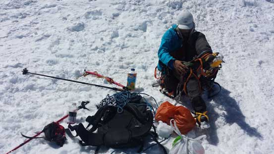
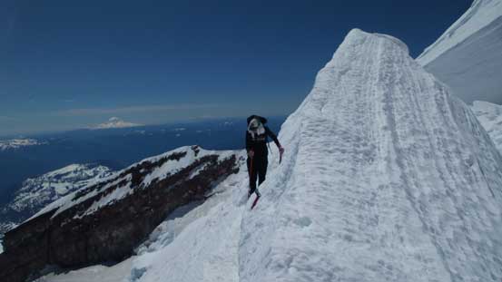
Gearing up… Photo by Alan
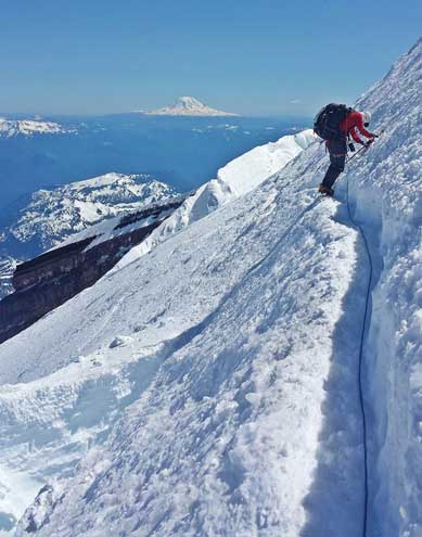
Me leading across a sketchy traverse. Photo by Alan
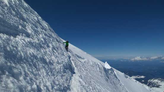
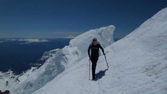
Al traversing

Ahead was that piece of bridge
Down the trickiest part now. Rope was off..
Now we were directly above the D. Cleaver and time to take the rope off. The snow had gone slushy but that’s good in the sense to save our knees. For every step down we could slide a bit forward and that also greatly speeded up the descent. It took us no time to get off the cleaver and then across the Ingraham Flats. Down the Cathedral Gap, across Cowlitz Glacier and now we were back to Camp Muir. As forecasted, the wind was picking up and we both agreed that it’s a good call to have made the summit push on Day 1. The hut was such a zoo that I felt uncomfortable being inside so I packed all the cooking gears out, dug a pit and made dinner on the snow. And now I was super tired so we went to sleep. Unfortunately, the sleep didn’t go well with all other parties waking up around 11:30 pm to about 2 am… The wind was howling but all other climbers went out nonetheless (people are tougher than you’d think)!.
Looking across the very fractured Emmons Glacier
Another look at the Emmons Glacier
Another look over the direction of Emmons Glacier
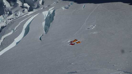
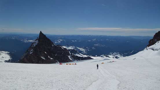
Zooming-in of the camp on Ingraham Flats

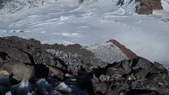
Little Tahoma is now on my “list” – such a sexy peak, and the 3rd highest in Washington too
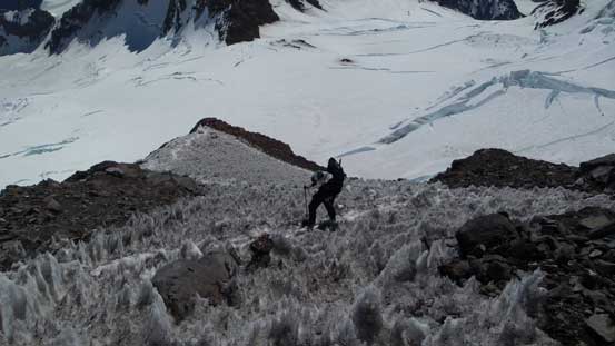
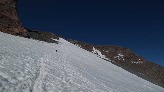
Down the D. Cleaver
Looking at the Ingraham Flats

The Ingraham Direct route was falling apart

Me traversing out of the D. Cleaver. Photo by Alan

Looking back at the D. Cleaver
Cracks on the Flats

Seracs…

The guided team’s camp and Little Tahoma

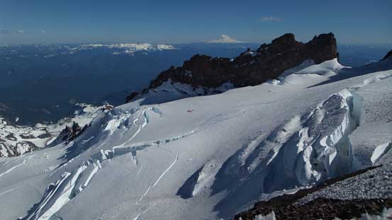
Still lots of impressive glacier scenery
Looking back at the upper mountain
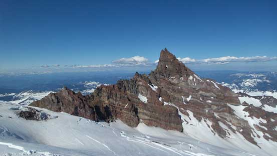
One last look at Little Tahoma
Another shot of Emmons Glacier
Down the Cathedral Gap
Across Cowlitz Glacier
The next morning we woke up at a “normal” time, had some leisure breakfast and went out. The wind was howling but didn’t seem as strong as in the forecast. Oh well.. Down we went we initially travelled with crampons on and took them off about half an hour later. The sun was beating down brutally and the snow was softening up fast. The Muir Snowfield felt super tedious even during the descent but at least went by fairly quickly. We retraced our ascent route over Panorama Point and then down the steepish slope into the treeline. Lots of post-holing was encountered in the last half an hour but nothing too terribly bad.

Time to go home. Photo by Alan
Muir Snowfield
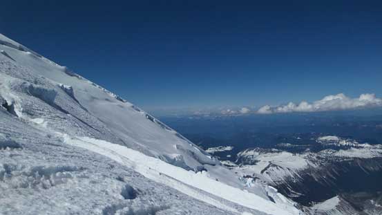
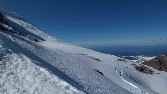
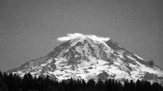
The scale of this giant was unbelievable
Icefalls everywhere anywhere
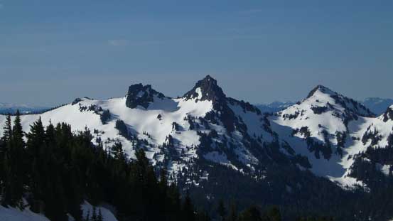
Pinnacle Peak et al. in the Tatoosh Range

Into the woods now
Done…
Now it’s time for the long drive back home, but with a successful ascent of Mt. Rainier I managed to maintain an excited state so did the entire drive. We took a few stops along Highway 161 for pictures. It’s really hard to describe how huge this peak is unless you see it yourself. All in all Mt. Rainier is a grand prize and I’m super glad to have it in the bag already, but probably not again as those crevasses were a wee bit scarier than my like…
