Lion Peak (Resolute Mountain)
July 7, 2013
3150m
David Thompson Country, AB
After crossing Phillipps Peak, Mount Tecumseh, and Numa Mountain off my list over Thursday to Friday, I took a day off in Calgary on Saturday since the forecast was calling for thunderstorms everywhere. Sunday looked to be pleasant and Vern, Ben and I were looking for a success on Mount Athabasca. However, we eventually downgraded our ambition to just a scramble since the weather didn’t look perfect for Columbia Icefield region. We still wanted a big ascent. The two summits of Resolute Mountain have different names: Lion Peak and Lioness Peak, and my inspiration mostly came from Eric and Raf’s ascent a few years ago. These two peaks are a bit overshadowed by the 11,000er Mt. Cline but equally beautiful in their own. Did we pick a technically easy objective? Yes, since this is only an easy scramble.. Did we pick a light objective? Not really.. This one has 1900 vertical meters elevation gain…

Resolute Mountain ascent route. GPX DL
Due to the thunderstorm forecast and the length of this trip, we had to leave the “trail-head” at first light, so we decided to meet at there at 4:30am. The “trail-head”, or the “parking lot” is on David Thompson Highway, directly across from Thompson Creek Campground. There is no parking lot and we just parked on the shoulder of highway. I had to drive separately with both guys since I would start the drive from Calgary, and finish the journey at Edmonton. I was afraid that my alarm wouldn’t work since I was pretty tired, so I just slept at the trail-head.
Next morning we started our long trek at 4:40 am. We managed to find the trail immediately on the climber’s right side of Thompson Creek. It was generally easy to follow initially, but at one point we lost it on the creek bed with a ton of deadfalls ahead. We bailed the creek side and found faint tracks here and there, and stayed on the high bank in the next short while, and eventually we picked up the trail again. The missing part obviously got washed out by the recent floods.. Higher up, the trail went up steeply towards climber’s right side and we soon lost it again. Thankfully the forest around here got burnt and the bushwhacking was light. We resisted gaining more elevation and side-sloped towards the creek. If we left the faint tracks earlier we might can find the trail, but oh well, except for the last bit before the creek, travelling was pleasant and easy.

This trail comes from nowhere. Apparently here got damaged by the floods.

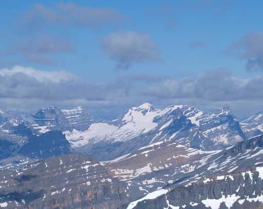
Alpenglow on Mt. Murchison

The mighty Mt. Forbes with Mt. Outram in front.
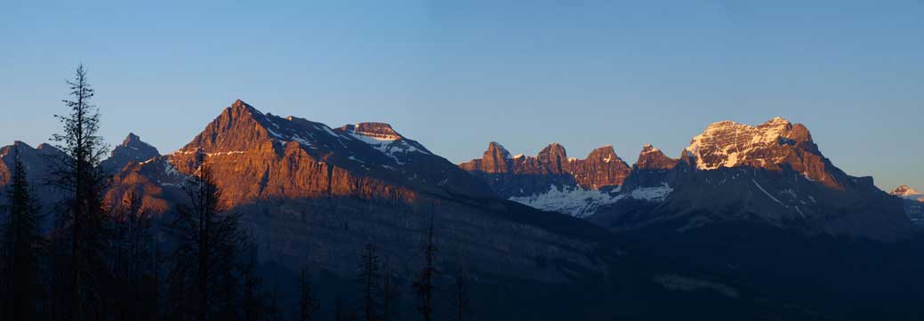
A long shot of Corona Ridge (left), and Mount Murchison (right)
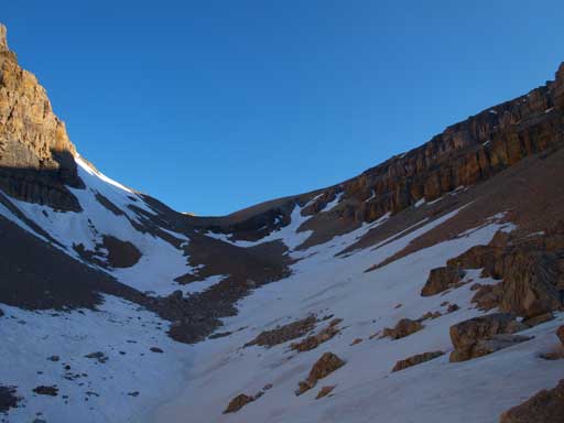
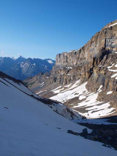
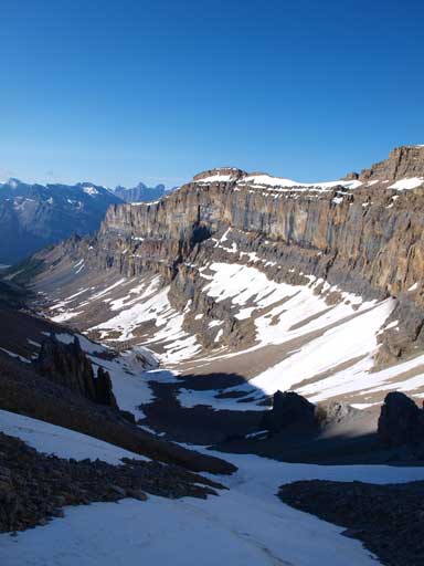
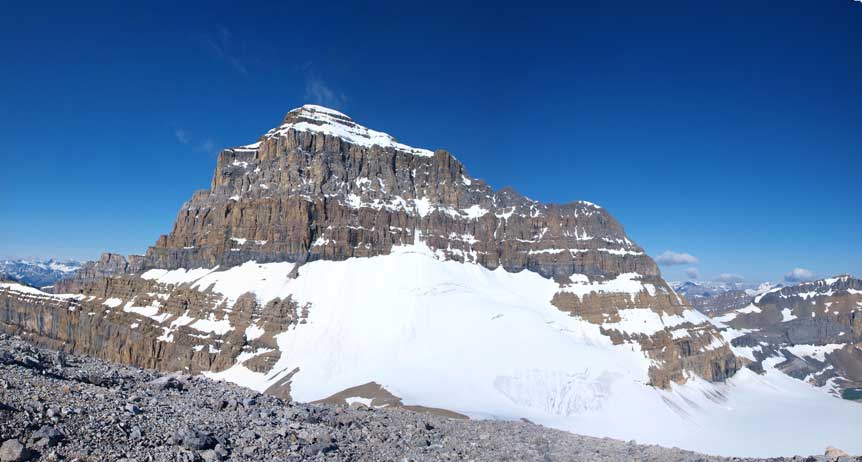
After dropping down to the creek, we regained the trail on its right side, and by now the rest of the approach would be hiking up this rarely traveled valley, with a trail accompanying pretty much all the way. This is such a beautiful area and definitely deserves more attention. We enjoyed the approach for most parts, and it was still very early in the day and the sun never got on us until high on the Cline/Lion col, so we didn’t really realize how much elevation we’d already gained, and how far we had already traveled. Higher up Vern and I merged to snow line. In the morning we definitely needed crampons, and from here on we would be taking advantage of the firm snow up a gully instead of slogging up the scree. Ben, on the other hand, didn’t bring crampons, and he had to slog up the scree. The snow gully was very pleasant to ascent, and three of us regrouped at about 50 vertical meters above Cline/Lion col. The view was amazing from here already, with the impressive east face of Mt. Cline dominating the view, and the three peaks of Whitegoat stealing the show looking north.
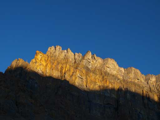
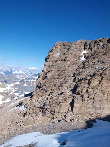
Impressive wall would accompany us for next next 2 hours

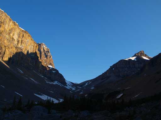
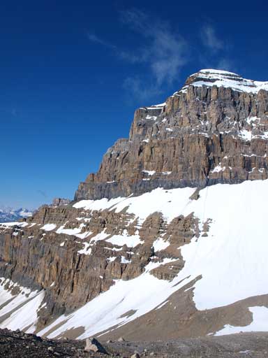
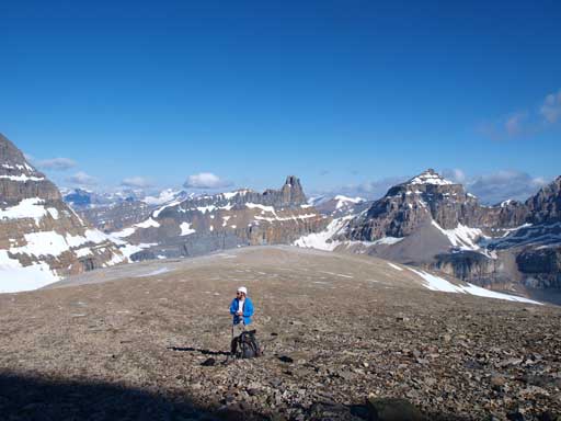
Our first objective, Lion Peak. Still a long way to go.
Hiking towards Cline/Lion col. It’s much further than it looks.

Vern hiking up the valley
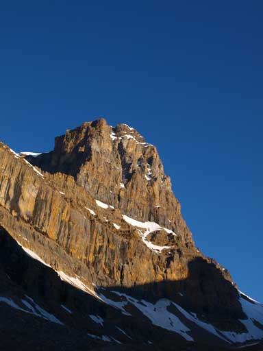
Mt. Cline

Looking back.
Vern and I would use the obvious snow line to avoid scree bashing.

Crampons on.

Looking down at Ben crossing a tricky icy slope without crampons.
Gaining elevation quickly on this slope.
Looking ahead to Vern leading the way.
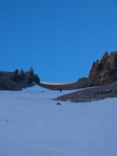
Higher up. We were still on the snow.
Finally gained the col. Look at this mountain!!
Mount Murchison would soon get obscured by clouds.

The three peaks of Whitegoat Peaks.
Mount Cline.
Gorgeous views from this plateau already.
Ben taking a break.

Some clouds around Cline.
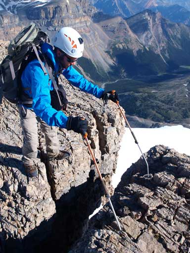
The ridge up Lion Peak looked to be scrambly but once getting closer, it became a lot easier. With a couple detours to climber’s right side, it’s an easy scramble. We generally stayed on the ridge crest and higher up we crossed two mini notches for some fun.. (Gettin’ prepared for Mount Cline?) The terrain soon became complicated once we got closer to the top, and since we knew this is supposed to be just an “easy scramble”, we started the horizontal traverse towards climber’s right. Around a corner, we were back on to easy terrain. By doing so, we actually bypassed the false summit, and now we could just aim for the true summit which was minutes away.

Vern scrambling up Lion Peak

Vern and Mt. Cline.

Vern and the typical terrain on Lion Peak
Ben ready to cross a (quite deep) notch..

Traversing around a difficult section.
By doing so we actually bypassed the false summit

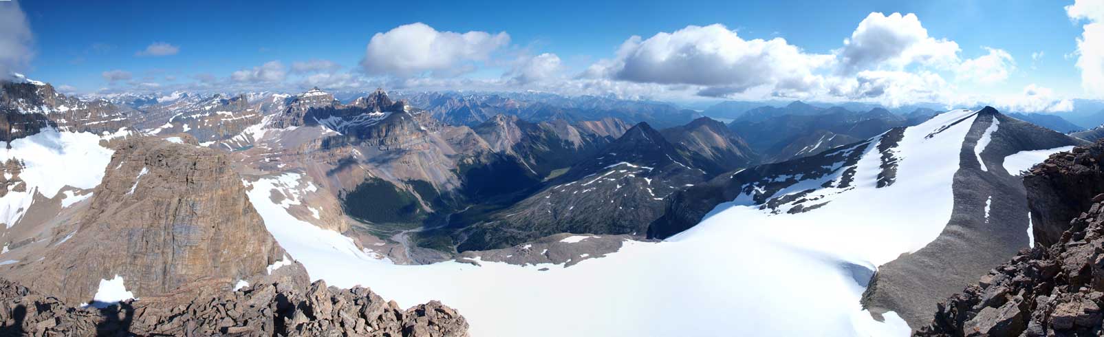
Summit Panorama. Click to view large size.

Abraham Lake and Mount Michener

Some clouds went in and out obscuring the views.

See? We lost Murchison…

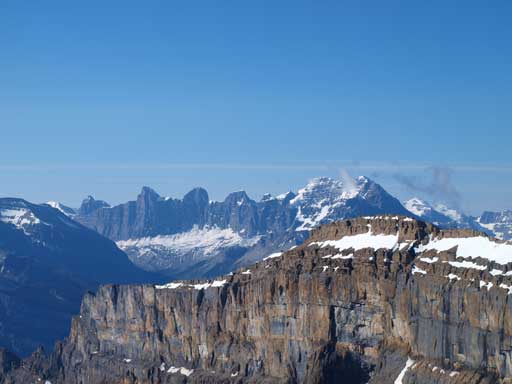
Looking over between Cline and Whitegoats revealed some nice peaks. Mount Columbia on the far left.
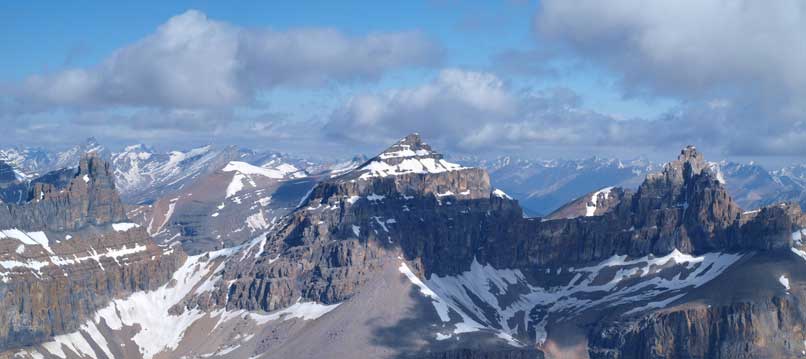
Whitegoat Peaks
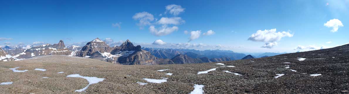
Another panorama. Click to view large size.
Cirrus Mountain is another big scramble on the Icefield Parkway

Can’t get rid of this peak…
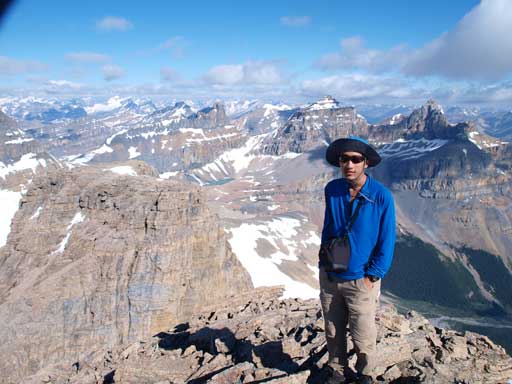
Me on the summit of Lion Peak

Mount Wilson. You get a better idea of the long icefield crossing from here!
We didn’t take a long break but immediately focused on our next objective, Lioness Peak.
